
Enepitsi (Ghost) Trail in the Santa Clara River Reserve
– By Tom Garrison –
Location: Santa Clara River Reserve in Santa Clara and Ivins, Utah.
Difficulty: Easy. It is mostly level with a few not very steep up and down sections.
Average Hiking Time: A little more than two hours at a leisurely pace with many photo stops.
Elevations: The trailhead is approximately 2,760 feet in elevation with about a 150 feet elevation gain from the highest to the lowest point.
Family Friendly: Yes.
Getting There: From St. George travel north on Bluff Street/Highway 18 to the sweeping left (west) turn onto Sunset Boulevard/Highway 8. Continue four miles from the Bluff Street/Highway 18 intersection on Sunset Boulevard/Highway 8 as it enters Santa Clara and becomes Santa Clara Drive. At four miles, turn left onto West 1700 North/Graveyard Wash Road. There is a large brown sign for Santa Clara City Public Works at the turnoff. Below the large sign is a smaller one with an arrow that reads “Trailheads.” After .1 mile, the paved road becomes a good dirt road, and .3 mile from the turnoff is the signed Tukupetsi Trailhead, which is also the trailhead for Enepitsi Trail. The trailhead is across the road from the parking area. Although a regular sedan should traverse the dirt road without trouble, I recommend a high-clearance vehicle.
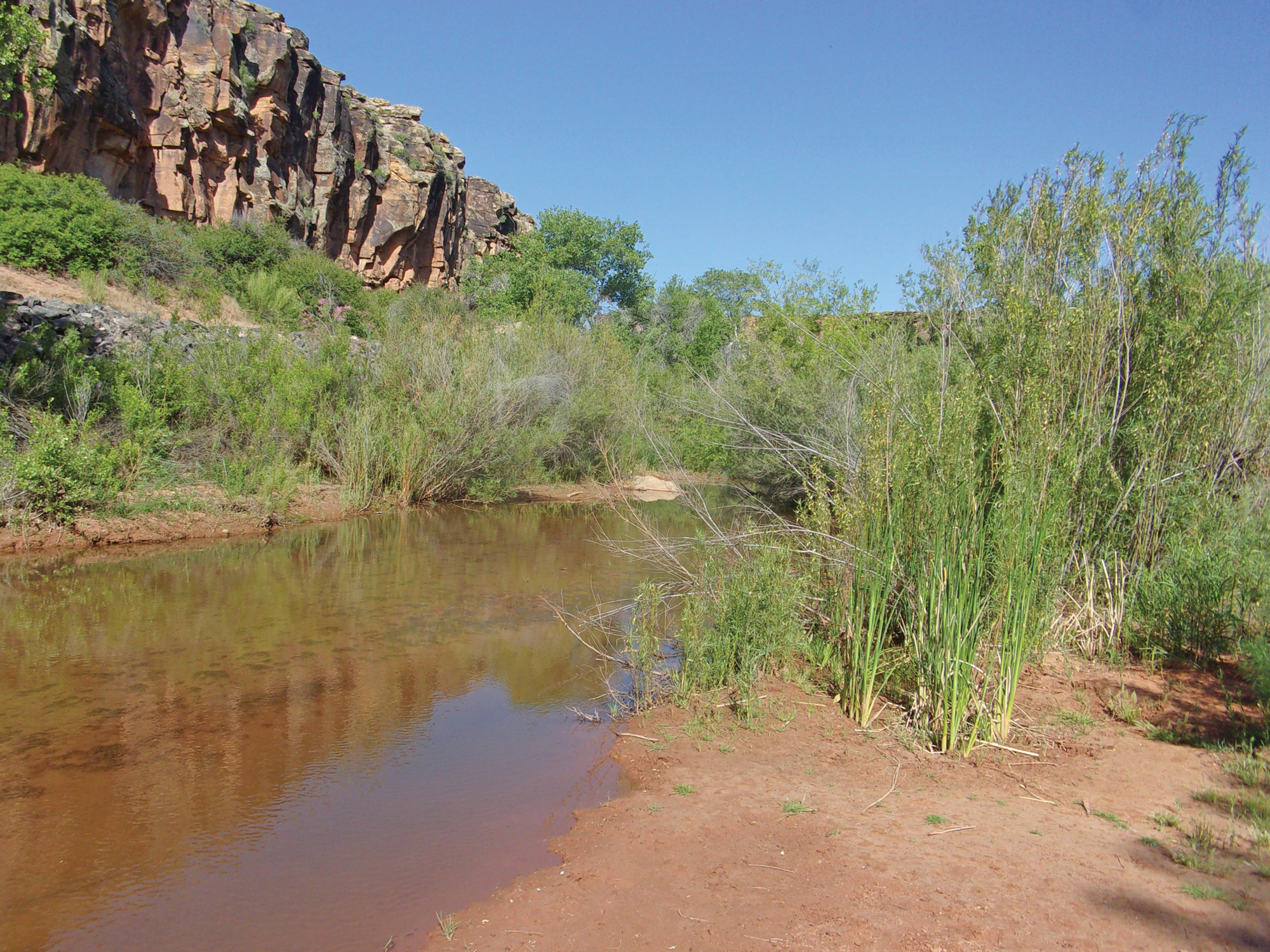
Several months ago my wife, Deb, and I hiked the Black Brush Trail in the Santa Clara River Reserve. The highlight of that hike were some great views of the Santa Clara River and its riparian environment from cliffs above the river. We saw a trail alongside the river and knew we had to explore that trail. And now we have the Enepitsi Trail. (Enepitsi, pronounced e’noo petes, means “ghost” in the Southern Paiute language.) This trail is an easy out-and-back hike, mostly along the Santa Clara River, featuring high cliffs, petroglyphs, and a riparian environment near the river.
The Santa Clara River Reserve was established through a partnership between the cities of Ivins and Santa Clara and the Bureau of Land Management (BLM). The 6,500-acre Reserve is administered by the BLM and is located southwest of Ivins and Santa Clara. The Reserve was created to protect open space and archeological and natural resources and promote recreational opportunities. More than 20 trails in the Reserve offer a variety of experiences—prehistoric petroglyphs (rock art), hiking sandy washes, desert landscape vistas, and lush (for a desert) riparian corridor along the Santa Clara River.
Our journey began on a Thursday in mid-May. We most often hike alone and enjoy trails with few or no other people. There were a few people on Enepitsi Trail, but no crush of humanity.
We arrived at the Tukupetsi Trailhead at about 9:30 AM, with the temperature in the mid-70s. The trailhead elevation is about 2,760 feet, with an approximately 150 feet elevation from the highest to lowest point during the almost five-mile hike (that includes the four short hikes on trails, almost two miles round trip, leading to the three-mile round trip hike on Enepitsi Trail). The sky was Utah blue making for excellent hiking weather and photos. Being mid-spring, we saw many animals—a jack rabbit hopping away from the noise of our footfalls, a bunch of birds, including a road runner, and many lizards.
The BLM recommends a convoluted way of reaching Enepitsi Trail to protect archeological sites and promoting a “good neighbor” policy since much of the adjacent land is private property.
The surrounding private property owners make this “good neighbor” policy a necessity. Just beyond the Tukupetsi Trailhead, Graveyard Wash Road forks. The left fork has a prominent sign reading, “Private Property No Trespassing.” The right fork’s sign reads, “No Public Access Beyond This Point, Private Road Do Not Enter.” Either fork is a short easy stroll to the Enepitsi Trail, but not available to the public.
We dutifully followed the BLM directions to Enepitsi Trail. We do want to be good neighbors, and the signs on the private property made it clear where we could not go.
From the Tukuetsi Trailhead we took the Fishhook Trail heading north for .3 mile to the Upper Graveyard Trail. We then turned left (west) onto Upper Graveyard (about .1 mile on this trail, we took the left fork) and proceeded .3 mile to the Tempi’po’op Trail. Going south, we crossed Tempi’po’op Trail onto Een’oog Trail for about .1 mile. Finally, we turned left (east) onto the U’waiv Trail and went downhill about .2 mile to the Enepitsi Trail.
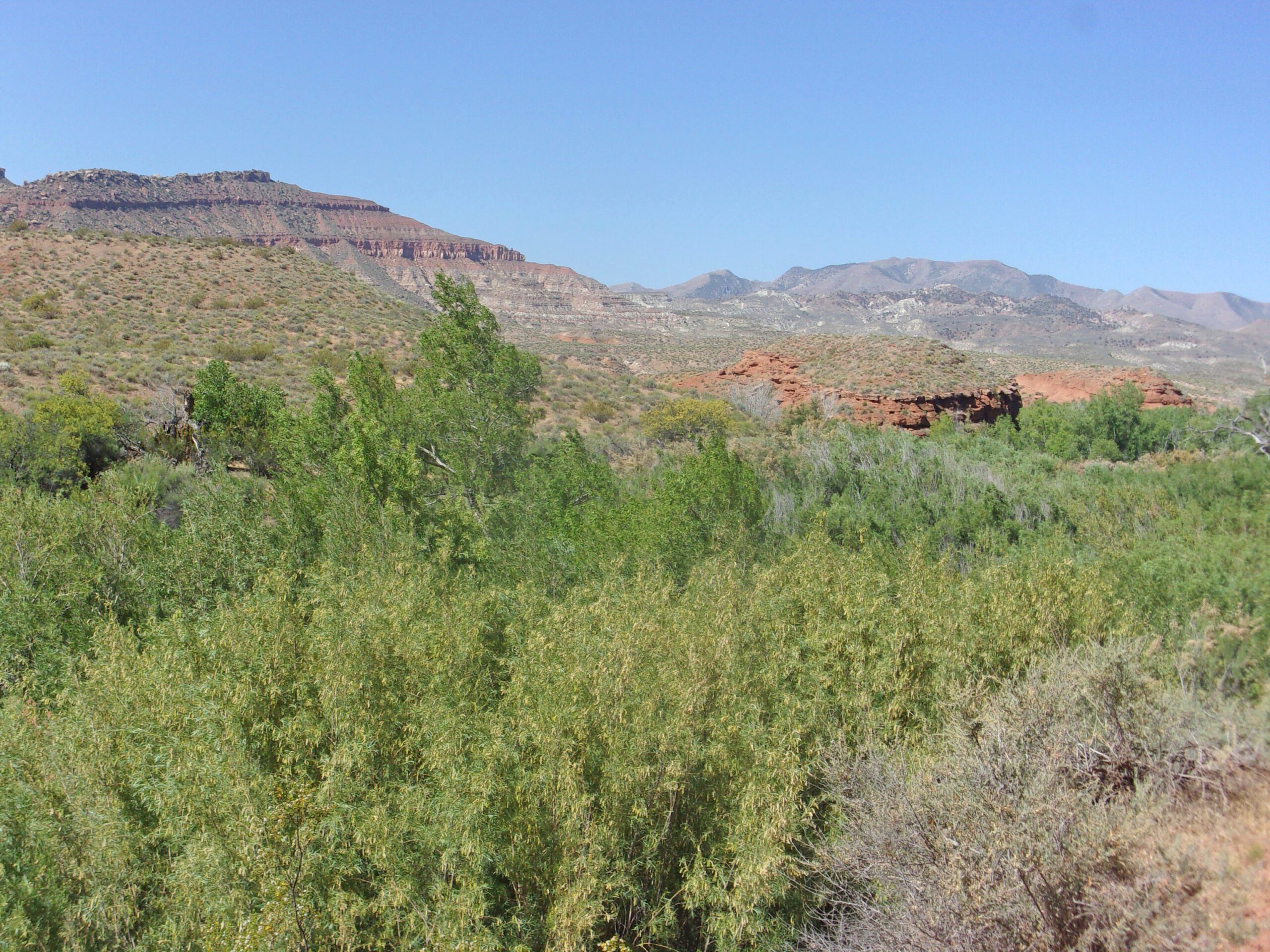
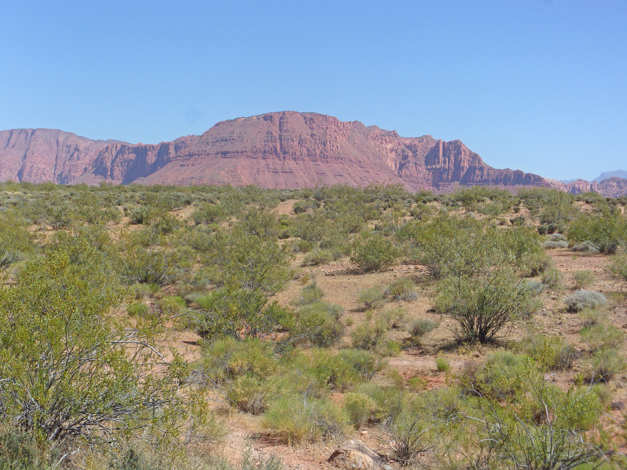
These four short trails, about .9 mile one way, are rather uninspiring. There were some good views of Red Mountain to the north and down into the canyon and Santa Clara River on the U’waiv Trail.
The U’waiv trail intersects Enepitsi Trail and we headed west (right) on a slope into the canyon. Enepitsi Trail, three miles round trip, follows an old pioneer dirt road, closed to motor vehicles.
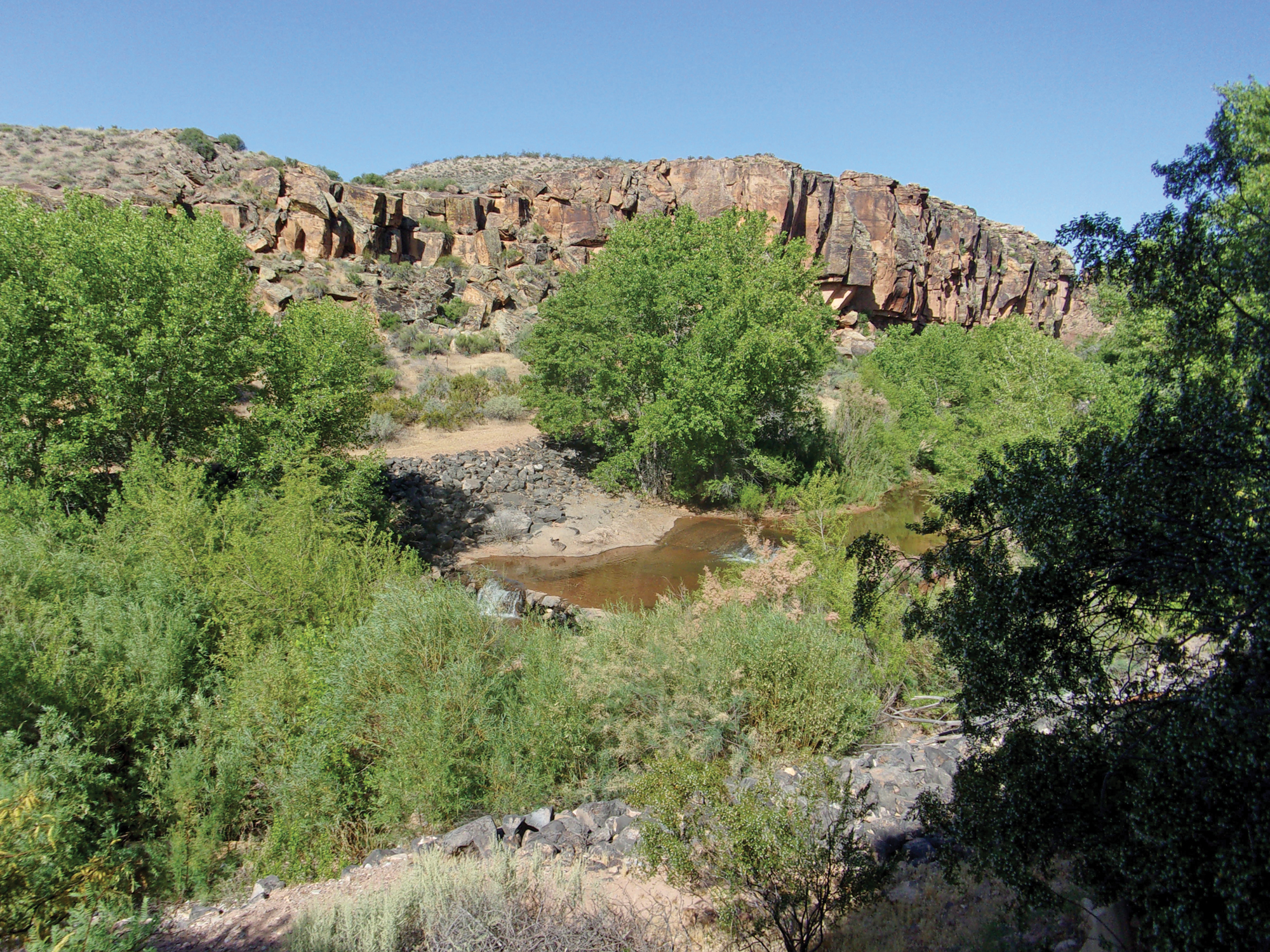
There is a gate near the beginning of Enepitsi Trail; be sure to close it on your way through. Soon after the gate, we came to an overflowing dam, and the lush foliage along the Santa Clara River came into view.
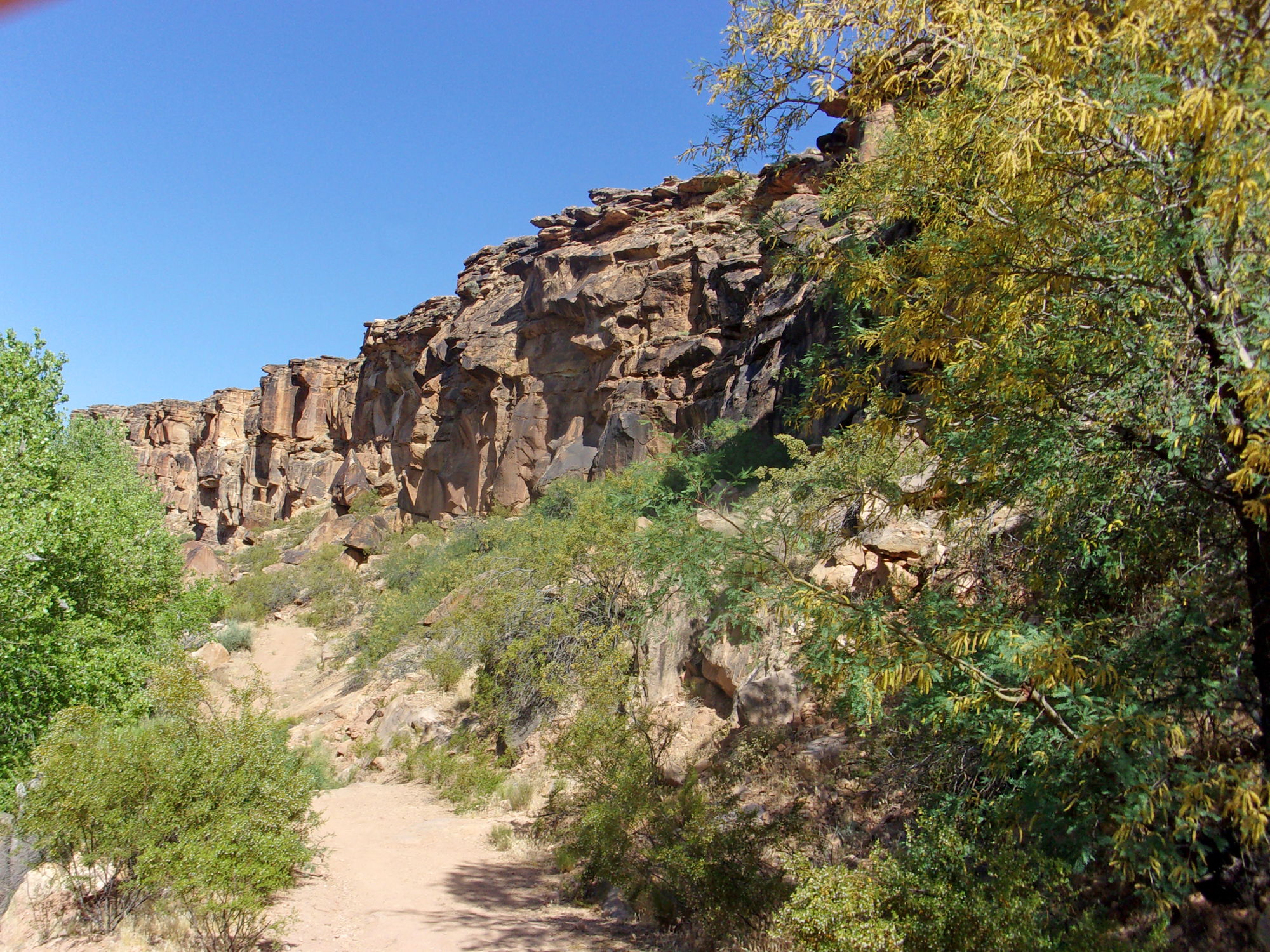
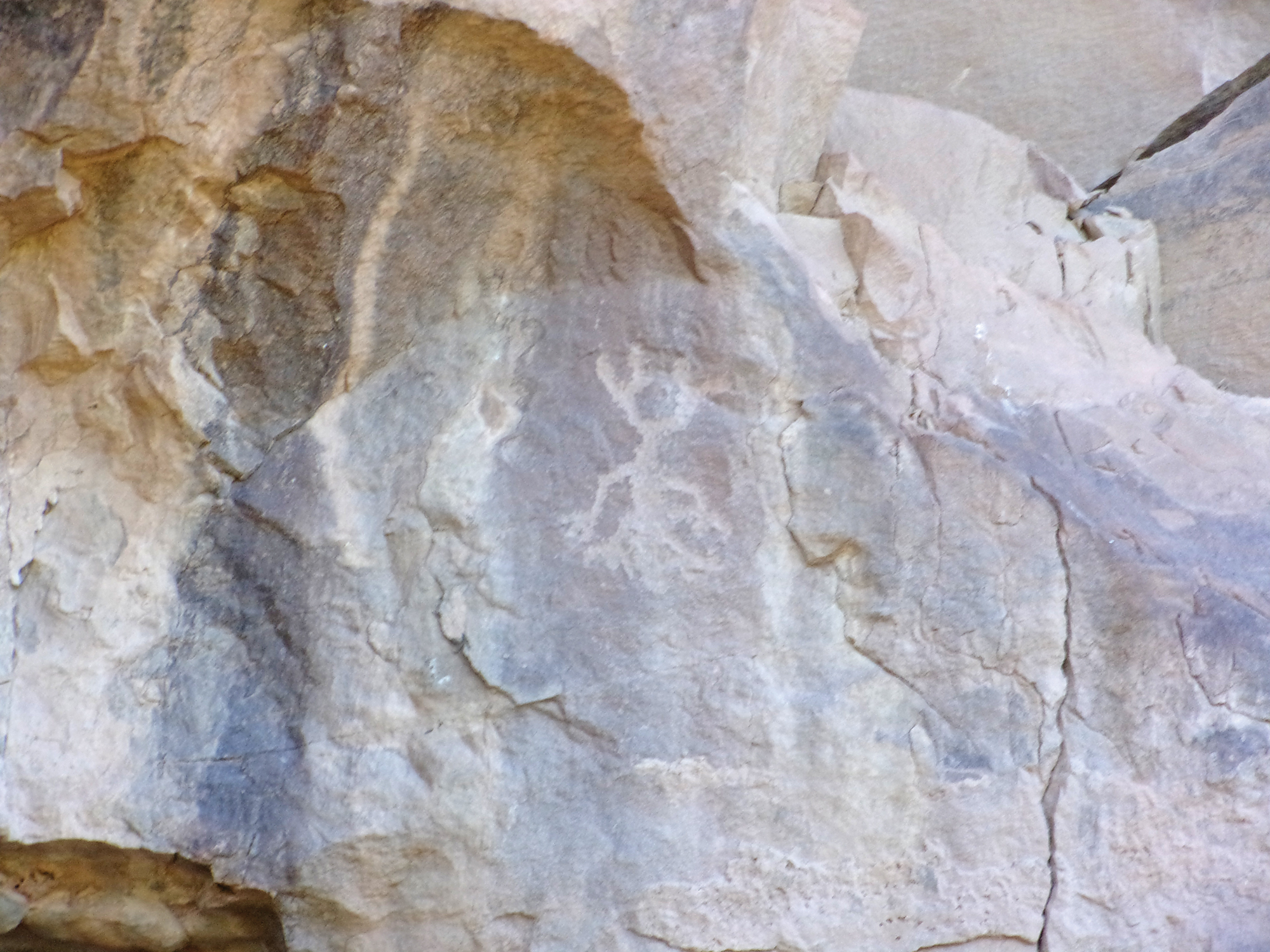
As we entered the canyon we searched for and found some petroglyphs on the canyon walls. If you hunt around you will find several places with rock art, many of them above eye level high on the cliffs.
In the canyon, the cliffs on both sides of the river towered above us with trees and bushes spreading out from the river. About ¼ mile along we took a user trail through the bushes and quickly reached the river bank—very nice relaxing babble of a gently flowing river. We saw a few users trails, some toward the river and some toward the cliffs and petroglyphs.
Most of the trail follows along the base of cliffs varying from a few to about 50 feet from the river. We continued through the canyon to where the road/trail forks. At this point, 1.5 miles from the Enepitsi Trailhead, the canyon has widened considerably. We explored a bit and then began our return journey.
This is an easy, almost five-mile round-trip hike with a few not-too-stretched up-and-down sections, mostly in a lush riparian environment, fairly atypical for the southwest desert. Give it a try.


