
 ==============================
Severe Watches and Warnings for Saint George
==============================
Flood Advisory
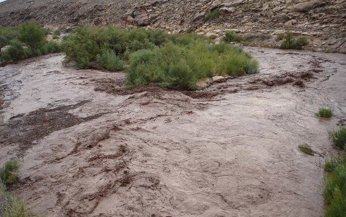
National Weather Service Salt Lake City UT
636 AM MDT TUE JUL 25 2017
The National Weather Service in Salt Lake City has issued a
* Urban and Small Stream Flood Advisory for Poor Drainage Areas
for…
South central Washington County in northern Utah…
* Until 930 AM MDT
* At 634 AM MDT, Doppler radar indicated heavy rain falling across
much of Washington County including the greater St George area.
This will cause urban and small stream flooding, including ponding
of water on area roadways, overflowing poor drainage areas, and
potentially high flows through normally dry washes.
* Some locations that will experience flooding include…
St George, Washington, Hurricane, Santa Clara, Ivins, Leeds,
Bloomington, Gunlock, Veyo and Snow Canyon State Park.
PRECAUTIONARY/PREPAREDNESS ACTIONS…
Remain alert for flooding even in locations not receiving rain. Dry
washes, streams, and rivers can become raging killer currents in a
matter of minutes, even from distant rainfall.
Flooding is occurring or is imminent. It is important to know where
you are relative to streams, rivers, or creeks which can become
killers in heavy rains. Campers and hikers should avoid streams or
creeks.


