
Hiking Southern Utah: Blake-Gubler Trail
Video and photos by Don Gilman
Trail Name: Blake-Gubler
Location: Pine Valley Mountains
Difficulty: Strenuous
Length: Approximately 8.8 miles roundtrip
Elevation gain: 1,900 feet
Family-friendly: The initial section to the first rocky spot would make for a great hike with little ones, but the trail in its entirety is too strenuous for all but older children who are ambitious, energetic hikers
Dog-friendly: Yes
Special considerations: At the very minimum, a high-clearance vehicle is required for the rough road to the trailhead, but a 4WD is greatly beneficial
Editors Note: This was first written and submitted a few years ago. With winter behind us as of the reposting of this piece, trail should be open and accessible. If you investigate this hike and find things have changed, please let us know!
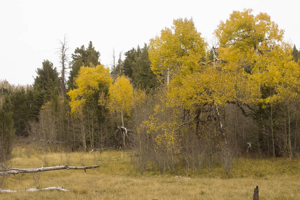
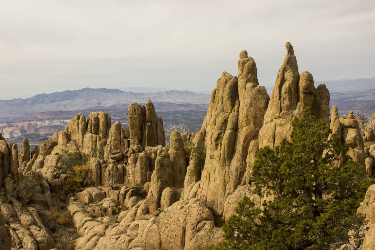
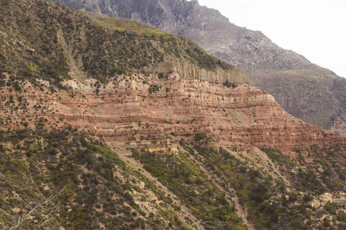
Winter’s snows will soon make it difficult to access this trail’s higher reaches, so get out there while you still can. In an area blessed with an abundance of hiking riches, the B-G stands out as one of the most beautiful spots in Washington County. Despite this, the trail is infrequently trodden and provides not only spectacular scenic beauty but solitude and peace as well. While gaining nearly 2,000 feet in elevation, the trail is very well-graded, maintaining a consistent upward pace before topping out at around 9,000 feet. The B-G also passes through a variety of ecosystems, beginning in the upland desert zone and ending in the alpine forests that the Pine Valley Mountains are known for. Another notable aspect of the Pine Valley Mountains is that the range is a laccolith, a lens of granite intruded between layers of sandstone. In fact, it is considered to be one of the largest laccoliths in the United States.

Access: The road to the trailhead is rough but relatively easy to follow. A high-clearance 2WD vehicle will most likely be sufficient, but a 4WD is recommended. In wet weather, the road, which is composed of clay in sections, would likely be impassable.
From the junction of Bluff Street and St. George Boulevard, drive north on Bluff Street/State Route 18 for 11.5 miles. Pass by the town of Diamond Valley, and turn right onto West 8500 North. From here on out, the road will become increasingly rough. After 0.8 miles, turn left onto Forest Road 33. Follow this rugged but decent road for 8.7 miles to the trailhead. Some care is required to be sure you don’t turn onto the wrong forest road, but the route is generally well-signed the entire distance to the trail. A small parking area and a wooden fence mark the beginning of the trail.
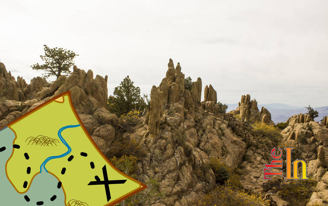
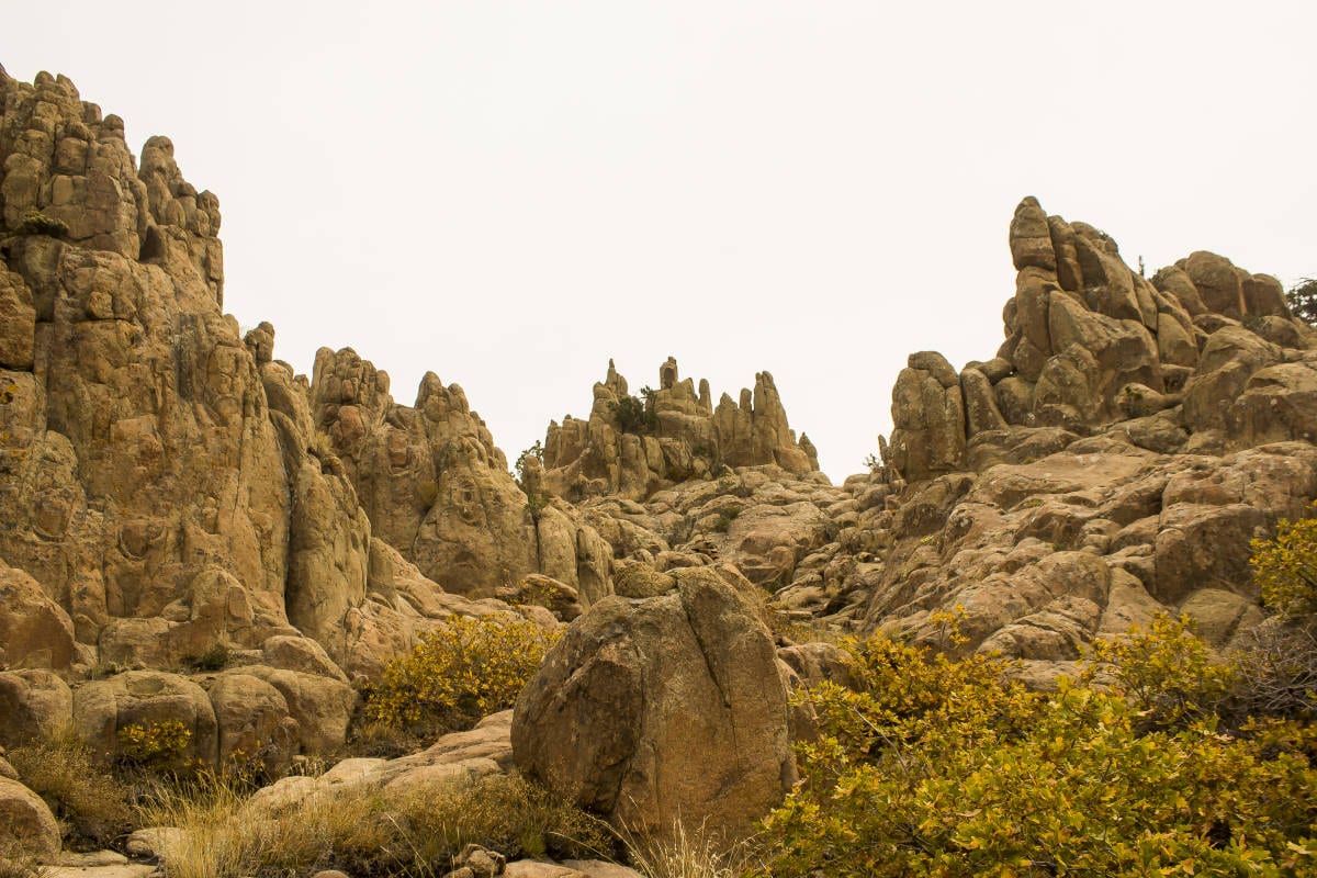
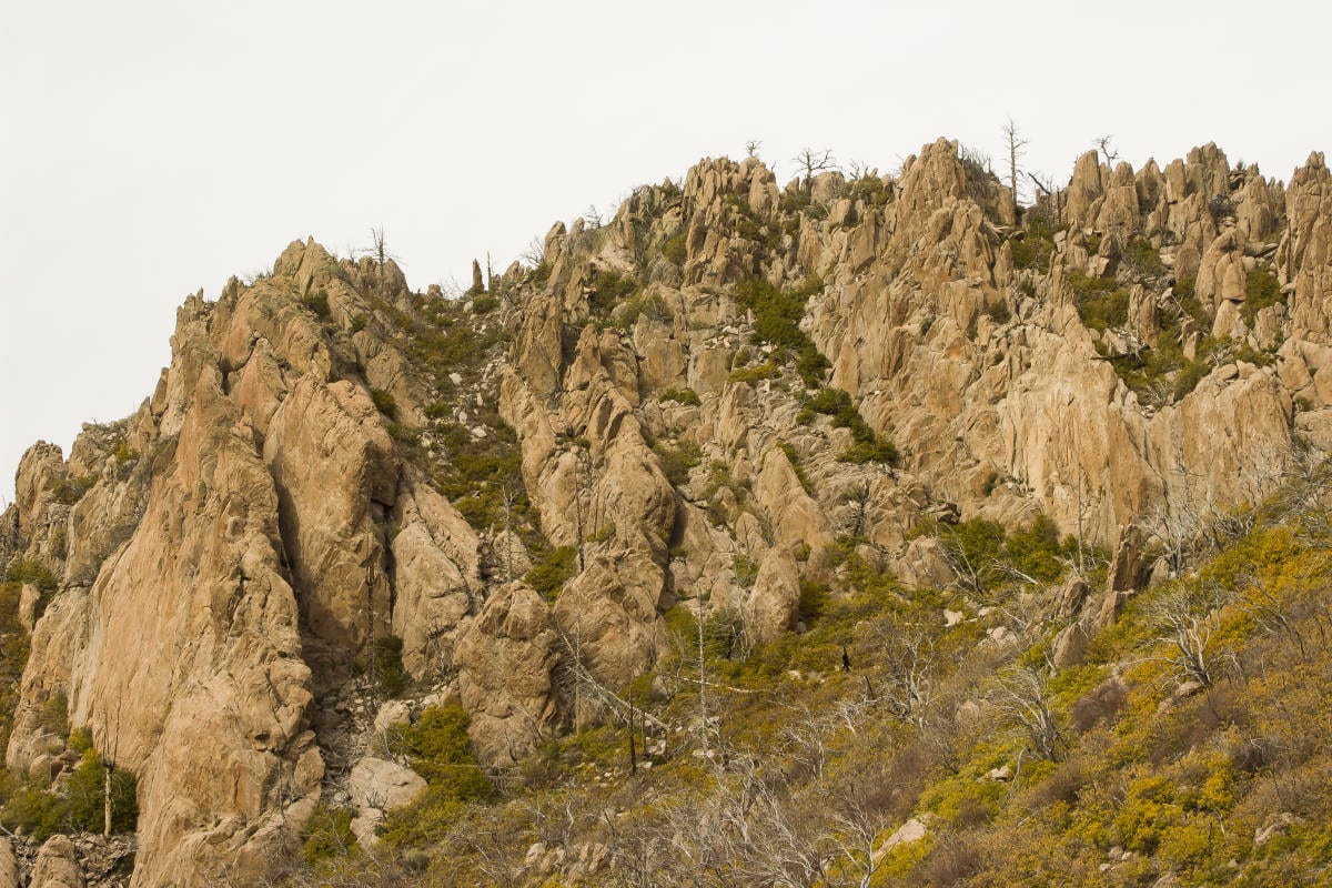
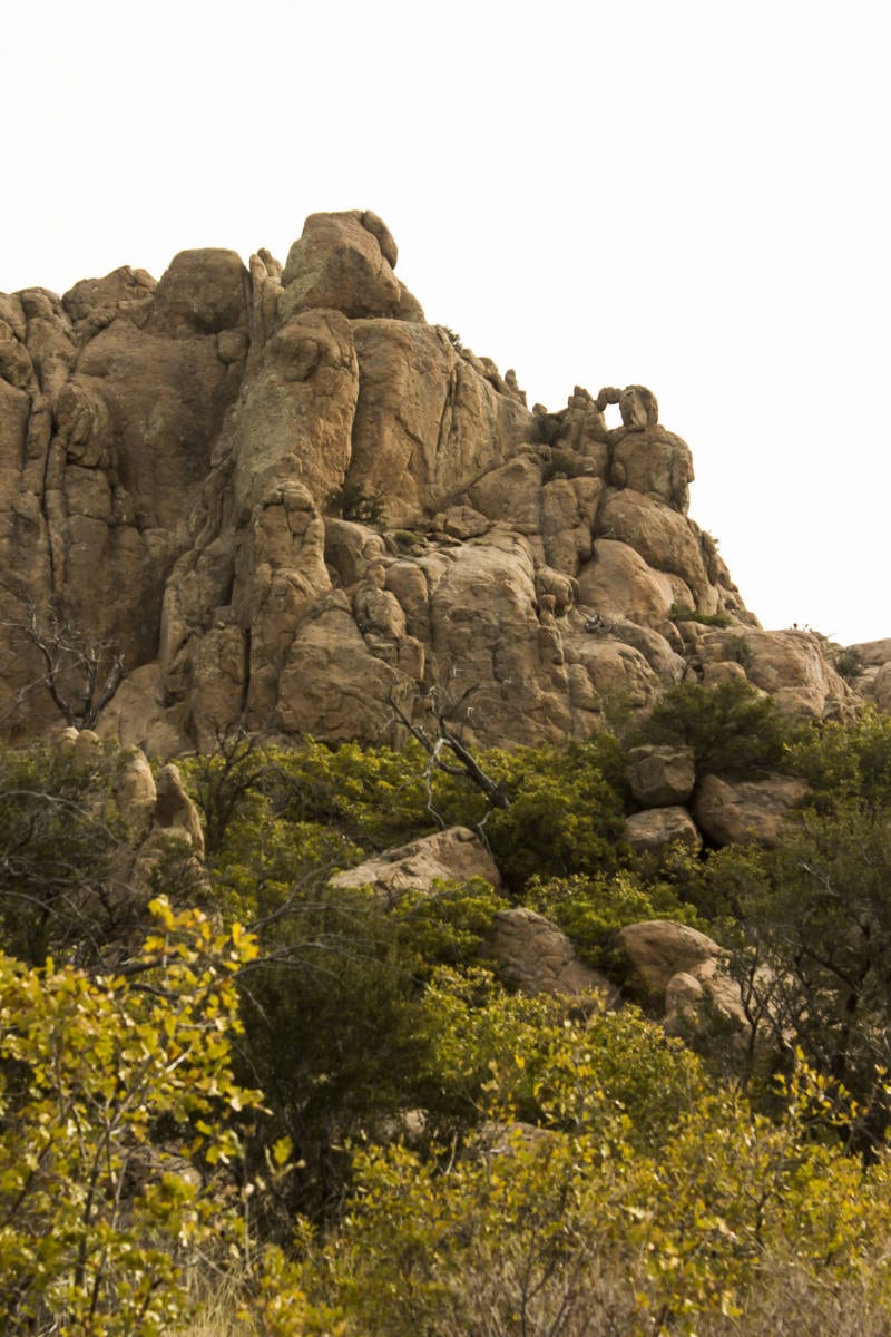
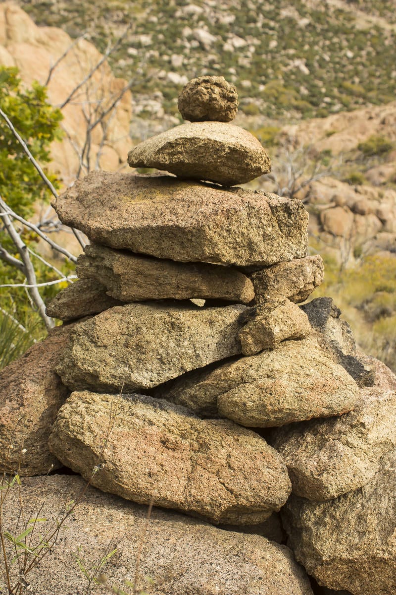
 The trail starts out through a forest of scrub oak and mountain mahogany and quickly ascends up a gentle ridge. Views of the contact zone of the Clarion Formation—where the Pine Valley Laccolith rests atop the sandstone beneath—appears at around 0.13 miles as a dramatic orange scar in the mountainside to the northeast. After a distance of around half a mile, the trail enters the first dramatic outcropping of jagged rocks, traversing between domes and pinnacles. Huge cairns mark the way towards the mouth of the massive canyon that the trail enters at around one mile.
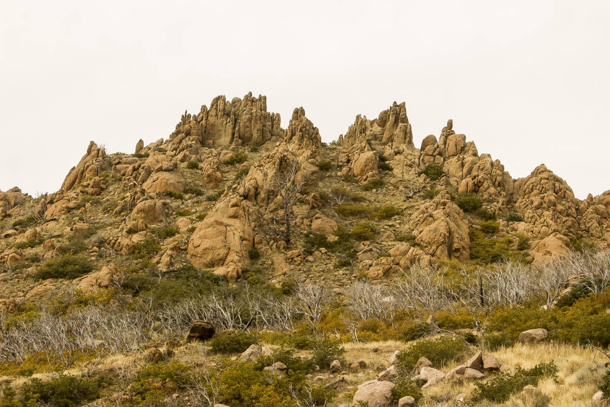
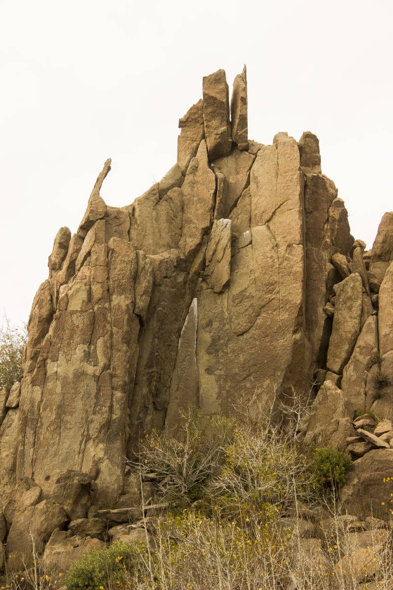
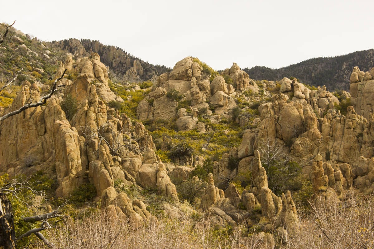
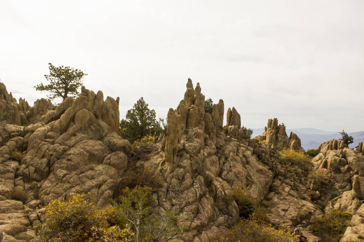
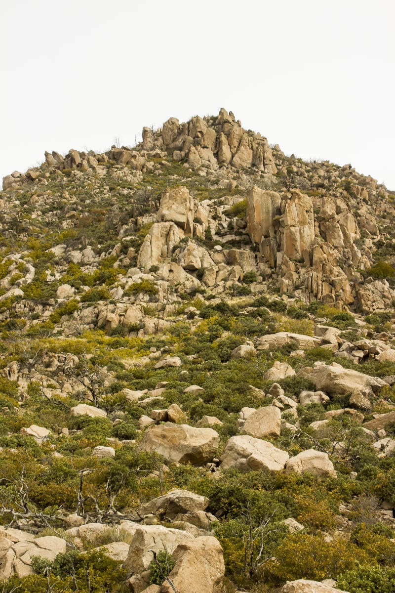
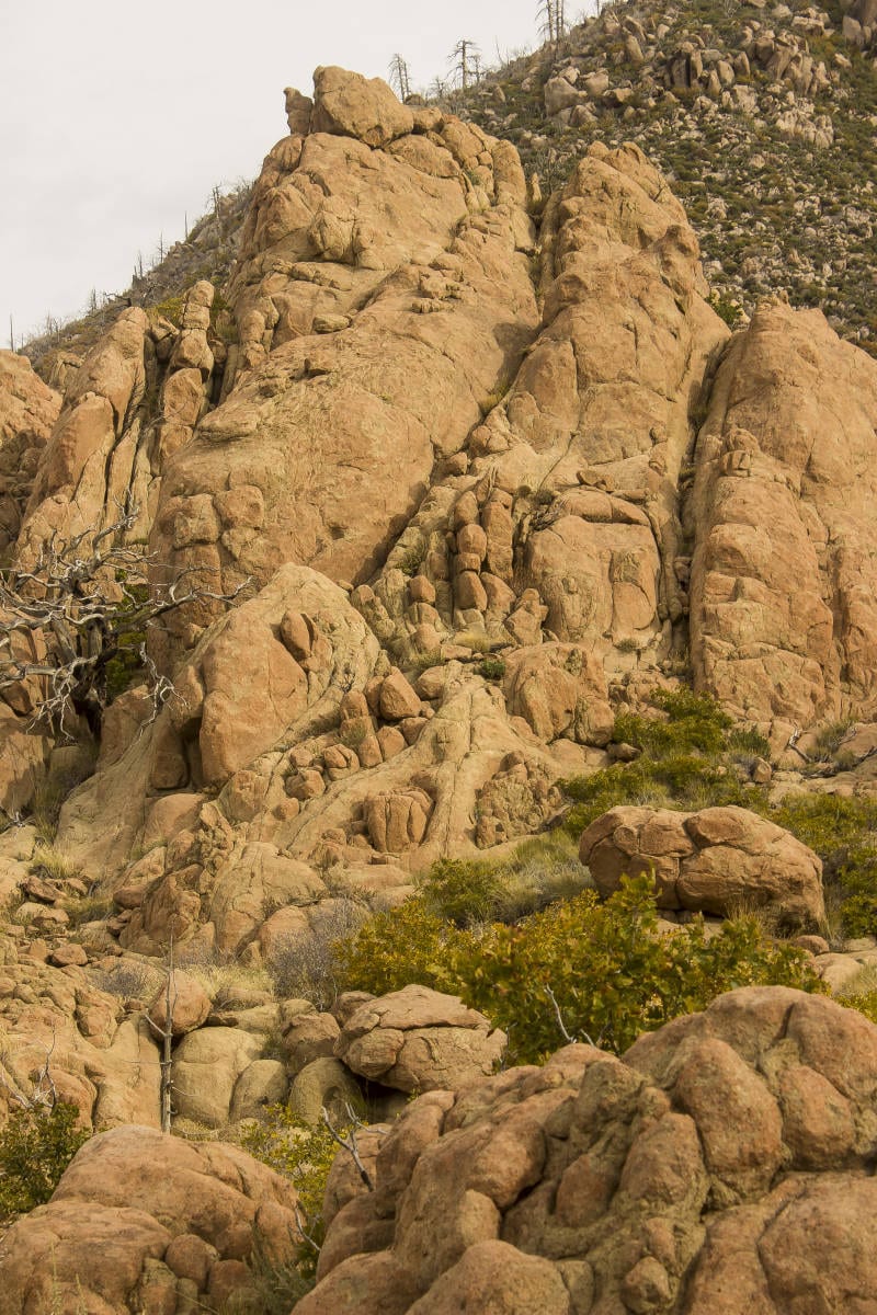
 The path follows a well-defined route up the west side of the huge canyon, occasionally traversing around fallen trees and boulders. After 1.15 miles, the trail veers east, across the head of the canyon. The route becomes rockier as it progresses, with numerous large boulders lining the trail. The route continues to divert around big deadfalls and hikers will have to pay close attention to routefinding to stay on track. At around 1.7 miles, the trail enters a wondrous spot of pinnacles, towers, and slender fingers of rock that resembles a scene from a fantasy movie. The otherworldly appearance of this spot has to be seen to be believed. The route through this section is circuitous and winding, and the large rock cairns keep the traveler on route. This would be an exceptional spot to spend an afternoon, wandering through all the nooks and crannies. However, the trail continues on, beckoning mountain pilgrims to the alpine terrain that lies ahead.
 Once past the fantasy towers, the trail diverts back to the west, heading at a steady incline up the final slope that leads to a high saddle. This point marks a dramatic change from the scrub oak and brushy environment of the lower slopes of the Pine Valley Mountains to the truly alpine terrain of evergreens and aspens of the upper mountains. Upon reaching the saddle at around the 2.25-mile mark, hikers have a couple of options. The first is to make this the turnaround point, an excellent option if you have expended all your energy hiking 1,500 feet to the saddle. However, if you have time and energy, the trail continues on to the north-northwest, making a gradual ascent through a valley of pines and aspens and tranquil meadows. At just under 4.5 miles, the Blake-Gubler Trail ends at the junction with the Forsythe and Summit Trails. From here, the Forsythe Trail leads north to the town of Pine Valley, while the Summit Trail heads south and east. Peakbaggers, take note of this latter option. In a few miles, the Summit Trail leads to within a short distance of the summits of the two highest points in the Pine Valley Mountains: Burger Peak (10,322′) and Signal Peak (10,364′).
To return to the parking area, head back on the trail the way you came.


Hi there, thank you for sharing this information on the Blake-Gubler trail. My son and I did it last year and loved it!! Can’t wait to get back up, probably my favorite hike here in St George area. Safe and happy trails