

Hiking Southern Utah: Confluence Park is not your typical hike
– By Don Gilman –
 Trails: Confluence Trail, Virgin River Trail
Difficulty: Easy
Distance: Approximately 4 miles
Average Time: two hours
Total elevation gain: Approximately 300 feet (virtually all of it on the initial trail down into the gorge)
Kid friendly: Yes, but bring bug spray or wear long pants
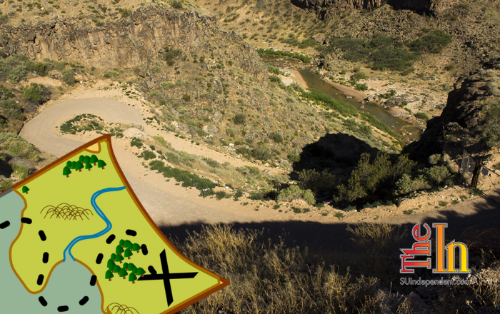
Tucked between La Verkin and Hurricane, down in the bottom of a rocky gorge, Confluence Park combines scenic beauty with history and biology in a quiet setting just a short distance from Utah State Route 9. A nearly 100-year-old power station, an equally old grain storage structure, and an ancient Native American site beneath a low rocky overhang are all found in the first 1 ¼ miles of the hike. Beyond are two barns in distinct states of decay. Across the river lies a tortoise rehabilitation pen with razor wire atop the fence and smiley faces informing the hiker that they are on camera. This is not your typical hike.
There are multiple ways to reach this unique and historically important area.
To arrive via the Hurricane Trailhead, drive north on Main Street until the road ends at the parking area. Alternatively, take 200 North to its end, and follow the Tortoise Track trail down into the park.
From SR-9 in La Verkin, take a left on Center Street and follow it to its end at the trailhead. Follow the Cactus Cliffs Trail down into the gorge.
From State Street in La Verkin, take a left on 900 North, following it until it turns into a gravel road and eventually ends at a parking area.
To find the trailhead for the Confluence Trail, drive on SR-9 through Hurricane, then north as the road heads into La Verkin. Shortly after crossing the Virgin River bridge, look for a pullout on the left side (just south of the River Rock Roasting Company). Park here. A gated road with a step-over leads steeply down into the canyon.
 The old road switchbacks down to the river, where numerous large cottonwoods and other flora have created a riparian, oasis-like feel to the canyon. The Virgin River flows noisily beside the trail. After approximately half a mile, the old power station is reached. Built in 1916, the ruined structure still houses the turbine and machinery once used to generate electricity.
Continuing down the trail, several routes branch to the right. Take any of these branches, and in about another half-mile, the tall grain storage building appears beneath the basalt cliffs. A short distance beyond, the cliff band bends back to the east, and a trail junction appears (where the Confluence Trail meets the Cactus Cliffs Trail). At the very bottom of the basalt, the Anasazi overhang can be seen. Scrambling up to it reveals the fire-blackened roof where, hundreds of years ago, Native Americans sought shelter and warmth from the elements.
At the junction, take the lower left-hand fork, and follow the old road grade as it contours in a northerly direction. A sign for the Virgin River Trail is soon passed, but keep heading north on the Confluence Trail. In another quarter mile of hiking, the remains of the old barns are reached. The Confluence Trail continues northward, but this is a good spot to turn around. Head back to the sign for the Virgin River Trail and follow it west across the river to the far bank.
 A short walk of another quarter mile brings travelers to the tortoise rehabilitation pens: a large fenced area topped with razor wire. Smiley-face signs inform visitors that they are on camera. Just north of this spot is where Ash and La Verkin creeks meet the river, giving the park its name. The Virgin River Trail continues on for another quarter mile before ending at the banks of its namesake river. (The trail in actuality continues for some ways further, but not for the purposes of this hike.) When ready, return east on the Virgin River trail, cross the river, and head back into the gorge towards the trailhead.


As someone who lives within walking distance of Confluence Park and has hiked it dozens of times from all the trailheads, let me say:
1) The Center St. Parking lot in La Verkin has ZERO parking.
2) The parking for the South end in La Verkin has moved from the South side of the River Rock Coffee to the North end (near the La Verkin Animal Shelter), since they are now building vacation rentals on the spot of the old parking area.
3) Crossing the Virgin River this time of year is very dangerous because of the fast flow, plus the river is full of quicksand now, which I personally hit this spring just by getting too close to the river.
4) The north parking lot in La Verkin is by far the easiest hike since it’s fairly level. All the other trailheads have a big hill.
5) Enjoy and be safe!