Hiking Southern Utah: Shivwits Arch
Trail: Shivwits Arch
Location: Virgin River Gorge, Arizona
Distance: 1.6 miles round trip
Difficulty: Challenging
Average time: Round-trip 2.5 hours (with half an hour spent at the top)
Starting elevation: 2,447 feet
Highest elevation: 3,333 feet
Total elevation gain: 992 feet
Best season: This is a good winter hike. Summer months will be hot, unless you start early in the morning. Best not to do it too soon after it rains, either.
The Virgin River Gorge has beautiful views that most people just observe as they drive through it on their way to somewhere else. Not many people think of it as a place to stop and hike. While technically not in southern Utah, the hike up to Shivwits Arch is reached by a short drive partway down the gorge.
From St. George, head south on Interstate 15 and get off at exit 18 to Cedar Pocket. You’ll then have to cross the overpass and head back north on Interstate 15 to mile marker 23. If coming from Mesquite, it will be on your right as you head north. Just past the mile marker, pull over onto the gravel pull-out area on the right. If you look up from here, you can see the Arch.
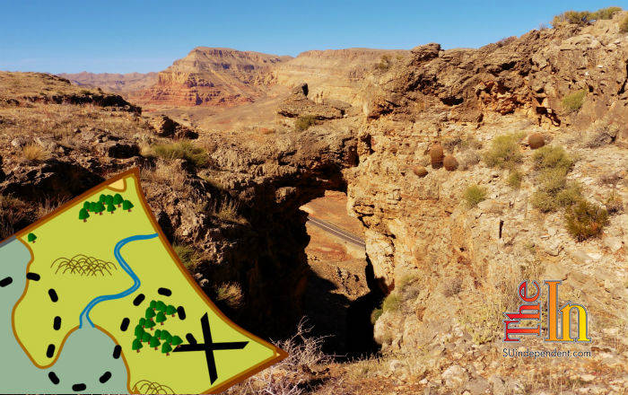
Yes, you are going to go up through that tiny hole!
There are several paths to choose from to reach the Arch. My hiking group chose the most challenging way (of course); right up through the middle of the Arch. It may not seem possible as you look at it from the road, but it really is. The hike is not long, but is difficult due to the elevation gain and trail conditions. It involves some route finding and quite a bit of boulder hopping. There are a few places near the opening of the Arch where stemming is required. This is a canyoneering technique of placing your back against one side of a canyon wall and putting your feet across to the other side and working your way up.
There is not really a defined trail up to the Arch the way we went. Just look up every once in a while to make sure you are headed in the direction of the Arch. We gained about 900 feet in elevation in the 0.6 miles up to the Arch and it took us about an hour. If you want a less strenuous hike, with a more obvious trail, you could go up the way we came down. You would cover the same elevation gain over a mile that way.
From your car, go down into the wash and back up the other side and look for a place to crawl under the barbed-wire fence. The bottom row of wire is not barbed, making it easy to slide under (don’t tell the cows). We started out on the right side of the canyon and worked our way up and towards the center of the Arch. Some places have loose rocks, so be careful not to stay too close to the person in front of you in case they send some rocks down the hill towards you. There are a few spots where you can see the paths the cows have taken. Use them when you can (just watch out for their droppings).
As you reach the opening of the Arch, you will need to use your hands and legs to pull yourself up through the opening of the Arch. This is where the stemming comes into play. There are some trees and bushes that have taken up residence in the opening of the Arch that you will need to push out of your way.
The view from the top is spectacular. You can even walk out onto the top of the Arch for some great photo ops. Both sides of the mesa offer breathtaking scenery. Make sure you take your camera with you. Take a few minutes to enjoy the fruits of your labor, (and to catch your breath) before you head back down.
You could probably go back down the way you came, but we chose to take a path that starts from the top of the Arch and heads north. It goes along the back of the mesa and then comes around some rocks to the front where you can see the freeway again.
Head south following the trail which leads you to a rope attached to the side of the hill that seemingly appears out of nowhere. You can use it to lower yourself down the steep hill-side (or if you decide to go up this way, you could use it to pull yourself up). When you get to the end of the rope, just make your way back to your car, again finding a good place to slide under the fence. You end up coming out a little further north than where you started, so just walk carefully along the shoulder of the free-way back to your car. We came out at the “watch for rocks” sign in case you want to go up that way.
Make sure you look back up at the arch when you get back to your starting point. You will be amazed that you actually made it up through that tiny hole. I told you that you could do it.


