
 Red Mountain Traverse

– By Charlotte Emett –
Photos by Travis Higley
Trail name: Red Mountain Travers
Location: Red Mountain Wilderness area
Difficulty: Strenuous
Length: About 10 miles
Elevation Gain: Extreme
Family-Friendly: Could prove too difficult for young hikers
Red Mountain Traverse is located primarily in the Red Mountain Wilderness area, along the edge of Snow Canyon State Park. It extends from the Ivins trailhead, located at the end of 200 East in Ivins, all the way to the Red Mountain Trailhead above Diamond Valley on Highway 18. This is a strenuous hike that consists of a steep climb, backcountry area with no trail, almost no shade, and a very long distance of about 10 miles. It is an easy hike to  get lost on, and search and rescue missions for lost hikers are common. The hike will allow you to see views of Snow Canyon that cannot be seen any other way and is free to the public. Keep in mind, you will need to arrange transportation to shuttle you back to the starting trailhead after you finish.
The Traverse covers a lot of ground and therefore offers more variety of scenery than you would see in most other hikes. Ivins consists of the beautiful contrast of red-orange sandstone and black lava rock. Cacti are prevalent, and if you hike in spring you will see them bloom with pink and yellow flowers. This extends through the first section until you reach the beautiful white sandstone that makes Snow Canyon unique to its surrounding area. Up near Diamond Valley, the area is less desert-like, filled with green pine trees, but volcanic rock still surrounds the area.
The trail begins with a mountain that looks impossible to climb. Luckily, it is easier than it looks. This doesn’t mean that it is easy, but just that it doesn’t require ropes or much upper body strength to make it possible. It is a very steep trek up a trail made up of loose dirt and rocks. It’s hard to tell where the trail is in some spots, but as long as you are still going up  you should be ok. The climb is about one mile long and contains four different sections before you reach the actual top. Once there, take a look at the surrounding mountains for landmarks. To the right is Snow Canyon, to the left are the deep red mountain of Kayenta, and straight ahead you should see a pointy mountain rising above the sandstone that looks like a shark’s tooth. This is the direction you are headed, but be aware these mountains will drop out of a view for a large portion of the hike and it is extremely easy to become disoriented.
The next few miles have no trail and is considered backcountry hiking. It is filled with sand, slick-rock, cacti, pine trees, and juniper. Try to avoid the cryptic soil whenev er possible. It is sand with a crusty layer that looks almost black in spots and is responsible for giving all the plants in the area the nutrients they need to survive. Eventually, you should come to a wash that provides an easy path to follow. You will want to make your way over to the Snow Canyon side occasionally in order to see the gorgeous views that allow to you see the combination of red sandstone, white sandstone, and the purple mountains of Pine Valley. However, be careful about staying too close to Snow Canyon because you may be following a wash that ends in a drop off and will cause you to backtrack.
Eventually, the red sand you are walking on will turn to red sandstone and then white sandstone. Depending on the time of year you will see pools of water in s ome of the sandstone low spots. One pond in particular lies just on the edge of the rock that looks out into Snow Canyon and looks spectacular when full. After a while, you should be able to find the trail that connects to the Red Mountain trailhead. It is very sandy and in some places extremely rocky, but very clearly marked, including signage to point out another gorgeous view of Snow Canyon.
There are a few alternative routes with this hike. The first is to start at the Red Mountain Trailhead and end in Ivins. This may sound easier because it means you’ll be climbing down instead of up, but keep in mind there is only one way down and it can be hard to find. Many people who try to go down end up having to backtrack quite often, which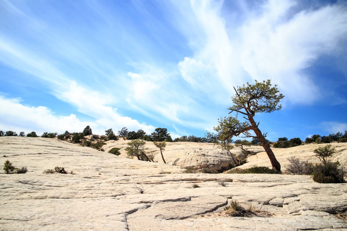 will be made more difficult if done at the end of a ten-mile hike. You also lose the bragging rights of being able to tell people you climbed that impossible-looking mountain. Another alternative is Gunsight Trailhead. I have not hiked this myself, but have heard it is much more difficult than the Ivins trail. The last alternative is to start at the Red Mountain trailhead, and hike to the end of the trail and then turn around. This will remove some of the gorgeous views seen at the beginning of the hike, but is a safer alternative for those who haven’t experienced hiking without a trail.
If you choose to try out this hike make sure you study the maps and GPS, or you should have an experienced guide with you as it is easy to get lost. I would also recommend taking 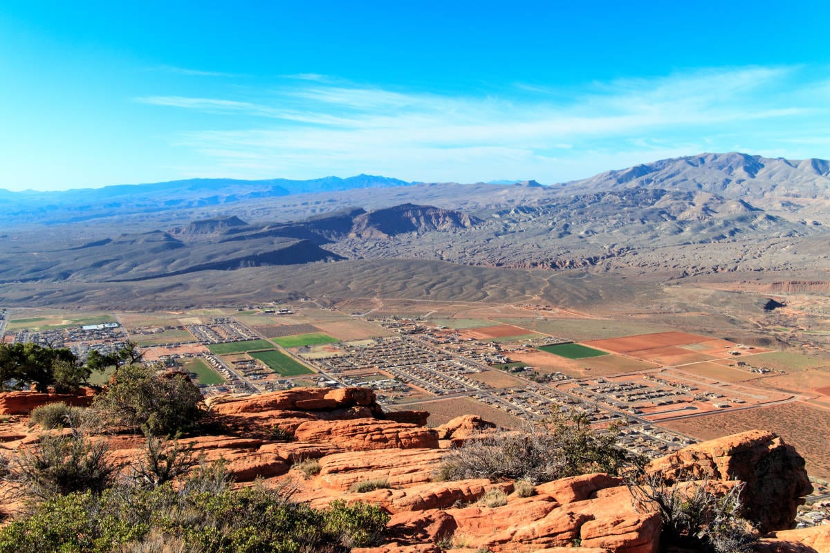 extra water and sunblock as there is very little if any, shade or covering. This is not a hike to do in the summer, and it is best to start as early as possible. It took my companions and me about seven and a half hours to complete. If you choose to do the hike in the winter, make sure you check the weather. Just because there isn’t any snow in Ivins, doesn’t mean there isn’t any on top of Red Mountain. Overall, the hike is a lot of fun, but very exhausting. It is the type of hike that every hiker in St. George should try to do at least once. The views of Snow Canyon and the surrounding area are spectacular and worth the long trek.


i do a lot of hiking where ever i end up.
the begining of this trail is VERY challenging and not for the casual hiker.
while i realize you are likely well experienced in hiking/climbing that this first portion
out of Ivins requires, think it is out of many folks ability to undertake and should
not be portrayed as something any one can take on. i would suggest that coming down
that steep portion would be the worst possible experience.
I grew up in this country stomping around these mountains its just a good fun walk