 Written by Don Gilman
Hiking Southern Utah: Cinder Cone Trail
Trail name: Cinder Cone
Difficulty: Moderate
Length: 1.5–2.5 miles, with options
Elevation gain: 250 feet
Time required: 2 hours
Family-friendly: Yes, with some loose rock, especially near the summit which may be difficult for children still developing coordination
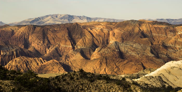
 Visitors to St. George and the surrounding areas are often struck by the sheer enormous rock architecture of our landscape: towering sandstone cliffs, lofty mountains of limestone and granite, and crumpled fields of black lava. While the limestone and sandstone are ancient sentinels from a time long past, the dark flows of basalt are relative newcomers to the area. One of the primary sources for this rock is the volcano in Diamond Valley, just north of St. George. A short but steep path spirals around and up to the summit of this lofty perch.
Access: The Cinder Cone Trail is easily accessible from St. George. Simply follow Bluff Street north out of town, driving 10.25 miles from the junction of Bluff and St. George Boulevard. Snow Canyon will pass on the left, and as the road makes a steep rise, look for the volcano to appear on the right, abutted against a sandstone ridge. Parking can be found at the junction of West Diamond Valley Drive (the entrance to the community of Diamond Valley) and State Route 18.
The hike begins by following the highway before veering into the lava beds, traversing over jumbled blocks of black basalt. In a very short time, however, the trail diverts to the east and onto the side of the cinder cone itself. From here, the trail begins its sinuous wrap around the volcano, passing from the north side to the west and eventually the south in a little over a half-mile. For the most part, the trail is well-packed, easy to follow, and of a moderate grade. However, loose cinders on the lower part of the trail occasionally make the footing treacherous, and the final slope to the summit is very loose. Caution should be exercised.
When the trail turns back toward the west, the path becomes more difficult, with more loose rock as it makes the final rise to the saddle that separates the cinder cone from the sandstone ridge to the south. A short spur path leads to better views to the west. To the north, the last short stretch of trail leads to the summit. Unfortunately, it is a very eroded, loose, and tedious ascent across a shifting slope of black and red cinder rock.
 In less than a quarter-mile, the broad summit is reached, a huge crater yawning beneath the rim with views stretching north to Signal Peak and the Pine Valley Mountains, east into the Red Cliffs Desert Reserve, and south toward Ivins and Santa Clara. The vast majority of the view to the west is taken up by the stunning landscape of Snow Canyon, and the perspective from the top of the volcano is stunning. Below, SR-18 and the passing vehicles look like a child’s playset.
From here, there are multiple options for extending this hike. The first is to walk around the lip of the crater and even descend down into it. A well-traveled path makes a loop around the top of the cinder cone and at the lowest point, descends down into the cool recesses of the crater.
To reach the second option, descend the trail back to the saddle with the sandstone ridge and head southwest along an obvious trail. Soon the trail traverses along the spine of the sandstone, weaving in and out of outcroppings and stands of pinyon and juniper trees. The path reaches a suitable turnaround spot at a high point on the ridge in a little over a half-mile. When ready, return to the saddle by the volcano and descend the Cinder Cone Trail back to the car park.


