 Hiking Southern Utah: Yellow Knolls Trail
Written by Ashley Gilreath
Trail name: Yellow Knolls Trail
Distance: 4 miles round-trip
Elevation Change: 537 ft.
Directions: From Interstate 15 Exit 8, turn west on St. George Boulevard. Turn at the first right on 1000 East. Turn right onto Red Hills Parkway. Turn left on Cottonwood Springs Road. It’s about a 6.5 mile drive from where you turn off Red Hills Parkway to the trailhead which will be on the right side. The road is rocky in places but passable without high clearance or 4-wheel drive.
You can find more information on the Yellow Knolls trail and maps on the Bureau of Land Management’s website.
An easy drive from town, Yellow Knolls feels like it is much further away. The trail is in the Broken Mesa section of Red Cliffs National Conservation Area. While much of the area has burned in the last decade and looks a little worse for wear, Yellow Knolls is still a little patch of pretty desert. With plenty of native plants, biological soils, and red rock, it’s a good place for an easy, short hike right outside town.
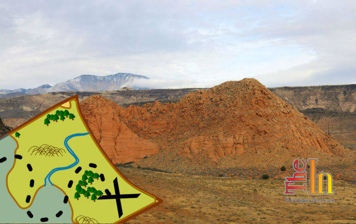
The first part of the trail is a leisure walk down the hill towards the knolls. The view exemplifies the colors of southern Utah. The “yellow knolls” are actually Navajo Sandstone and are quite red in places. Tumbling down the opposite hillside are dark lava flows that contrast with everything else. Above the knolls, the Pine Valley Mountains peek over the top of both with a snowy white top. There are many native plants, including globe mallow, along the trail making it quite scenic in the late summer as well.
Once the trail winds down to the knolls, it starts to get a little rockier. Up close, the basalt boulders are a deep black color, more so than many places around St. George. Desert varnish has really done a gorgeous number on the boulders. From here, the trail travels up the wash right next to the knolls giving an up-close view of the colors and patterns running across the sandstone. The knolls are a fantastic example of jointing in Navajo sandstone (similar to Checkerboard Mesa in Zion). Here, it is a paler pink and pentagon-shaped patchwork stretches across the sandstone. This is actually a great place to take kids close to town and show them the geology of the area.
The trail starts to get a little sandy at this point as it moves past the knolls and into a small valley. This area is full of deep red sand and agave plants are everywhere. Again, it seems like an area that is probably a gorgeous wildflower hike during the right season. There are also wildlife tracks everywhere through the sand making it clear that humans aren’t the only visitors to the area.
After the rains, an unusual thing pops up around the trail: desert shaggy mane mushroom. It’s a desert-adapted mushroom that only appears after heavy rains. The mushroom will eventually dry out and become so brittle that a slight breeze will split it apart, scattering the spores. In other parts of the world, they were used as a hair dye by some cultures.
The Yellow Knolls Trail ends at a junction with the High Point Trail. A longer loop can be made by making a loop with other trails or just hiking back along Yellow Knolls. The hike back down Yellow Knolls does afford a nice view of the knolls and a tiny slice of view across St. George.
Ashley Gilreath received her master’s degree from the Bren School of Environmental Science and Management with an emphasis in conservation planning. While in graduate school, she completed her thesis on fire management strategies at the private Tejon Ranch. She now works for local nonprofit Citizens for Dixie’s Future on their lands programs, where she spends her days managing volunteer and education programs for the National Conservation Areas of Washington County.


