 Article and photos by Ashley Gilreath
Hiking Southern Utah: Yant Flat
Trail name: Yant Flat
Elevation gain: Entirely dependent on how much exploring of the flats you do
Difficulty: Easy
Length: 2-3 miles
 Access: Heading north on Interstate 15, take exit 22 and drive through Leeds to get onto Silver Reef Road, or south bound exit 23, turn right on Silver Reef Rodd. Follow Silver Reef Road and it will change into Oak Grove Road. Continue on Oak Grove Road into Dixie National Forest and up the dirt (but graded) Forest Road 032. You will reach a junction, and need to stay straight onto Forest Road 031.
Continue driving for another 7 miles or so until you see the small sign for Road 903. There are a few informal parking spots on the side of the road. The trail starts opposite from Road 903. High clearance vehicles are not needed, but depending on road conditions, you may need four-wheel drive.
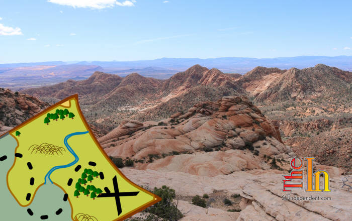
Yant Flat is the perfect viewpoint from which to see the topography of Washington County. From high up, one can look down and see the winding canyons of the Red Cliffs National Conservation Area, the slice of blue of Sand Hollow Reservoir, and Zion peeking out from the side.
Located on the edge of Dixie National Forest and the NCA, it is an easy spot to access. Once parked at the informal trail area (marked by the sign for Road 903), there’s an old Jeep trail running right out to Yant Flat. At just over a mile, it is a short enough hike to leave plenty of time to explore the Dr. Seuss-like curves and colors of the actual flats. The only downside is that the trail is very sandy, and your calves will get a workout.
It is worthwhile, though, and once past the sand, the flats are almost unreal to look at. After carefully working down a section of the cliff to a good viewpoint, one can look back and get an almost vertigo-like sensation from the kaleidoscopic patterns and shapes of the rock. Much like the Wave in Arizona, the contour and colors do not fit together quite right, and it creates a kind of funhouse experience when standing in the right place.
 Parts of the flats have extreme joints and cross-bedding, the geological processes that forms those quilted-looking “patches” on Navajo sandstone. On Yant Flat, it is so extreme in places that a person can actually sit on the “patch” of the steep cliffs, adding to the funhouse feeling of gravity just not being quite right. On top of the bends and geologic structure are color patterns that also go in every which direction. Rather than just bands and swirls of red (and only here are we all so spoiled that swirling red cliffs are no big deal) there are bands of yellow, white, red, and orange.
Continuing to the edge of cliff, there is a fantastic view of much of the county. To one direction are pieces of Kolob and Zion, while in the other direction are St. George and Red Cliffs. For people that commonly hike in the front country behind St. George, the vertical view also makes the trails behind St. George and Washington fit together in a new way. From this vantage point, the number of side canyons and washes is overwhelming, but many are recognizable as popular hiking trails. Seeing how they all fit together also inspires a whole new list of places to explore and navigate. Tucked into the landscape below are also plenty of remnants of pioneer history. With a decent pair of binoculars, old markers and water infrastructure are visible.
Hiking over to the other side of the flats, one can peer down the sheer cliff side at the start of one of the many washes that go through Red Cliffs. Spend a few moments, and a huge diversity of wildlife and plants start to pop out from the cliffs. Hummingbirds dive-bomb each other, and the small critters living in the nooks of the cliffs come out.
Once done, it’s a quick hike back to the car and less than an hour back to town.


