
Location: Red Cliffs Desert Reserve, Utah
Difficulty: Easy with some moderately strenuous inclines. The last half of Beck Hill Trail is almost all uphill, not too steep, on a rocky trail. The trail also has some sandy sections and lengthy rocky sections.
Average Hiking Time: About 2 ½ hours at a leisurely pace with many photo stops.
Elevations: 3,018 feet trailhead elevation. Chuckwalla Trail is fairly level. The last half of Beck Hill Trail is almost all uphill, not too steep. The elevation gain from the Chuckwalla Trail trailhead to the highest point on Beck Hill Trail is approximately 345 feet.
Family Friendly: Sections of the trail are loose sand, much of it is rocky, and the last portion on Beck Hill Trail is almost all uphill (not too steep). Can your kids and dogs do it?
As a rule, my wife, Deb, and I do not revisit hikes. In the past 35 years or so, we have hiked more than 250 trails in the southwestern desert (California, Arizona, Nevada, and Utah). Almost 100 of these have been in Utah, the large majority in southwest Utah. Even given those rather large numbers, there are simply too many trails we have not hiked, no need to revisit a hike. There are two exceptions to this rule.
First, we do take our hiking club, which we have led for eight years, on hikes we have done (we wouldn’t take the club on a hike new to us).
Secondly, we will revisit a trail if it leads to a hike we have not done. That is the situation for our latest adventure. To reach our destination trail, Beck Hill Trail in the Red Cliffs Desert Reserve, we must first traverse Chuckwalla Trail that we have previously hiked.
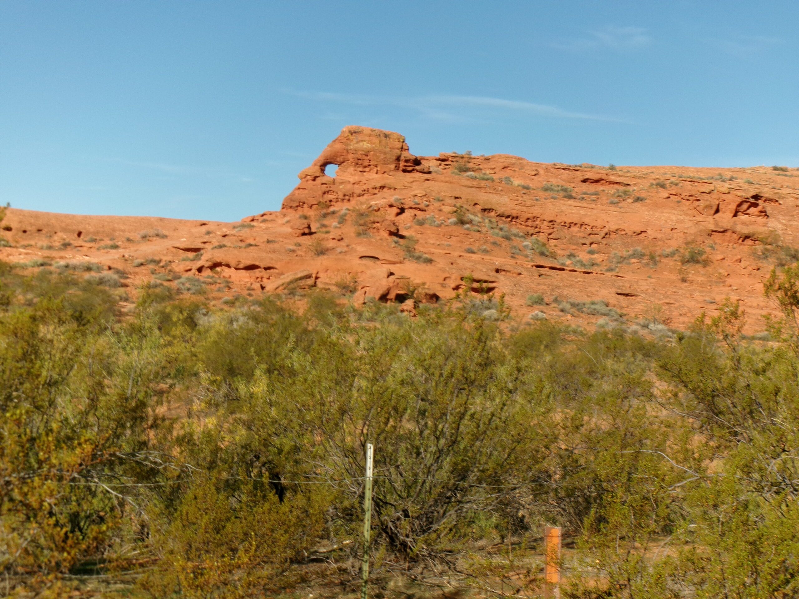
This merged out and back trail includes beautiful red rock formations, some distant arches, great views, and wildlife sighting opportunities. The entrance fee for Utah residents with a Utah driver’s license is $10 per vehicle (up to eight people). For non-Utah residents the fee is $15 per vehicle (up to eight people). No permit necessary.
The Red Cliffs Desert Reserve was established in 1996 to protect a large and diverse habitat capable of sustaining wildlife populations threatened by development and habitat loss. It comprises 62,000 acres and has more than 130 miles of shared use trails for hiking, horseback riding, and mountain biking. Three ecosystems—the Mojave Desert, the Great Basin Desert, and the Colorado Plateau—merge in southwestern Utah and the Reserve reflects the biological diversity of this unique region.
We began our adventure on an early November morning under a deep blue Utah sky. From the intersection of St. George Boulevard and Bluff Street/Highway 18 in St. George, we went north on Bluff Street/Highway 18. After 1.7 miles we reached the intersection with Red Hills Parkway/Snow Canyon Parkway. We continued north through the intersection and turned left (west) at the first opportunity (there is a sign pointing to Chuckwalla Trail on the right side of the road), about .3 mile from the Red Hills Parkway/Snow Canyon Parkway intersection; 2.1 miles from the St. George Boulevard intersection. The first hundred yards of the road into the parking area is paved, after that it is a good dirt road. There is a large parking area with pit toilets.
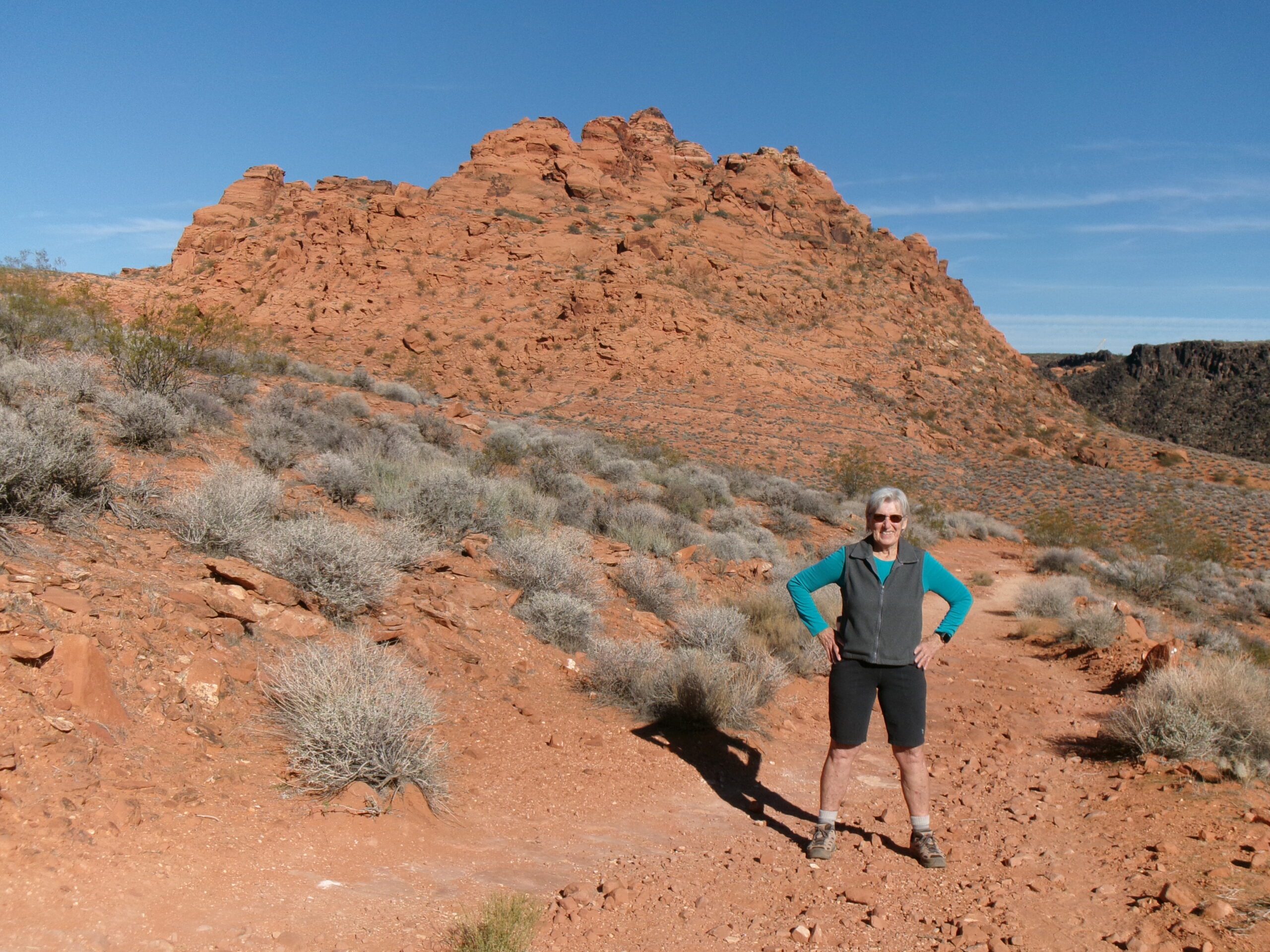
We reached the trailhead at 9:30 am with the temperature in the high 60s. The trailhead elevation is 3,018 feet and the elevation gain from the Chuckwalla Trailhead to the highest point on Beck Hill Trail is 345 feet. The hike is easy with some moderately strenuous inclines. The last half of Beck Hill Trail is almost all uphill, not too steep, on a rocky trail. The trail also has some sandy sections and lengthy rocky sections. We paid the $10 day use fee and began our hike.
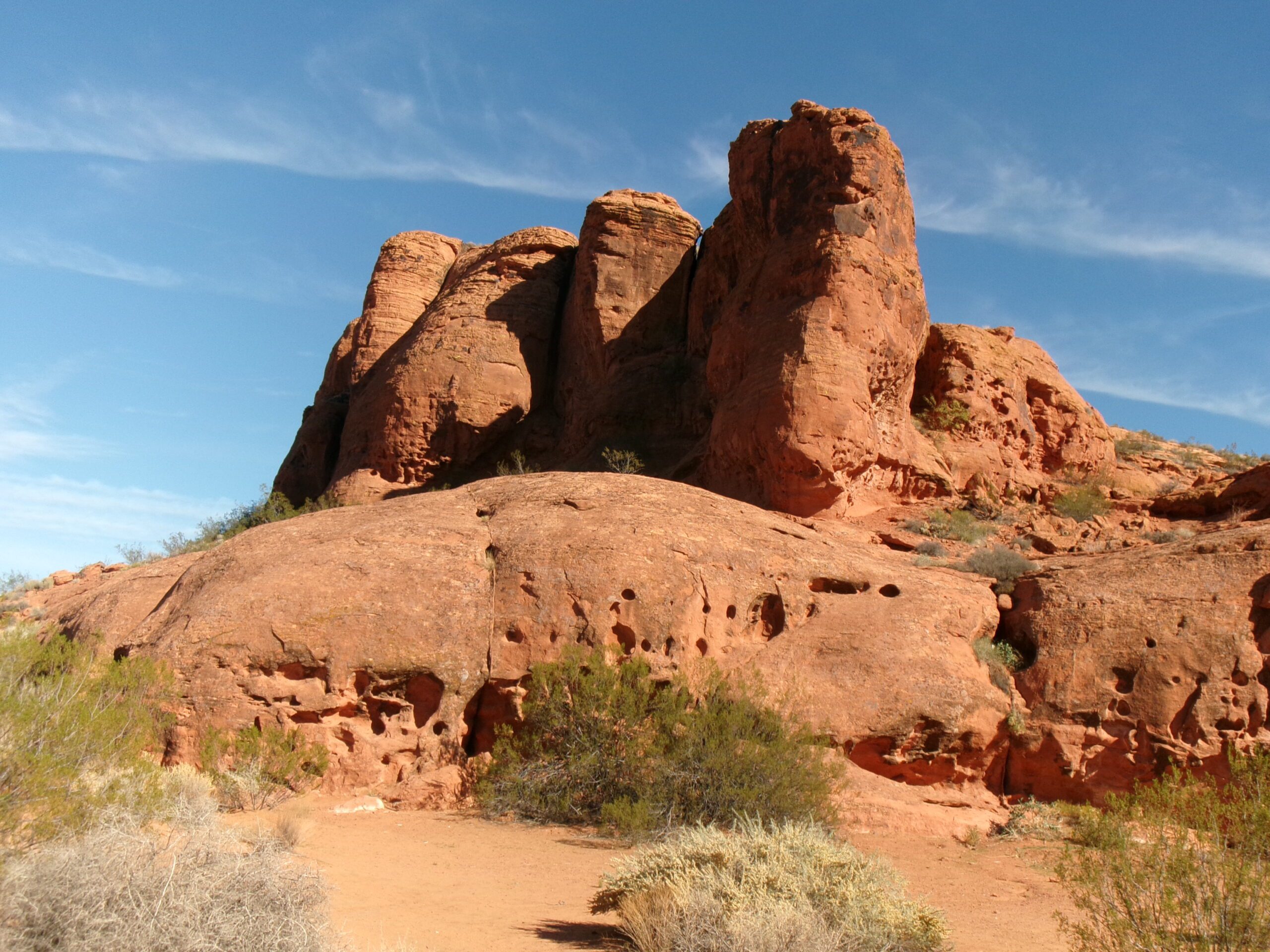
The first section of Chuckwalla Trail runs northwest along a series of sandstone cliffs popular with the rock climbing folks—not for us. The path then hooks left (southwest) for a short distance and the remainder of the .9 mile long trail goes north following the east side of Halfway Wash. We soon reached a junction with Turtle Wall Trail going left (west) crossing Halfway Wash and Beck Hill Trail going north.
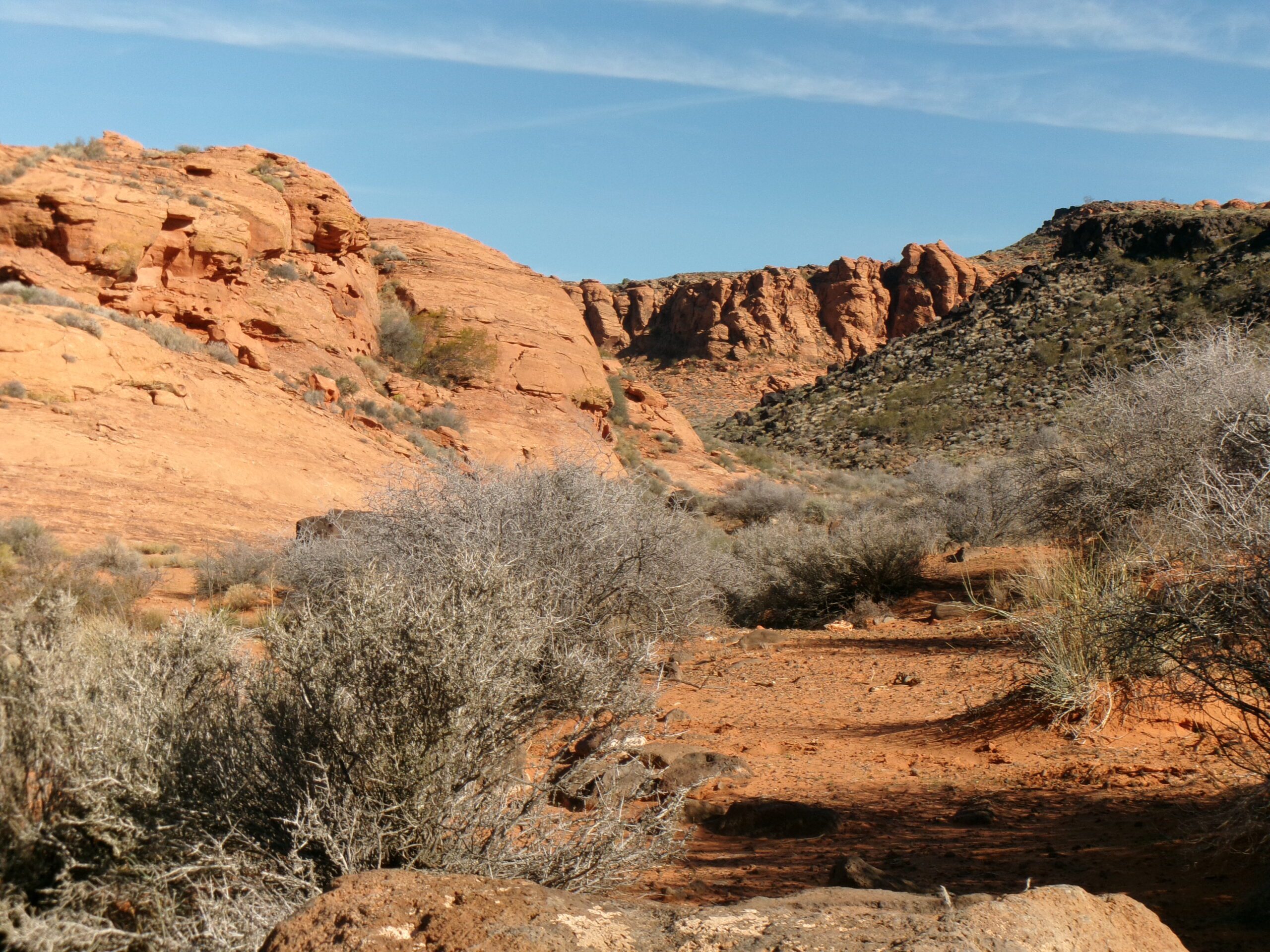
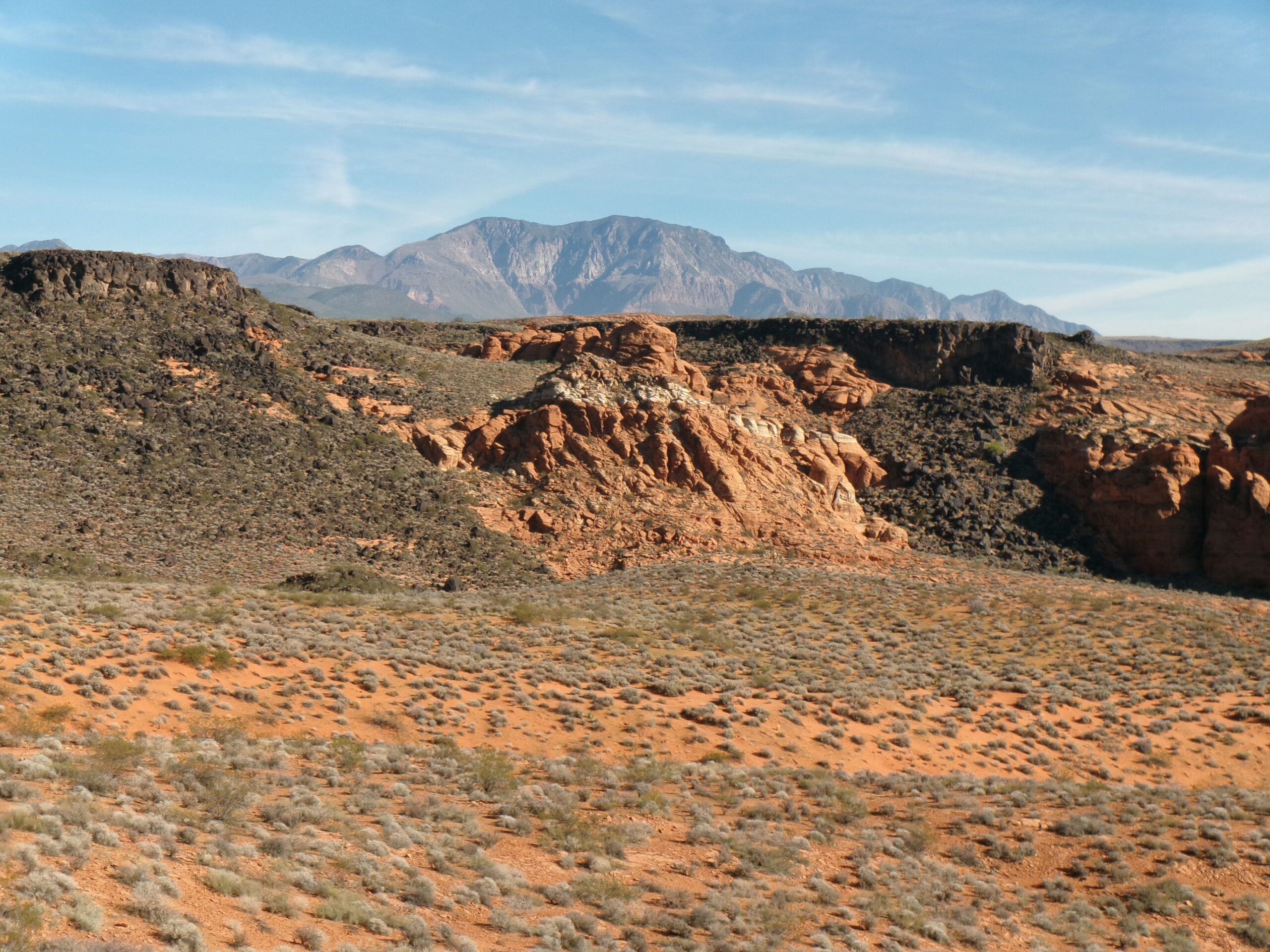
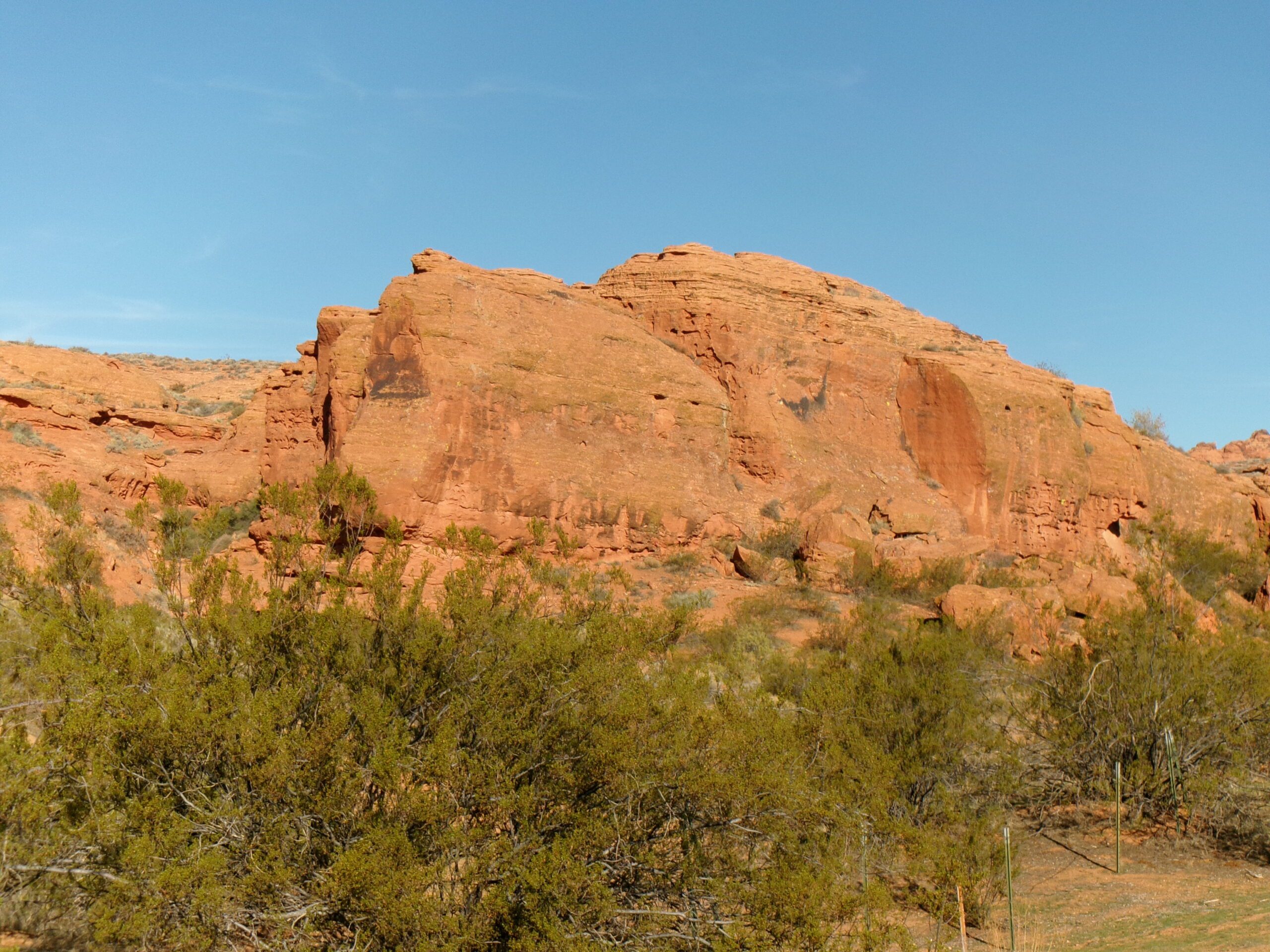
We proceeded north on Beck Hill Trail. After about .4 mile we crossed a shallow ravine, Twist Hollow. Except for crossing the hollow this first section is relatively flat. After crossing the hollow, the trail is mostly sandy or rocky. The views of red sandstone formations and distant canyons are awesome along the entire trail. At the highest point, we could also see part of St. George and Santa Clara. The last half of the trail is a mostly rocky steady incline, although not too steep. After 1.4 miles on Beck Hill Trail (2.3 miles from the Chuckwalla Trailhead) we reached the end. We headed back, again admiring the views.
We also some wildlife on our hike—many birds and one very fast jack rabbit. I expected to encounter a lot of hikers on popular Chuckwalla Trail, and we did. I didn’t expect to see so many fellow hikers, at least 15, on the more obscure Beck Hill Trail. We also met a horse, Ace, and his rider.
The round trip from the parking area is approximately 4.6 miles. While there is some elevation gain along Beck Hill Trail, overall it is an easy hike. The hike took us 2 ½ hours at a leisurely pace with many photo stops.
I highly recommend this hike. If you want a decent workout with fantastic views, massive red sandstone formations, and distant canyons consider this journey.


