

Da Vinci Petroglyph Trail in the Virgin River Gorge
By Tom Garrison
Location: Virgin River Gorge, northern Arizona
Difficulty: Moderately strenuous due to the mostly rocky trail and rock scrambling after cresting the first ridge, and some fairly steep sections.
Average Hiking Time: Almost two hours at a leisurely pace with much exploring for the two mile hike.
Elevations: The trailhead is approximately 2,387 feet elevation with a 175 feet elevation change from the trailhead to the highest point. There are a couple of steep sections, one at the beginning of the hike and one going down to “Newspaper Rock” petroglyph site.
Family Friendly: Because of some steep sections and mostly rocky trail, this might be difficult for young kids.
Finding the Trailhead: From St. George drive south on Interstate 15. At seven miles from the signed Utah-Arizona border pull off the road on the right into a large dirt parking area, .2 mile past the first bridge over the Virgin River. Since this is not an official trail, there are no trailhead signs.
To return to St. George, continue south on Interstate 15 3.5 miles to the Cedar Pocket exit, Exit 18. Take the exit, cross over the Interstate, and get back on the road heading north.
The Virgin River Gorge between St. George and Mesquite is quite impressive. You’re cruising along Interstate 15 admiring the rugged mountains, deep canyons, the cliffs, and the Virgin River. What could be better? Better is stopping along the interstate and actually exploring the gorge. How about a moderately strenuous hike to some great petroglyph sites with colorful mountains as a backdrop. Especially if one of the glyphs resembles Italian Renaissance master Leonardo Da Vinci’s (1452-1519) famous Vitruvian Man featuring a male figure with outstretched arms and legs inside a circle and square. If that appeals, along with nice views, you might want to hike Da Vinci Petroglyph Trail in the Virgin River Gorge a few miles south of St. George.
The hike to the petroglyphs is in the Beaver Dam Mountains Wilderness, managed by the Bureau of Land Management. The wilderness area, proclaimed/instituted in 1984, has approximately 2,600 acres in Utah and approximately 15,000 acres in Arizona.
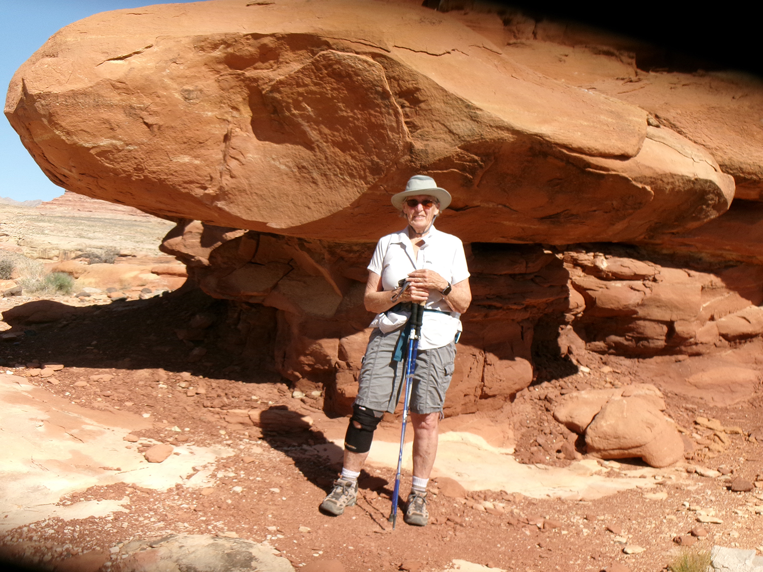
My wife, Deb, and I left St. George on a sunny mid-May weekend morning. We arrived at the trailhead about 8:30 am with the temperature in the mid-70s under a blue Arizona sky. The trailhead elevation is 2,387 feet with a 175 feet elevation change from the trailhead to the highest along the trail.
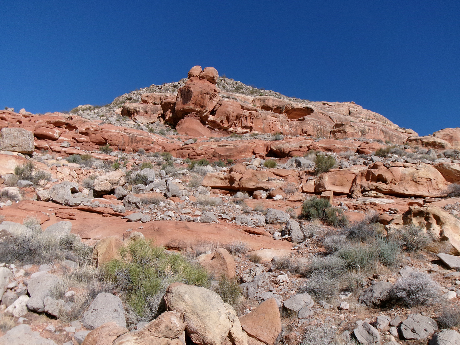
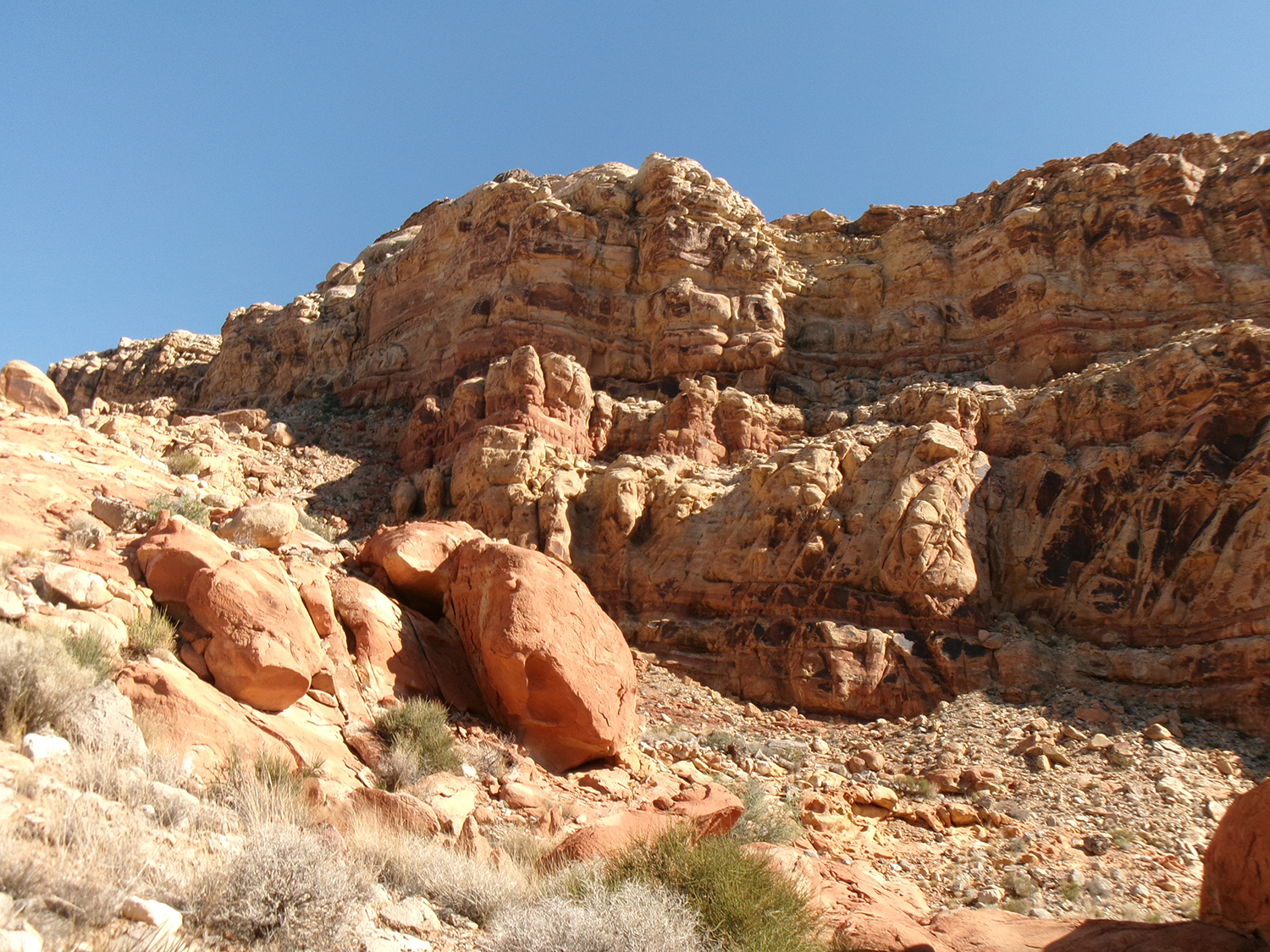
There is a barbed wire fence behind (north) the parking area. We went up a very short, but steep, incline to reach the fence. We crawled through a gap under the fence, easily located by a large black boulder directly under the fence, then turned right (east) following the fence on an obvious trail for about 100 yards until the trail made a sharp left turn (north). The trail descends a bit and then ascends to a low sandstone ridge about .2 mile ahead, now going northeast as it does for the remainder of the hike. Nice views from the top of the ridge, as are the views the entire hike.
Looking back from the top of the ridge, we saw a couple (guy and a gal) coming up the trail toward the ridge. When they reached the top, we chatted a bit. I was surprised to meet any other people on this isolated non-official trail.
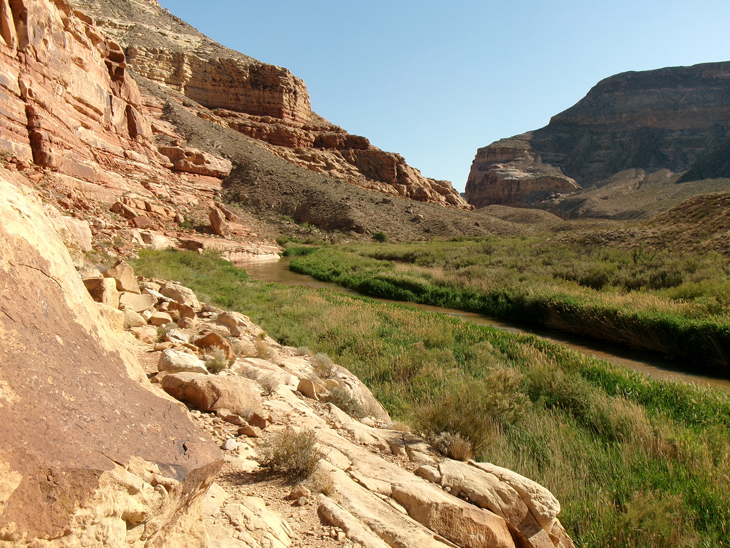
We walked down the back side of the ridge on a faint rocky user trail on our left. The idea is to avoid trails that head straight down to the Virgin River. The trail, marked with a few rock cairns, is mostly level. At about .8 mile from the trailhead to our right we saw a large isolated boulder down the slope that hikers have named Newspaper Rock. We went down the slope in a gully slightly to the left of Newspaper Rock.
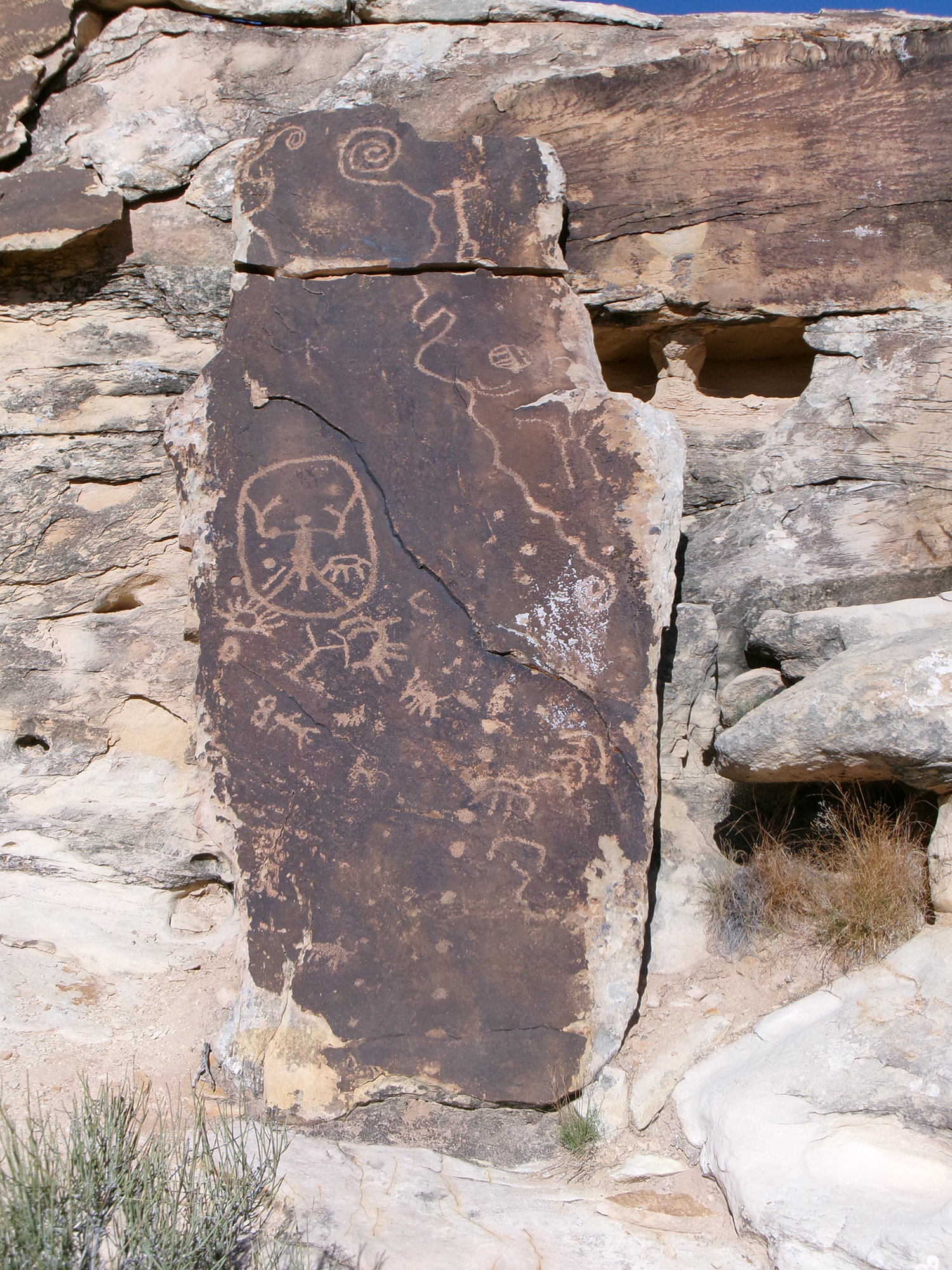
Newspaper Rock has a wide assortment of images—animals, human figures, geometric shapes, and general scribbles. Most are on the side away from the river. It also has “Ide. 1876 Feb.” scratched in the upper part of the rock. There are glyphs on some smaller rocks in the area.
Before finding the elusive Da Vinci Panel (actually quite easy to see), we took a short detour to a more recent rock carving. We followed the faint user trail in back of Newspaper Rock about 70 yards upstream (northeast) to a large boulder near the cliff edge with and inscription “IA Feb 1976.” We explored a bit admiring the river and mountains.
Next was locating the Da Vinci Panel. We retraced our steps to Newspaper Rock. Just before reaching it, we looked ahead at a series of shelves (short cliffs) overlooking the river. And there it was about 100 yards away. The dark rock slab Da Vinci Panel (about eight feet high by four feet wide) on a lower shelf not far above the river. We descended a bit and followed the cliffs to reach the panel.
The slab leaning against a large outcropping features the abstract likeness of Da Vinci’s Vitruvian Man—a two feet wide circle surrounding an outstretched male figure. There are other, less interesting petroglyphs on the rock.
At this point, we hiked about one mile from the trailhead, including exploring the petroglyph areas. We scrambled upslope to the user trail and headed back to the trailhead.
We arrived back at the trailhead after almost two hours on the two mile round trip hike. We were in no hurry and stopped often to take photos, simply admire the scenery, and hunt for petroglyphs.
I highly recommend this hike. If you value solitude, consider that we only saw two other people on the trail. The views are great, the petroglyphs interesting, and it is always fun to hike alongside the Virgin River.


We never found it. After going over the first ridge and following the path a short way, we went up and paralleled the mountain for awhile without finding a way down. So we stopped and just went back to the car. Should we have gone down closer to the river ?
After crossing the first ridge, did you ever see, looking downslope, a large boulder, Newspaper Rock, by itself in an open area? If you went far enough, it is pretty easy to see. Once you get to it, finding the rest is easy.
We figured we’d give it a shot on our way from Mesquite to St. George; after missing the parking area the first time, we pulled a U and found it on the second pass. The exacting descriptions enabled us to, with few detours, locate Newspaper Rock, and then the da Vinci Panel. I’m grateful to report that there was no vandalism or defacing of either of these cultural treasures. I’ve seen other petroglyph panels that ignorant a-holes have defaced; mercifully, this weren’t two one them. What made finding the panels mildly challenging was a complete lack of cairns. We just had to pay attention and discern from your description what to do, and luckily found them.
Thanks for going to the trouble of providing the descriptions and photos; it enabled a couple of complete strangers to enjoy and appreciate something left behind by an ancient people.