 Article and photos by Ashley Gilreath
Hiking Southern Utah: Beaver Dam Mountains
Trail: Beaver Dam Mountains
Length: 2.5 miles
Elevation: 250 feet
Directions: 4-wheel drive needed. Park at the top of the hill and hike down. DO NOT drive down the hill; many people have been stuck, even in 4-wheel drive.
From Interstate 15, take the Bluff Street exit into St. George. Turn north on Bluff Street. Turn left on Black Ridge Drive. Turn right on Hilton Drive. Turn left on Tonaquint Drive. Turn right on Bloomington Drive. Turn right on Navajo Drive, and to continue until it turns to a gravel road. You will pass the parking area for the Bearclaw Poppy trailhead. Past this area, the road network is extensive, and it gets very hard for people to find this spot without a map. Click here for a Google Map.
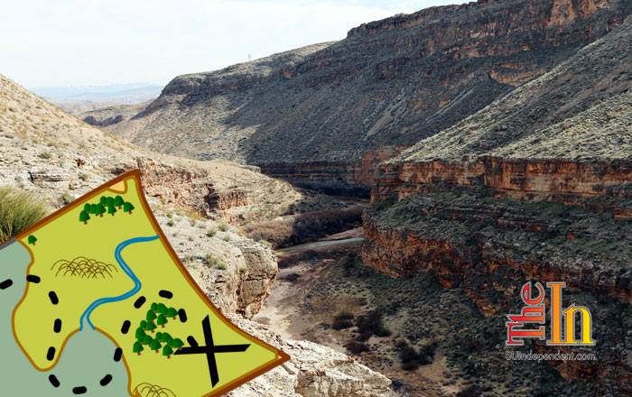
Far beyond the Bearclaw Poppy Trail and down a winding dirt road past popular shooting areas, one can access the Beaver Dam Mountain Wilderness Area where it starts to enter the Virgin River Gorge. Here, Interstate 15 does not roll through the gorge, creating a quieter experience of the same soaring cliffs and winding river. Granted, this is one of those hikes where the car ride out takes almost as long as the hike, but it’s a spectacular view of the Virgin River as it starts to meander through the gorge.
From the parking spot at the top of the hill, hike down the road to the river. The road down is very steep and rocky, so be careful navigating down. At the bottom of the hill, the road will taper out and approach the river. During higher flows in spring, you can actually raft down the river here (obviously at your own risk, and the rapids can be class IV).
Many folks stop and wonder at this point what a dam is doing way out here. It is actually a fish barrier designed to keep Red Shiner from traveling up the Virgin River from Arizona. One of three barriers the Virgin River Program has installed, the barrier allows the conservancy to treat sections of the river as needed to keep the Red Shiner out. For those not familiar, Red Shiners are an invasive fish species that have a tendency to chow down on our native fish species.
To the west (looking right) is a step-over gate to Beaver Dam Mountain Wilderness area. From here, an unsigned trail travels up and along the ridge overlooking the river. As with much of the gorge, this area is full of barrel cactus and desert plants that are pure Mojave desert species. Keep an eye open as there are also a few Bureau of Reclamation markers out here too.
About 0.5 mile up the trail, there is an overlook that has a great view of the gorge and makes a decent turnaround point, although folks can follow the trail for quite a while longer. Here, one can look down at the gorge and see all the layers of rock in the canyon. The river curves through the rock quite a bit in this section, making layers upon layers of giants “S” shapes as you look downstream. It’s a reminder of the sheer force a tiny river like the Virgin has on the surrounding landscape.
To get back to the car, head back the way you came. At the bottom of the hill near the river, take 10 minutes and stroll down the river. Up close, the cliffs here have all sorts of interesting formations going on, even if they do not have the same diversity of color seen in much of the area.
Ashley Gilreath received her master’s degree from the Bren School of Environmental Science and Management with an emphasis in conservation planning. While in graduate school, she completed her thesis on fire management strategies at the private Tejon Ranch. She now works for local nonprofit Citizens for Dixie’s Future on their lands programs, where she spends her days managing volunteer and education programs for the National Conservation Areas of Washington County.


