
Location: Red Cliffs Desert Reserve, Utah
Difficulty: Easy. There are many up and downs sections along the trail, but none are very long nor are they very steep.
Average Hiking Time: A little more than 1 1/2 hours at a leisurely pace with many photo stops for this three mile round trip hike.
Elevations: White Reef trailhead, the starting point, is approximately 3,035 feet elevation with approximately a 100 feet elevation gain from there to the highest point of the hike.
Family Friendly: Yes, this is an easy hike.
Finding the Trailhead: The trailhead is about 10 miles from St. George. Driving north on Interstate 15 take Exit 16 onto State Route 9 toward Hurricane. At the first traffic light turn left (north) and proceed northeast on Old Highway 91 for four miles. Around four miles you’ll see a brown sign on the right reading Red Cliffs National Conservation Area/Red Cliffs Recreation Area and arrows pointing to the left. Within a hundred yards or so, take a left turn (northwest) through two narrow tunnels under Interstate 15. Go right (northeast) on a good dirt road after transiting through the tunnels and continue for .1 mile (.2 mile from the Old Highway 91 turnoff) to the signed White Reef Trailhead and large parking area.
Or, going south on Interstate 15, take Exit 22 to the town of Leeds. At the end of the off ramp, make a sharp right (south) onto Old Highway 91. Travel approximately two miles and turn right (northwest) just past the Red Cliffs National Conservation Area/Red Cliffs Recreation Area sign and proceed through two narrow tunnels under Interstate 15. Then follow the directions above.
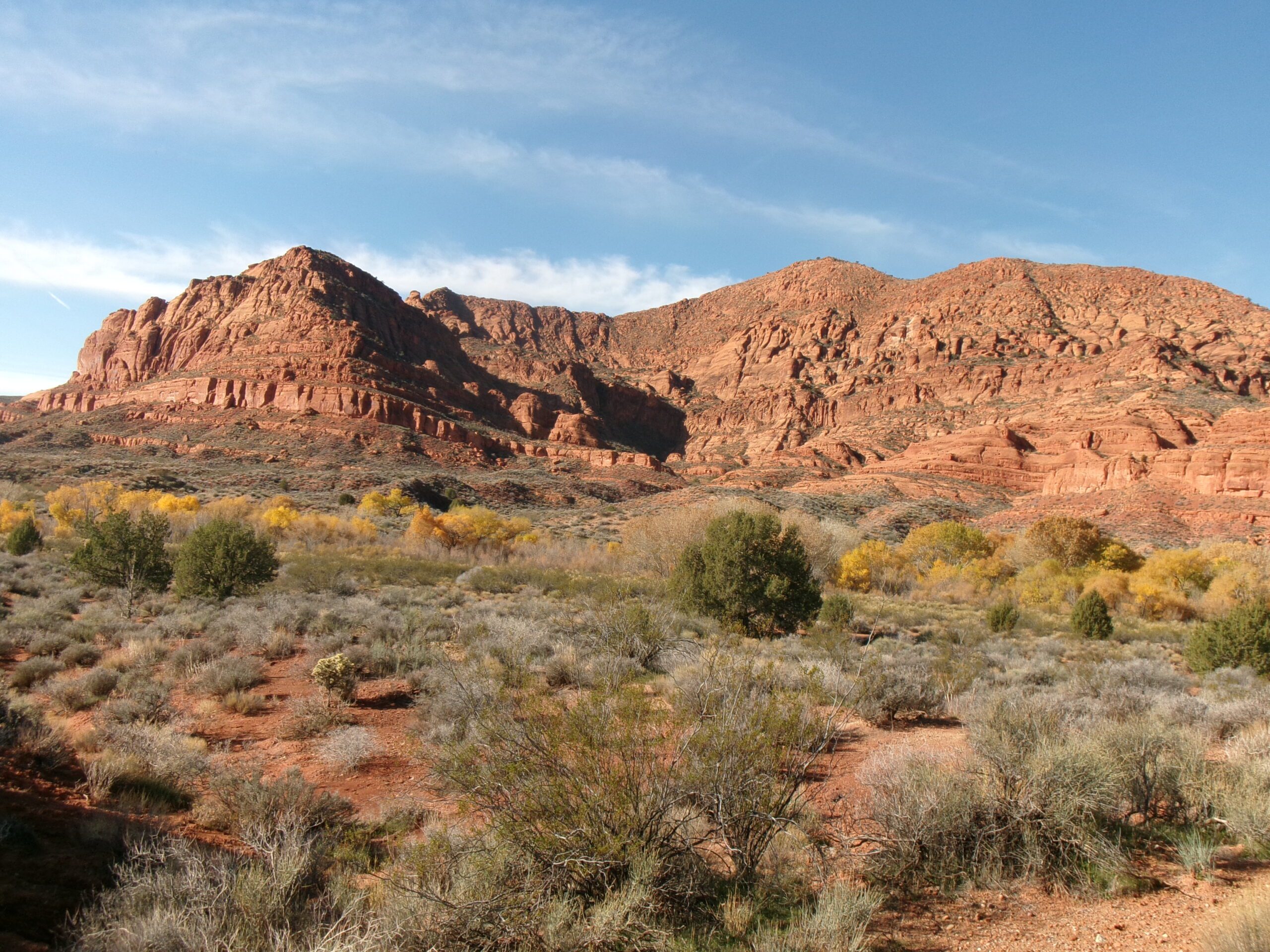
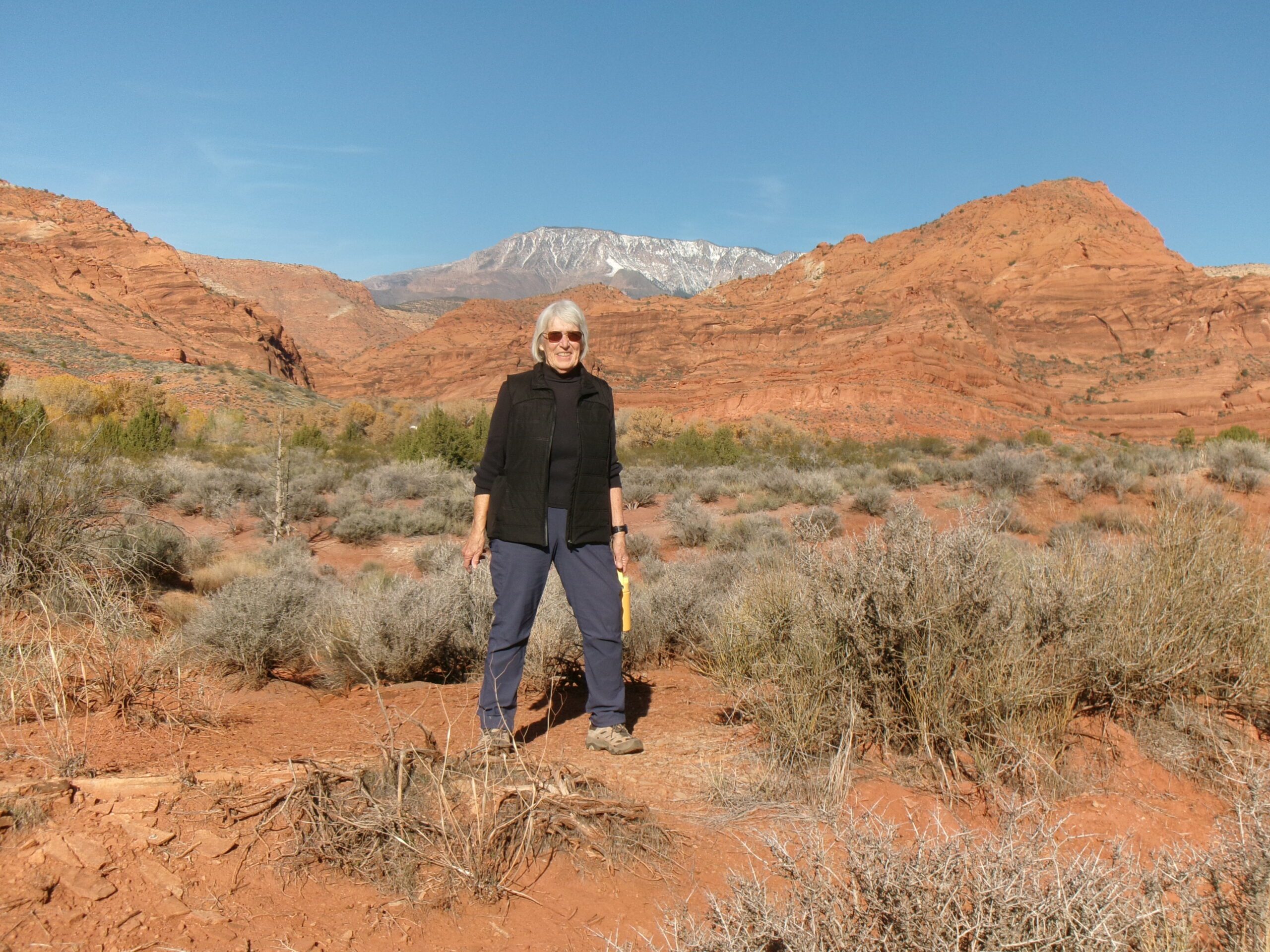
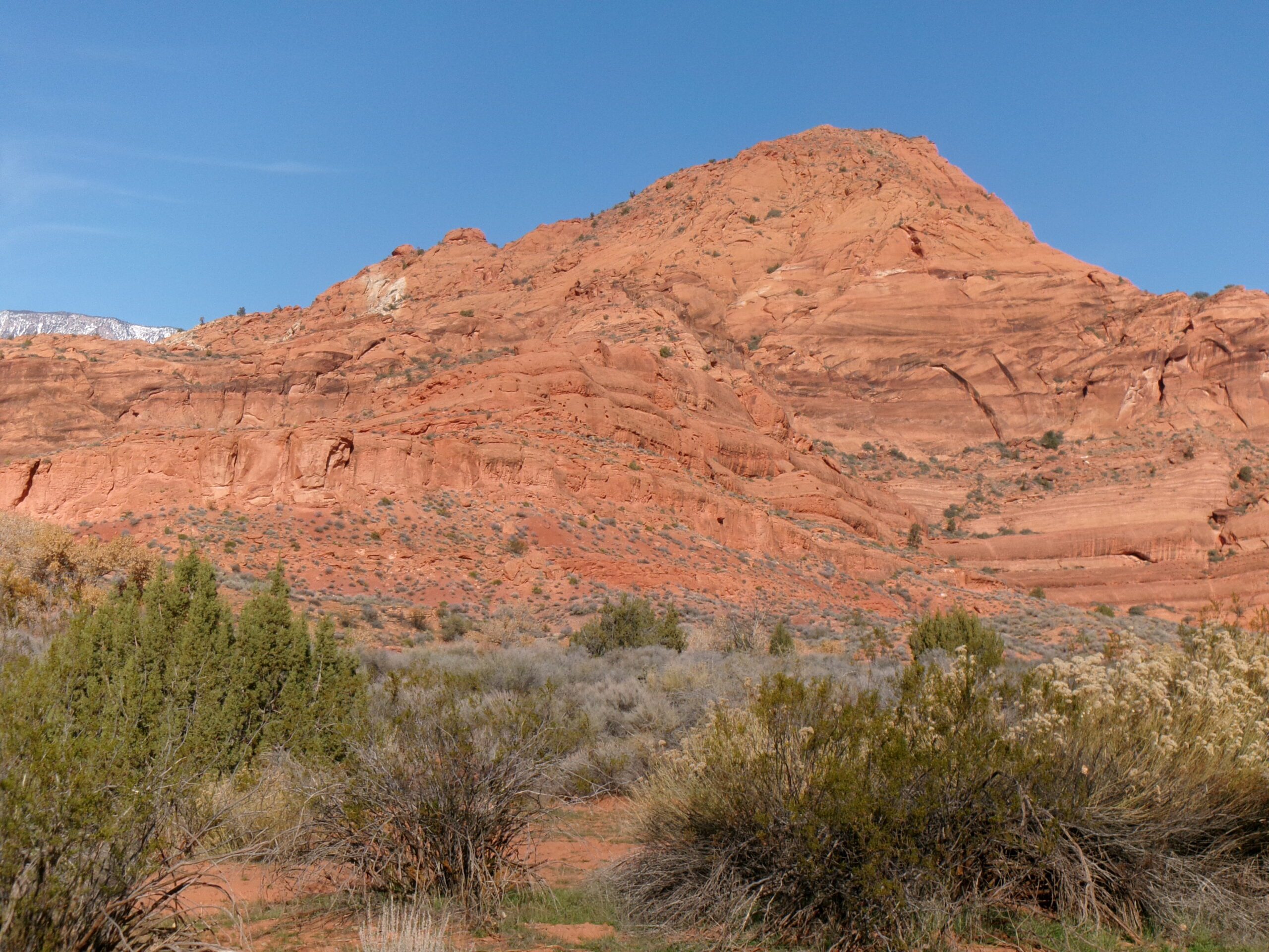
Two things often missing from southwest desert hiking are running water and shade. The easy three mile round trip Quail Creek Trail is a bit unusual because about half of the hike is through a shaded riparian area of cottonwoods and willows alongside Quail Creek. It also features magnificent views of the red sandstone mountains and cliffs to the north and west. This is the newest adventure for my wife, Deb, and me. The trail is located in the Red Cliffs Desert Reserve.
Hiking short distances on three trails is required to reach Quail Creek Trail trailhead (one way distances)—.2 mile on White Reef Trail; .2 mile on Adams Trail; and .1 mile on Prospector Trail.
The Red Cliffs Desert Reserve was established in 1996 to protect a large and diverse habitat capable of sustaining wildlife populations threatened by development and habitat loss. It comprises 62,000 acres and has more than 130 miles of shared use trails for hiking, horseback riding, and mountain biking. Three ecosystems—the Mojave Desert, the Great Basin Desert, and the Colorado Plateau—merge in southwestern Utah and the Reserve reflects the biological diversity of this region.
We set off on our journey to Quail Creek Trail on a crisp, clear last Saturday morning in November. We parked at the White Reef trailhead about 10 am under a deep blue Utah sky with the temperature in the low 50s. The White Reef trailhead elevation is 3,035 feet with approximately a 100 feet elevation change from there to the highest point of the hike.
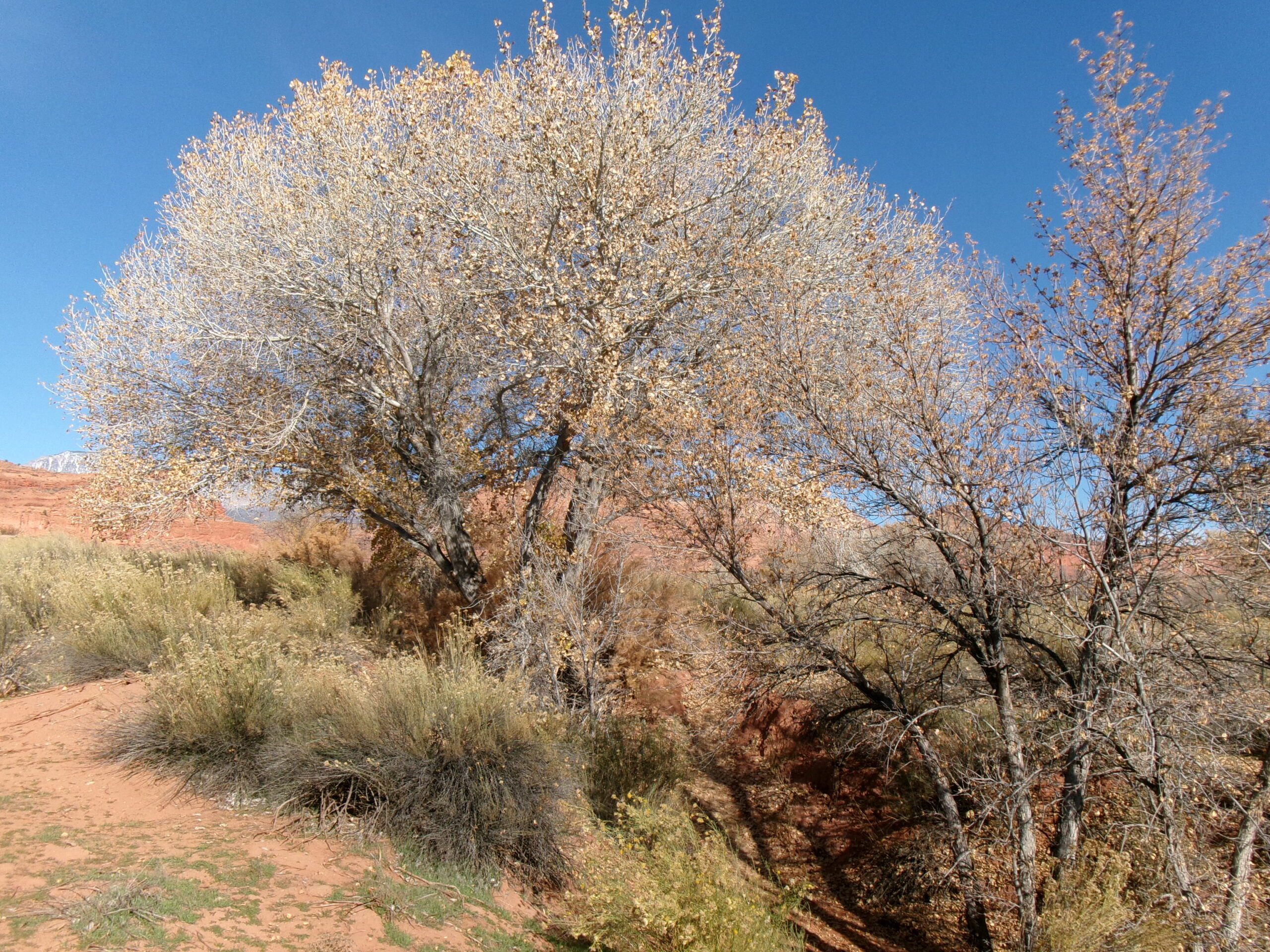
We began by heading northwest on signed White Reef Trail, actually a dirt road. We quickly reached, about .2 mile from the White Reef Trailhead, the intersection with signed Adams Trail and took it going left (southwest). Within .2 mile we crossed over Quail Creek on a small wooden pedestrian foot bridge. The creek carries water through most of the year, but may be dry during hot summer months and in times of drought. By this time, we were in the riparian environment of Quail Creek with lots of trees and vegetation.
Shortly after crossing the creek, we came to an intersection with unsigned Prospector Trail on the right, signed Adams Trail on the left.
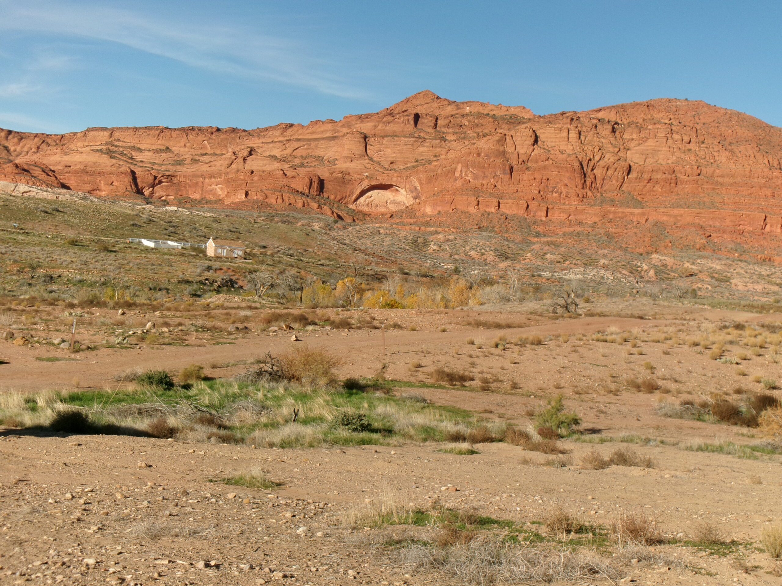
If you have not visited the historic Adams house, you might want to take a small detour to check it out. The Adams Trail leads up a short steep slope to the bluff above where the house is located. Several signs describe this pioneer family and the area in general.
After exploring the Adams house, or deciding not to as we did because we had been there before, we headed north on Prospector Trail. After about .1 mile we reached yet another intersection, signed Prospector Trail to the left and signed Quail Creek Trail to the right going north.
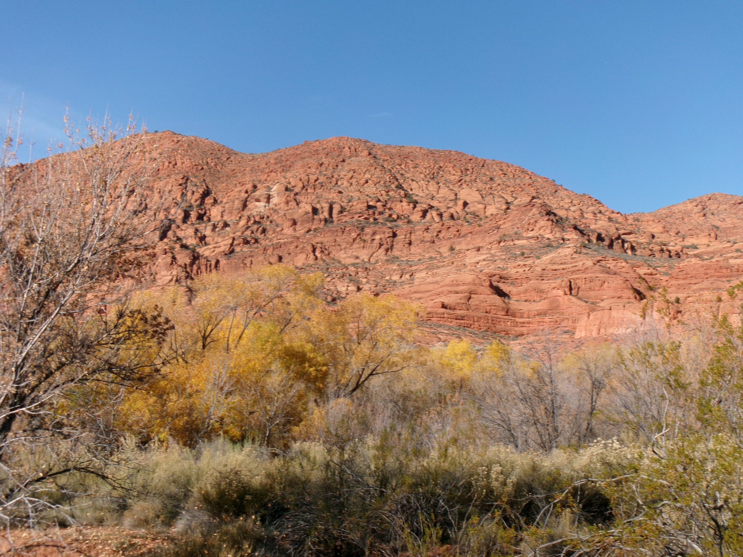
Quail Creek Trail runs parallel to Quail Creek for around half its length, about .5 mile. As expected, hiking a meandering trail alongside a creek was shady and filled with trees and bushes. We could hear the water rushing by. The experience was a bit different for us, we could simultaneously be in a riparian environment and still see the amazing red sandstone mountains and cliffs to the north and west.
Around .5 mile from the Quail Creek Trailhead we again crossed the creek. Because the creek was low, we easily stepped across on some rocks in the creek bed.
Within a few hundred yards after fording the creek, the trail moves away from Quail Creek and crosses a relatively flat area still heading north. At one mile from the Quail Creek Trailhead (1.5 miles from the White Reef Trailhead) we came to another intersection, this time with signed Anasazi Trail. This was our turn around and head back point.
This easy three miles round trip hike took us about 1 1/2 hours at a leisurely pace. There are many up and downs sections along the trail, but none are very long nor are they very steep. We encountered eight others on the trail, half of them on bicycles. We saw some birds in the areas close to the creek. The best part was the great views.
I recommend this adventure—a natural setting with fantastic views about 10 miles from St. George. A great way to break late autumn doldrums.


