
Location: South of Leeds in the Red Cliffs Desert Reserve.
Difficulty: Strenuous (very strenuous for older folks–my wife Deb and I are in our mid-70s) with some rocky sections, several long deep sand sections, and much up and down hiking, sometimes over fairly steep ridges. The absence of trail signs after the initial one at the trailhead makes this hike a bit more difficult than it need be (wandering around looking for the correct trail).
Average Hiking Time: About 2 1/2 to 3 1/2 hours at a leisurely pace with many stops for resting and photos.
Elevations: Approximately 3,110 feet trailhead elevation with a 550 feet elevation change from the lowest to highest point. We only did a portion of the hike and gained approximately 400 feet.
Family Friendly: Nope, unless everyone on the hike is in pretty good shape.
Finding the Trailhead: Heading north on Interstate 15 take Exit 22 onto Old Highway 91. Continue north approximately 2.2 miles through the town of Leeds. (In Leeds the highway is renamed Main Street.) Next turn right (south) onto unsigned Babylon Road just past the sign for the Red Cliffs National Conservation Area. Babylon Road (the primary access to seven trailheads and 13 designated trails) is also known as 900 North Road. It is mostly a good dirt road, especially the first part near all the new development. However, past the development, there are a few very rocky and deep sand sections.
At 2.7 miles upon encountering a major (for dirt roads) signed intersection, go left (east) to the Sand Cove and Sandstone Mountain trailheads. Less than .1 mile further is the Sand Cove Trailhead parking area. Continue east past the Sand Cove Trailhead and at .2 mile from the Babylon Road intersection turn right (south) at the first junction.
The road past Sand Cove Trailhead parking area is very rough in a few places and includes a high ledge in the road. Driving over the ledge requires a high clearance 4-wheel drive vehicle. You could park at the Sand Cove Trailhead parking area and walk about .3 mile to the Sandstone Mountain Trailhead.
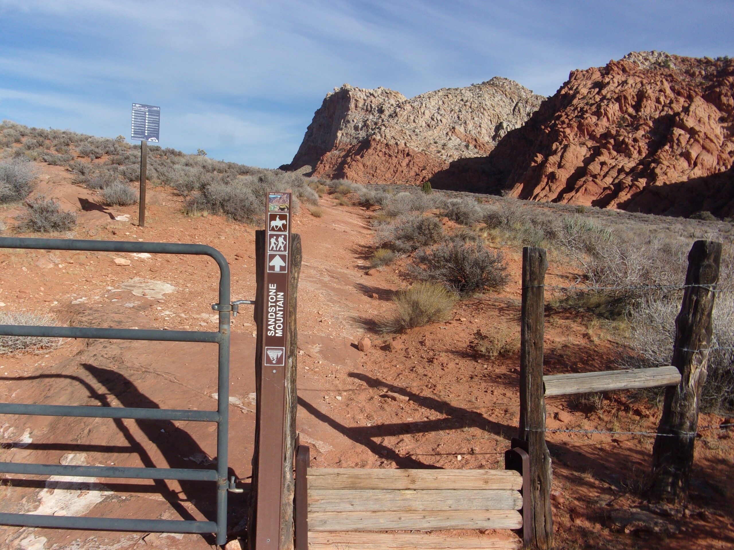
About .4 mile from the Babylon Road intersection is the signed Sandstone Mountain Trailhead/stepover on the left (north) side of the road. There is a small area for parking, space for three or four vehicles. If the trailhead parking area is full, follow the sign to the Sand Cove Primitive Camping Area about .1 mile ahead which has plenty of parking. If you park at the Sand Cove Primitive Camping Area, walk back about .1 mile to the Sandstone Mountain Trailhead (now on your right) and begin your hike. I strongly recommend a high clearance vehicle due to road conditions in the last .4 mile.
Red sandstone mountains are anything but rare in southwest Utah. But how often do you get to explore them up close? There is one close by, Sandstone Mountain, where the trail circles the base and crosses over the mountain. My wife, Deb, and I decided that’s the hike for us. We did not do the entire hike, it was strenuous. But the views were worth the effort.
Sandstone Mountain Trail is located in the Reds Cliffs Desert Reserve near Leeds. The Red Cliffs Desert Reserve is a 62,000 acre scenic wildlife reserve set aside in 1996 to protect the desert tortoise and other sensitive plants and animals. The reserve has more than 130 miles of shared use trails for hiking, horseback riding, and mountain biking. Remember, the reserve is a sensitive area, stay on the trails and minimize your impact—walk as if you are kissing the earth with your feet.

Our adventure began on a weekday in late February. We parked at the signed Sandstone Mountain Trailhead/stepover on the left (north) side of the road, ours was the only vehicle there.
The temperature was in the mid-50s at about 9:30 am as we began our hike under a slightly overcast blue Utah sky. The trailhead elevation is approximately 3,100 feet with about a 550 feet elevation gain from the lowest to highest point.
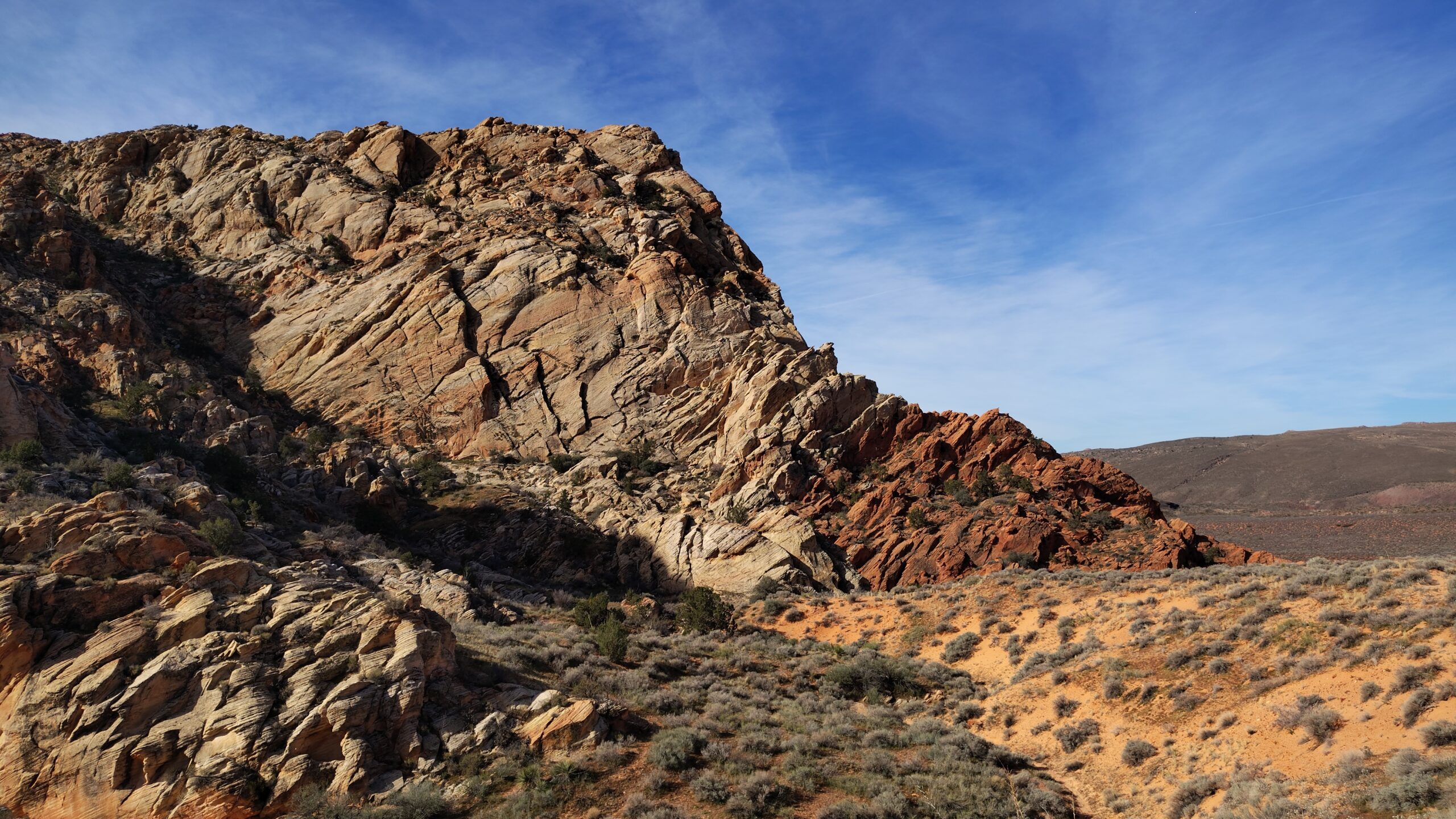
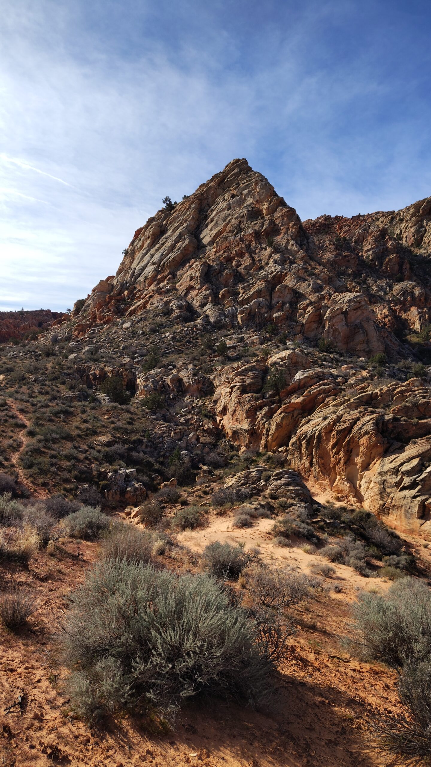
We headed northeast on a fairly flat wide trail toward the highest peak of Sandstone Mountain. This .4 mile portion of the trail is packed dirt with some rocky areas, easy to walk on. It then transforms into the fun part for another .6 mile—loose, deep sand almost all uphill. Along this first mile of the trail are splendid views to the north of the Pine Valley Mountains and the smaller red sandstone mountains and cliffs in front of them. And Sandstone Mountain towering above on our right (east).
About one mile from the trailhead we came to a stepover in the fence that runs along the right side of the trail. Since there was no trail sign we did not know if it was the correct route to take. Over the stepover was a definite trail leading to the saddle between the mountains. Deb checked ahead a couple of hundred yards on the loose sand trail and did not find another obvious trail going east.
We crossed the stepover and headed east up and down sandy ridges into a wash, the lowest part of the saddle between Sandstone Mountain and the mountain to the north. We noticed a couple of what seemed to be user trails headed in different directions. Due to the lack of trail signs, we were not sure which way to go and continued east.
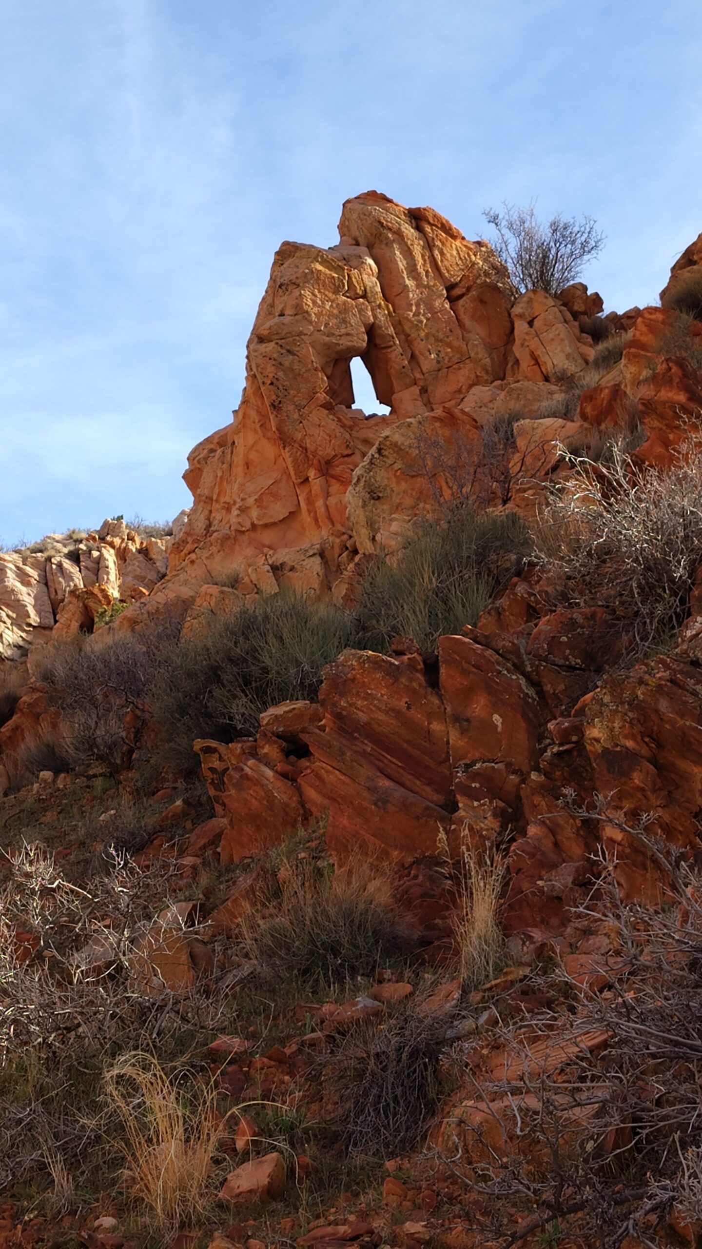
Once out of the wash, the trail was rocky and up and down. We did some fairly serious rock scrambling and explored the tops of two deep canyons looking for the trail.
By then we had meandered around for awhile in difficult terrain and were tired when we saw a trail on a very steep slope, it looked near vertical, heading north. Probably the way out of the saddle. However, we could not find a connector trail to the near vertical trail and decided it was time to head back.
The payoff for our wandering was the amazing views of Sandstone Mountain, deep canyons, and jumbled rocks in all directions and many colors. During our hike we encountered some desert denizens—lizards and quail.
The lack of trail signs is usually not a big concern because it is obvious where the trail leads. That is not the case in the maze of the Sandstone Mountain saddle.
This is a strenuous hike, suitable for most adventurers in decent physical shape, with great scenery. As with many of our hikes, we did not encounter other people. The entire hike we did was around four miles and took about three hours.


