
Tipple Trail via (by way of) Red Reef East Trail
– By Tom Garrison –
Location: Red Cliffs Desert Reserve, Utah
Difficulty: Red Reef East Trail is easy—not rocky, with only a few sections that are not too steep up and down. Much of Tipple Trail is rocky, mostly up and down, with some fairly steep inclines. I rate it as moderately strenuous. Remember, you cross Leeds Creek on the way out and back. If the water is low, it is easy; if the water is high, be careful.
Average Hiking Time: About 2 1/4 hours at a leisurely pace with many photo stops.
Elevations: The Red Reef East trailhead is approximately 3,159 feet in elevation, with a 190-foot elevation gain from there to the highest point of the hike.
Family Friendly: Red Reef East is fine for all family members; Tipple Trail might be a challenge for young children.
Finding the Trailhead: The trailhead is about 10 miles from St. George. Driving north on Interstate 15, take Exit 16 onto State Route 9 toward Hurricane. At the first traffic light, turn left (north) and proceed northeast on Old Highway 91 for four miles. Around four miles, you’ll see a brown sign on the right reading Red Cliffs National Conservation Area/Red Cliffs Recreation Area and arrows pointing to the left. Within a hundred yards or so, take a left turn (northwest) through two narrow tunnels under Interstate 15. Go left after transiting through the tunnels and follow the signs and the paved road .4 miles from the Old Highway 91 turnoff to the Red Cliffs Recreation Area entrance station. After the entrance station, continue on the paved road and park in the day parking area on the right, 1.3 miles from the Old Highway 91 turnoff. Then, walk north about 200 yards against traffic on the eastern paved road to Campground 8. The Red Reef East trailhead, a stepover and sign, is at the back of Campground 8.
Or, going north on Interstate 15, take Exit 22 to the town of Leeds. At the end of the off-ramp, make a sharp right (south) on Old Highway 91. Travel approximately two miles and turn right (northwest) just past the Red Cliffs National Conservation Area/Red Cliffs Recreation Area sign and proceed through two narrow tunnels under Interstate 15. Then, follow the directions above.
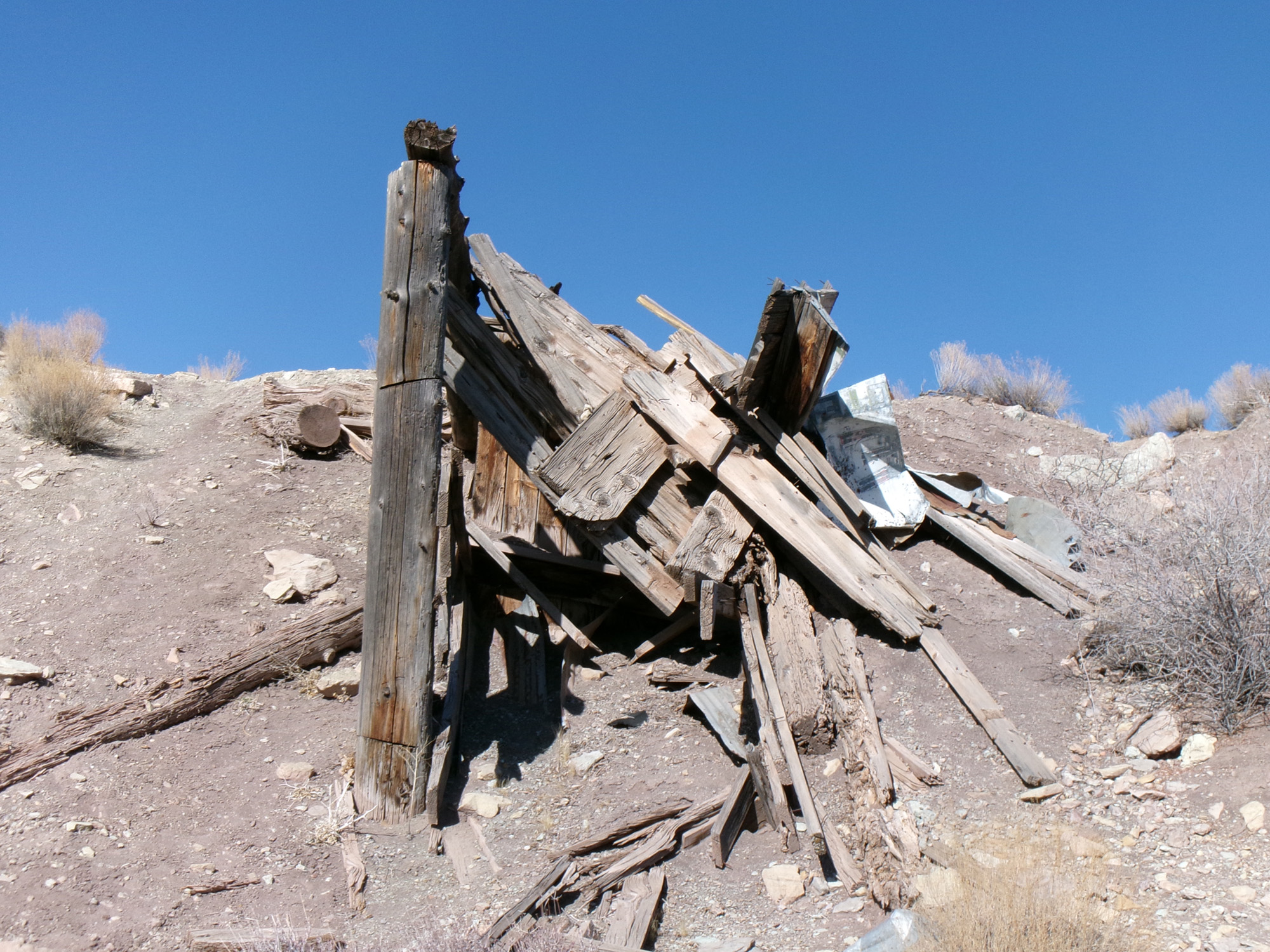
Mining played a big part in southwest Utah’s history. The area around Leeds was heavily mined for silver in the late 1800s. By the early 1900s, the mines had closed. There were some mining revivals the next 50 years, but none lasted long. This mining era did leave many two track dirt roads and boarded-up mines in the Leeds area.
If you want to explore a portion of this mining area and experience some splendid views of southwest Utah’s red sandstone mountains, then the 3.6-mile round trip Tipple Trail via Red Reef East Trail is for you. This trail is in the Red Cliffs Desert Reserve. The name of the latter section of this trail, Tipple, refers to a “tipple” structure used in mining to load extracted rock for transport.
This area is also known for its reefs. Most people think of reefs as bars of rock, sand, coral, or similar material lying beneath or just above the surface of a body of water. When geological formations were being named in southwest Utah, someone went wild applying the moniker “reef” to every ridge they saw. Reefs not near water are simply ridges resulting from tectonic (faults and earthquakes) and volcanic uplift and erosion. They may be colorful depending on the composition of the original sediments that were deposited and subsequently uplifted.
In the Harrisburg/Leeds area are at least five lengthy ridges called reefs—Red Reef, White Reef, Silver Reef, Buckeye Reef, and Leeds Reef.
The Red Cliffs Desert Reserve was established in 1996 to protect a large and diverse habitat capable of sustaining wildlife populations threatened by development and habitat loss. It comprises 62,000 acres and has more than 130 miles of shared-use trails for hiking, horseback riding, and mountain biking. Three ecosystems—the Mojave Desert, the Great Basin Desert, and the Colorado Plateau—merge in southwestern Utah and the Reserve, reflecting this region’s biological diversity.
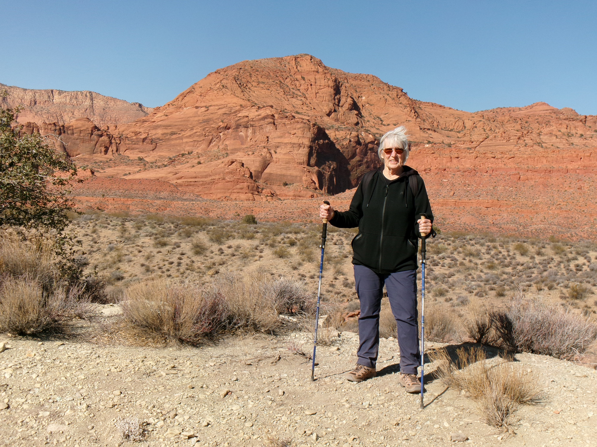
My wife, Deb, and I set off on our adventure to Tipple Trail via Red Reef East Trail on a crisp, clear mid-February morning. We parked about 10 am near the trailhead under a deep blue Utah sky with the temperature in the high 40s. The trailhead elevation is 3,159 feet with about a 190 feet elevation change from there to the highest point of the hike.
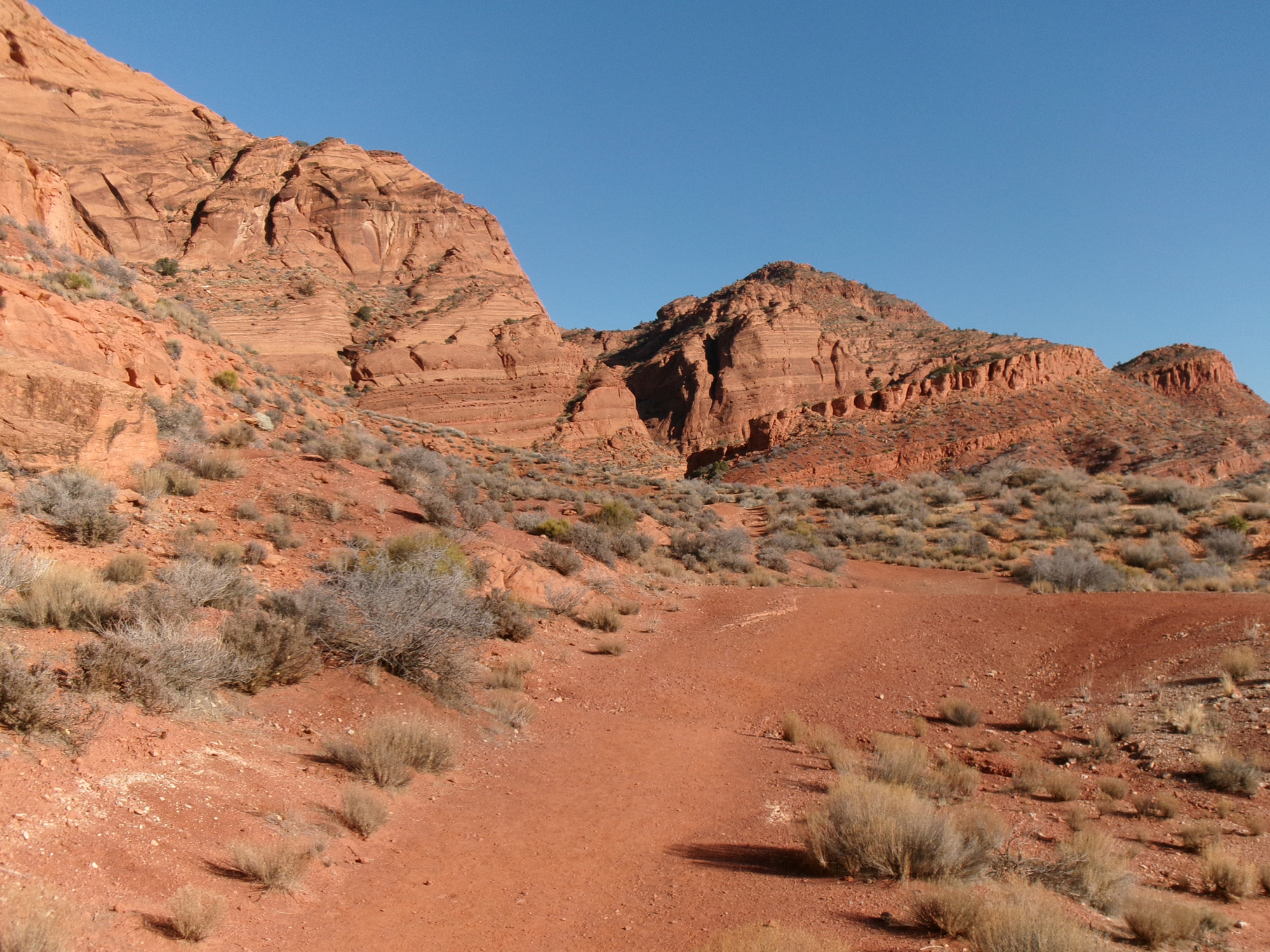
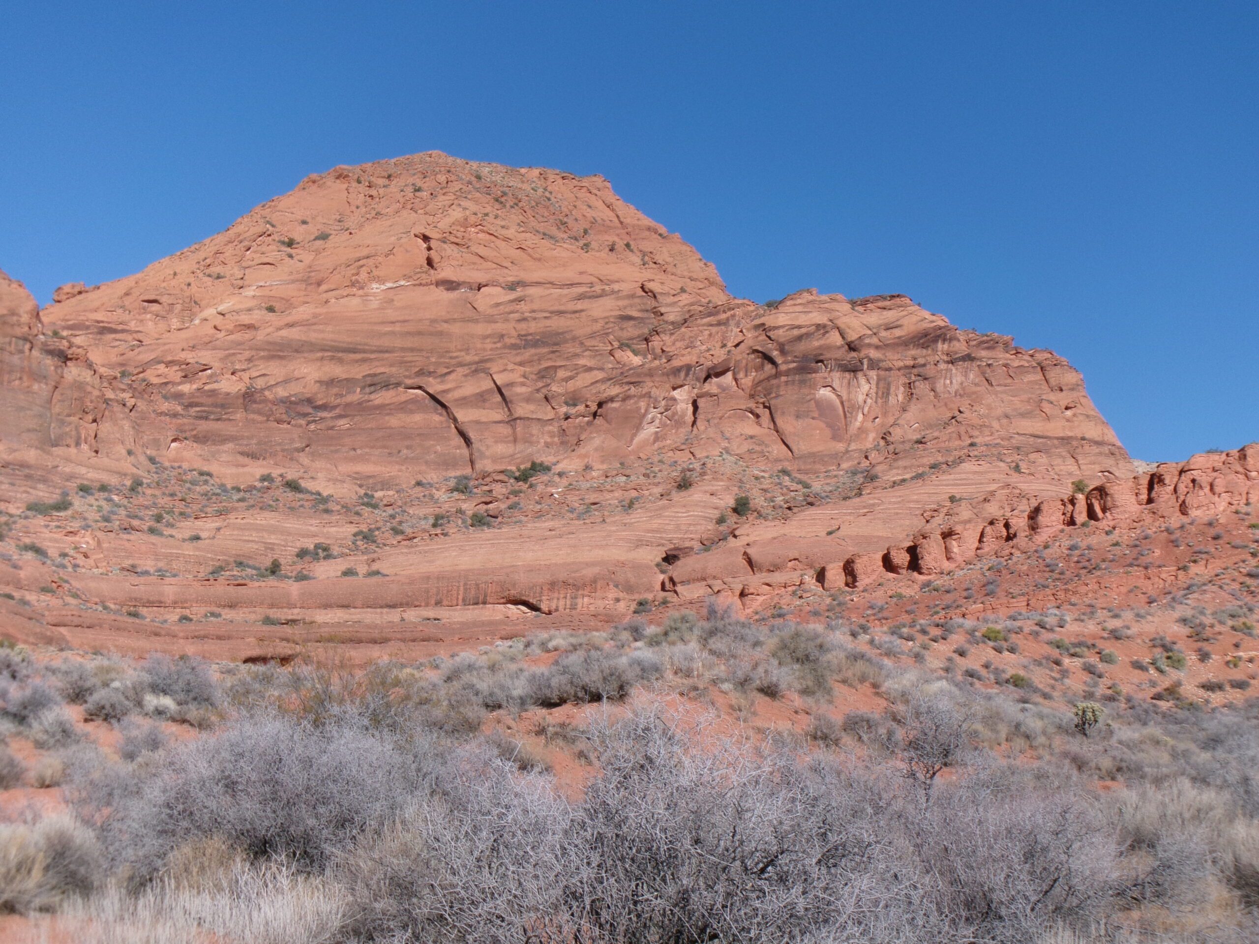
We stepped over the trailhead stepover (neither one of us tripped) and headed east along the wide trail. The well-marked trail meanders a bit, sometimes going north but mostly east. We crossed a couple of dry washes and a few mild inclines. The views of the red cliffs and mountains to the west and north were magnificent.
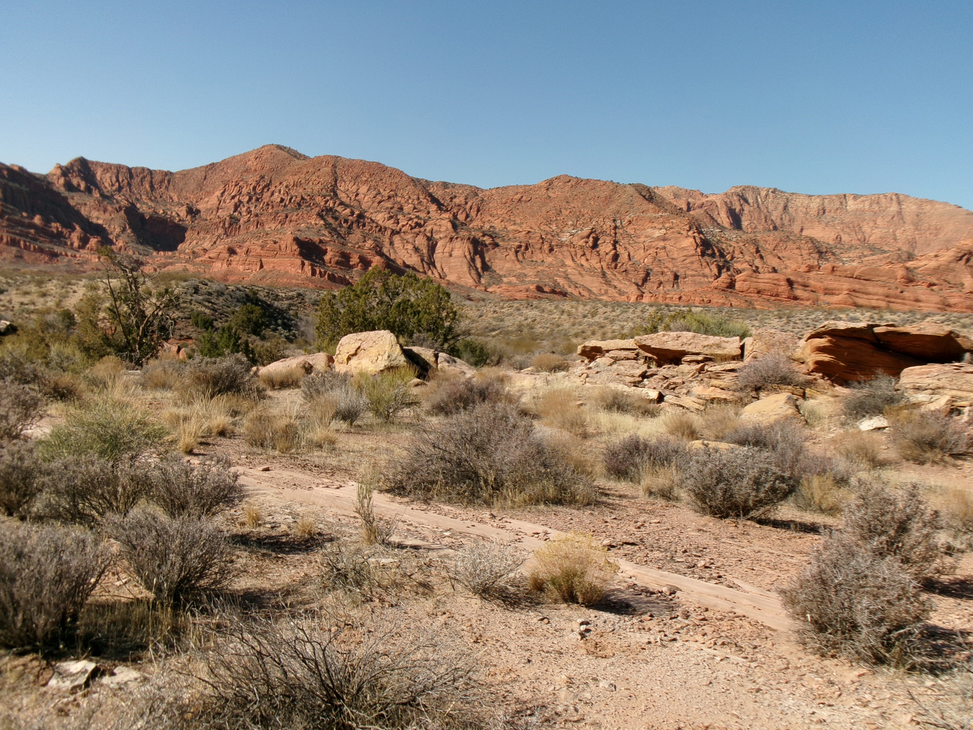
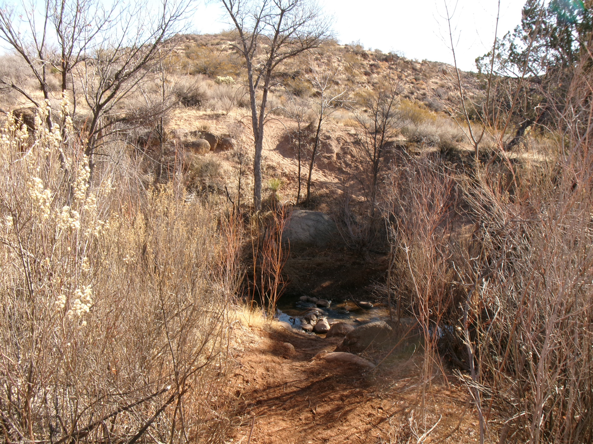
After .7 miles from the trailhead, we came to the intersection with Tipple Trail on our right. The first section of the well-marked Tipple Trail goes south and then west, closing in on the riparian environment of Leeds Creek. Within .3 miles, we came to the creek and easily crossed (the water level was low). Be advised that after rain, the creek may be challenging to cross. Then, the trail led upslope and onto a ridge line (aka White Reef) going east. The views remained good. Hiking along, we came across the ruins of an old mine. The trail is mostly up and down slopes, some of them fairly steep.
The trail ends about 1.1 miles from the Red Reef East Trail intersection, with a stepover and sign at the northern boundary of the Red Cliffs Desert Reserve. About 100 yards prior to the boundary is an intersection on the right with Adit Trail.
We then began the return trip. The returns are always fun because you are looking at what you didn’t see (unless you are walking backward or always glancing back the way you came) on the way out. The views were just as good as on the way in.
Being mid-winter, the flora was dormant, and a few birds were the only animals we saw. We only met two humans and their dog on the trail, maybe because it was a Monday morning in the winter.
We spent about 2 1/4 hours on the 3.6-mile round-trip hike. East Reef Trail is easy, and Tipple Trail is moderately strenuous due to its up-and-down nature with several rather steep slopes. I recommend this adventure—a natural setting with fantastic views about 10 miles from St. George. A great way to break mid-winter doldrums.


