

Hiking Southern Utah: The Maze
 Trail name: The Maze
Location: Near Upper Sand Cove Reservoir, just south of Veyo
Difficulty: Moderate
Length: 2 miles
Elevation gain: 400 feet
Average time: 2–3 hours
Family-friendly: Yes, but several short, steep sections of rock scrambling require care, in addition to proximity to cliffs and the ubiquitous desert dangers.
The Maze in an off-the-radar hiking spot that is scenic, intriguing, entertaining, and easy to get to. While the overall hike itself is fairly easy, route-finding can be challenging. The path starts out with a steep pitch of switchbacks and bare stone, passes over a section of nearly level pinion-juniper forest, drops into a magical slot canyon and finally, as an option, ascends out of the ravine and onto the southern end of the tall plateau with stately views towards the rarely-seen northern side of the Red Mountain Wilderness.
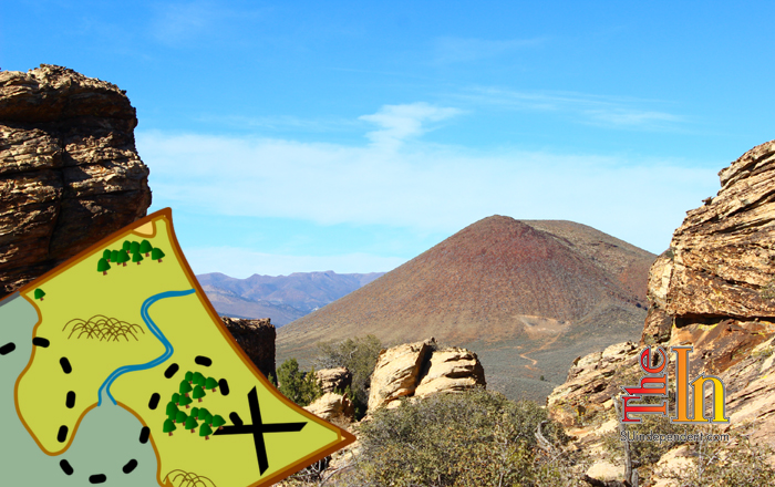
Access: To find The Maze, start from the intersection of Bluff Street and St. George Boulevard. Head north on Bluff, continuing as it turns into Utah State Route 18, driving for just over 16 miles to Lower Sand Cove Road. This dirt road can be a little difficult to spot, but it appears on the left just as the highway reaches the base of the Veyo Volcano. Follow this road for a mile and a half. The Upper Sand Cove Reservoir appears on the right, while a depression appears on the left. Follow a dirt road down into the depression and find a place to park. Note that this is a common area for target practice, and sportsmen will occasionally be shooting firearms here.
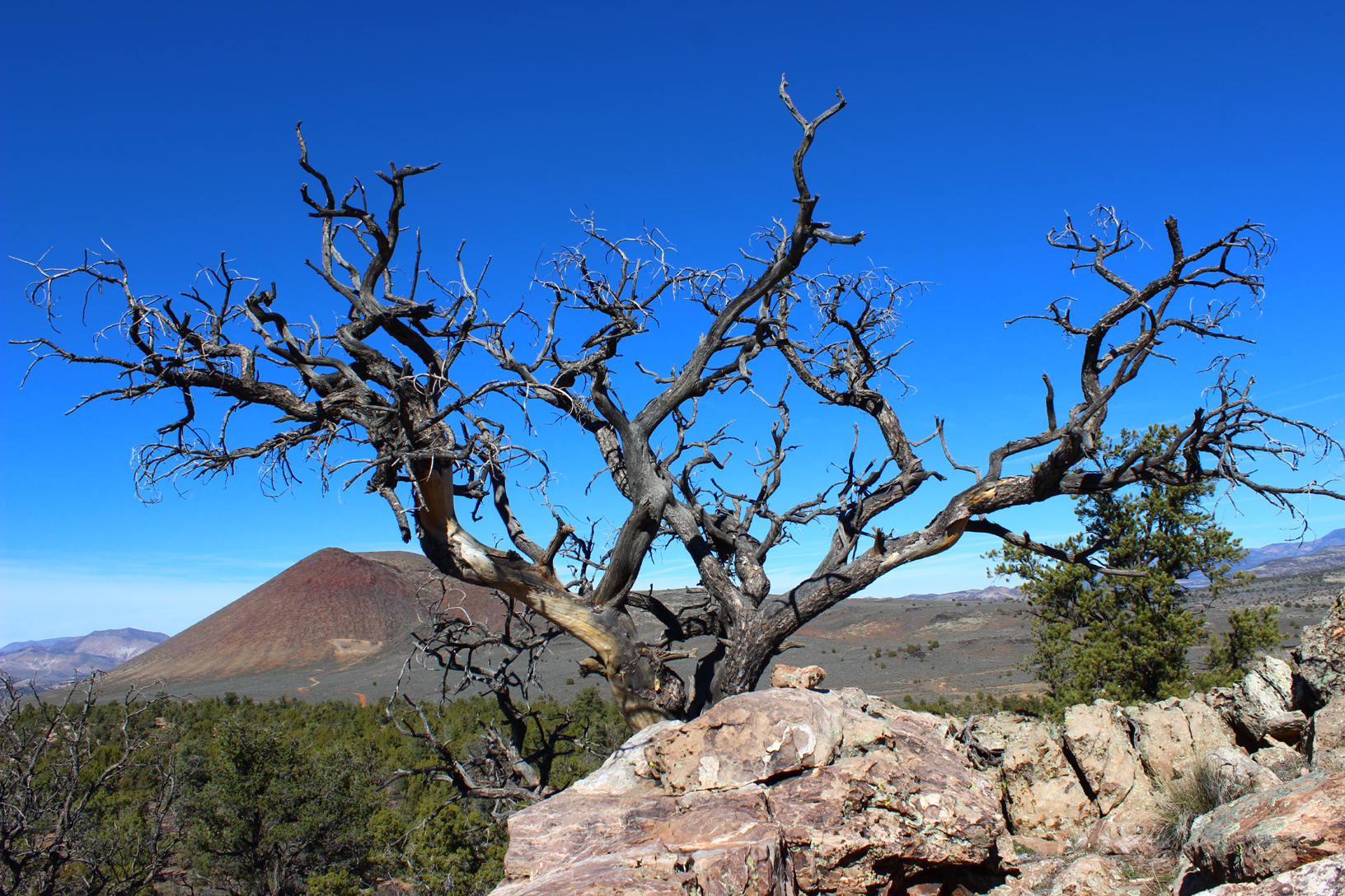
The hike: Head up a scramble path at the southeast corner of the overflow dam, and once on top of the wide earthen berm, head east up the hillside, looking for a well-worn path making very short switchbacks up the rocky slope. This is the steepest section of the entire hike with the majority of the elevation gain, but it doesn’t last long. Soon, the trail flattens out and heads in a southeastern direction again, this time through a pinion-juniper forest. Here, the trail can be somewhat difficult to follow as multiple use and game trails zigzag through the mail trail and can lead the hiker the wrong direction. Caution should also be exercised in this section as social trails sometimes cut right through large patches of cryptobiotic soil, and care must be taken not to disturb this living matrix of cyanobacteria, algae, mosses, and lichens. The main trail continues for approximately a quarter mile, arriving at a shallow, rocky saddle with lovely views of Signal Peak and the Pine Valley Mountains.
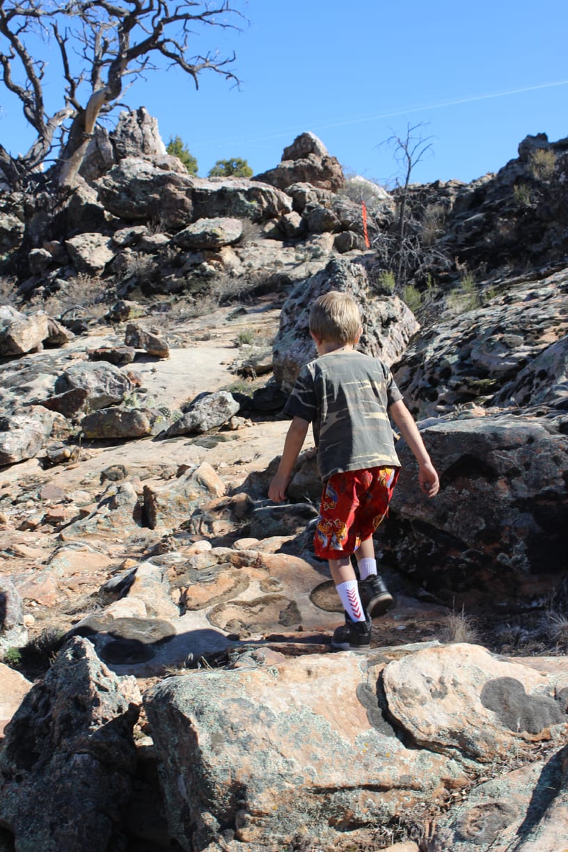
 From here, the path descends down into the canyon that leads to the main part of The Maze. Flagging occasionally marks the route, the trail following a southerly direction while descending to soon reach the canyon floor. Continue south along the bottom of the draw. The canyon walls will get narrower and taller, and small alcoves, side canyons, and slots will appear. This place is aptly named. There are lots of nooks and crannies to explore along the way, but continue on the (obvious) main trail. After approximately a quarter mile from the saddle, the canyon splits. Take the left-hand fork.
Soon after the fork, the trail reaches a seeming impasse where the path dead-ends. This is the most interesting portion of the journey. Look for a large boulder with an opening beneath it. Scramble up and through this opening, into a small slot and out the other side, where the main canyon continues. There are often pools of water here (and in other spots in the canyon.) Shortly after popping out of the slot, the canyon dead-ends. From here, there are two options. The first is to return back through the canyon on the same trail (probably the best option for hikers with young children) to the parking area, while the second is to look for a way out of the canyon, an easy scramble up and out of The Maze on the eastern side of the ravine (on the left, facing up-canyon).
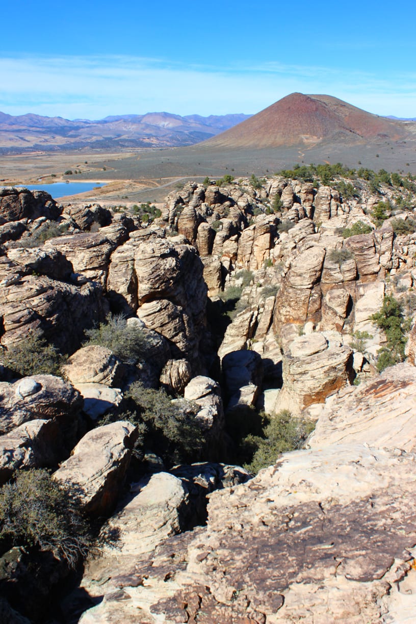
 The top of the plateau is a flat expanse of pinion-juniper forest, cacti, and sage with few landmarks and no established trail to use. Instead, numerous game and social trails crisscross the top of the mesa. Continue on toward the south. Soon, the cliff-top rim will appear on the right, and numerous stellar viewpoints make themselves available. The Veyo Volcano, the Red Mountain Wilderness, and the Camelbacks provide a stunning backdrop. These viewpoints make excellent spots for picnic or a rest stop. When ready, carefully return to the exit from The Maze, and scramble back down into its depths. Return down-canyon and back to the parking area.

Articles related to “Hiking Southern Utah: The Maze”
Hiking Southern Utah: Spectra Point Trail in Cedar Breaks National Monument


