
 Issued: 11:08 AM MDT Sep. 22, 2016 – National Weather Service
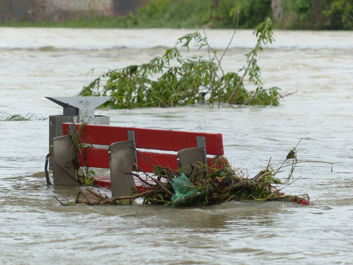
... A Flood Warning remains in effect until 1015 PM MDT Thursday for
southeastern Utah... southern Duchesne... Wayne... San Juan...
Garfield... Kane... southeastern Sanpete... eastern Sevier...
southeastern Iron... western Carbon... Emery and southeastern
Washington counties...

At 1056 am MDT... reports of widespread flooding across southern and
eastern Utah are being received.  The following list includes rivers
that are in flood.  These are the larger rivers... and as such all of
the tributaries of these waterways are also flooding. This list is
an indication of the flood magnitude... and others are not listed.

The Virgin river near Virgin rose from 100 cubic feel per second
(cfs) to over 3000 cfs.

The North Fork of the Virgin river... which flows through Zion
National Park rose from 40 cfs to over 2000 cfs.  However... the
North Fork is receding quickly.

The Escalante river near the town of Escalante rose from 5 cfs to
over 1000 cfs and is rising.

The Paria river near Kanab rose from 2 cfs... to over 1000 cfs and
is expected to rise further throughout the day.

The price river rose from 6 cfs to over 900 cfs.

As Utah is expected to receive additional thunderstorm activity
throughout the day... additional river rises are expected.

Some locations that will experience flooding include...
price... Kanab... Escalante... Hanksville... St George... Capitol Reef
National Park... Washington... hurricane... La Verkin... Helper...
Huntington... Wellington... Big Water... Sunnyside... Henrieville...
Boulder... Torrey... Clawson... Hatch and Halls Crossing.


Precautionary/preparedness actions...

Remain alert for flooding even in locations not receiving rain.
Normally dry washes... streams... and rivers can become raging killer
currents in a matter of minutes... even from distant rainfall.


Lat... Lon 3748 11321 3812 11158 3963 11123 3995 11069
      3958 11036 3810 10998 3761 11053 3745 11053
      3738 11069 3725 11059 3725 11058 3729 11047
      3711 11057 3716 11057 3718 11058 3700 11091
      3700 11368


Mcinerney
Flash Flood Watch
Issued: 3:09 AM MDT Sep. 22, 2016 – National Weather Service
... Flash Flood Watch remains in effect through late tonight...

The Flash Flood Watch continues for

* much of southern Utah... including the cities of St George and
  price... along with Zion National Park... Bryce Canyon National
  Park... Capitol Reef National Park... and Glen Canyon Recreation
  Area.

* Through late tonight

* rainfall across the area will continue to become widespread and
  locally heavy today. Embedded thunderstorms will also enhance
  the heavy rainfall potential.

* Areas at higher risk of flash flooding include slot canyons...
  normally dry washes... and small streams. These areas should be
  avoided. Flooding of urban areas with poor drainage and
  basements is also possible. Dirt back roads will likely become
  difficult to navigate.

Precautionary/preparedness actions...

A Flash Flood Watch means that conditions may develop that lead
to flash flooding. Flash flooding is a very dangerous situation.

You should monitor later forecasts and be prepared to take action
should flash flood warnings be issued.


Rogowski
Wind Advisory
Issued: 3:08 AM MDT Sep. 22, 2016 – National Weather Service
... Wind Advisory in effect from 9 am this morning to 11 PM MDT
this evening...

The National Weather Service in Salt Lake City has issued a Wind
Advisory... which is in effect from 9 am this morning to 11 PM MDT
this evening.

* Affected area... west central and southern Utah including
  Delta... Cedar City... St George... Bryce
  Canyon... Kanab... Hanksville... and Lake Powell.

* Winds... southwest 30 mph with gusts around 50 mph.

* Timing... developing this morning and persisting through this
  evening.

* Impacts... strong Crosswinds may impact travel especially for
  high profile vehicles and those towing trailers. Wind sensitive
  operations may be impacted. High winds will cause hazardous
  boating conditions.

Precautionary/preparedness actions...

A Wind Advisory means that sustained wind speeds of at least 31
mph or gusts of 45 mph are expected. Motorists in the advisory
area should be prepared for sudden gusty cross winds which can
make driving difficult.

Boaters on area lakes can expect gusty winds... very choppy
water... large waves... dangerous lightning... and poor visibility in
heavy rain. Boaters should seek safe Harbor immediately.
Click This Ad


