
Black Brush Trail
– By Tom Garrison –
Location: Santa Clara River Reserve near Santa Clara and Ivins, Utah. Managed by the Bureau of Land Management.
Difficulty: Moderately strenuous. Much of the trail is rocky; it crosses several ravines, some of them fairly steep, and there is a lot of up-and-down hiking.
Average Hiking Time: A little more than three hours at a leisurely pace with many photo stops.
Elevation: The trailhead is approximately 3,100 feet elevation with about a 200 feet elevation gain. There are several fairly steep sections going into and out of the ravines.
Family Friendly: Watch your step on the rocks and be aware of drop offs on the cliffs and everyone should be okay.
Getting There: From St. George travel north on Bluff Street to the sweeping left (west) turn onto to Sunset Boulevard. Continue on Sunset as it enters Santa Clara and becomes Santa Clara Drive. Turn left (south) at Gates Lane (three blocks past the Post Office) and cross the Santa Clara River. Set your odometer after crossing the river. Stay on the road, the pavement ends after about .1 mile, and continue straight on the now unsigned dirt road. At .5 miles turn right (west) at the Cove Wash Trailhead sign and soon pass a water tank. About ½ mile further (approximately one mile from the river crossing) turn right (west) at another Cove Wash Trailhead sign. The visible parking area and trailhead is .2 further. The Cove Wash Trailhead is also the Black Brush Trailhead. Although a regular sedan should make it without trouble, I recommend a high clearance vehicle.
Ready for a moderately strenuous rocky, ravine infested hike with some great views of Ivins, Red Mountain, and the Santa Clara River from cliffs above the river? Who isn’t. Oh, and solitude. Three hours on the trail, 4.7 miles, on an early fall morning and we saw no other people doing the hike. Our destination was the Black Brush Trail in the Santa Clara River Reserve.
The Santa Clara River Reserve was established in 1997 through a partnership among the cities of Ivins and Santa Clara and the Bureau of Land Management (BLM). The 6,500 acre Reserve is administered by the BLM and is located southwest of Ivins and Santa Clara. The Reserve was created to protect open space, archeological and natural resources, and promote recreational opportunities. More than 20 trails in the Reserve offer a variety of experiences—prehistoric petroglyphs (rock art), hiking sandy washes, desert landscape vistas, and lush (for a desert) riparian corridor along the Santa Clara River.
Our journey began on a Saturday in late September. We, my wife Deb and I, loaded our packs, snacks, water, and cameras. We most often hike alone and enjoy trails with few or no other people. Black Brush Trail certainly meets that criteria.
We arrived at the trailhead about 9:30 am with the temperature in the mid-70s. The trailhead elevation is about 3,100 feet with an approximately 200 feet elevation gain during the 4.7 mile hike. The day was overcast, making for excellent hiking weather, but not so good photos. Being the beginning of fall, we did see a few animals—a rabbit hopping away from the noise of our footfalls, a family of quail, some lizards, and a chipmunk.
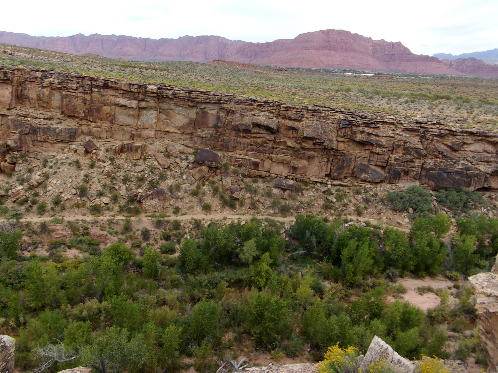
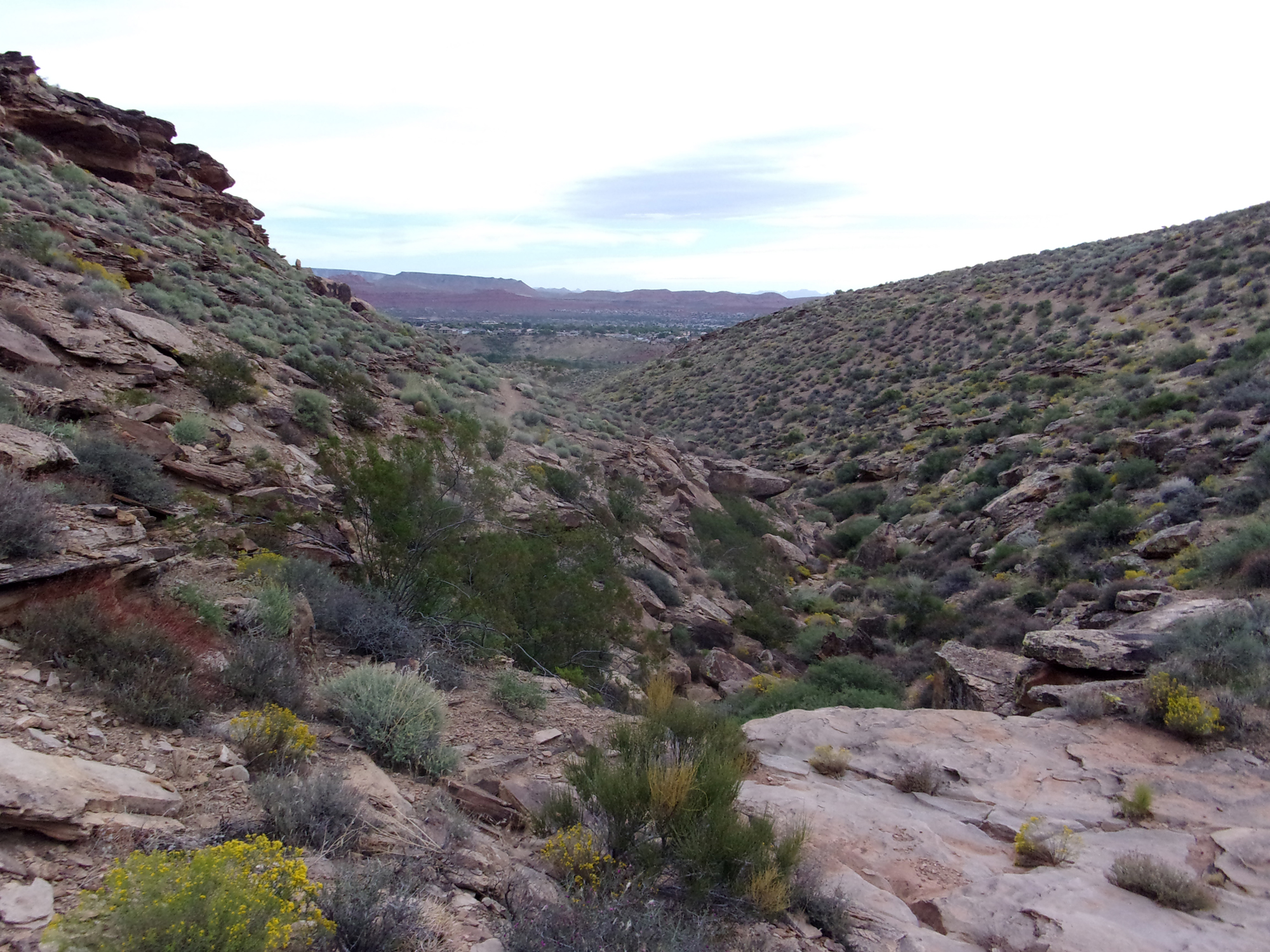
From the trailhead, we took the Black Brush Trail heading north. The first section of the trail is a dirt road that quickly becomes a smaller path. Most of the trail is rocky, watch your step. The trail is well marked and easy to follow with several trail signs. This section goes along the sides of a large sloping hill crossing a few ravines carved into the hillside. The hillside was covered in small vegetation, but strangely no black brush. To the north are some good views of Ivins nestled below Red Mountain.
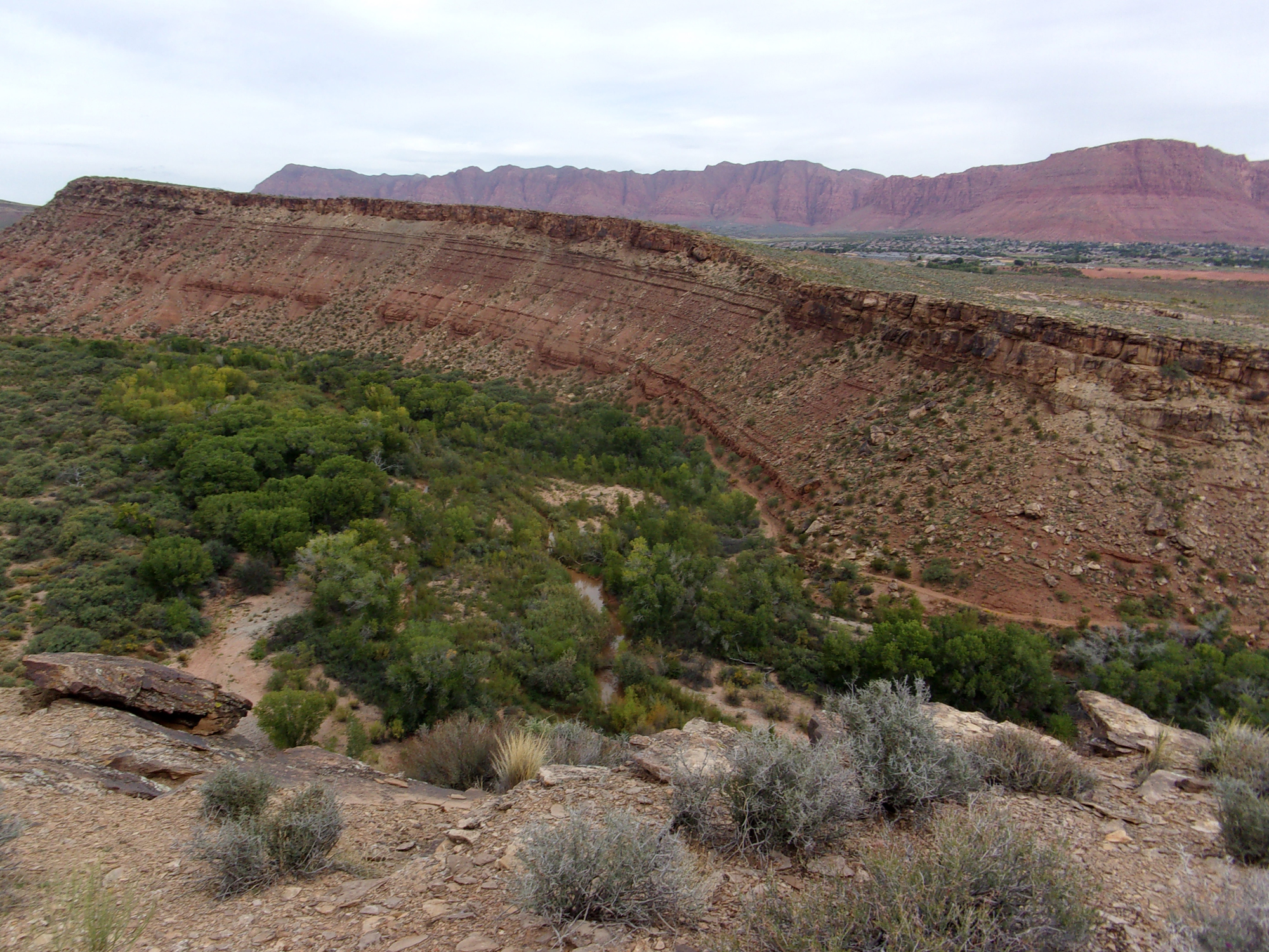
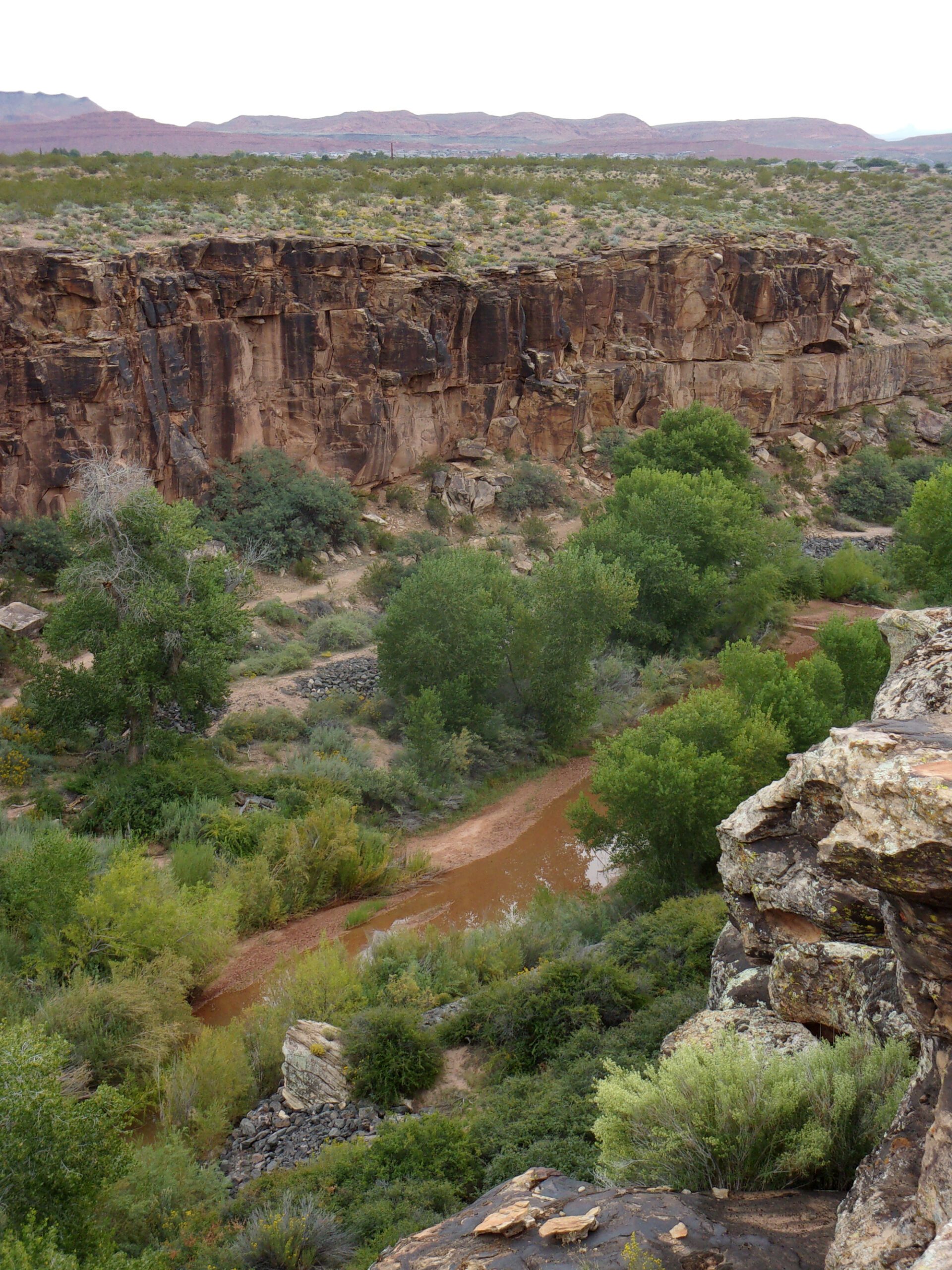
At 1.1 miles in, we came to the loop intersection of the trail, we went right, northeast and then north heading uphill. The loop is 2.5 miles long crossing ravines and washes with much zigzagging. About .5 mile from the intersection (1.6 miles from the trailhead) came the highlight of the hike. The trail reaches the cliffs above the Santa Clara River—great views of the riparian environment below with trees and bushes lining the river framed by dark canyon walls. There are a couple of vista points where we approached the edge of the cliffs and peered below at the spectacular view. Along this area are also the best views of Red Mountain and Ivins.
Soon the loop turned away from the river and we returned to cutting across washes and ravines—not too exciting. We reached the loop intersection and headed the 1.1 miles back to the trailhead.
Deb and I have hiked several score of trails in southwest Utah. While Black Brush Trail is overall not spectacular (although the views of the Santa Clara River are spectacular), it is close to St. George and, from our experience, not crowded. If you want a moderately strenuous decent 4.7 mile hike, try this one.


