
Black Gulch Trail in the Red Cliffs Desert Reserve
Trail: Black Gulch Trail
Location: Red Cliffs Desert Reserve about six miles north of St. George
Difficulty: Moderately strenuous with much rock scrambling
Average hiking time: About three hours
Elevation: The trailhead elevation is 4,170 feet with an approximately 450 feet elevation change from lowest to the highest point in Black Gulch.
Family-Friendly: No, unless the kids are grown, in at least okay shape, and have a decent sense of balance.
Getting there: From downtown St. George go north on 1000 East and turn right (east) on Red Hills Parkway. Take the Parkway .7 miles and turn left (north) onto Cottonwood Springs Road (aka 1550 East). Stay on the main road and drive 6.5 miles to the “Black Gulch” signed trailhead on the right (east). (It is about 1.2 miles past the signed Yellow Knolls Trailhead.) The first three miles of Cottonwood Springs Road is paved, the remainder a good dirt road, that poses no problem for a standard sedan.
Or, from Washington go north on 3050 East Street/Green Springs Drive, cross under Interstate 15 (at exit 10), and turn left (west) onto Red Hills Parkway. Continue on Red Hills Parkway for 1.6 miles and turned right (north) onto Cottonwood Springs Road. Follow the above directions from there.
Who doesn’t love living in southwest Utah’s red rock country? Our area is a major tourist destination for a reason. However, don’t you just kinda sometimes need a break from the privileged red rock formations. Perhaps a bit of diversity? Since as a society we seem to demand more than a dollop of diversity, how about some diversity in hiking?
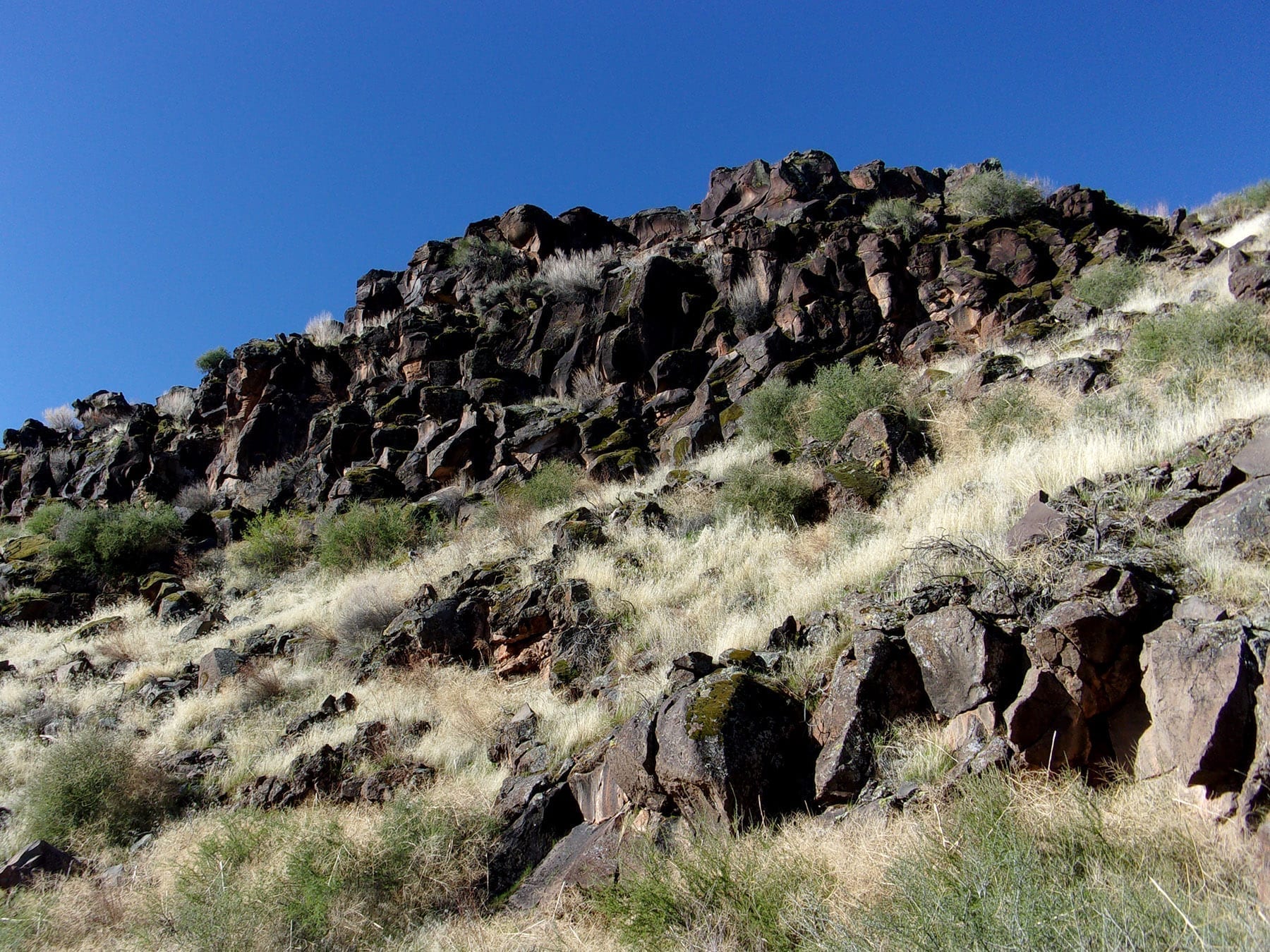
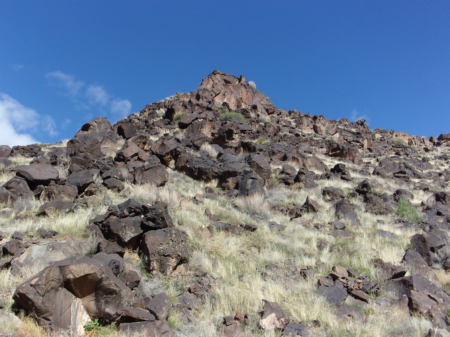
Our hike through Black Gulch in the Red Cliffs Desert Reserve is dominated by ancient lava flows and black and greyish rocks and boulders—certainly different from the predominate red rocks in southern Utah.
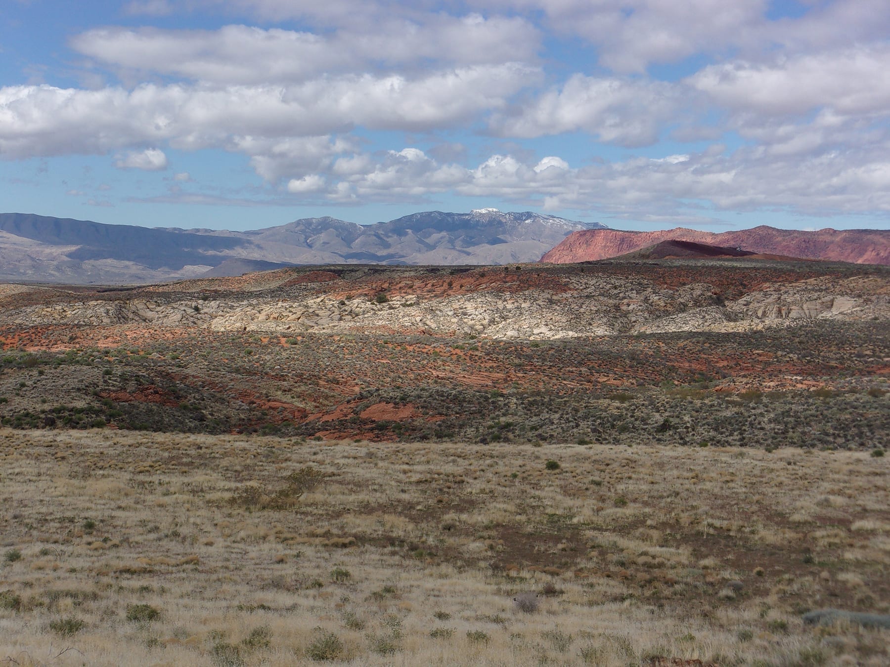
The Red Cliffs Desert Reserve was established in 1996 to protect a large and diverse habitat capable of sustaining wildlife populations threatened by development and habitat loss. It comprises 62,000 acres and has more than 130 miles of shared-use trails for hiking, horseback riding, and mountain biking. Three ecosystems—the Mojave Desert, the Great Basin Desert, and the Colorado Plateau—merge in southwestern Utah and the Reserve reflects the biological diversity of this unique region.
My wife, Deb, and I began this adventure on a clear late March morning. The trailhead has a large parking area without water or toilets. It is the starting point for three trails, Black Gulch Trail, High Point Trail, and Lange’s Dugway Trail. The trailhead elevation is 4,170 feet, the temperature in the mid-50s, and the cloudless sky a deep blue as we geared up. Since Black Gulch Trail is in the Red Cliffs Desert Reserve there are no fees or permits necessary.
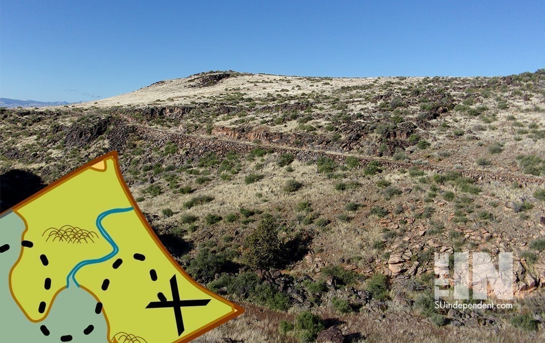
Access to Black Gulch Trail is gained by first hiking about ¼ mile on Lange’s Dugway Trail. There is a stepover at the beginning of Lange’s Dugway Trail about 75 yards up (north) Cottonwood Springs Road from the parking area. Following this trail downslope led to the bottom of Black Gulch drainage and we turned left (south) beginning the major part of our hike.
Like almost all canyons, gulches, and ravines, Black Gulch serpentines as we headed downstream (generally south). Also, like many canyons, Black Gulch alternates between open stretches and more cliff-faced closed-in sections. In places, the primeval lava flows upslope along both sides of the canyon seemed ready to topple down—luckily that did not happen.
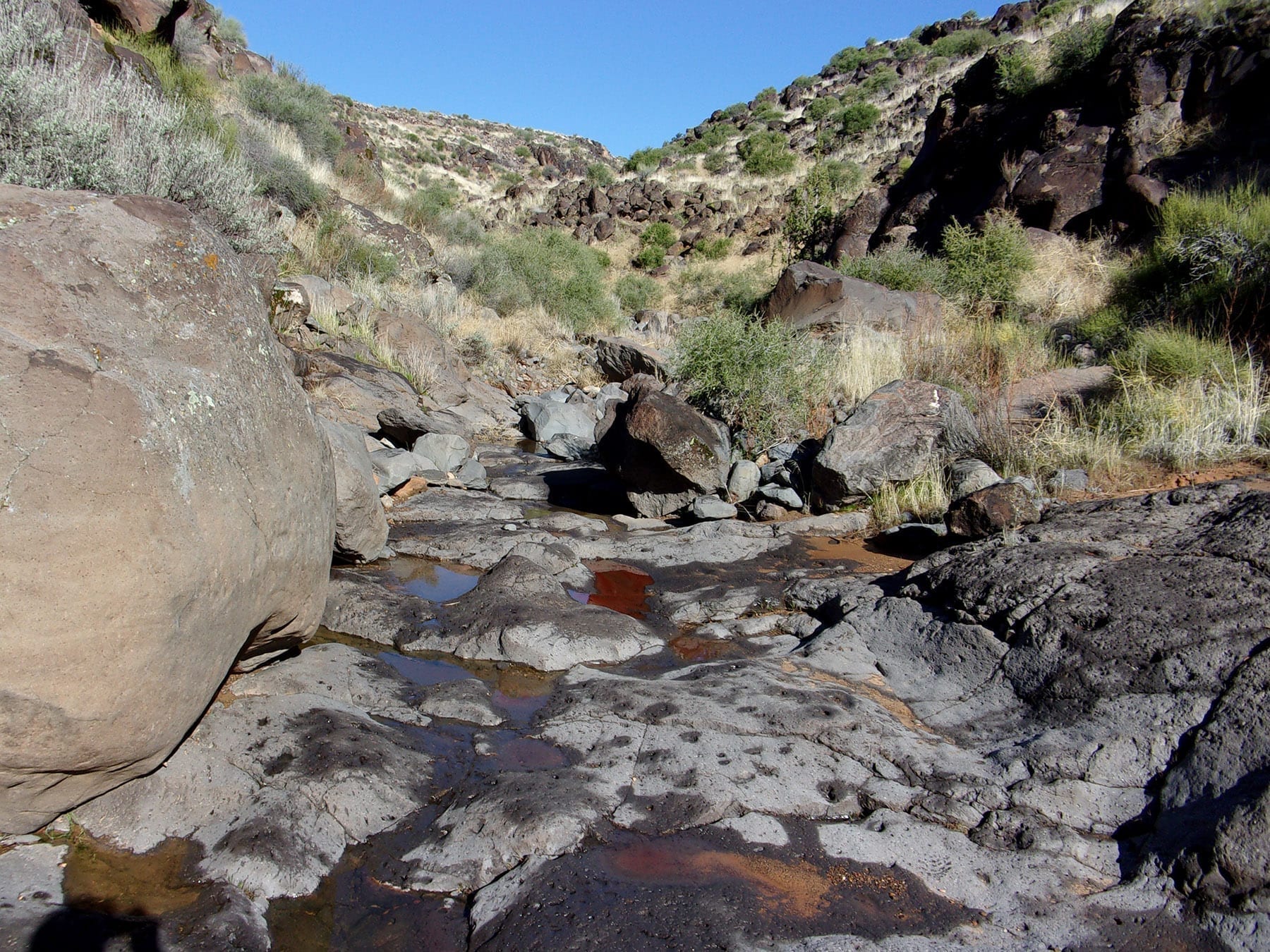
The bottom and sides of the drainage are strewn with black volcanic boulders. Many places require rock scrambling over or around the larger boulders. There are rocks/boulders from small to very large throughout most of the hike in the gulch. It is imperative to watch your step; a twisted ankle is only the next stride away. (I know, among my many non-hurtful slips was one about halfway down the gulch in which I suffered a pretty painful rolled ankle. But I sucked it up and finished the hike.)
In parts of the canyon, user trails exist on upland benches and can be used to avoid some obstacles. We took advantage of some to circumvent the more precarious boulder jams in the bottom of the canyon.
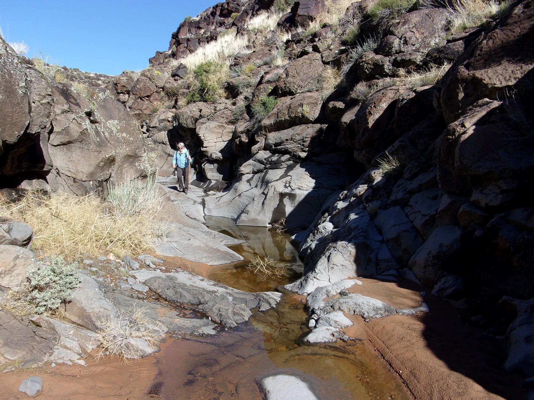
Because of heavy rain the day prior to our hike, a plethora of small rock tanks, mostly in the middle section of Black Gulch, were filled with water—a boon to the local animal population. Unfortunately, the recent rain added a couple of pounds of mud to our boots and made us even more cautious due to slippery surfaces.
While Black Gulch is difficult to maneuver, it is photogenic and secluded. We did not meet another human in the gulch, although we did scare a family group of four deer who bounded downstream. Although Deb and I are pretty quiet on the trail, we also flushed several coveys of quail as we trod downstream.
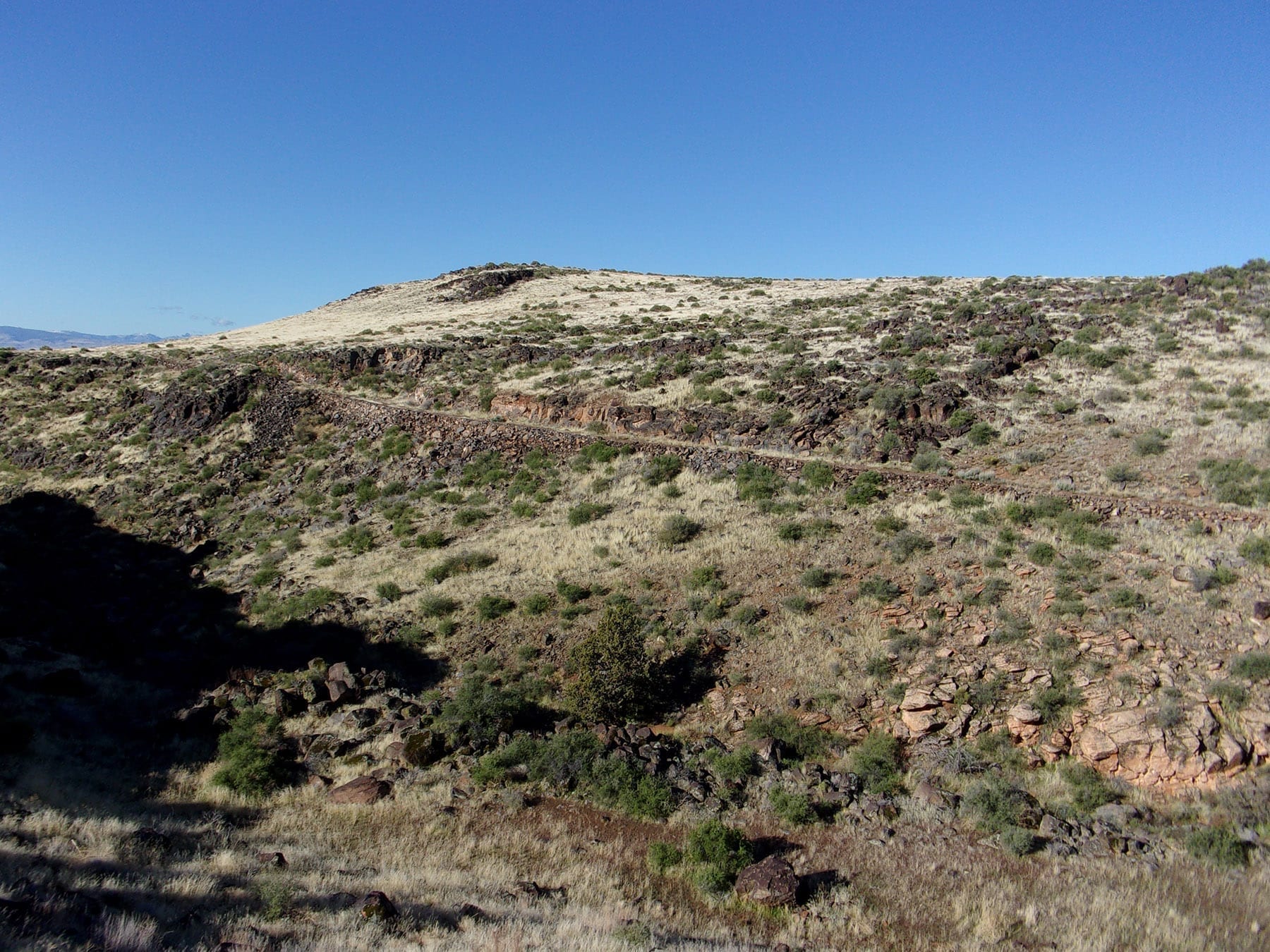
After approximately 2.5 miles in the drainage, Black Gulch Trail ends where it intersects Winchester Trail coming in from the left (east). Normally Winchester Trail is a rock-strewn narrow path. However, a line of utility poles roughly paralleling Winchester Trail was being replaced and a road was needed for the huge equipment. The utility company scrapped Winchester Trail free of large rocks and about 15 feet wide—good for us.
We scampered, well actually trudged, up the steep part of Winchester Trail. Once upon the flat plateau, we walked to the intersection with Cottonwood Springs Road, very near Yellow Knolls Trailhead. We were on Winchester Trail for approximately ½ mile. From here it was a quick 1.2-mile walk north along the road back to the Black Gulch Trailhead.
Be aware that Black Gulch is known for an above-average population of rattlesnakes, be careful where you place your next step and hands. We hiked on one of the first days of spring, the temperature in the 50s, and did not see a snake. In warmer weather spotting and avoiding snakes should be a priority.
The hike 4 ½ loop round trip and took a bit more than three hours with many opportunities to stop and take photos. This adventure is for hikers in pretty good shape with a decent sense of balance who prefer to avoid other folks on the trail. If you meet these criteria, this a great hike in a different environment very close to St. George.
Viewpoints and perspectives expressed throughout The Independent are those of the individual contributors. They do not necessarily reflect those held by the staff of The Independent or our advertising sponsors. Your comments, rebuttals, and contributions are welcome in accordance with our Terms of Service. Please be respectful and abide by our Community Rules. If you have privacy concerns you can view our Privacy Policy here. Thank you!
Click here to submit an article, guest opinion piece, or a Letter to the Editor


Sounds like a place you don’t want to be in the summer time, or maybe at any other time..should not go this alone.
You are correct about not hiking this trail, or most any trail in the St. George area, in the summer–too hot.
Your comment about not hiking alone is good. I always hike with my wife and often other people come with us. I talk about hiking with a lot of folks. Some tell me how they hiked some trail by themselves. I discourage that behavior. But, they are adults and do what they want.