
Coral Pink Sand Dunes State Park, Utah
Location: Coral Pink Sand Dunes State Park, Utah
Difficulty: Two short (about ½ mile each) hikes. Both are easy, except for the hiking in deep sand part.
Average Hiking Time: Less than two hours combined for both hikes.
Elevation: The Sand Dune Arch elevation is 5,584 feet with very little elevation change. The Coral Pink Sand Dunes State Park Nature Trail elevation is 5,877 feet with less than 100 feet of elevation change. Climbing to the top of some of the sand dunes is more challenging with a couple of hundred feet elevation change in a short distance through deep sand.
Family Friendly: Yes for both hikes. The only drawback is hiking through loose deep sand.
Getting There: From St. George drive to Hurricane on Highway 9 and then on to Fredonia, Arizona via Highway 59 (Highway 389 in Arizona). In Fredonia turn left (north) onto Highway 89A and a few miles later entered Kanab—means “place of willows” in Paiute. This leg of the trip is approximately 75 miles depending upon your starting point in St. George. In Kanab, at the intersection of Highway 89A and Highway 89, set your trip odometer to zero and continue north on Highway 89. Approximately 7.8 miles from the intersection turn left (west) onto Hancock Road (the signed south entrance to Coral Pink Sand Dunes Park), about .5 miles past mile marker 71. After approximately nine miles, Hancock Road intersects Coral Pink Sand Dunes Road (aka Highway 43). Turn left (south) onto Coral Pink Sand Dunes Road and the main park entrance is three miles ahead on the left.
Sand dunes are a part of desert hiking my wife, Deb, and I generally avoid. Of course, we have explored major dunes such as Mesquite Flats Dunes in Death Valley National Park and others. Dunes have an allure, the ripples and sweeping graceful curves. If you forget that you are slogging through loose sand, dunes have appeal.
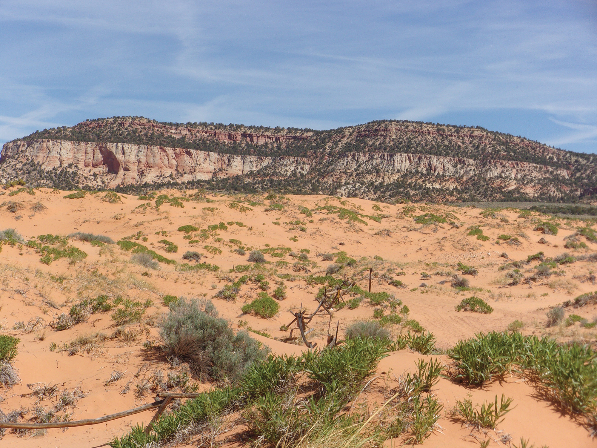
It’s time to reconsider sand dunes. Not far from St. George is Coral Pink Sand Dunes State Park, established in 1963. The park includes 3,370 acres of sand dunes beside red sandstone cliffs. The dunes formed from the erosion of pink-colored Navajo Sandstone surrounding the park. Winds pick up velocity passing through a notch between the Moquith and Moccasin Mountains. This, along with water erosion, wears away the sandstone and loose sand particles are swept up. The winds lose speed as they pass beyond the notch and into the open valley and grains of sand fall to the ground creating sand dunes. This is called the Venturi effect.
The dunes in the park are estimated to be between 10,000 and 15,000 years old. It is the only major sand dune field on the Colorado Plateau.
Contrary to what I imagined, Coral Pink Sand Dunes support a diverse population of insects, including the coral pink tiger beetle which is found nowhere else on the planet. The area surrounding the dunes is home to several types of trees, including juniper, pinion, and ponderosa pines. In the spring, wildflowers are abundant.
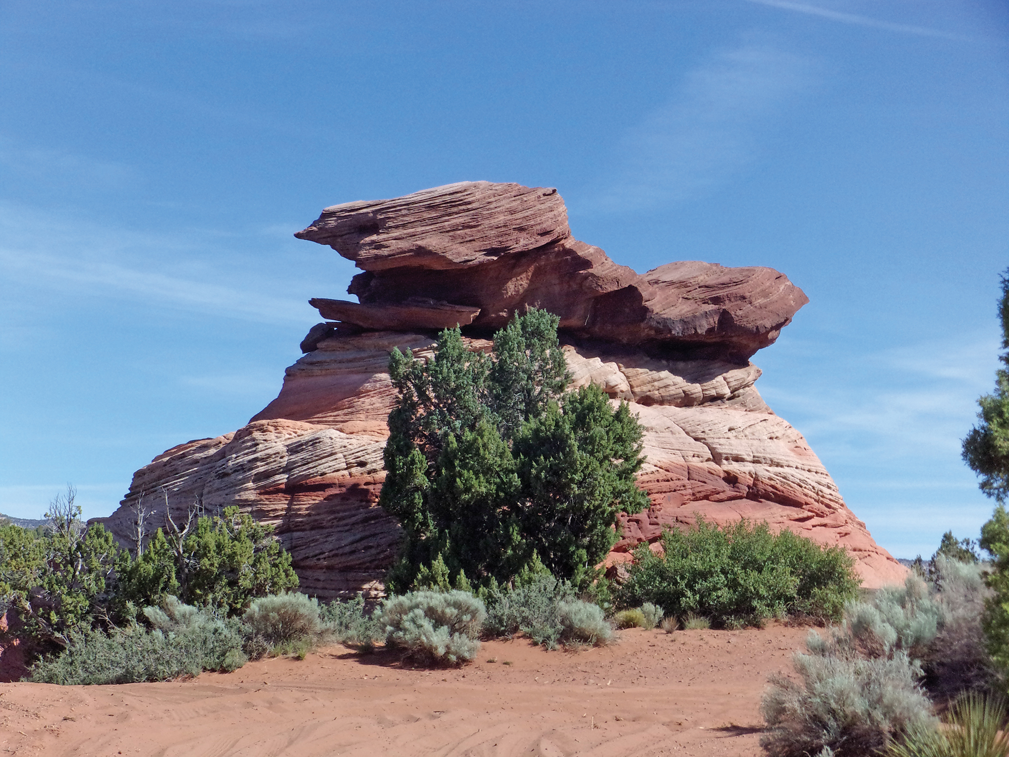
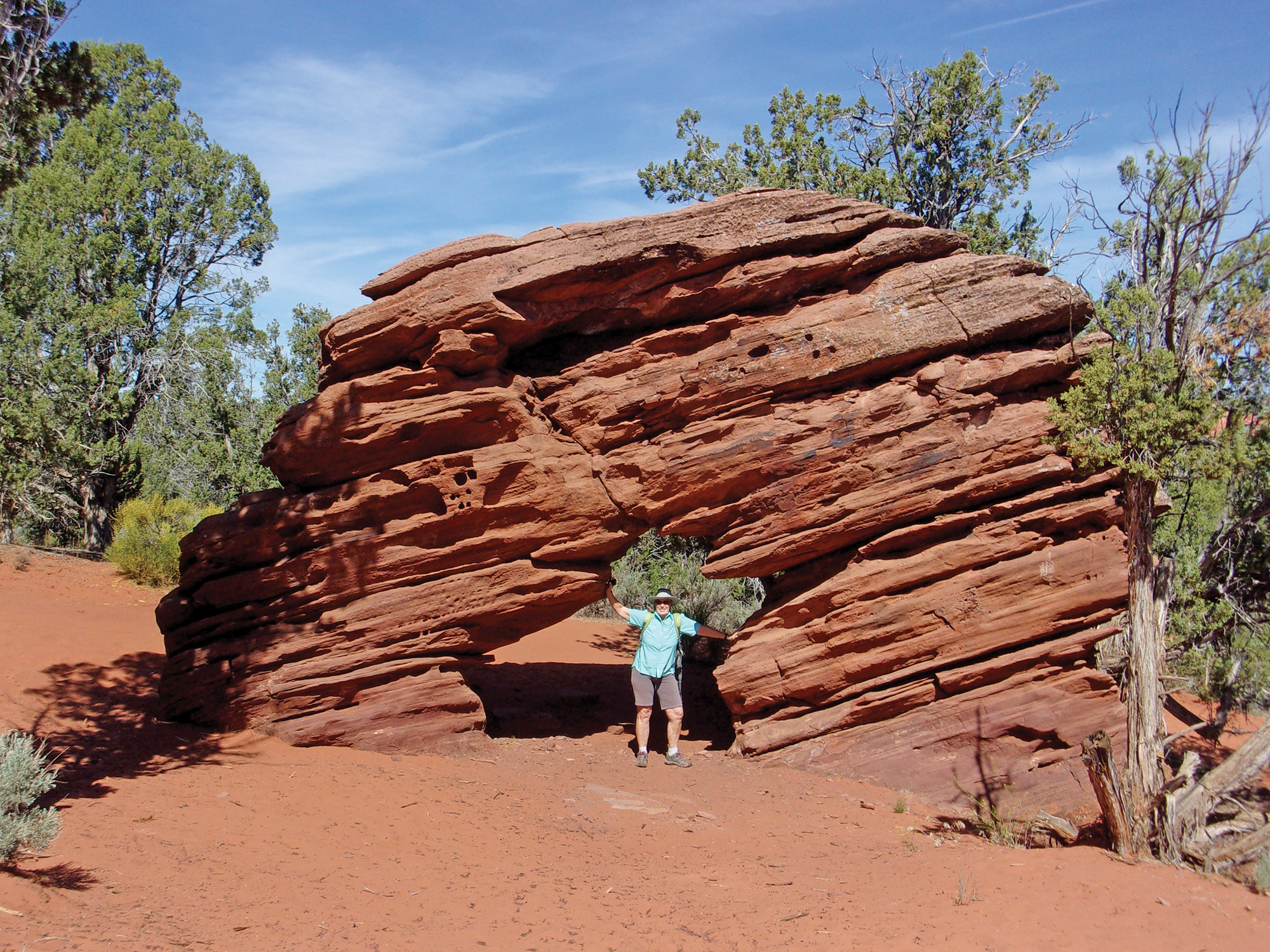
We, and so should you, stopped for a short easy hike to a wonderful arch on our way to the park. (In different published stories, the arch is called Coral Pink Sand Dunes Arch or Sand Dune Arch.) Here’s what we did coming from Kanab. After turning west onto Hancock Road from Highway 89 we traveled .8 mile and turned right (north) on a dirt road signed as 64B heading toward a huge red and white sandstone monolith. The road is deep loose sand. We parked alongside the road and walked to the 60-foot-tall monolith, about 150 yards. You can drive to the monolith, and to the arch if you have high clearance and four-wheel drive.
The trailhead elevation is 5,584 feet and there is little elevation change on the hike to the arch. This short hike is less than ½ mile round trip, including wandering around at the arch, and took ½ hour at a leisurely pace. There were wispy clouds above in the blue southern Utah sky and the temperature was in the low 80s.
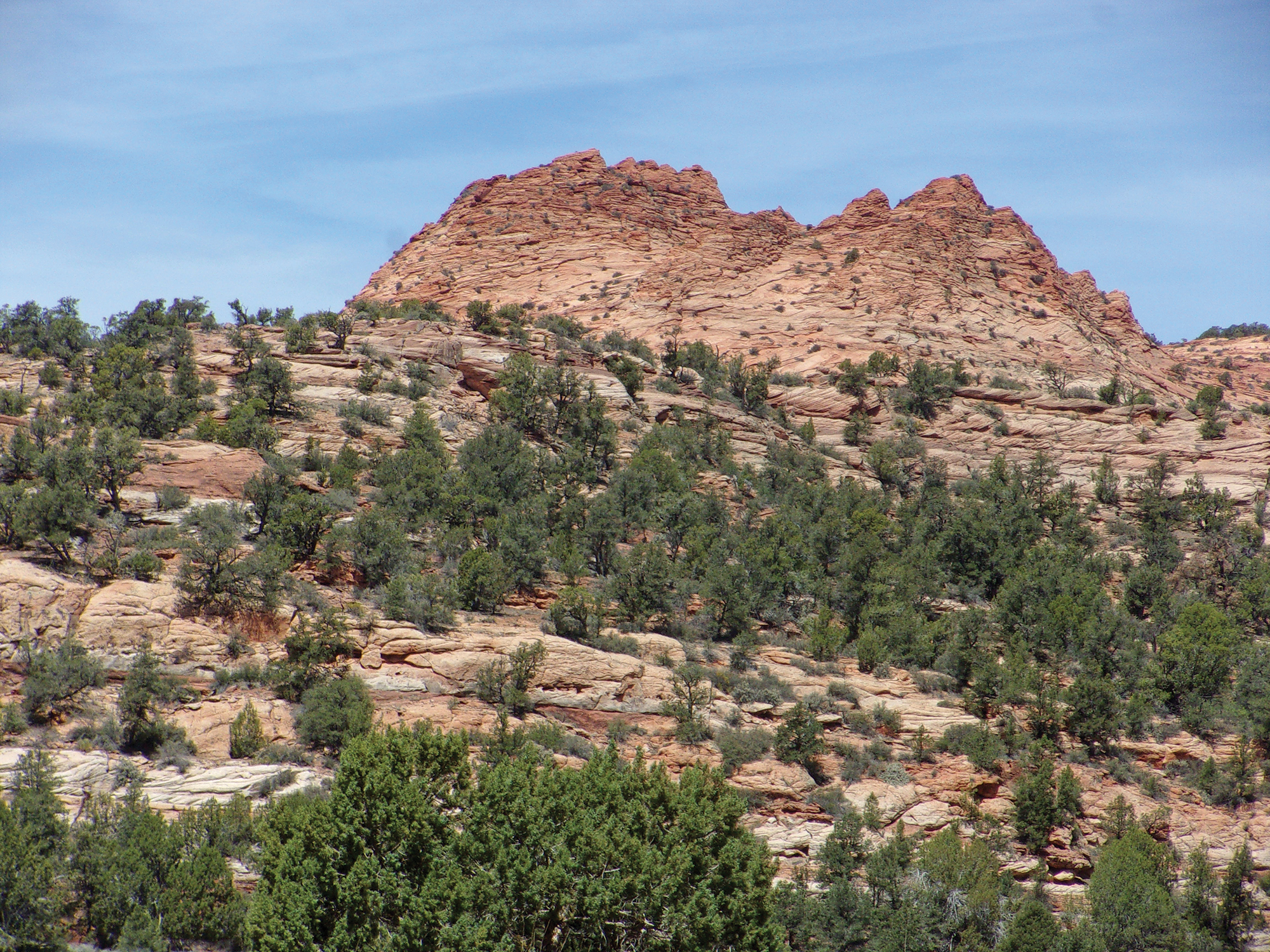
We located a road near the monolith heading northwest, walked about 100 yards on the trail, and found a spur ATV track on the right. Following this spur another 100 yards we arrived at two outcroppings on our left. The second outcropping is the arch—about 30 feet wide, 15 feet tall, with an opening we could walk through. The arch is layered sandstone nestled among pinions and junipers. Not a huge, amazing arch, but certainly worth the minimal effort if you are going to Coral Pink Sand Dunes State Park anyway. The area also has great views of surrounding red mountains and cliffs.
After our short detour to the arch, we continued to the state park and paid the $10 per vehicle entrance fee at the park office/visitor center. The center is a must-stop for their displays about the dunes, surrounding area, and the local flora and fauna (and to pay the fee).
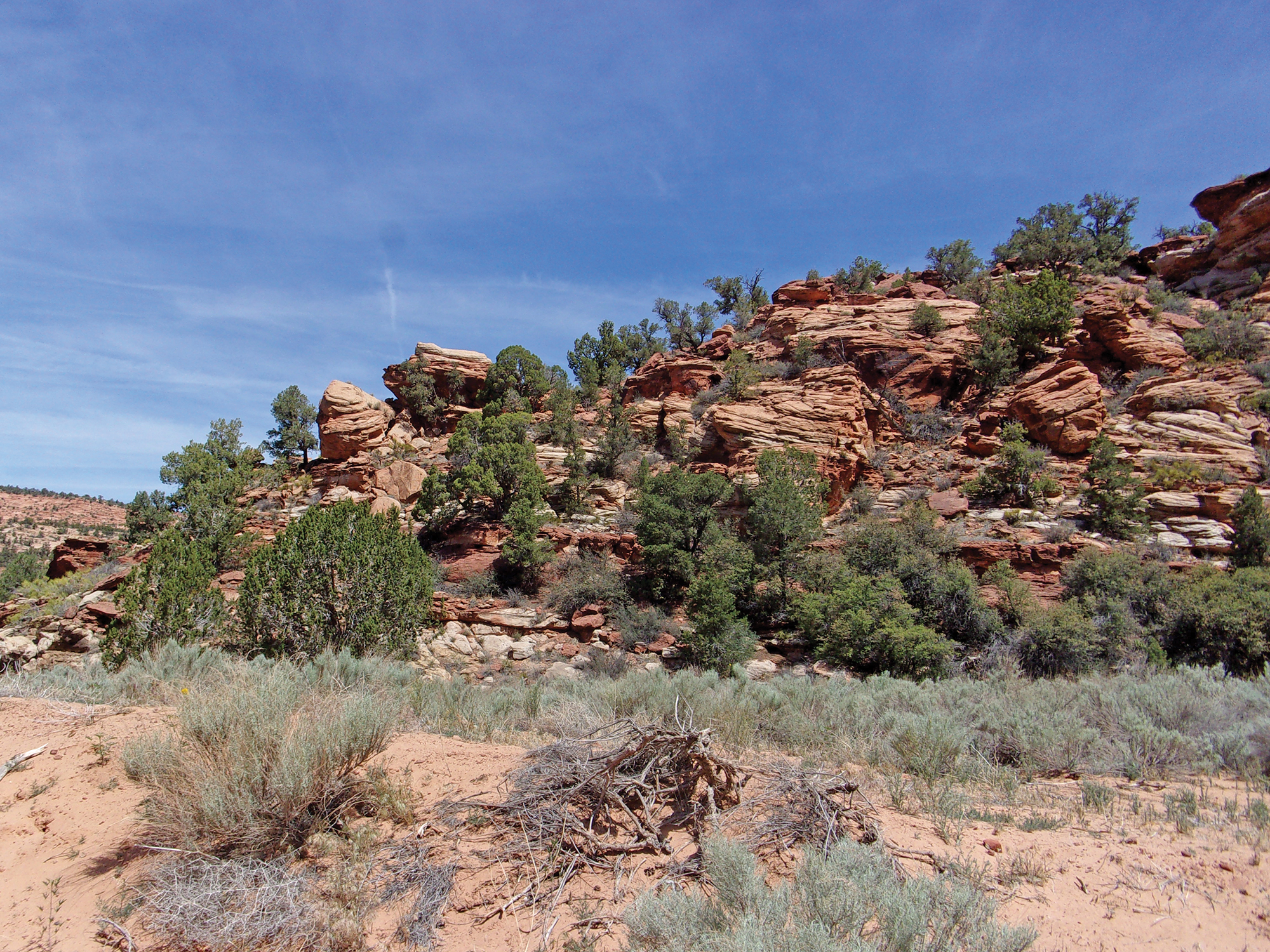
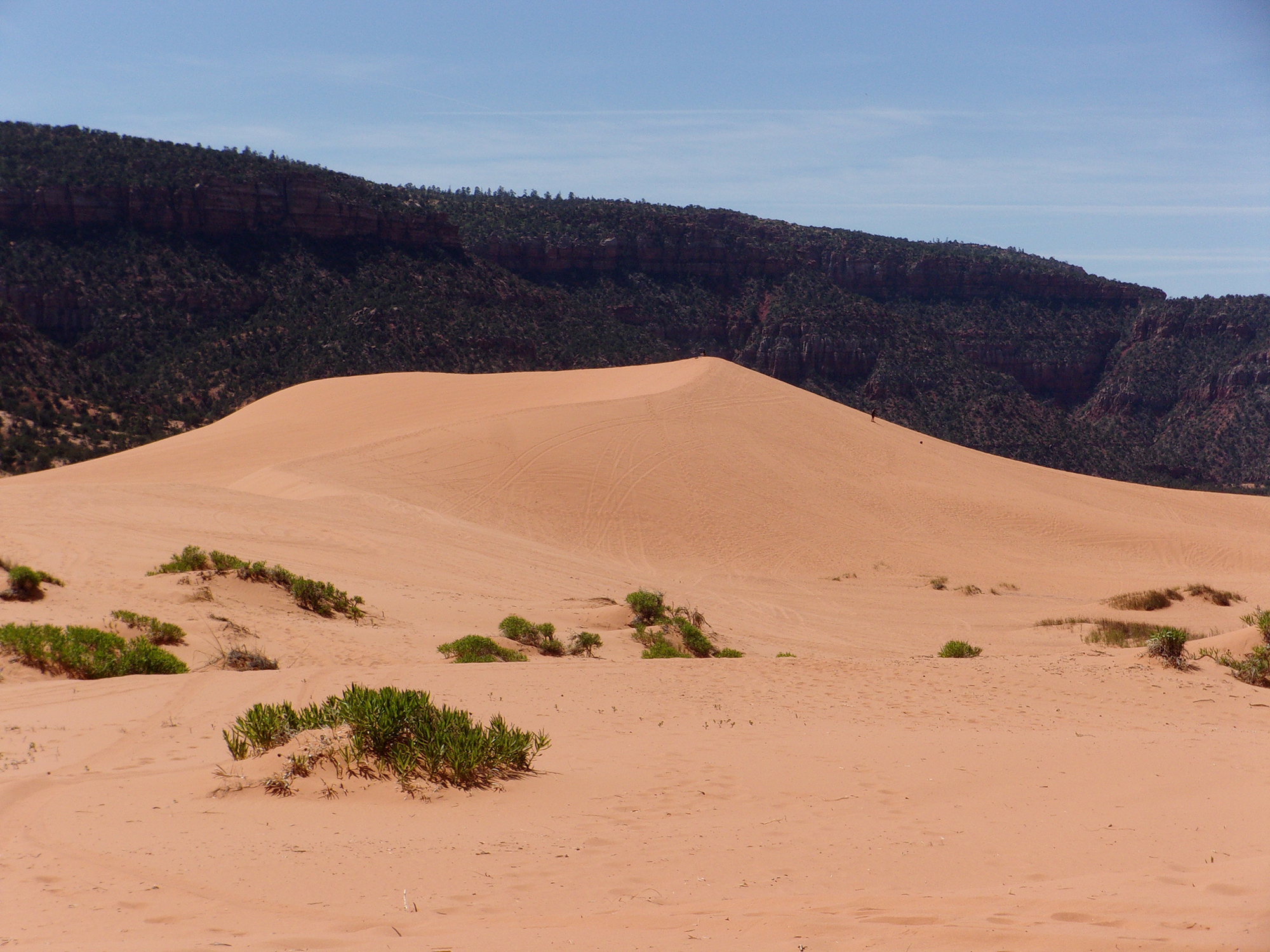
The park offers some great eye candy—the colorful sand dunes contrast with the deep blue Utah sky, steep red cliffs and outcroppings, and the varied greens of junipers and pinion pine trees offers a visual delight.
About 90% of the dunes are open to ATVs, and all the dunes are open to hiking and playing in the sand. There is only one developed hiking trail in the park—our destination, the Nature Trail.
Driving out the back end of the visitor center parking area, we turned right onto a paved park road and drove about 200 yards to the day use parking area on our left. Above the day use parking area is a large observation platform—the Nature Trail trailhead.
The trail begins to the left of the observation deck and loops around to end on the right side. The trailhead elevation was 5,877 feet with less than 100 feet elevation change along the up and down trail. It was good hiking weather—deep blue sky, a few wispy clouds, and the temperature in the low to mid 80s. The way is marked with posts located around the edge of a large no motor vehicles allowed fenced area.
The hike is a loop trail about ½ mile long and took us about 45 minutes at a very leisurely pace with many stops for shooting pictures of the massive dunes. It seemed longer since all of it was deep sand. Not being crazy, we did not climb any of the nearby large sand dunes.
If you want even more adventure after exploring the arch and dunes, try what we did. Instead of retracing our route going home, we took Highway 43 (aka Coral Pink Sand Dunes Road) southwest to return home. It is considerably shorter, and we traveled through backcountry most folks avoid. Once across the Utah-Arizona state line (7.7 miles from the park’s visitor center), the paved road becomes Arizona State Highway 237 (aka Rosy Canyon Road).
Rosy Canyon is worth the trip, a wide canyon with multicolored canyon walls. We stopped a couple of times to explore interesting looking areas. After four miles on Rosy Canyon Road, we then turned right (west) onto Cane Beds Road and within 4.2 miles turned right onto Arizona Highway 389 and headed west toward home.
This is a unique day trip journey. An easy to reach arch and hiking/playing in some giant sand dunes. We spent less than two hours on the trail for the two hikes and traveled about one mile with a lot of wandering around. The views were great. The only downside is trudging through a mile of deep sand.


Great article + photos. 1/2 a mile through sand sounds like a lot!
Thanks Max. A half mile through loose dry sand is a lot. Especially since I’ve had a bad hip and leg for the last four months. But what the hell, Deb and I have to explore.