
East Reef Trail in Red Cliffs Desert Reserve
Trail: East Reef
Location: Red Cliffs Desert Reserve near Leeds
Difficulty: Easy with some up and down sections
Average Hiking Time: Less than two hours at a leisurely pace for the 2.5-mile loop hike.
Family Friendly: Yes
Getting There: Heading north on Interstate 15 take Exit 22 near Leeds onto Old Highway 91. Turn left and continue north approximately 2.2 miles through the town of Leeds. (In Leeds, the highway is renamed Main Street.) Next turn right (south) onto signed 900 North/Babylon Road just past the sign for the Red Cliffs National Conservation Area. Babylon Road (the primary access to seven trailheads and 13 designated trails) begins as asphalt and becomes a dirt road at .6 miles in. Stay on the main road and at four miles from the turnoff you reach the unsigned East Reef Trail trailhead and small parking area, good for three vehicles on the right (west) side of the road. A few feet beyond the trailhead is a large red sign reading, “All motorized vehicles must stay on designated roads.” The trailhead is also .3 miles past the well-marked Historic Babylon trailhead. I strongly recommend a high clearance vehicle.
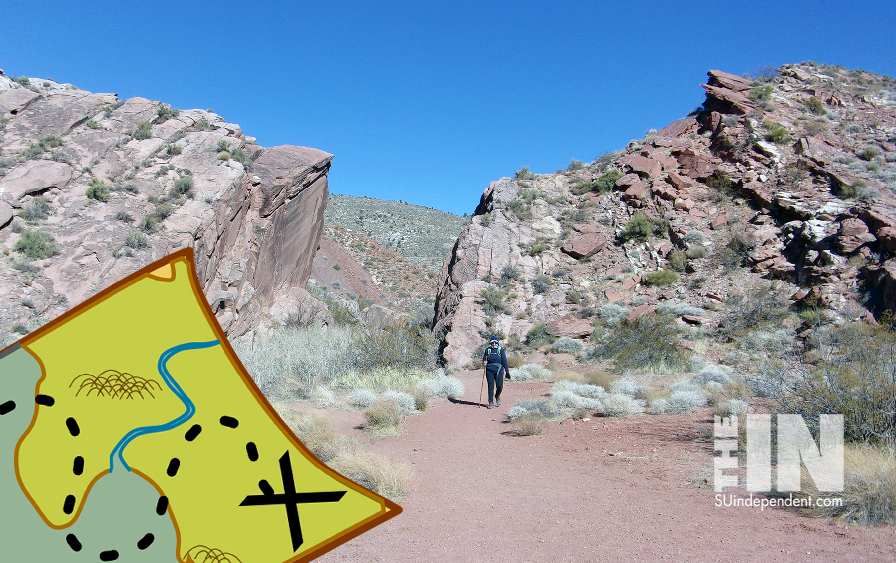
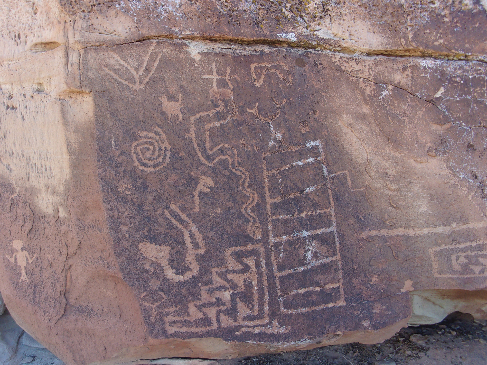
All hikes are good. Some have one or two attractions, others more. This hike, East Reef Trail in the Red Cliffs Desert Reserve, is one of the multi-attraction hikes. First, although only a few miles from civilization, it feels like, and is, wilderness. A place of solitude, we encountered no other people on our trek. Upon hiking to the top of East Reef/ridge are great views of the Virgin River. Past inhabitants of the area also left their mark—petroglyphs on the western side of East Reef. We, my wife Deb and I, began our adventure on a Thursday morning in late February.
The Red Cliffs Desert Reserve was established in 1996 to protect a large and diverse habitat capable of sustaining wildlife populations threatened by development and habitat loss. It comprises 62,000 acres and has more than 130 miles of shared-use trails for hiking, horseback riding, and mountain biking. Three ecosystems—the Mojave Desert, the Great Basin Desert, and the Colorado Plateau—merge in southwestern Utah and the Reserve reflects the biological diversity of this unique region. The Red Cliffs Desert Reserve Habitat Conservation Plan is administered by Washington County in coordination with the Bureau of Land Management, the US Fish and Wildlife Service, Utah Department of Natural Resources, and the Utah School and Institutional Trust Lands Administration. Remember, the reserve is a sensitive area, stay on the trails and minimize your impact—walk as if you are kissing the earth with your feet.
Marked by a short wooden fence and stepover, the trailhead elevation is 2,810 feet with a 120 feet elevation change from the trailhead to the highest point. There are some not-too-steep up and down sections.
The temperature was in the low 40s at about 9 am as we began our hike under an awesome blue Utah sky. Unfortunately for us, a cold gale-force wind accompanied us for the entire hike—brrrrrrr. It never got warmer.
Be advised that the trail is marked by four widely spaced, almost unreadable trail signs. And there are several user trails that while not the official trail, do eventually get back to the main trail.
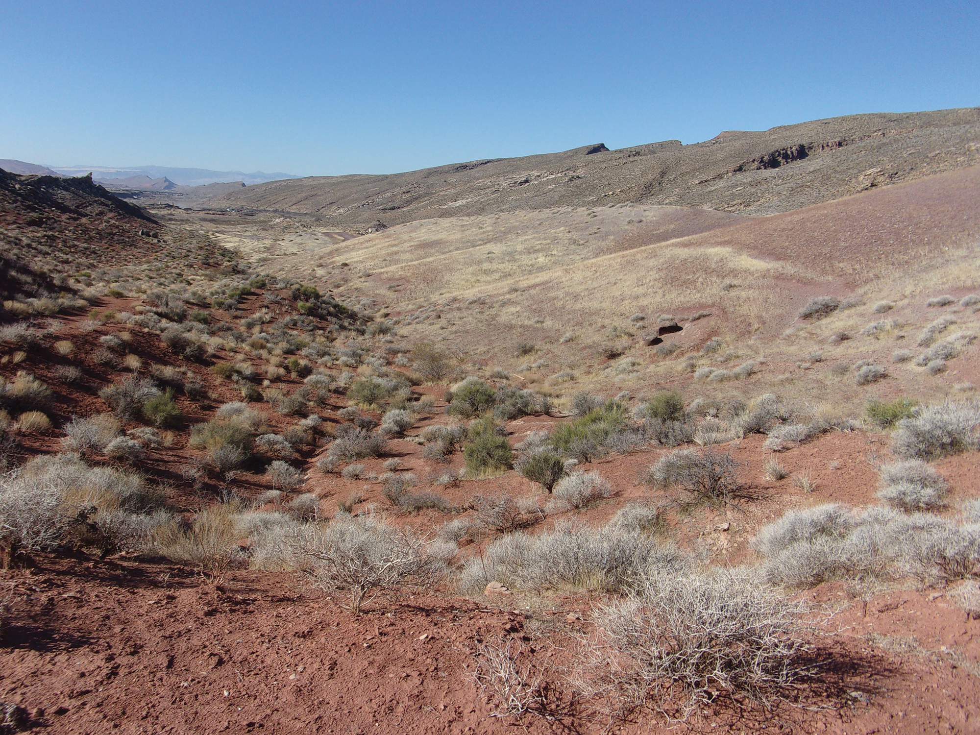
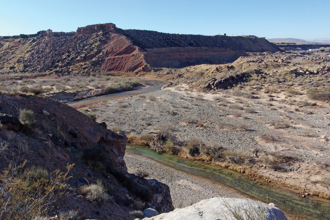
We began heading southwest on the eastern side of the reef (ridge) along the left side (south) of a gully. Within ¼ mile the trail became steep for a while and then down a bit to the southwestern tip of the reef. This vantage point afforded great views of the Virgin River.
At about ¾ miles along we descended the western side into a valley formed by two ridges and followed a dry streambed for about ¼ mile. The trail then jogs slightly to the right (east) and is closer to the bottom of East Reef. Less than 1 ½ miles along the trail, we came across two very large free-standing boulders, one of which has some nice petroglyphs.
This section of trail also features a large mound, or small hill, with wide grey and reddish bands. Fairly odd in this area of mostly brownish and reddish ridges.
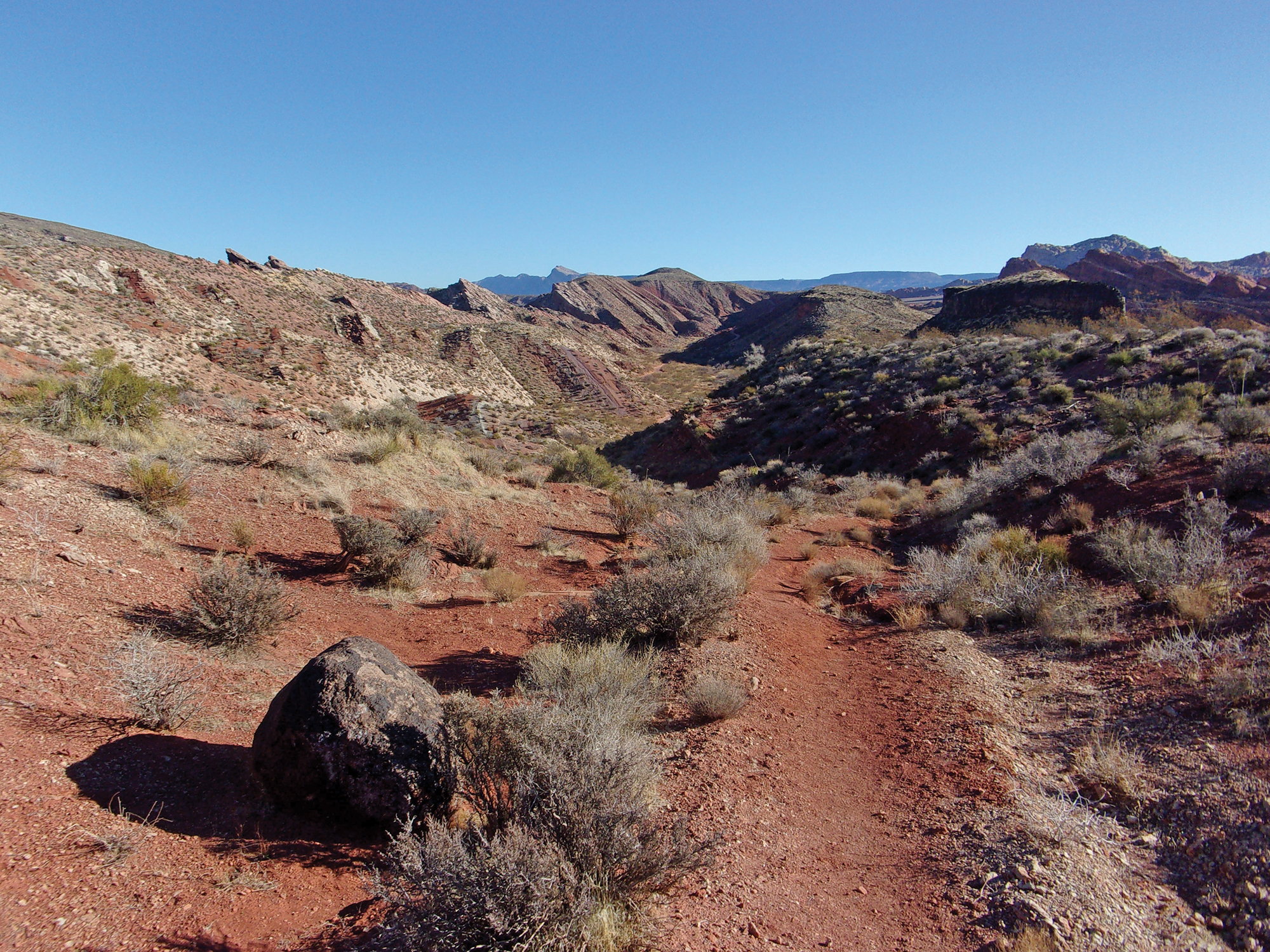
Then it was up an incline where we took some photos back toward the valley we traversed and soon our trail merged with Historic Babylon Trail. It quickly turned south to confront East Reef. On Historic Babylon Trail we crossed the ridge by walking through a large gap filled with boulders and almost vertical walls.
Through the ridge, we were now at the Historic Babylon trailhead and headed southwest down Babylon Road .3 mile to complete the loop hike back at the East Reef trailhead.
This is an easy hike with some not too steep up and down sections. The views are good as were the petroglyphs. As with most of our hikes, we did not encounter other people. The entire hike was about 2 ½ miles and took less than two hours.
Tom Garrison has been an avid hiker for more than 30 years. He is the author of seven books, the most recent hiking book being “Hiking Southwest Utah and Adjacent Areas, Volume Three.”


