
Foothills Trail in Mesquite, Nevada
– By Tom Garrison –
Location: Mesquite, Nevada. The hike is free, and no permit is necessary. Managed by the city of Mesquite.
Difficulty: Easy with a few short, steep sections.
Average Hiking Time: Less than 1 ½ hours at a leisurely pace with many photo stops and exploring.
Elevation: The trailhead is approximately 1,780 feet elevation with a 230 feet elevation change.
Family Friendly: Yes. It is a short, easy hike.
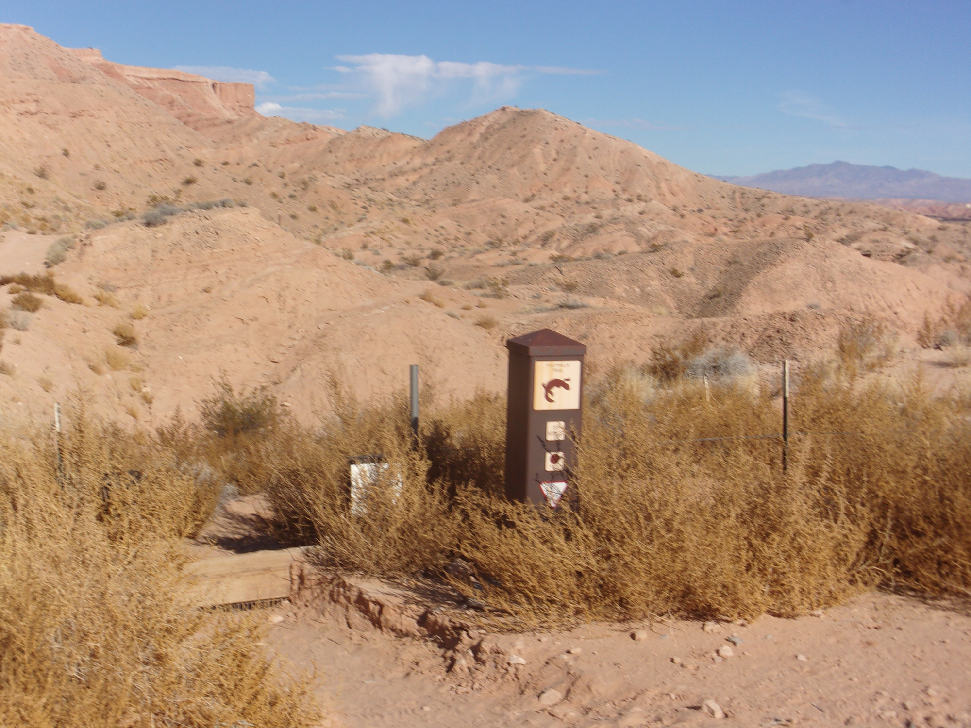
Getting There: From St. George, head south on Interstate 15. Just south of Mesquite, take Exit 118 and proceed north (right) on Lower Flat Top Drive. At 1.7 miles from exiting Interstate 15 is a large parking area and trailhead on the left (north). (Beware that about 100 yards before reaching the trailhead parking area is a paved road intersecting Lower Flat Top Drive. It is named Wittwer Trail. It is not a trail, and drive about 100 yards past it to turn left to the trailhead parking area.) This is the Foothills Trail trailhead. The parking area has a bathroom, benches, and a covered picnic area.
Going to Mesquite, Nevada? Try your luck at the casinos? Or perhaps purchase some legal marijuana for personal use (up to one ounce, and you must be 21 years old) for that special day, like Saturday. Maybe to play a round of golf. There are eight golf courses in the Mesquite area.
For whatever reason, if you need a short, interesting diversion, try hiking Foothills Trail. This easy hike, approximately 1.5 miles round trip, features desert landscape, a small wash, views of Mesquite and the Virgin Mountains, and a tiny bit off the trail, the Statue of Liberty sculpted in clay. It is a perfect winter hike, not too far from home and not too cold. Mesquite generally runs about 3 to 6 degrees warmer than the St. George/Washington area in southwest Utah.
We arrived at the trailhead about noon under scattered streaky clouds with the temperature in the low 60s. There were few other hikers, the parking lot only had two other cars. If you value the solitude that often accompanies desert hiking, this may be the hike for you.
Foothills Trail, a trailhead elevation of 1,780 feet with a 230-foot elevation change from the highest to the lowest point, begins at the north end of the parking area.
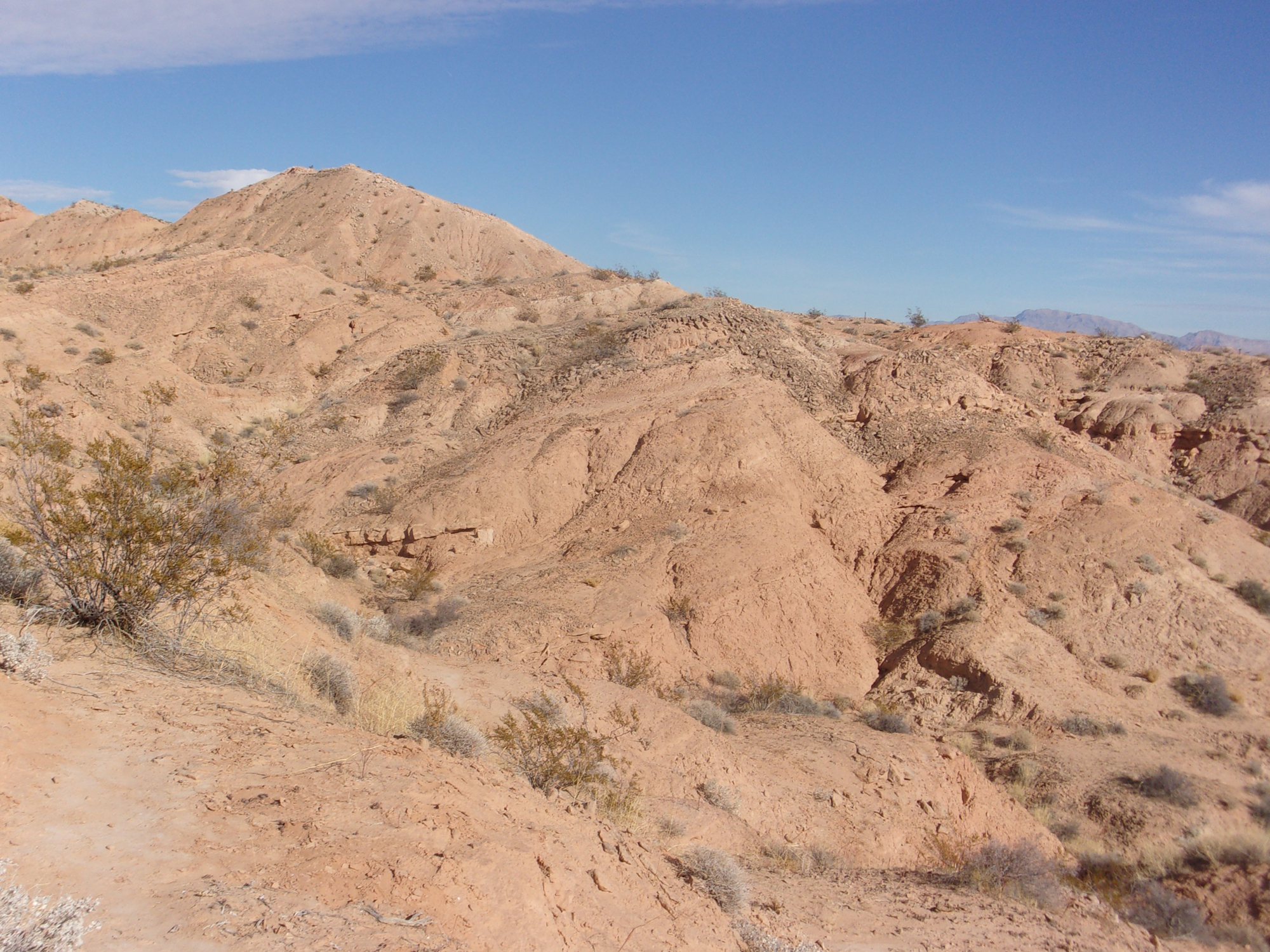
We began the hike by heading north. Be aware that Foothills Trail has several “user trails” branching out like the legs of an octopus. We did our best to stay on the approved trail, sometimes difficult because there seemed to be more than one official Foothills Trail. It helped that there are several “Trail” marker signs along the way. Much of the hike was sandy, fortunately not the deep slogging along the sand.
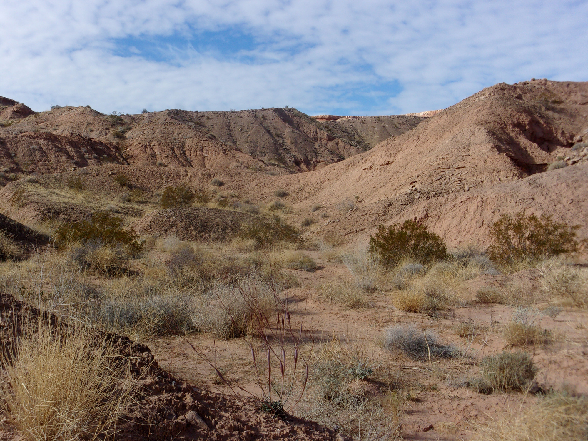
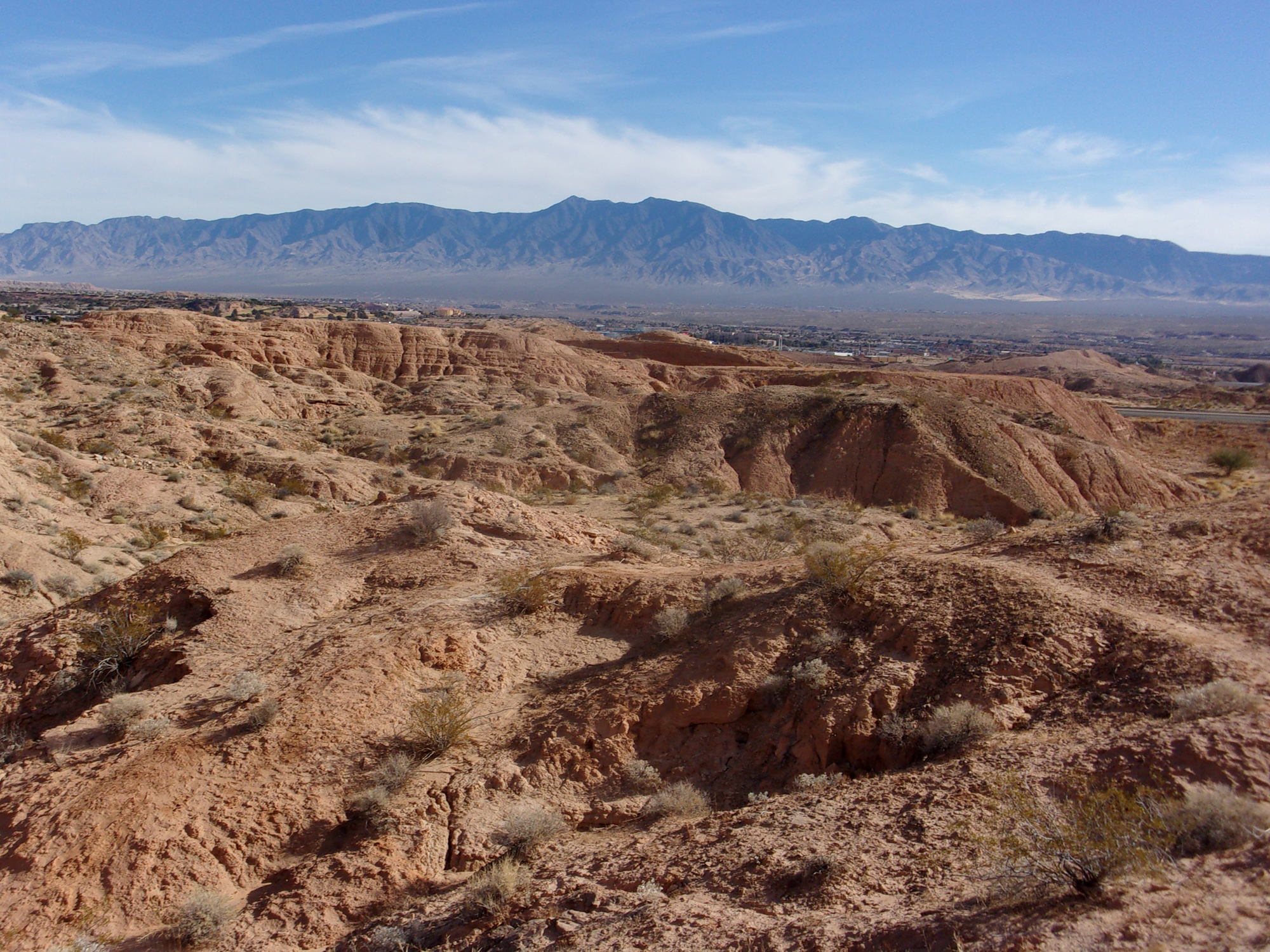
About .2 mile in is a marked short spur trail to the right (east) leading to an observation point. It’s worth the very short detour for a nice view of desert hills, the city of Mesquite, and the Virgin Mountains with Virgin Peak (7,046 feet elevation), the highest peak in the Virgin Mountains, just south of Mesquite.
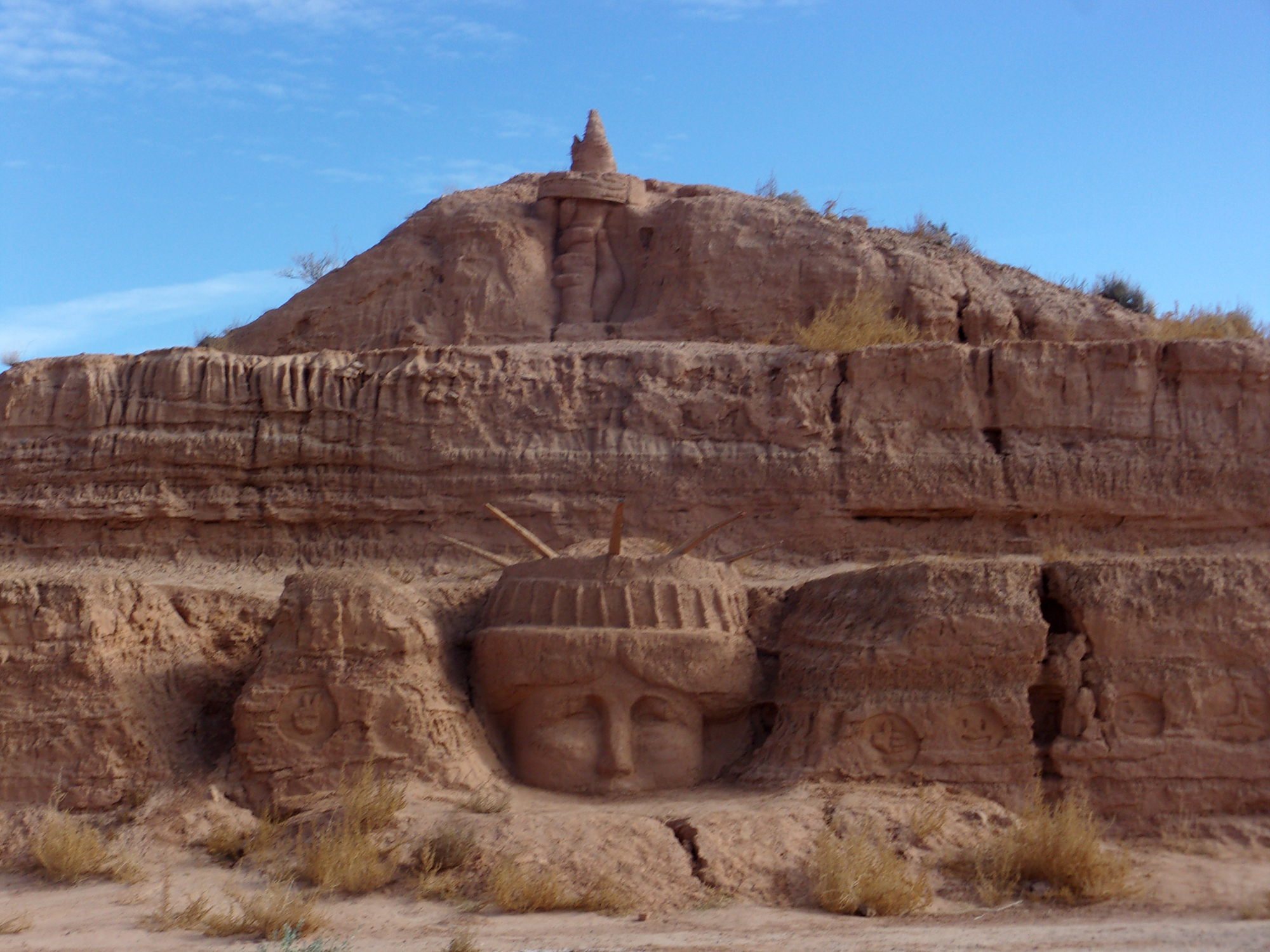
The first section, about .4 mile, traverses the slopes of some low hills with sparse vegetation. Then, the trail takes a hard right (east) along a ridge with Desert Wash Trail in the wash to the left (north) below the ridge. A short distance later, the end of the trail overlooks Lower Flat Top Drive. Across the road from our vantage point, we saw what looked like the head and arm of the Statue of Liberty carved into the vertical clay cliff that was cut to make the road. Really? We had to check this out.
We walked down the slope and reached the road, and there it was in amazing detail. We later learned that a local retired real estate broker, Pete Karns, created the Statue of Liberty head and torch. This is his latest public art work—in the same area he created a mini-Mt. Rushmore and several smaller figures.
(You can see this amazing public art without hiking. Simply go to the intersection of Lower Flat Top Drive and Wittwer Trail Road and drive north on Lower Flat Top Drive. In less than half a mile, you will come to the clay cliffs on your right (east). Look closely, and you will see various forms and shapes carved into the cliffs.)
After studying the sculpture for a while, we headed north on Lower Flat Top Drive and, within 100 yards or so, left the road and entered a wash on the left (west) side of the road. Depending upon your starting point, this was the beginning or end of Desert Wash Trail. We followed the trail/wash west about ¼ mile and left the wash via an extension of Foothills Trail, where it intersected Desert Wash Trail.
The slope out of the wash was the longest and steepest of the hike, but still no problem. This spur of the main Foothills Trail soon joined the main trail and we headed south back to the trailhead.
Since it was winter, we saw a few animals, including one small mouse, scampering away.
This is a short, easy hike, taking less than 1 ½ hours, and well suited for the weary gambler who wants a break from losing. The hike is a winner.


