
Goblin Valley State Park
– By Tom Garrison –
Trails: Entrada Canyon Trail and Carmel Canyon Loop Trail
Location: Goblin Valley State Park, Utah
Difficulty: Each hike is easy. There is a short steep section at the beginning of Entrada Canyon Trail and almost all the trail is narrow at the bottom of a natural drainage comprised of hardened mud. The last section of Carmel Canyon Loop is somewhat steep with rock scrambling through a narrow canyon. Carmel Canyon is not well marked, with some trail markers knocked down, and several user trails leading in different directions. Follow the rock cairns.
Average hiking time: Less than one hour for Entrada Canyon Trail and about one hour for Carmel Canyon Loop Trail. Both at a leisurely pace with many photo stops.
Elevations: Entrada Canyon Trail, 4,933 feet trailhead elevation with less than a 100 feet elevation change. Carmel Canyon Loop, 4,893 feet trailhead elevation with about an 85 feet elevation change.
Family-Friendly: Yes, although probably a bit much for very young kids. Dogs are allowed on a leash.
Getting there: From St. George head north on Interstate 15. About 117 miles later (the mileage depends upon your exact starting point) take Exit 132 near Sulphurdale onto Interstate 70/Highway 89 (which later becomes Highway 50) going east. Stay on Interstate 70 for approximately 148 miles and exit the Interstate via Exit 149 onto State Highway 24 going south. Remain on Highway 24 for 24 miles and then turn right (west) onto Temple Mountain Road. After five miles turn left (south) onto Goblin Valley Road. Almost seven miles later is the park entrance station and visitor center. After paying your fee and examining the displays at the center, drive past the entrance station for .4 mile and turn right toward the campground. About .1 mile past the intersection, take the second left turn (the first left goes to the group campsite) into the campground. Unless you have purchased a campsite, the only place to park is in front of the bathrooms. Park there and walk back to the group campsite. The Entrada Canyon Trailhead, marked with a sign, is on the southeast side of the entrance.
Looking for that desert playground with goblins being the most prominent feature? We were and Goblin Valley State Park in south-central Utah fit the bill.
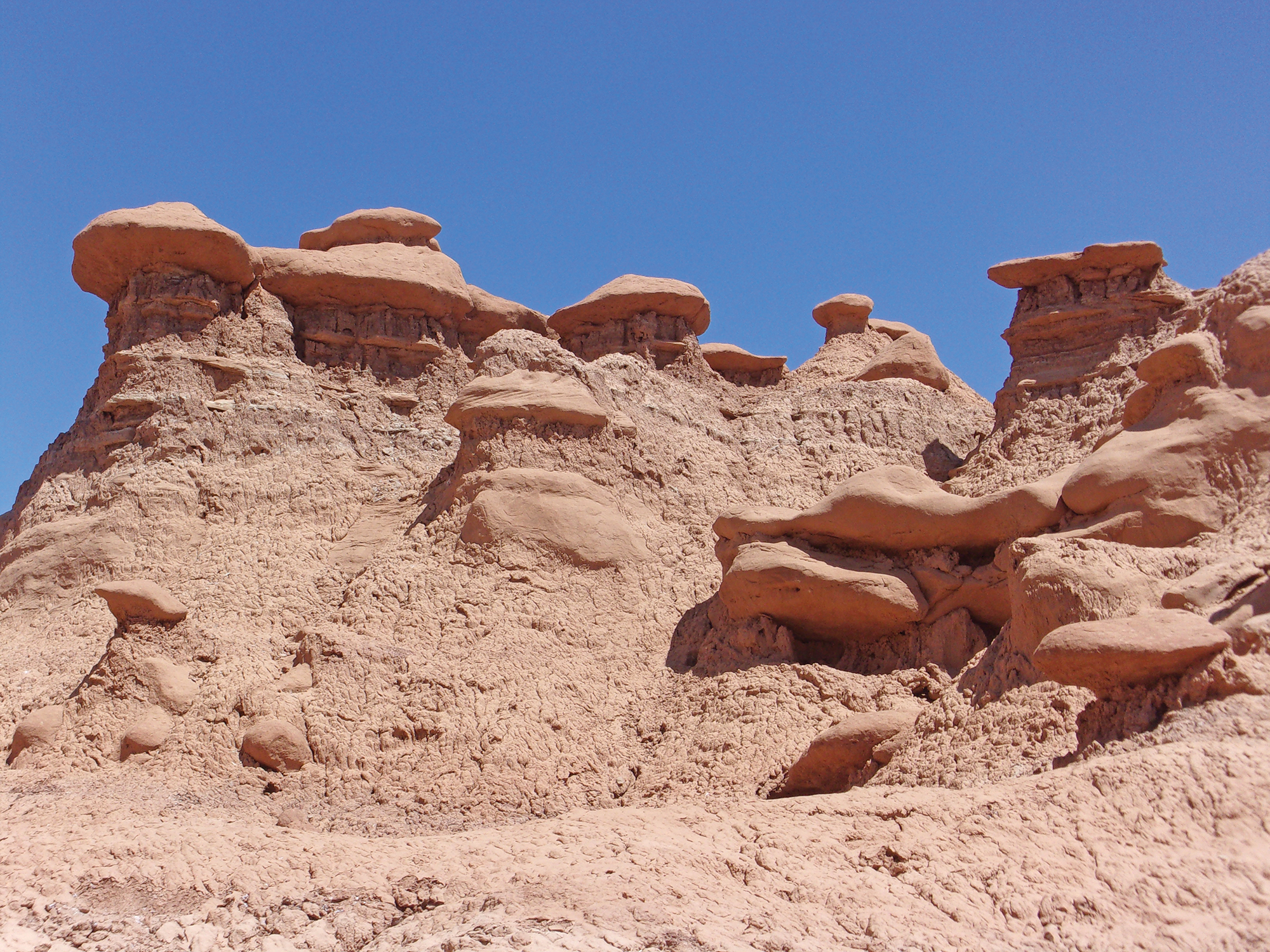
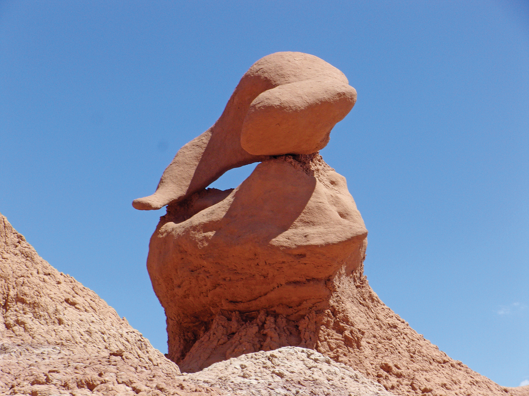
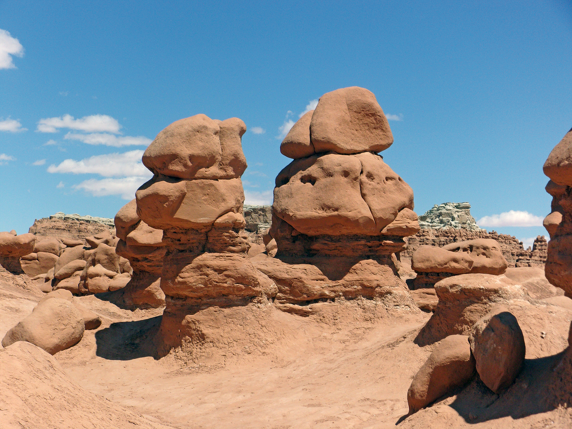
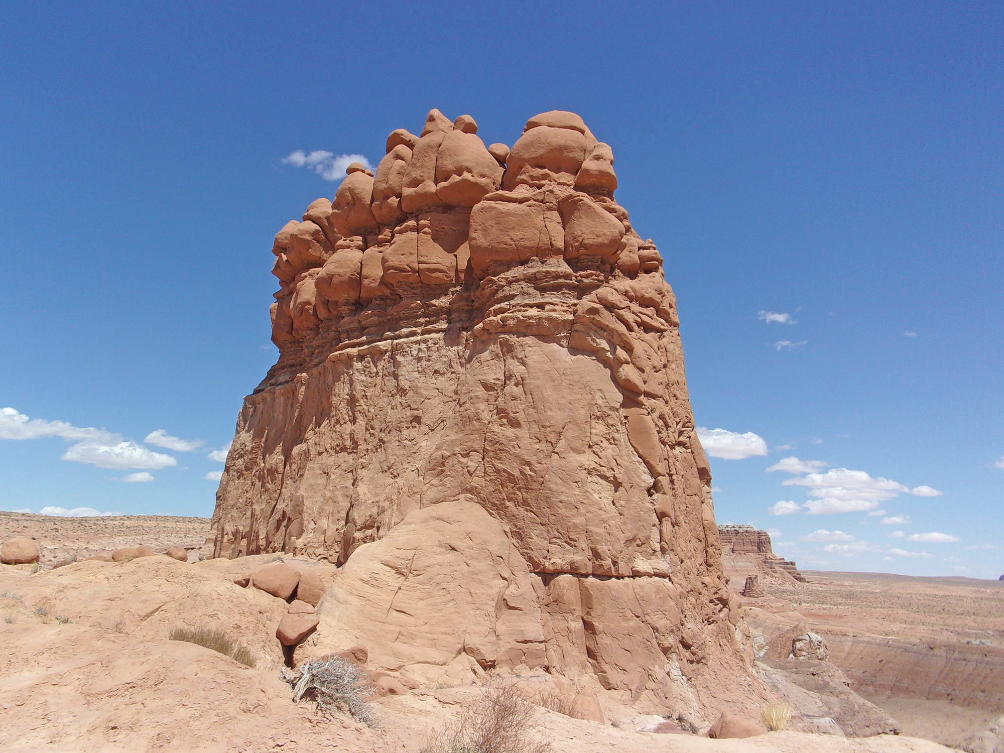
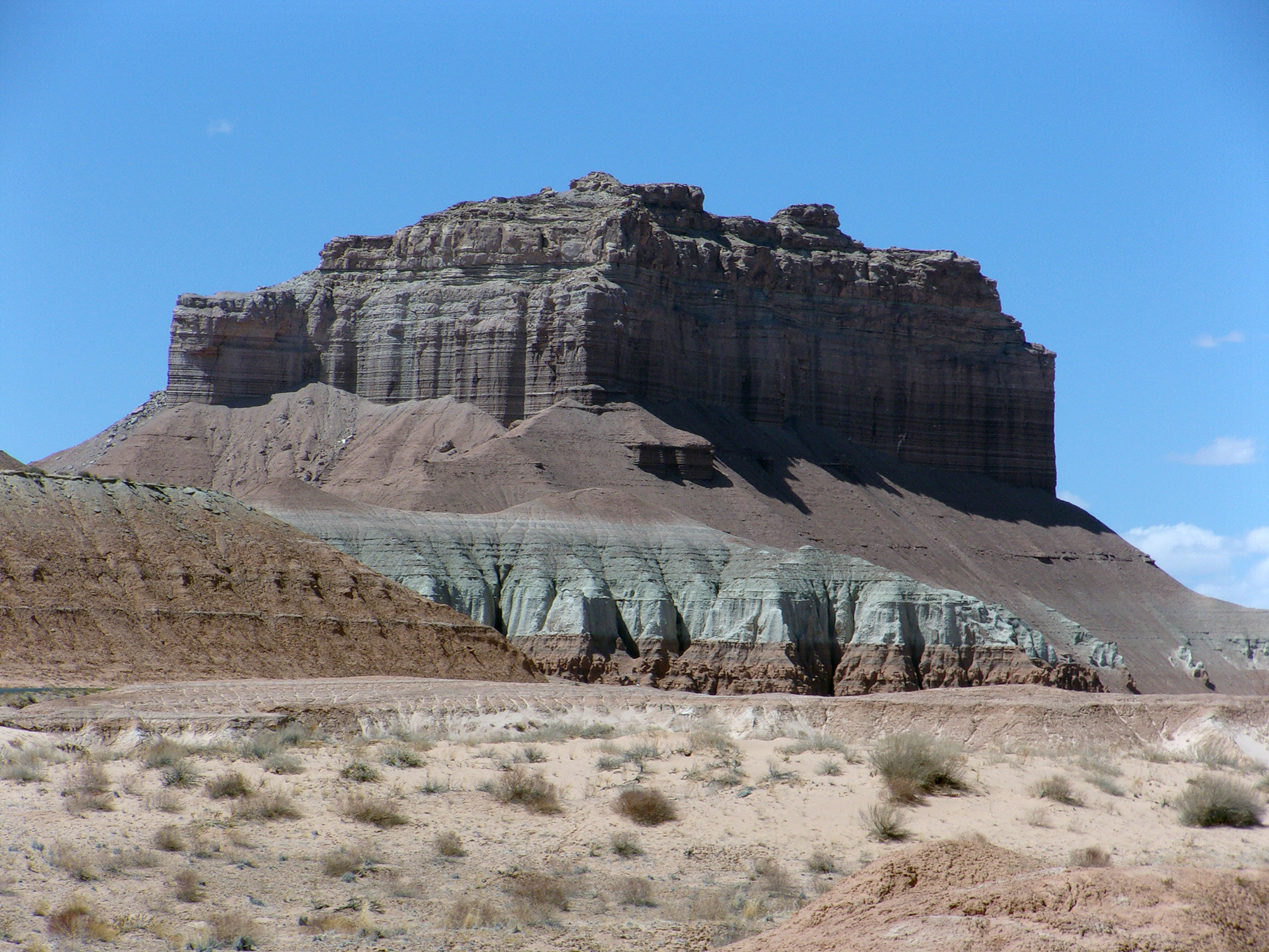
Encompassing only 3,654 acres, Goblin Valley State Park became an established state park in 1964. It features amazing red sandstone formations, many resembling animals, faces, and portals to alien worlds. The stone formations of Goblin Valley result from millions of years of geological history. The most famous structures are thousands of pinnacles or hoodoos, referred to as goblins. These are formations of mushroom-shaped rock pinnacles, some as tall as several yards. The distinct shape of these formations results from an erosion-resistant layer of rock atop relatively softer sandstone. Time and the forces of nature—uplift, wind, and water erosion created the forms we see today. It is an alien landscape on good old earth.
While Native Americans left their mark in Goblin Valley in the form of petroglyphs, the first Americans to view the valley are believed to be cowboys searching for lost cattle. In the late 1920s, Arthur Chaffin and two companions were searching for an alternate route between Green River and Caineville. They came to the vantage point and were awed by what they saw—five buttes and a valley of strange-shaped rock formations surrounded by a wall of eroded cliffs. Chaffin returned in 1949 and spent several days exploring the area he called Mushroom Valley.
Despite its remoteness publicity attracted visitors to the valley. In 1954 it was proposed that Goblin Valley be protected from vandalism. The state of Utah later acquired the property and established Goblin Valley State Reserve. In 1964 it was designated a state park.
For our first exploration of Goblin Valley State Park, we chose two easy hikes, representative of the entire area. The first, Entrada Canyon Trail is a 1.2 mile one-way (you can go out and back) hike featuring interesting goblin formations on the rim of a dried mud drainage. The second, Carmel Canyon Loop Trail, 1.5 miles long, features more perspectives of the goblins and a short colorful narrows section.
Our adventure began on a late April morning. Before leaving Deb and I explained to Bob and Willa, our cats, that we would be gone overnight and under no circumstances were they to have some crazy cat conclave while we were gone.
The Entrada Canyon Trailhead elevation is 4,933 feet, the temperature was in the mid-60s, and the sky, of course, a deep Utah blue. There is less than a 100 feet elevation change during this easy hike which took us less than one hour.
There is a short steep section at the beginning of Entrada Canyon Trail and the trail tracks south and a little east following a natural drainage. About ¼ mile in, we passed a service road leading to bike trails. The entire trail past that intersection is a narrow track at the bottom of a hardened mud drainage. Most of the way, goblins are peering down on you from the rim of the mud walls. It is an easy climb to the rim of the walls, and we took many photos of the goblins.
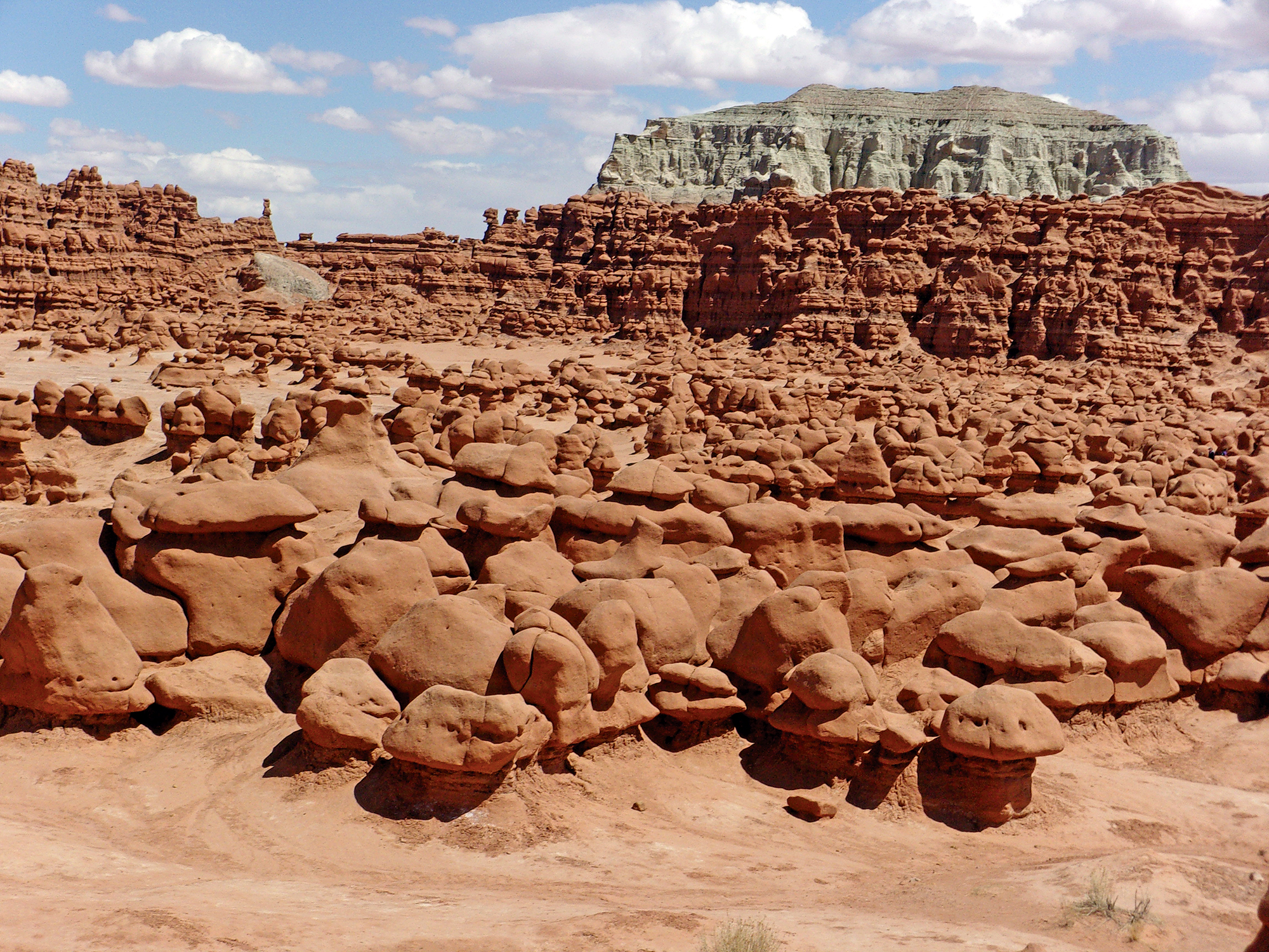
At the end is a short uphill section to the Goblin Valley Observation Point and parking area. Here most hikers turn around for the return trip. We took a break before our next hike to explore Goblin Valley directly below the Observation Point—an amazing sight. There are literally hundreds of hoodoos and rock formations of all sizes and shapes—the goblins. Most park visitors do not hike the trails, but come directly to the Observation Point, walk down a series of steps, and wander around the goblins.
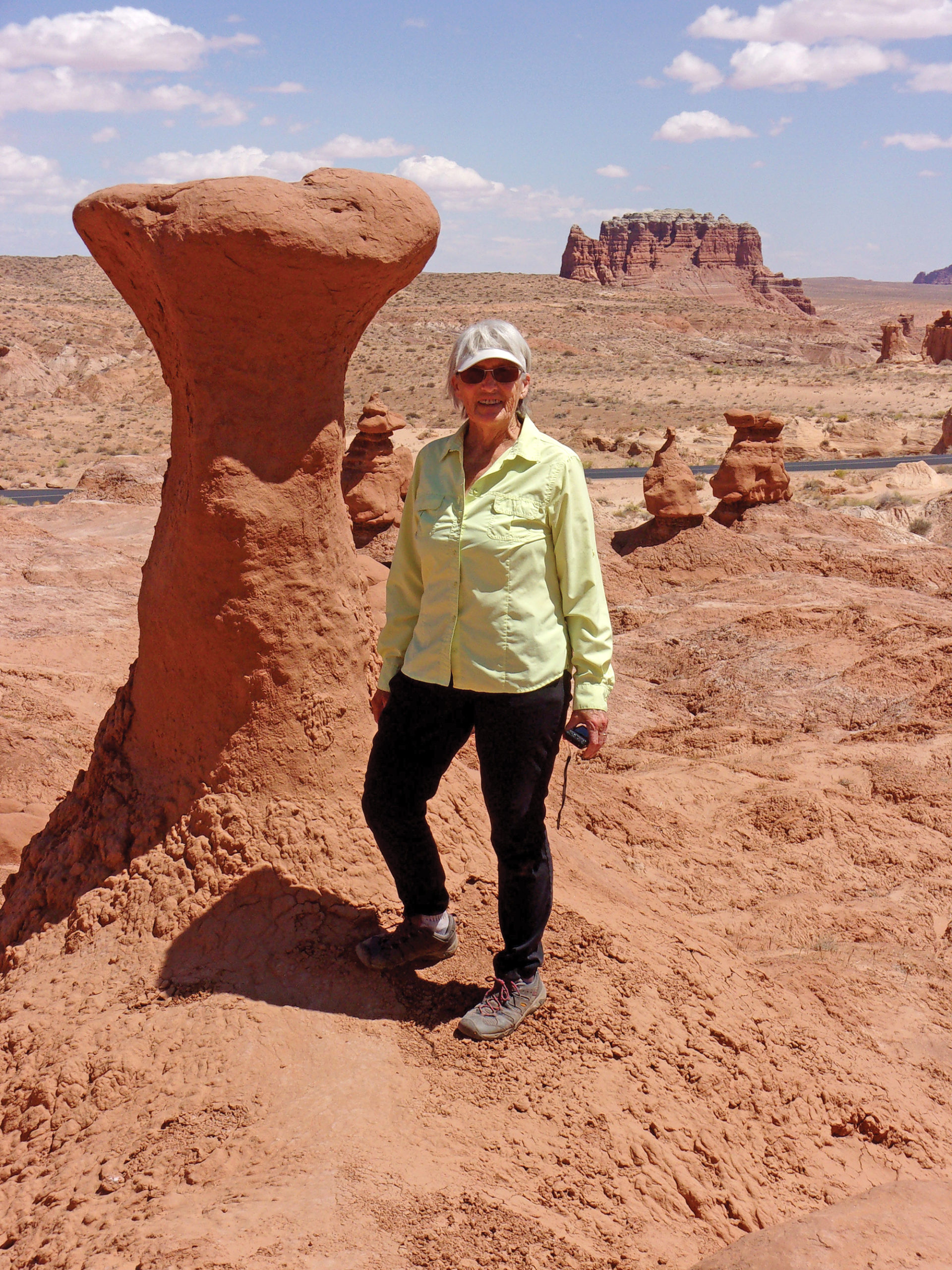
After communing with the goblins, we proceeded to the Carmel Canyon Trailhead located at the northeastern end of the parking area. The trailhead elevation is 4,893 feet with about an 85 feet elevation change during the hike. This is an easy 1.5 miles loop trail and we started in a counterclockwise direction heading northeast. Beware that Carmel Canyon Loop Trail is not well marked, with some trail markers knocked down, and several user trails leading in different directions. Follow the rock cairns.
In addition to goblins and other formations, the end of this hike features a short section of somewhat steep colorful narrows requiring some rock scrambling.
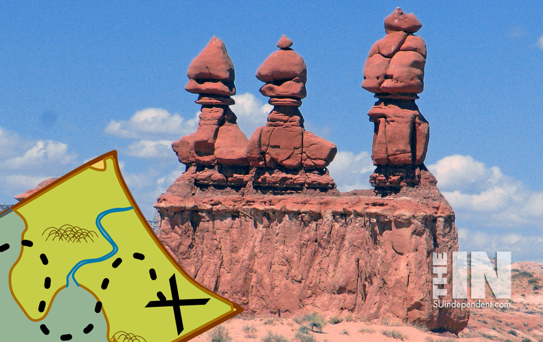
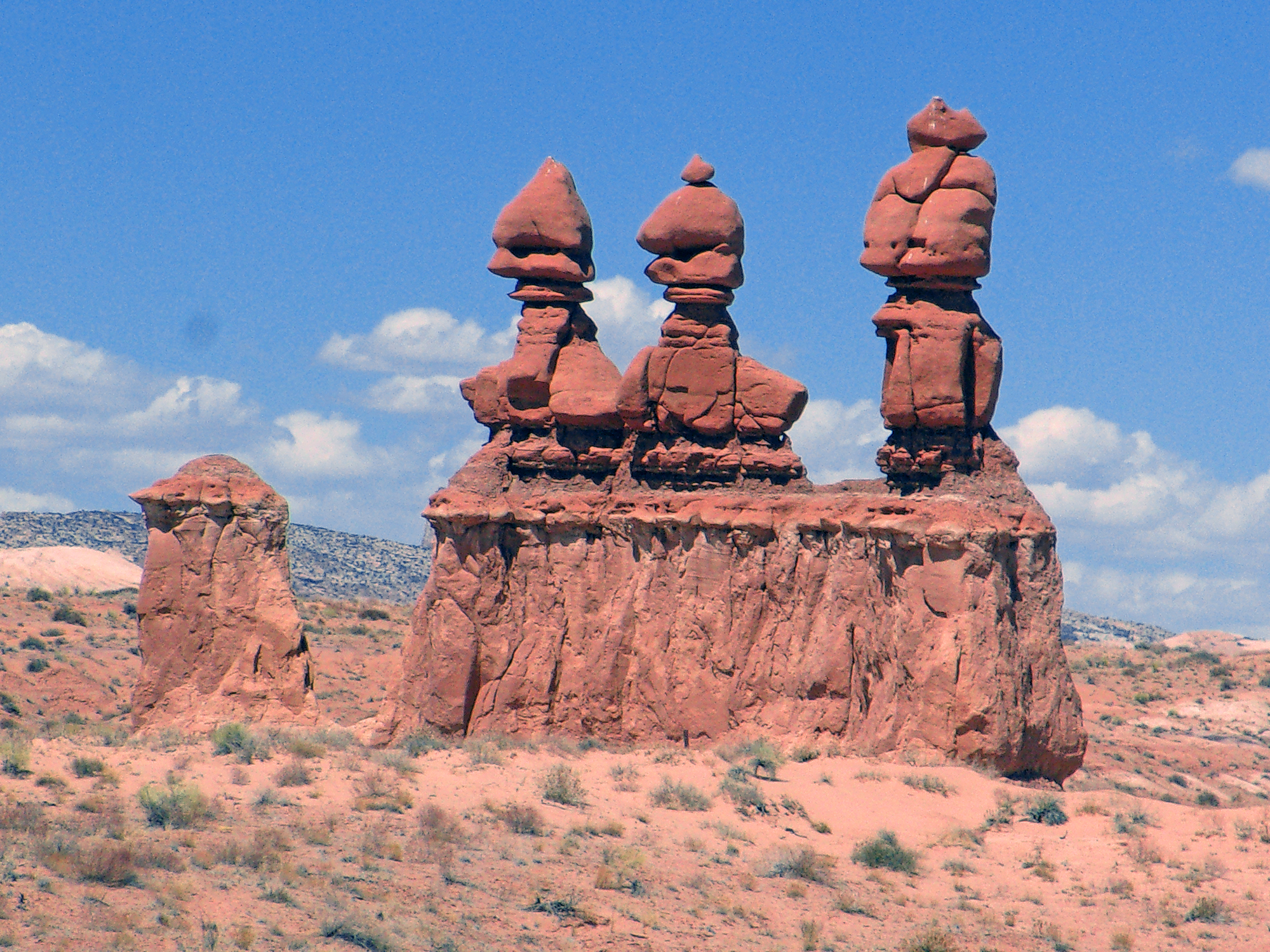
We finished the hike returning to the Observation Point (it is a loop hike) in about one hour. We then headed back along a paved road to the Entrada Canyon Trailhead and campground and our vehicle. The road passes close to the famous Three Sisters formation and we got some good photos.
Since it was a long drive home, about four hours, we spent the night in Green River, about 45 miles from the park. In 2019 Green River had a population of 856. It is a pleasant town straddling its namesake, the Green River, and alongside Interstate 70. Virtually everyone must work in motels, there at least ten in the town, and eateries.
While other Utah national and state parks receive more visitors and press coverage, don’t assume Goblin Valley State Park is something to bypass. It is isolated and receives some visitors, but sans massive crowds. Its’ weird goblin inhabitants make it a worthwhile trip.


