
Hidden Haven Falls Trail
– By Tom Garrison –
Trail: Hidden Haven Falls Trail
Location: Parowan Canyon Wildlife Management Area, about five miles east of Parowan. The hike is free, and no permit is necessary.
Difficulty: Easy with some Benson Creek rock scrambling and creek crossing the last part of the hike.
Average hiking time: One to two hours, depending upon your speed, photo stops, and a side trip to the amphitheater.
Elevation: 7,105 feet trailhead elevation with a 250 feet elevation change.
Family-Friendly: Yes, we saw several young kids and a dog on the trail.
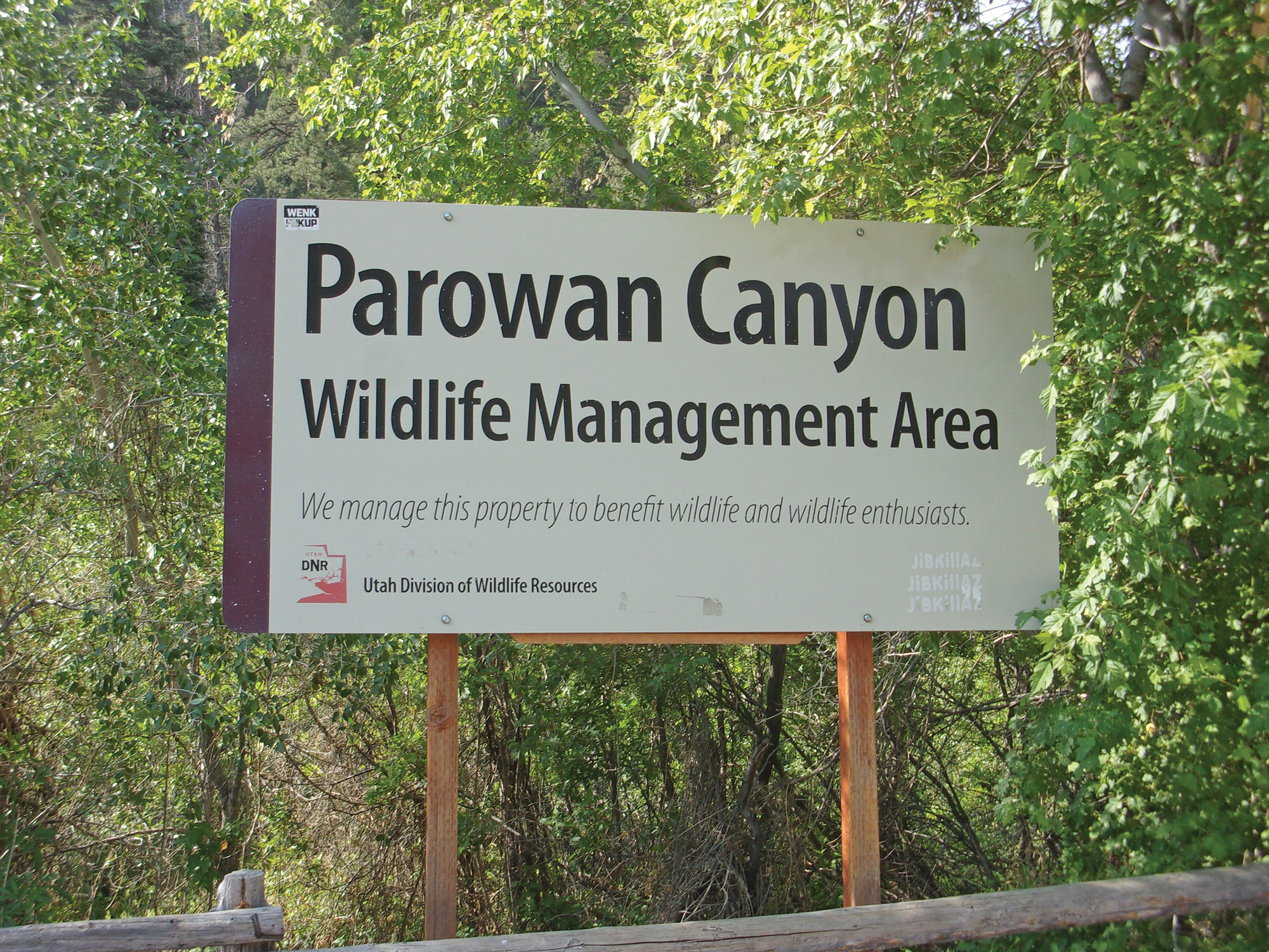
Getting there: Hidden Haven Falls Trail – From St. George travel north on Interstate 15. About 15 miles past Cedar City turn off at Exit 75 placing you on Highway 143 (aka 200 South Street) going east. Follow the signs for Brian Head and Cedar Breaks National Monument and after about 2 ½ miles turn right onto South Canyon Road, also known as Highway 143. Reset your odometer at this intersection and follow Highway 143 south for 5.5 miles where you will see a large white sign on the left (east) side of the road saying, “Parowan Canyon Wildlife Management Area.” The sign is in a large parking area. This is the Hidden Haven Falls Trailhead. There also was a smaller white and blue sign reading “Hidden Haven” attached to a fence rail. This small sign may or may not always be there.
No matter how wonderful home is, and southwest Utah is indeed wonderful, just about everyone needs to get out of town occasionally, even for a few hours. As we all know, the St. George area is hot in the summer. Not kinda hot, but a temperature close to that of the surface of the sun. What to do?
Our plan was an easy hike above 6,500 feet elevation (it’s cooler) in a wooded area. The perfect hike includes a waterfall.
Guess what? Hidden Haven Falls Trail near Parowan meets all those requirements. It is approximately two miles round trip doable in the summer and you probably won’t melt.
My wife Deb and I departed on a Thursday morning in mid-June during an extreme heatwave (it usually doesn’t get to 110 degrees until the middle of July).
We arrived at the trailhead about 9:15 am. The parking lot, and trailhead, elevation is 7,105 feet and the temperature was in the mid-80s.
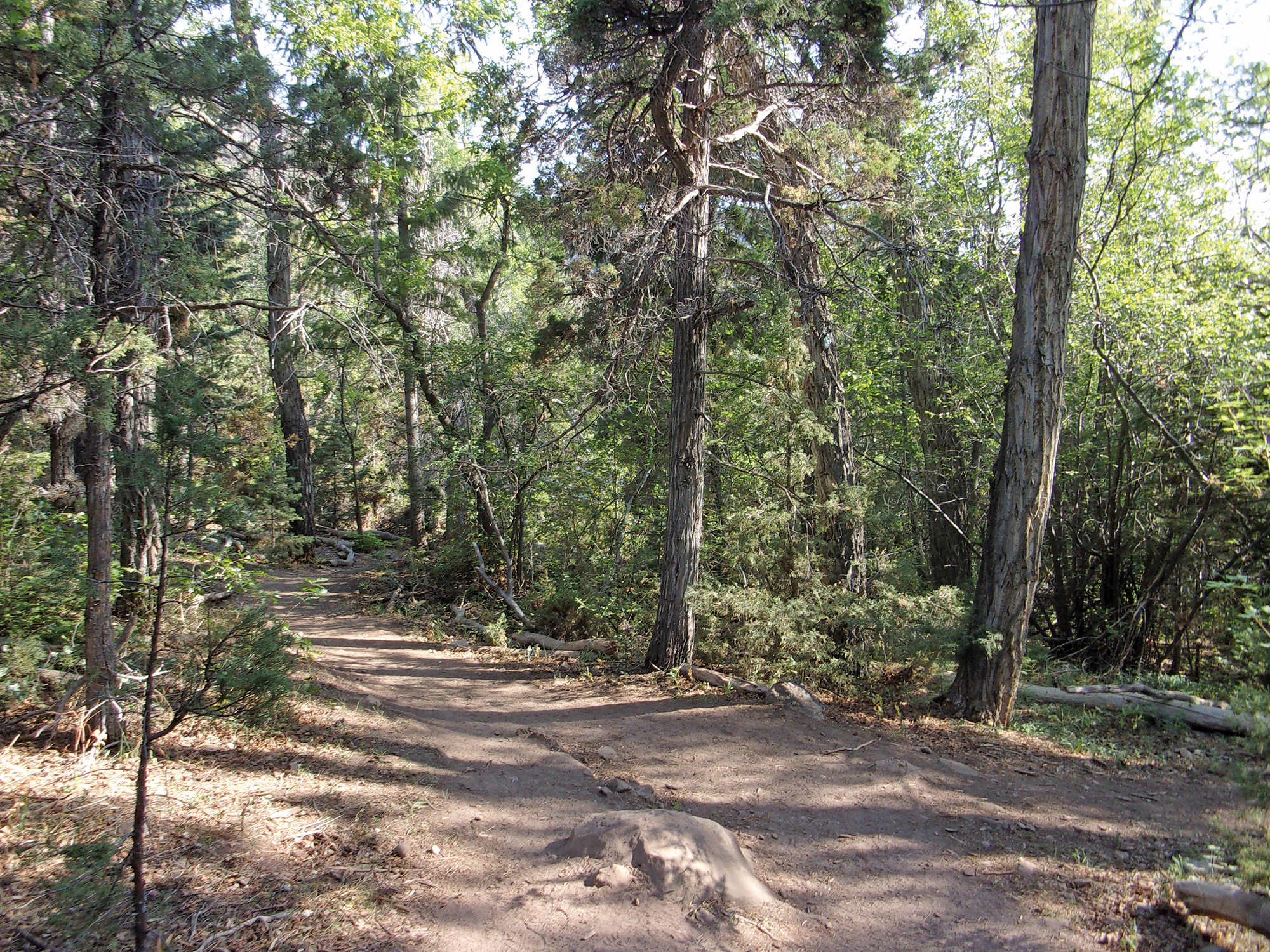
The parking area/trailhead is bounded by a wooden fence with an opening to the trail. The first section of the well-established trail, about 1/3 mile, runs north parallel to Highway 143 between the highway and Parowan Creek on the right. It is a wooded area and the trail winds in and out of the shade.
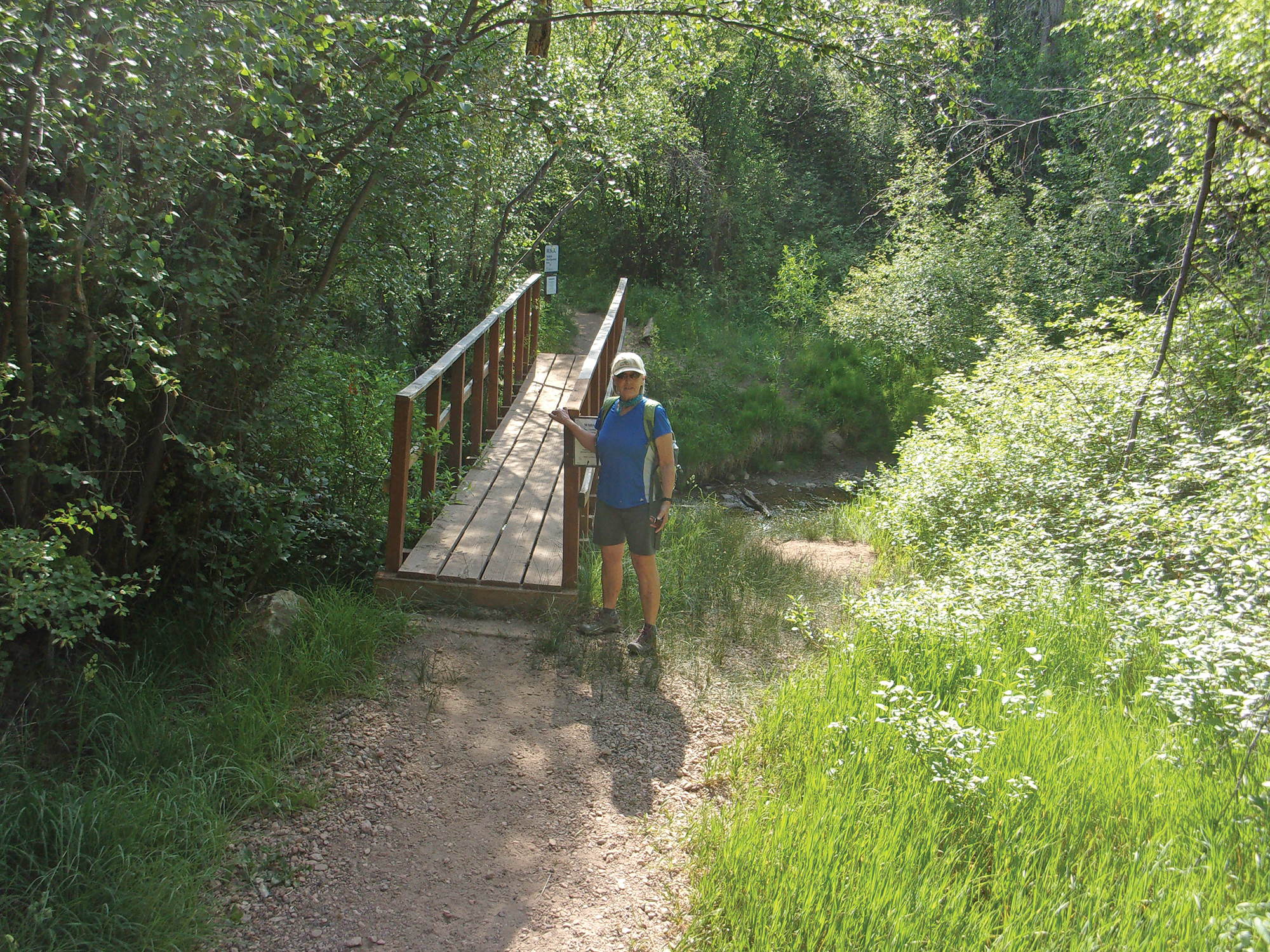
While Deb and I totally enjoy desert hiking, this woodland trail is a nice change. We came to the first small footbridge crossing Parowan Creek about 1/3 mile in when the trail bends away from the highway and heads east, now paralleling Benson Creek.
At approximately ½ mile along, we came to a fork in the trail marked by a solitary wooden bench. The right fork (heading south) heads uphill to an amphitheater. The left continues toward the falls, going east roughly paralleling Benson Creek to the left of the trail.
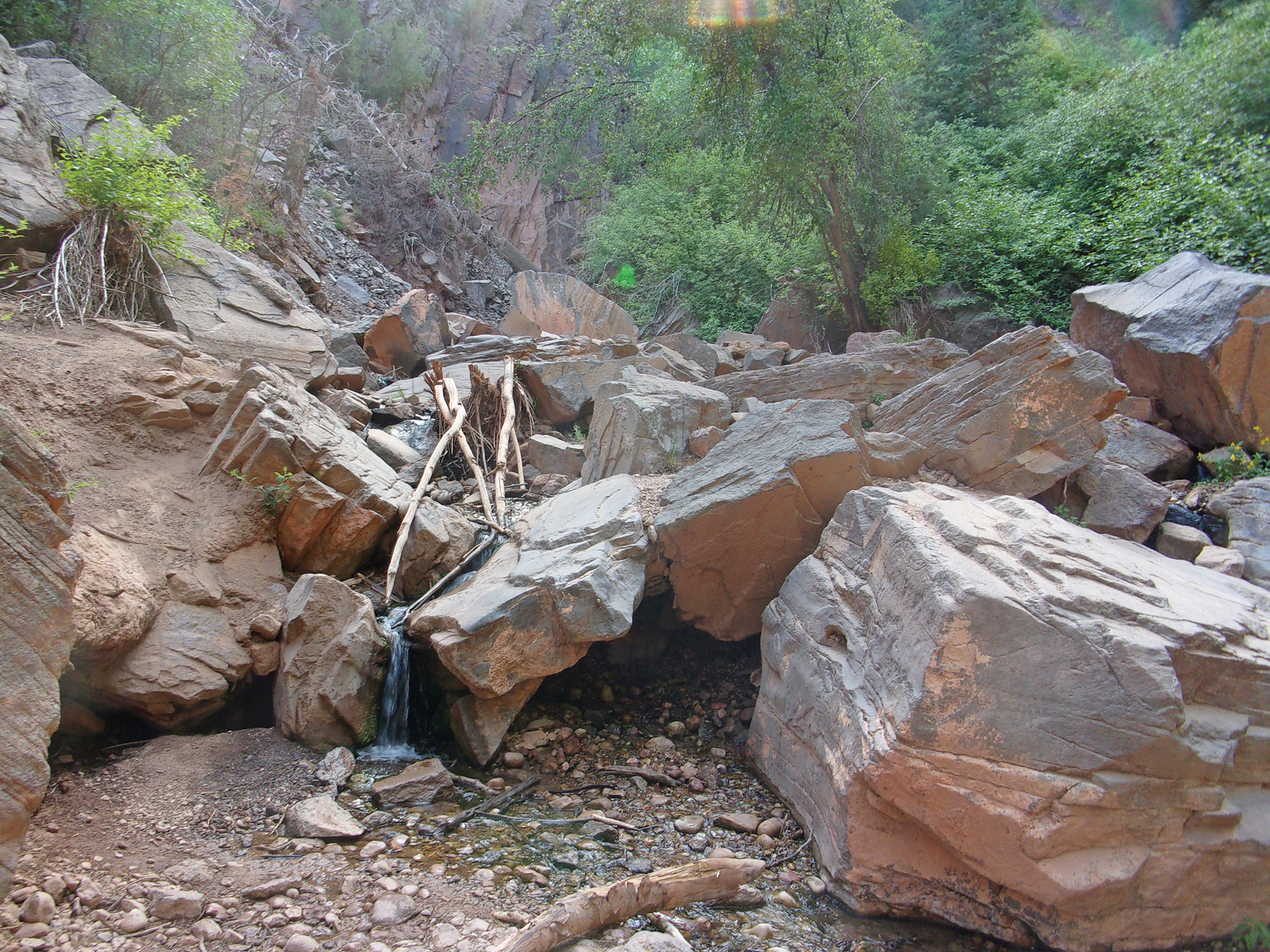
Next, we came to a second footbridge at .7 mile along the trail. Soon we entered a picnic area with tables and could see the top of Benson Canyon where the falls are located.
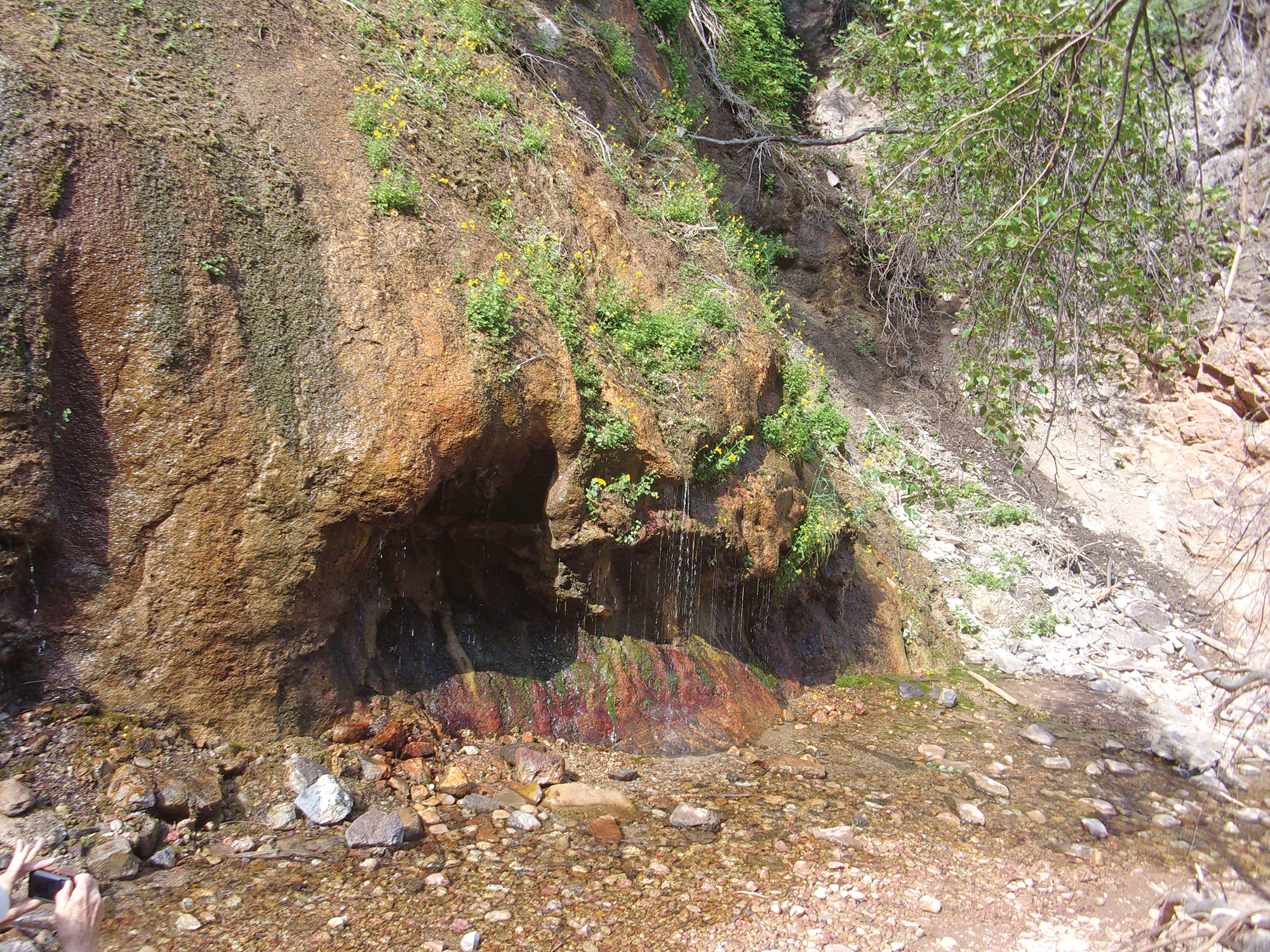
Just beyond the campground, we scrambled down the bank of Benson Creek where a huge tree had fallen across the creek and continued upstream. From here to the waterfall requires some easy creek crossing and rock scrambling.
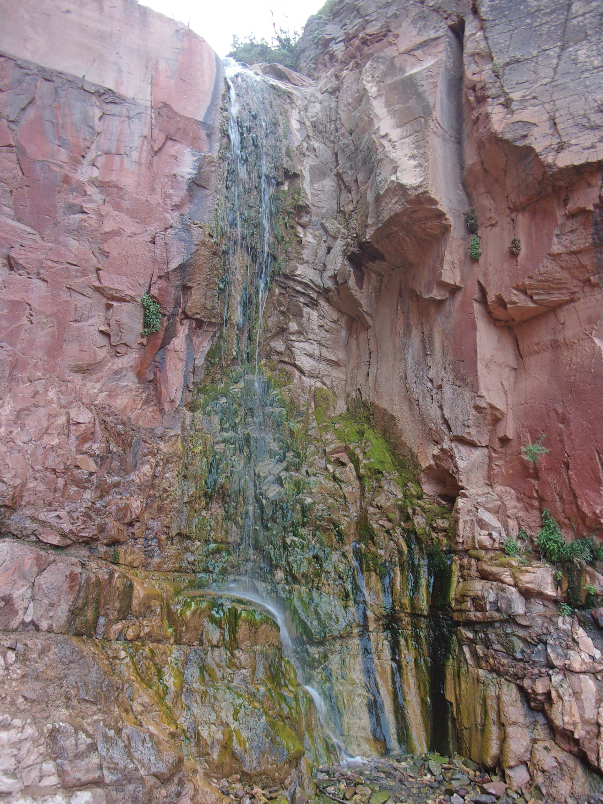
After about .1 mile we heard and saw the waterfall—a very nice cascade about 40 feet high in a shady cove. It was the beginning of summer in a dry year and the waterfall was flowing, but not a thundering torrent one could imagine in the spring of a wet year. The one-way distance from the trailhead to the falls is about one mile with a 250 feet elevation change, an easy hike.
On the return trip, we quickly explored the amphitheater, less than a ¼ mile round trip. It was somewhat odd to find an open area with a rough stage and staggered seating. It would be a great venue for a play. Then it was back to the intersection and return to the trailhead.
Deb and I are used to desert hiking where we can typically see scores of miles in every direction. This was different, albeit a nice change, in that most of what we could see was a bazillion trees everywhere. We didn’t see any squirrels or lizards but did spot a few birds and butterflies.
We were a bit surprised to meet at least 20 other hikers, including several young kids, on a fairly obscure trail mid-week during a heatwave.
All-in-all a pleasant hike. This family-Friendly adventure is worth the effort. We spent about 1.5 hours on the trail. The roundtrip distance is about two miles, add another ¼ mile to see the amphitheater. If you enjoy an easy hike in a cooler environment with a waterfall payoff, give Hidden Haven Falls Trail a try.


Please don’t tell people about our secret hikes we love this hike because it is not well known. All the other hikes, and national parks are too busy for the locals now.
Huh? Not “secret”, there’s a campground and an amphitheater there; nevermind the huge sign and parking lot. Anyone driving on this road to or from Bryce can’t miss this hike on public land!
Kati Meyers: Not very secret. I learned of Hidden Haven Falls Trail from a Facebook post. Then I did some basic Internet research and found several other reports about the trail. One of them was an AllTrails report that included many details and a map. By the way, AllTrails claims to have around 25 million users.
Second, my wife and I hiked the trail on a Thursday morning in mid-June. We finished within a couple of hours. In that time we saw at least 20 other hikers–not so secret.
Third, as you know, there is large sign, Parowan Canyon Wildlife Management Area, and large parking area marking the trailhead on Highway 143.
Finally, the hike is on public land. Anyone can enjoy the hike.