

Hiking Southern Utah: Tempi’po’op Trail
 Trail Name: Tempi’po’op trail (AKA Anasazi trail)
Difficulty: Moderate
Elevation Gain: 350 feet
Length: 3.5 miles roundtrip
Time Required: 1-2 hours
Family-Friendly: Yes, with short cliff bands requiring caution for younger children
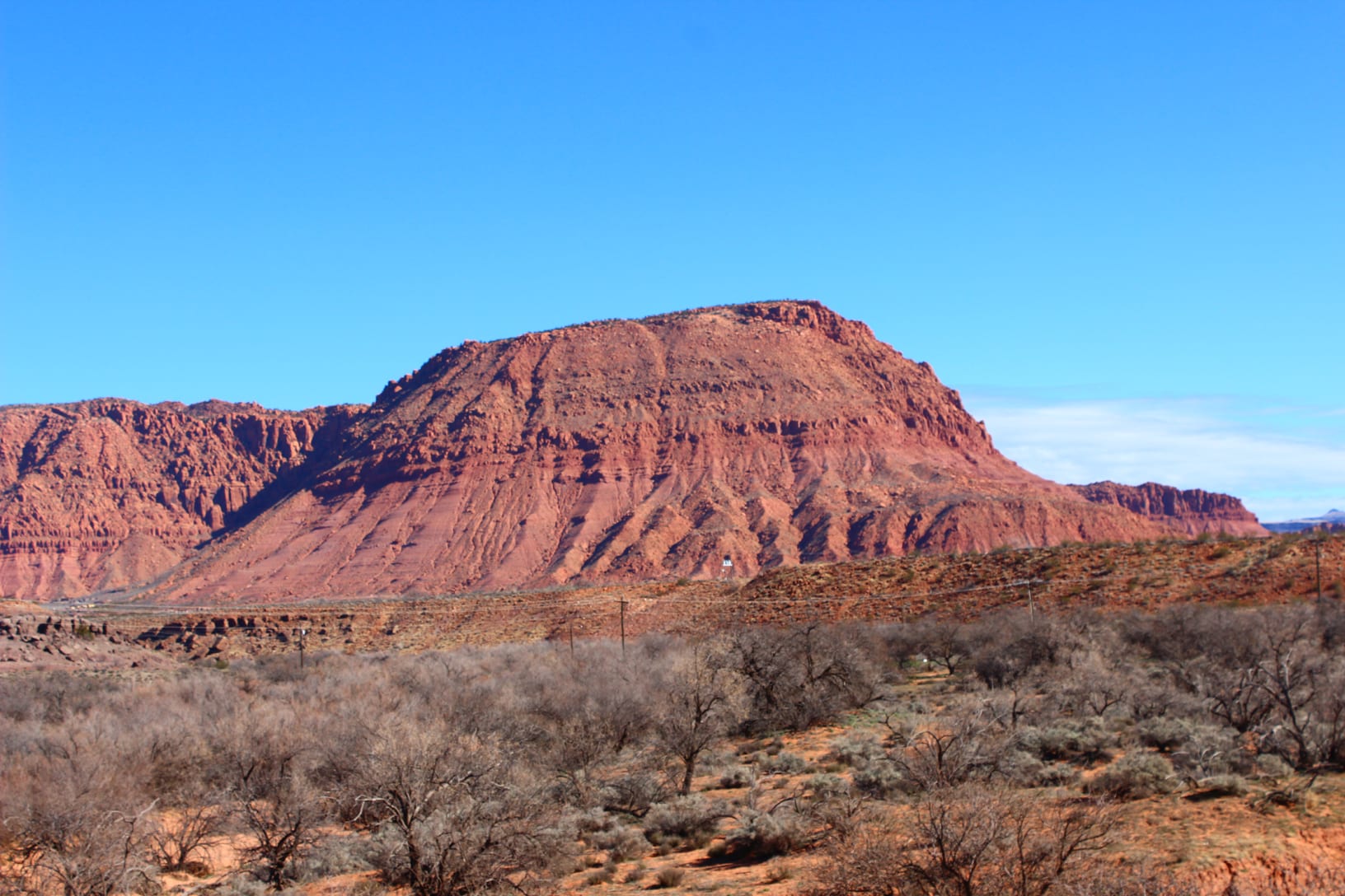
The Tempi’po’op (tum-pee-poo-oop) trail is a delightful trek that leads to one of the richest areas of petroglyphs in the region. “Tempi’po’op” means “rock art” in the Southern Paiute language. With a mild ascent up a butte historically known as Land Hill, this trail is perfect for both children and adults and culminates with wonderful views of the Santa Clara River, Ivins, and Red Mountain.
Access: From the junction of Bluff Street and Sunset Boulevard, follow Sunset for 6.75 miles west (continuing as Sunset becomes Old Highway 91). At the bottom of a hill, look for a metal arch on the left that marks the road to the trailhead. Follow this dirt road for a short distance until the large parking area is reached. There are bathrooms and an information kiosk here.
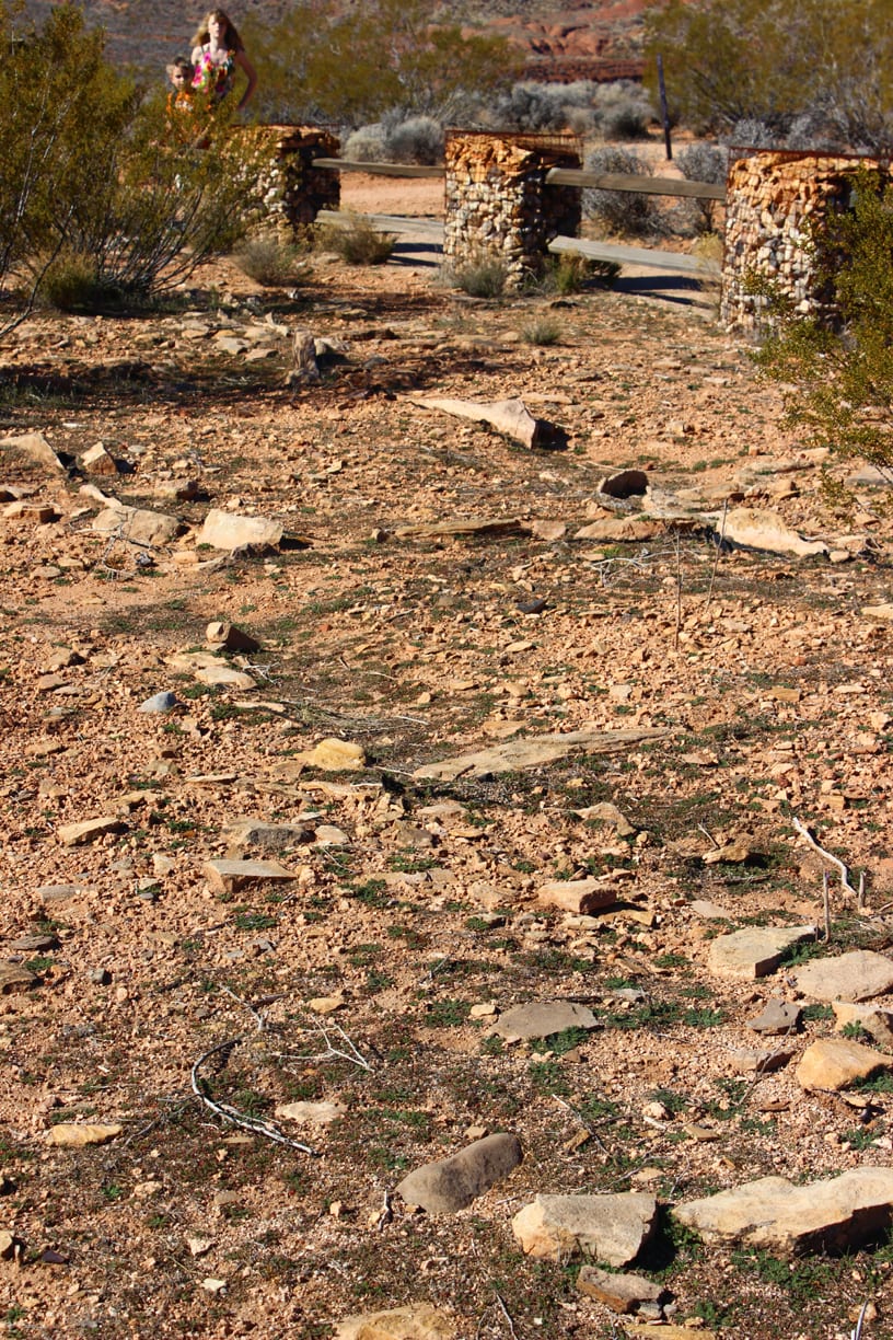
The trail initially heads north but then jogs back towards the south for the majority of its length, ascending Land Hill at a gradual grade. From the outset, the views of Red Mountain are spectacular. The path follows wide switchbacks as it ascends (and please, do not follow any shortcuts, as these cause erosion). After a little over a mile of hiking, the trail reaches the edge of the mesa and the site of an ancient Native American farmstead structure. All that remains of these ancient dwellings and storage buildings are the rock outlines, which are surrounded by wooden fences for their protection. An informative sign explains their origins and purpose.
The official trail diverts away from the ridgeline to switchback up the hillside, but most hikers seem to follow a direct route that sticks to the ridge. Ideally, all hikers would follow the “official” trail, but the direct route is so well-established that few seem to follow the switchbacks.
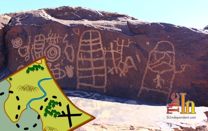
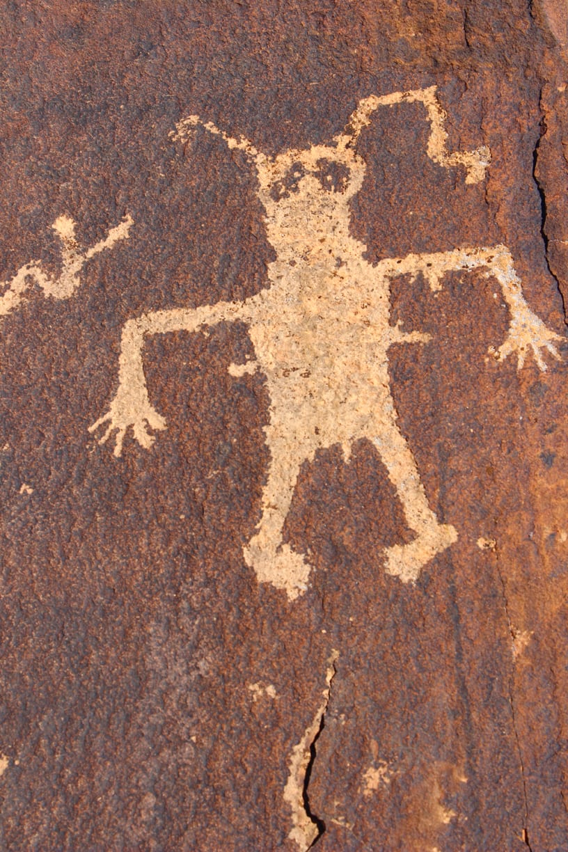
 From the farmstead site, the trail continues on for approximately another 0.75 miles to the petroglyph site. A small marker points towards the rock art. The first panel is at the edge of the ridge, but there are dozens more below the rim. To find them, hikers must scramble down into the rocks and poke around, but it is well worth the effort. The sheer volume of petroglyphs here is astounding, with everything from bighorn sheep to humanoid figures, six- and seven-toed feet, spirals, and more. In addition to the carvings, younger hikers will enjoy crawling through clefts, tunnels, and cracks that line the rocks on the mesa edge, but care must be taken to avoid injury. The petroglyph site is also an excellent spot for lunch.
Despite the fact that they’ve been carved into the rock, please do not touch these ancient inscriptions, which are hundreds or possibly even thousands of years old. They were carved by the Ancient Puebloan people (also referred to as the Anasazi) who lived in the Southwest approximately 1,000 years ago.
When finished exploring, return on the same trail back to the parking area.

Articles related to “Hiking Southern Utah: Tempi’po’op Trail”
Hiking Southern Utah: Spectra Point Trail in Cedar Breaks National Monument


 is a delightful trek near St. George to one of the richest areas of petroglyphs in the region.)