
Lava Flow Trail, Snow Canyon State Park
– By Tom Garrison –
Location: Snow Canyon State Park, St. George, Utah. The entrance fee is $10 per vehicle (up to eight people) or $5 per vehicle (up to eight people) for seniors 65 and older who are Utah residents with a Utah driver’s license. No permit is necessary. Managed by Snow Canyon State Park.
Difficulty: Easy. The hike isn’t difficult, but you must literally watch your step because almost all of the trail is strewn with lava rocks. Going into the lava tubes requires serious rock scrambling.
Average Hiking Time: About 1 ½ hours at a leisurely pace with much exploring at West Canyon Overlook.
Elevation: The trailhead is approximately 3,785 feet elevation with a 100 feet elevation change from the highest to lowest point.
Family Friendly: Watch your step and be aware of the considerable drops into the lava tubes, and everyone should be okay.
Getting There: From St. George, go north on State Highway 18 (Bluff Street) and turn left (west) onto Snow Canyon Parkway. Continue approximately 3.6 miles and turn right (north) at Snow Canyon Drive. The Snow Canyon State Park south entrance is .8 miles ahead. Pay the fee and continue north on Snow Canyon Drive 2.9 miles past the entrance station and park in the signed Lava Flow Trail trailhead/parking area on the left (west). There are no toilets or water at the trailhead.
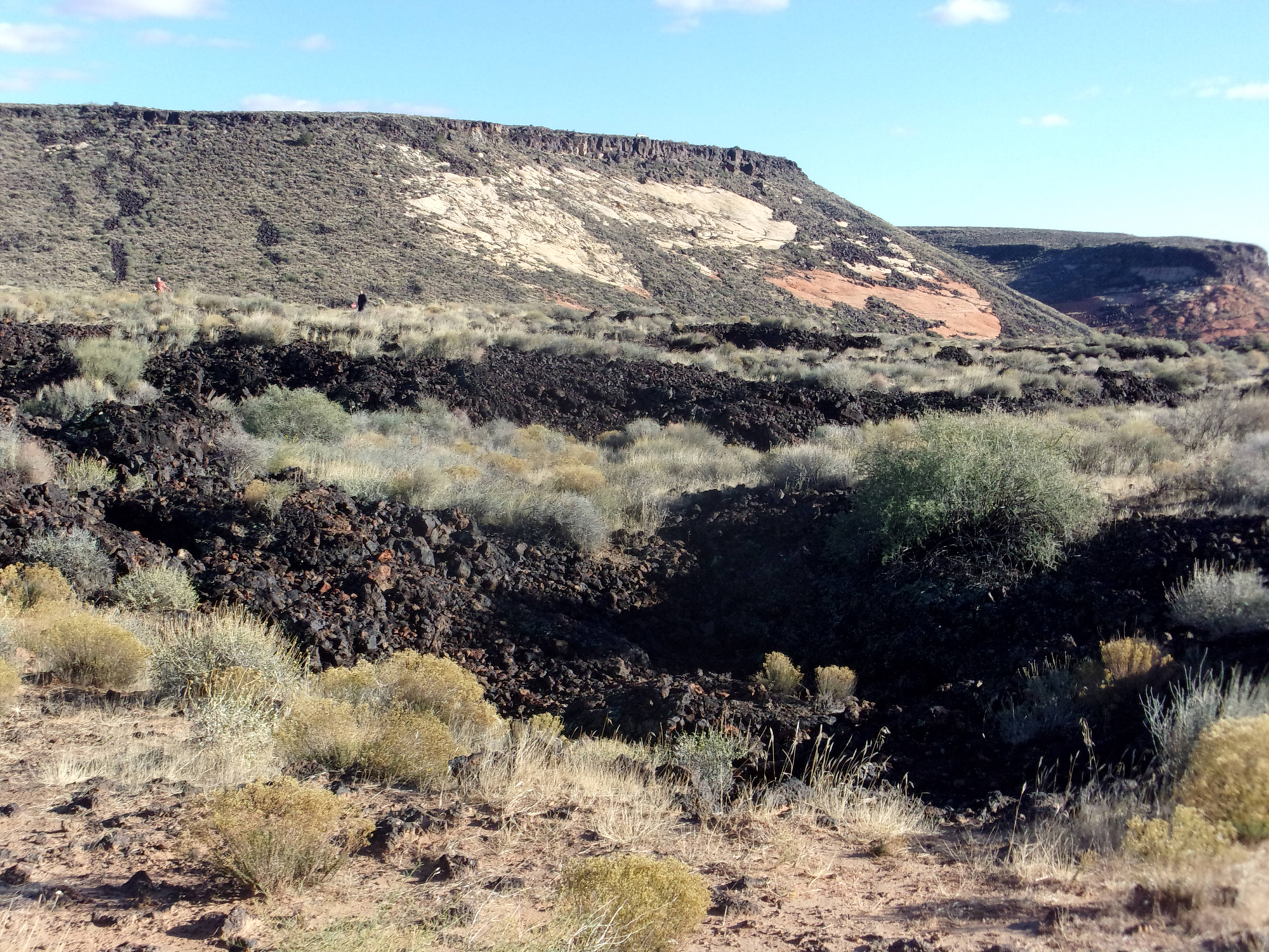
Along with red sandstone, ancient volcanoes, and lava flows (the dark volcanic stone known as basalt when it cools) are a major factor in the southwest Utah landscape. While my wife, Deb, and I are not vulcanologists, we have explored several dormant volcanoes and stumbled across many basalt fields. This adventure takes us to the heart of volcano-land—Lava Flow Trail in Snow Canyon State Park.
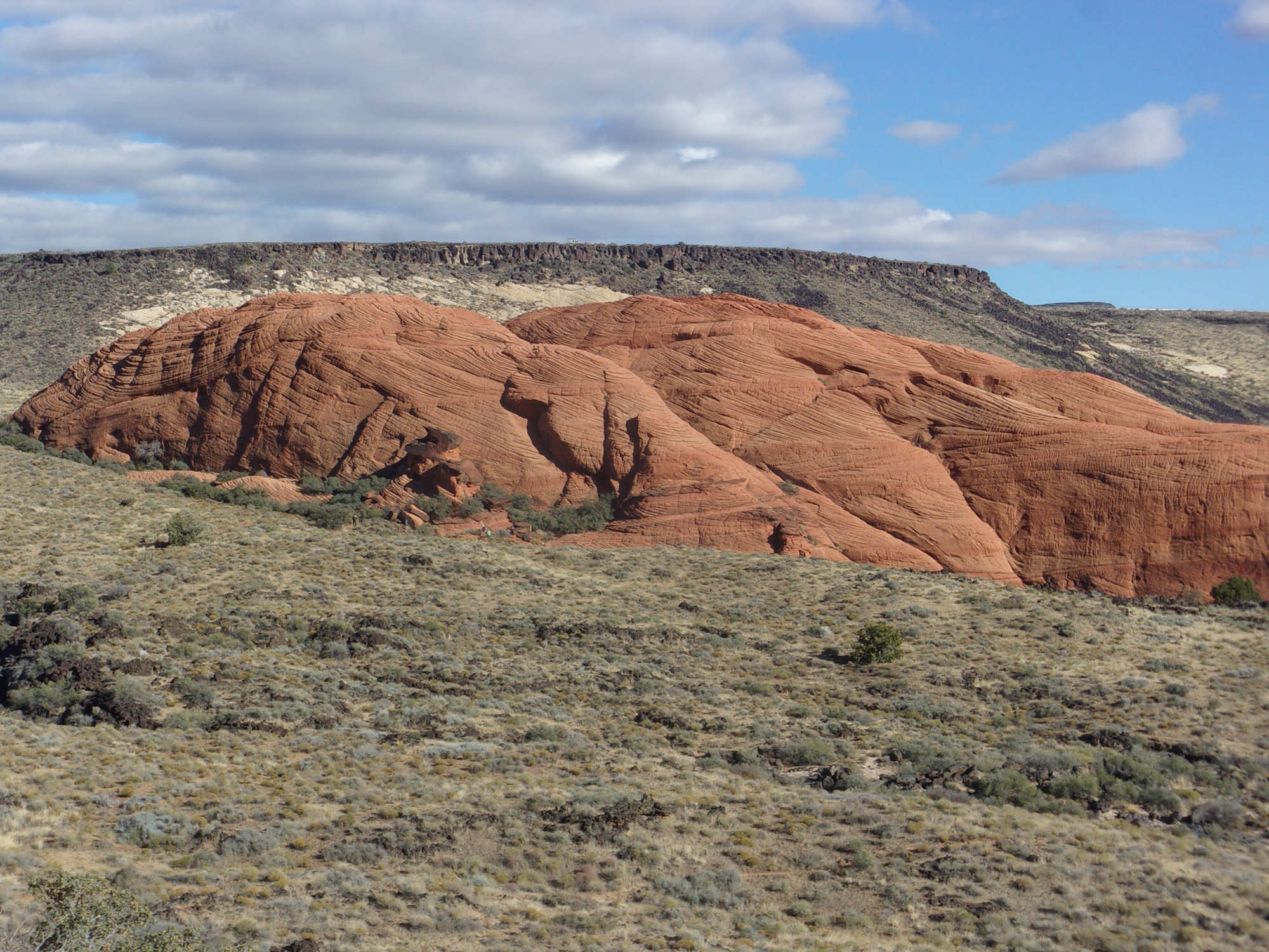
If the remainder of the St. George area was a vast wasteland, Snow Canyon would still be a good enough reason to live here for outdoor enthusiasts. The 7,400-acre park was created in 1959 and has views that rival the much better-known Zion National Park. There is evidence that the Ancestral Puebloans/Anasazi used the canyon for hunting and gathering and were followed about 1200 AD by the Paiutes. In the 1850s, Mormon pioneers discovered the area.
Snow Canyon State Park is home to a diversity of plant and wildlife species. However, since it was nearly winter and chilly, we did not see any animals.
We arrived at the trailhead at about 1:30 PM on a late November afternoon. The sky was blue with scattered clouds, and the temperature was in the low 50s. The trailhead elevation is 3,785 feet, with a 100 feet elevation change from the highest to the lowest point.
It was a Saturday (mistake), the Saturday after Thanksgiving (big mistake)—dozens of people on the trail. We have hiked the Southwest for more than 35 years, and except for Zion National Park on a weekend, we never saw this many people on the trail. On the other hand, it is good to see so many folks enjoying nature and everyone with whom we interacted was friendly.
This out-and-back hike is a 2.5-mile round trip to the end of Lava Flow Trail, where it intersects West Canyon Road. We only went as far as West Canyon Overlook, about two miles round trip.
Be advised that almost all of Lava Flow Trail is embedded with lava rocks (imagine that)—watch your step to avoid nasty falls.
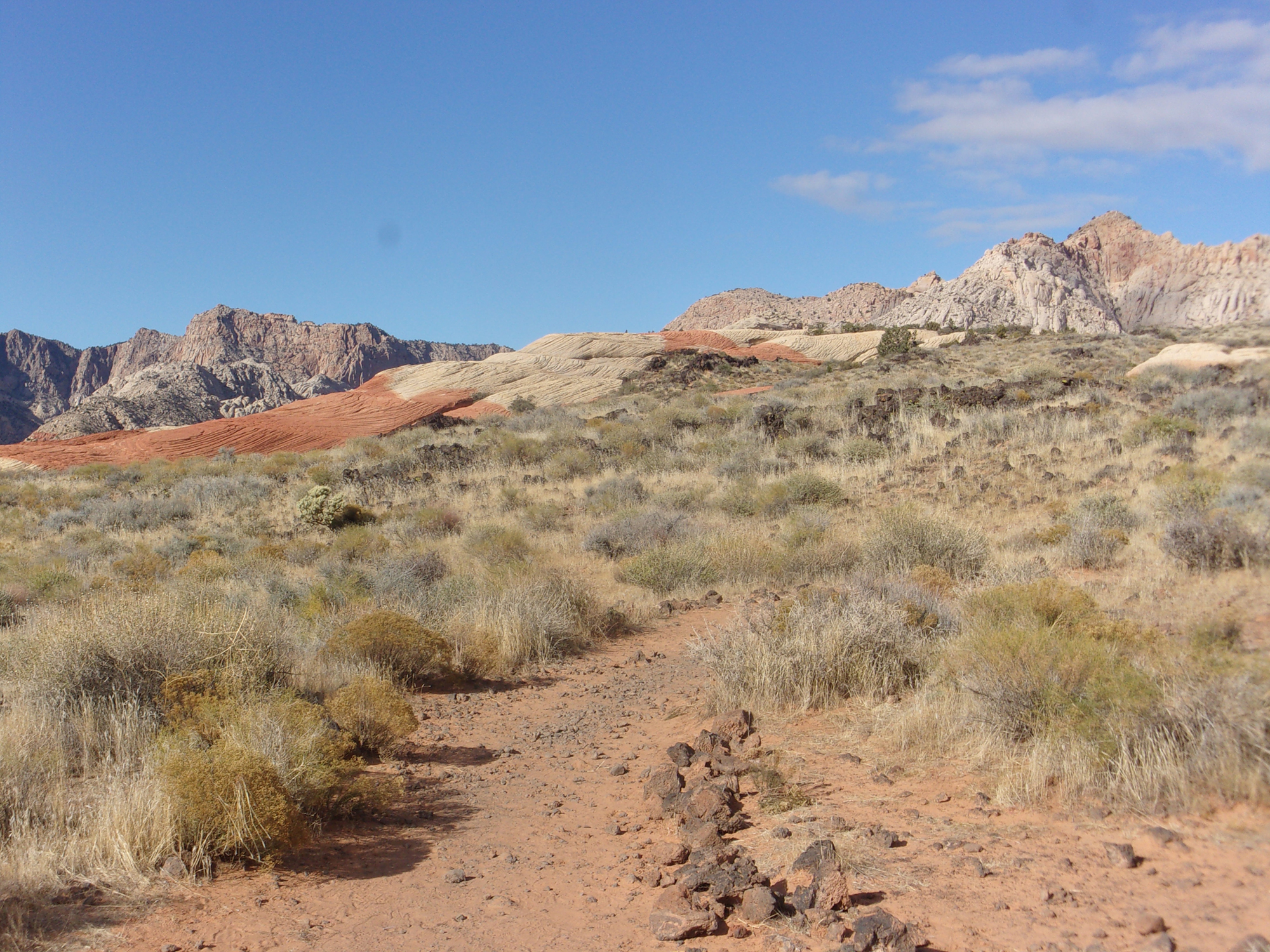
We began heading west on the well-maintained trail. Soon, the trail climbed slightly to reach a high point along an expansive lava flow. Now we went southwest, and about ½ mile from the trailhead, the Whiterocks Trail enters from the right. As we walked along, most of Snow Canyon was open to our view, very nice.
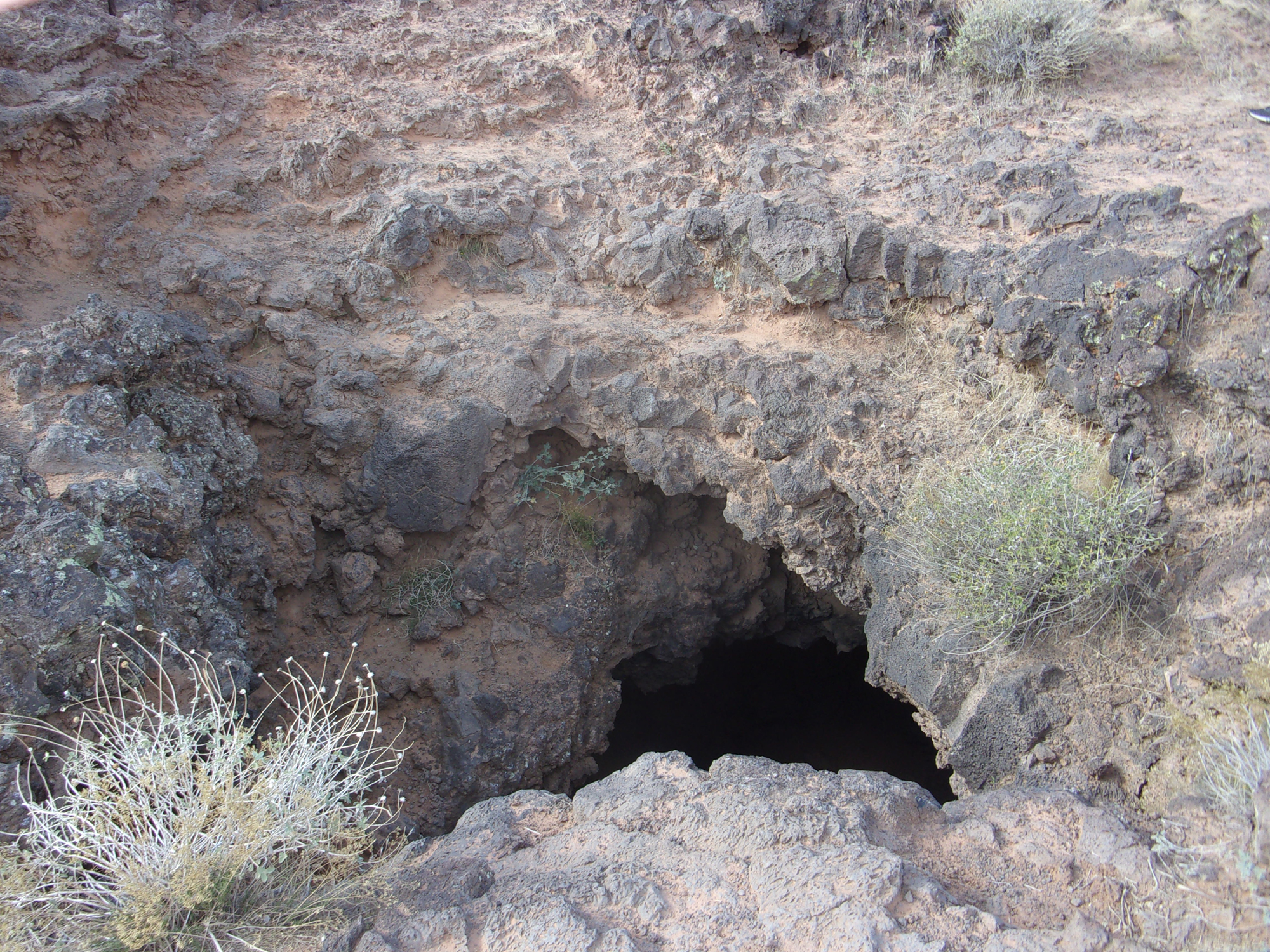
We continued along the sloping lava field and soon came to an education sign marking the location of two lava tubes near the trail—big black holes in the ground. We examined the lava tubes/caves from ground level. We’ll leave the actual tube exploring to the younger folks (we are both in our 70s).
Beyond the first two lava tubes, the trail gently heads downhill with the third lava tube on the left. The collapsed tube was a black lava rock depression.
A little further is an intersection with Butterfly Trail entering from the left, approximately .8 mile from the trailhead. Continuing south, a couple of hundred feet past the Butterfly Trail intersection, we came to another junction with a sign indicating the West Canyon Overlook ahead.
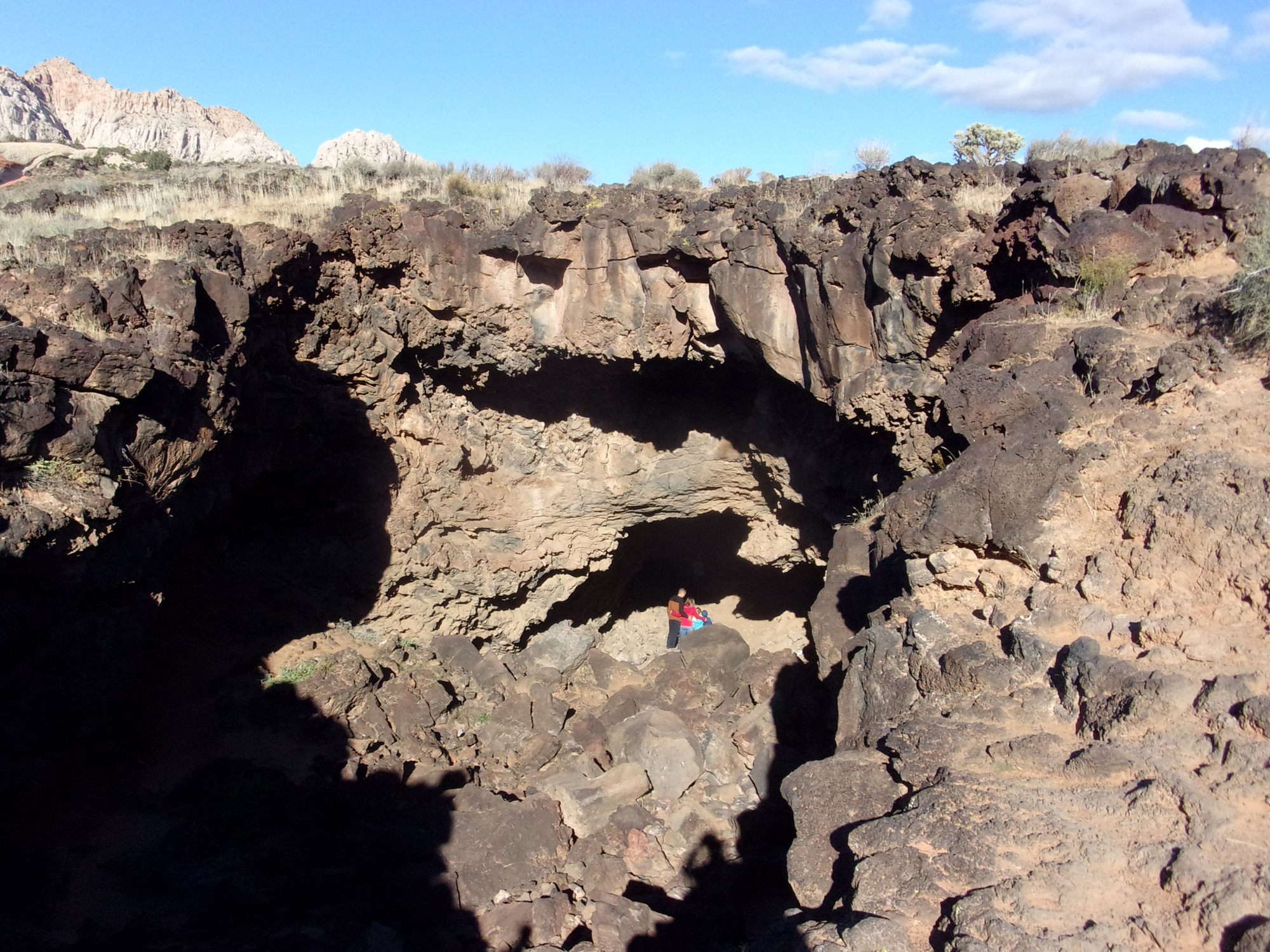
Before venturing to the overlook, we turned right (west), staying on Lava Flow Trail, and about 100 feet further, we came to an interpretive sign next to an open lava tube. The opening to this tube is impressive, about 75 feet long and 45 feet wide. I’m glad we were not in the area when the lava was fresh.
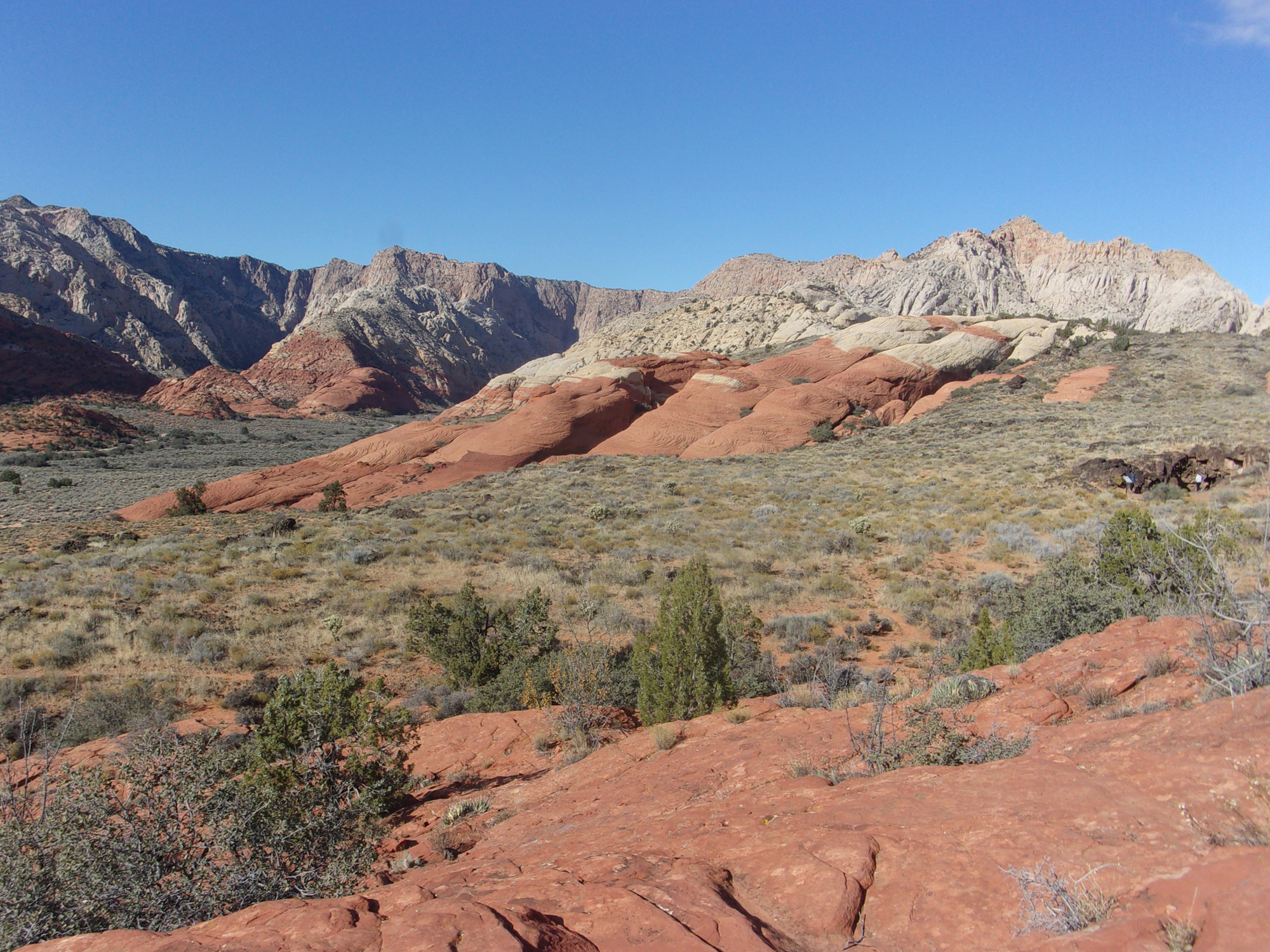
You can, although we did not, keep going downslope past this lava tube to where Lava Flow Trail intersects West Canyon Road. This part of the trail looked rather uninspiring, and instead, we headed back to explore West Canyon Overlook, a large pyramid-shaped sandstone knoll.
We soon came to the base of the huge dome and walked around the northern part to get a view of the canyon—good, but it looked as if the southern part was better. We then traversed the southern part of the dome, much of it on slickrock, and reached a prominent viewpoint on the south side. The hike was worth the vista of towering multi-hued sandstone cliffs. The overlook is aptly named, the views of the main canyon sandstone ridges and cliffs were beautiful.
Retracing our steps, we returned to the trailhead, enjoying slightly different views of this colorful post-Thanksgiving hike.
I recommend this hike. I rate this hike as easy even though almost all of the trail is strewn with lava rocks. Remember to bring a flashlight if you plan to explore inside the lava tubes. Take your time; it is a short two-mile hike with amazing views of sandstone and lava rock formations.


 are major factors)