

Our Geological Wonderland: A 270 million year record
Arriving in Washington County from any direction on the compass reveals some impressive geological features. Most obvious is Pine Valley Mountain, which reaches over 10,000 feet in elevation. Also, there are the three distinctive and unusual flat-topped ridges, which represent basalt lava flows and extend from north to south through part of St. George. The pervasive red coloration of many rock formations in the area is also readily apparent. In the distance to the southwest towards Arizona loom the Beaver Dam and Virgin Mountains, to the northeast are the western cliffs of Zion National Park, and to the south lies the Arizona Strip. Overall, this is a very visually stimulating region (Figure 1).

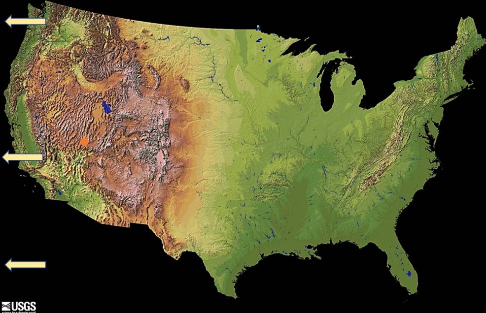
This plethora of geologic features occuring in a relatively small geographic area is the result of a number of geologic and geographic conditions. Perhaps the most important of these conditions is the fact that the area is located within the western portion of the North American Continent. This side of the continent has been significantly affected by the westward movement of the continent and resulting overriding of the rocks of the Pacific Ocean floor. This is a process termed subduction, and it is a result of Plate Tectonic activity over the past 180 million years of Earth’s history (Figure 2).
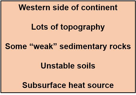
This movement has resulted in uplift of the entire region, creating high topographic relief, and it has generated a heat source below the surface. Subsequently, differential weathering and erosion of the various exposed rock formations has occurred in the area (Table 1). Combine this with an arid to semi-arid climate for most of the region, and geologic features that have been formed are generally very well exposed at the surface.
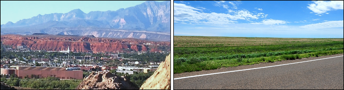
A comparison of the surface topography and geology of the St. George area with that of an area in the Great Plains provides a very sharp contrast (Figure 3). The Great Plains area has for at least the past 600 million years been at the center of the North American Continent and so has been relatively unaffected by plate tectonic movements.
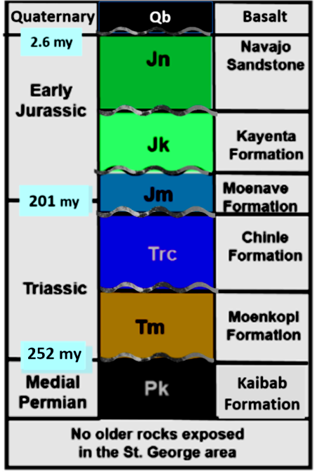
Distribution of rock units, called formations, within St. George can be illustrated by two types of geological illustrations. One is a geologic map and the other is a stratigraphic column (Figures 4 and 5).
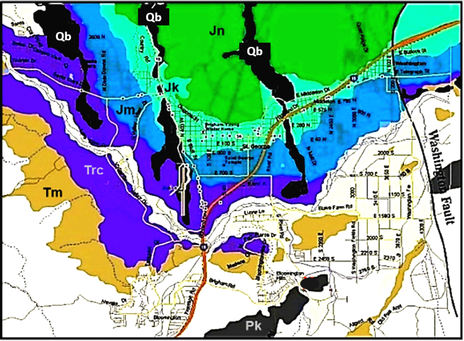
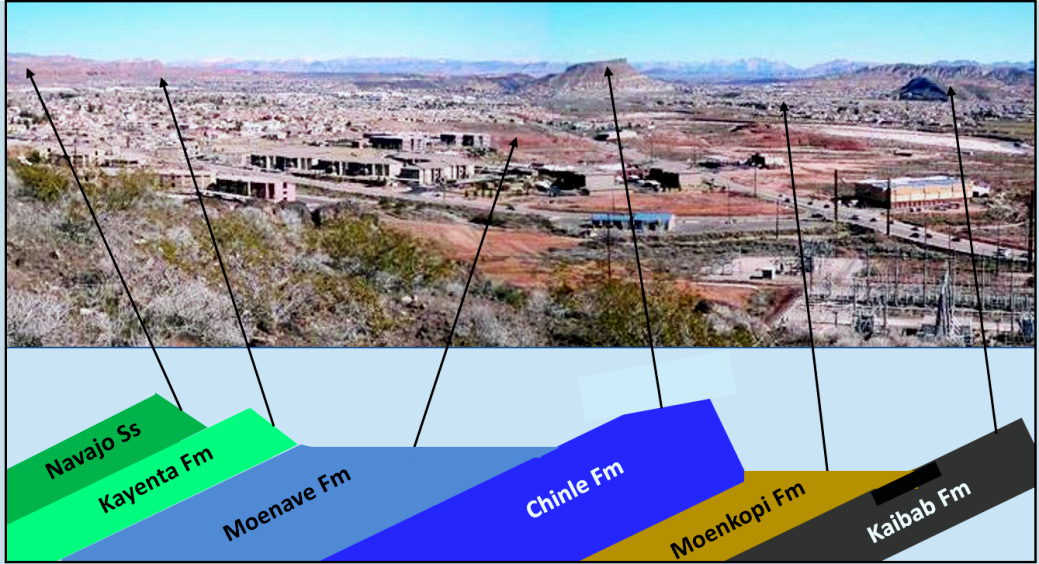
The east side of Middleton Black Ridge provides a view of the distribution at the ground surface for these rock formations (Figure 6). These formations are all tilted downward to the north and represent the northern limb of the Virgin Anticline, which is nicely exposed at Quail Lake Reservoir. Development of homes and other structures generally occur up on the less resistant units, which have been eroded to form relatively flat areas. Since this image was taken, Mall Drive has been extended into Washington Fields, and a number of new businesses and developments have been built in right center of the picture.
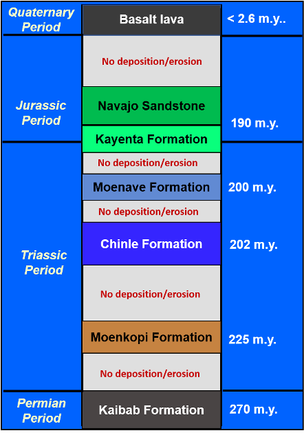
In summary, the exposed rock record in St. George represents only a partial record of events that have occurred over the past 270 million years of geologic time. Although rocks here do represent portions of that time interval, a greater percentage of that time has not left a rock record in this area (Figure 7). This absence can be due to no sediments being deposited or if deposited subsequently eroded away and therefore not preserved as part of the record.
Other surrounding areas in Nevada, northern Arizona, and even northern and eastern Utah contain rocks representing those time intervals that have no rock record in St. George. Combining the records from these and other areas allows geologists to make reconstructions of what kind of environmental and depositional conditions existed in the region for any given geologic time interval. Sort of like a Rand/McNally geographic map for millions of years ago.
Articles related to “Our Geological Wonderland: A 270 million year record”
Our Geological Wonderland: An ancient seaway, right here in St. George
Our Geological Wonderland: The Virgin River flows through here
Our Geological Wonderland: Geologic hazards in St. George and southern Utah


