
Quail Creek Reservoir Overlook Trail From The South Shore, Quail Creek State Park
– By Tom Garrison –
Location: In and just south of Quail Creek State Park near Hurricane, Utah.
Difficulty: Easy with several up and down sections.
Average Hiking Time: A little over two hours at a leisurely pace with many stops, including about 20 minutes looking for petroglyphs (a futile attempt on our part).
Elevations: 2,775 feet trailhead elevation with an approximately 250 feet elevation change from the trailhead to the highest point. There are several not-too-steep up and down sections.
Family Friendly: Yes, although the several up and down sections may be a bit much for young children.
Getting There: Heading north on Interstate 15 take Exit 16 onto State Route 9 toward Hurricane. Stay on State Route 9 for 2.5 miles and then turn left (north) onto State Route 318/5300 West. After .3 mile on State Route 318 turn right (south) onto an unsigned dirt road 4275 West. At the turn is a large “Zion Base Camp” sign on a chain link fence. For most of the .7 mile to the trailhead, 4275 West follows the chain link fence (on your left as you drive to the trailhead) surrounding the Quail Creek Water Treatment Plant. All along the fence are many “No Trespassing” signs. After about .2 mile on 4275 West the road makes a 90 degree left turn and continues following the fence. This section goes approximately .3 mile and then makes a 90 degree right turn. After almost .2 mile on this fenceless section of the road, to your left you’ll see a large parking area and wooden stairs embedded in the dirt on the first part of a steep slope. This is the trailhead. Park and climb the slope to reach the beginning of the trail with a large trailhead sign.
I’ve lived in the St. George area for 15 years and never did more than a quick drive by at Quail Creek State Park. My loss. Deb, my wife, occasionally goes kayaking with friends at Quail Creek Reservoir. We decided to explore the southern section of the reservoir by hiking Quail Creek Overlook Trail on the south shore of the park. A good decision for the hike featured great views of surrounding mountains and hills, colorful rugged terrain, massive dams, and a tranquil artificial lake.
Quail Creek Reservoir was completed in 1985 to provide irrigation and culinary water to the St. George area and opened to the public as a state park in 1986. The reservoir’s surface area covers about 600 acres. Most of the water in the reservoir does not come from Quail Creek but is diverted from the Virgin River and transported through a buried pipeline.
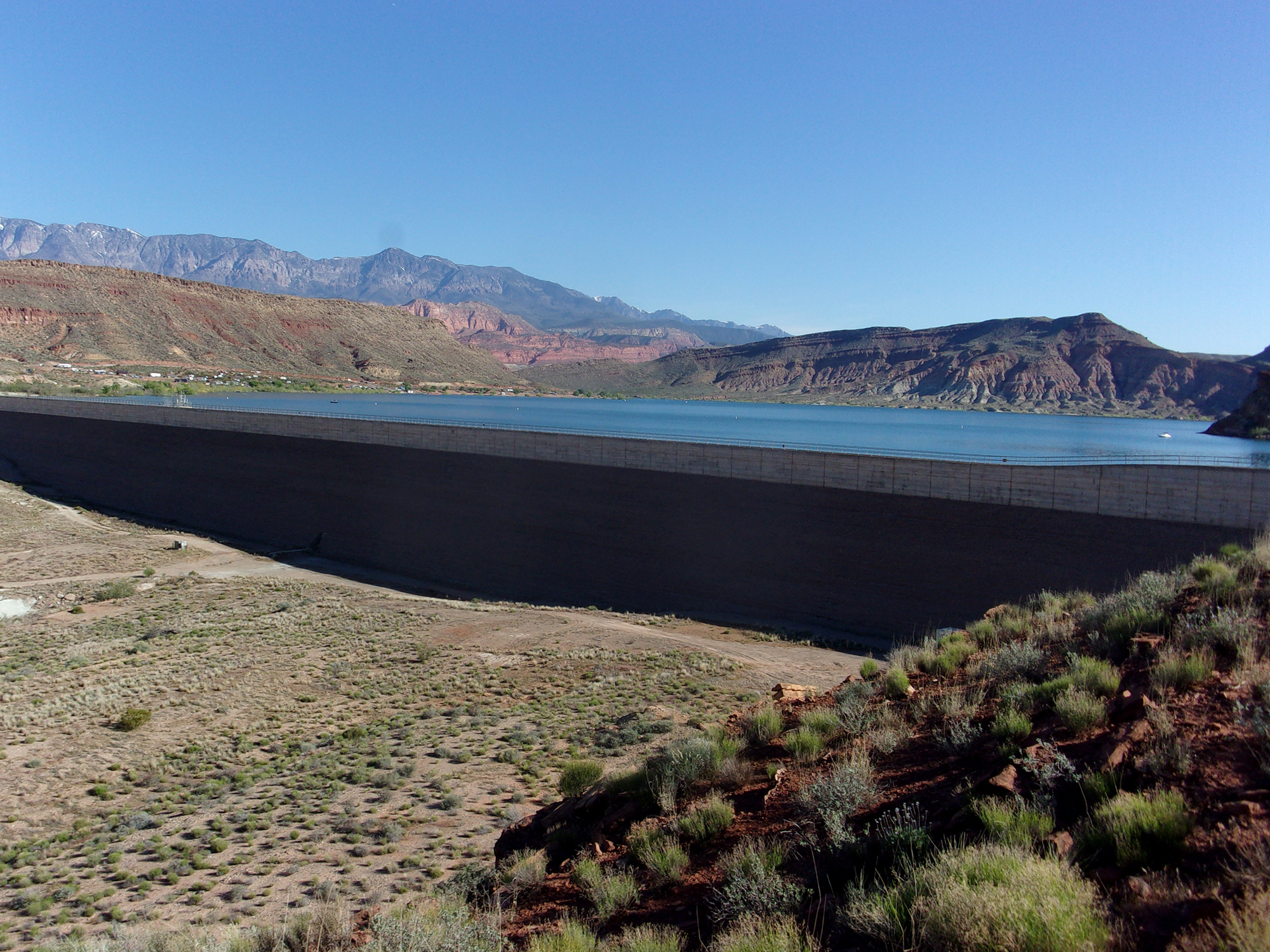
Two dams form the reservoir. The main dam is an earth-fill embankment dam. The south dam is a roller-compacted concrete dam constructed to replace the original earth-fill dam that failed in the early hours of New Year’s Day 1989.
Quail Creek’s maximum depth can reach 120 feet, so it is cold enough to sustain the stocked rainbow trout, bullhead catfish, and crappie. Largemouth bass and bluegill thrive in the reservoir’s warmer upper layers.
Remember, Quail Creek State Park is a sensitive area, so stay on the trails and minimize your impact—walk as if you are kissing the earth with your feet.
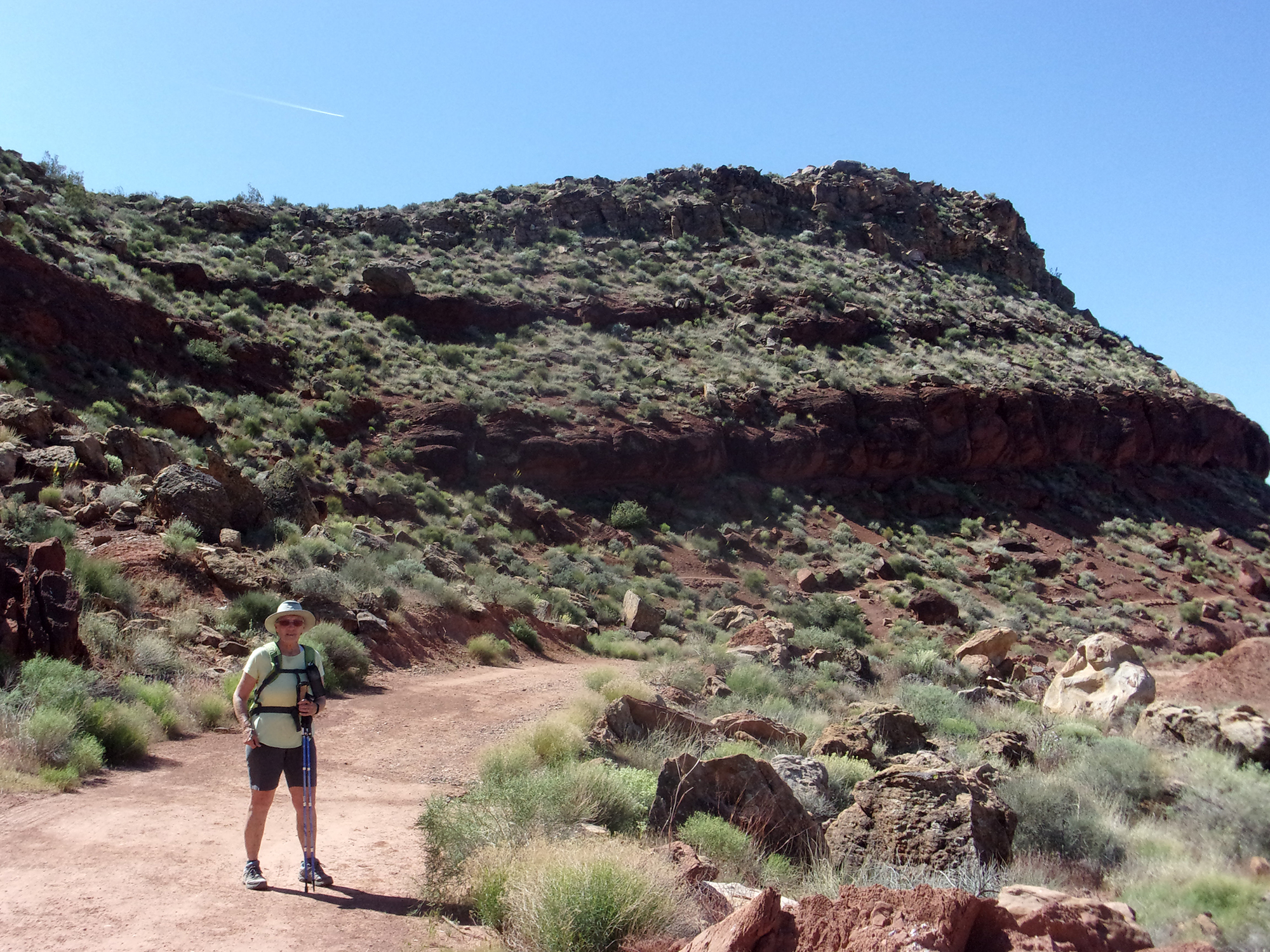
My wife Deb and I began our adventure on a Thursday morning in mid-April. At about 9 a.m., the temperature was in the mid-60s, and we began our hike under an awesome blue Utah sky.
The trailhead elevation is 2,775 feet, with an approximately 250-foot elevation change from the highest to the lowest part of the trail. At about 9 a.m., the temperature was in the mid-60s as we began our hike under an awesome blue Utah sky.
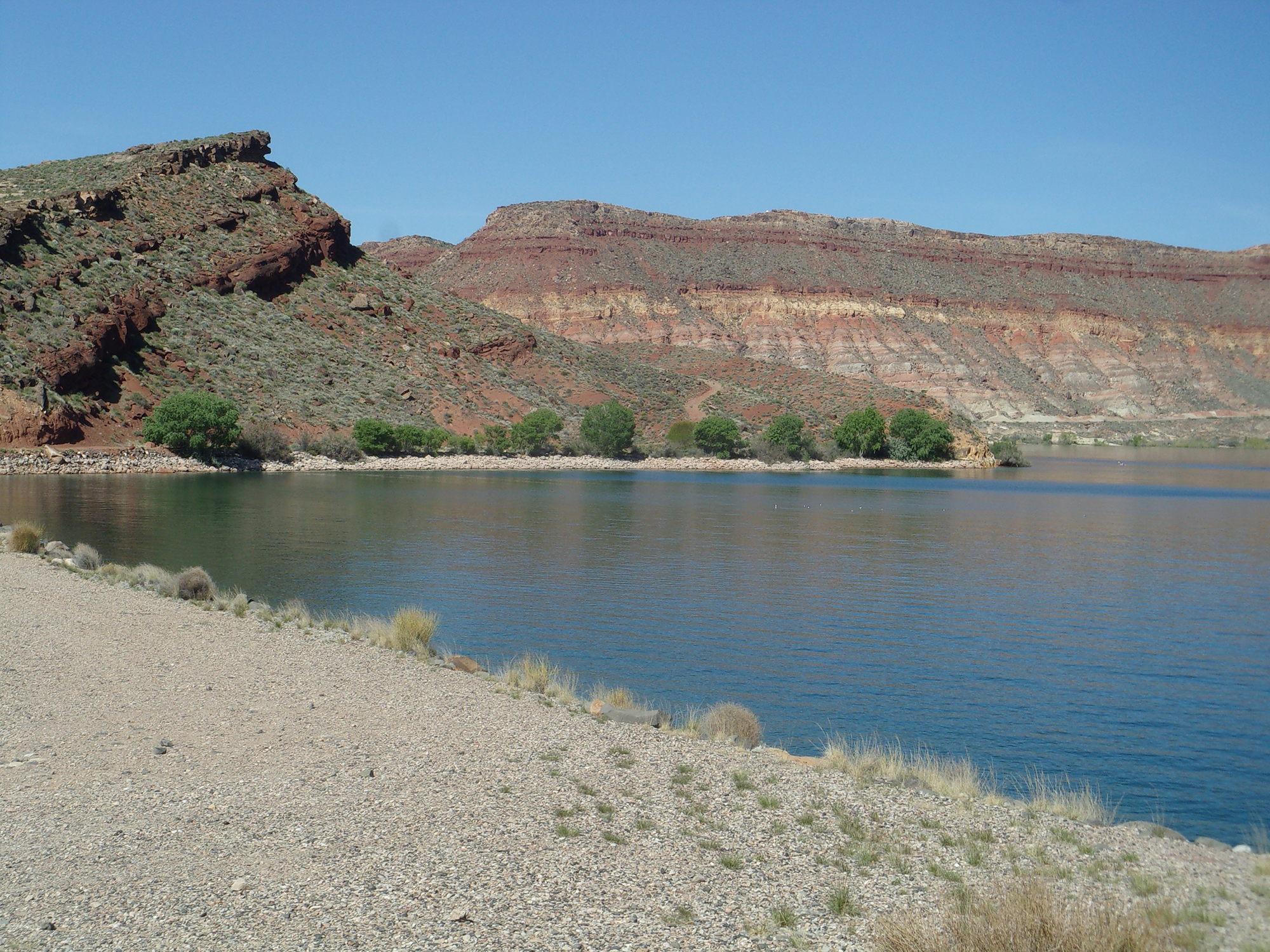
The trail started out heading northeast, mostly uphill, along the side of a reddish-colored ridge. Within .4 mile we reached the southeastern edge of the southernmost concrete dam. Damn, that thing is large.
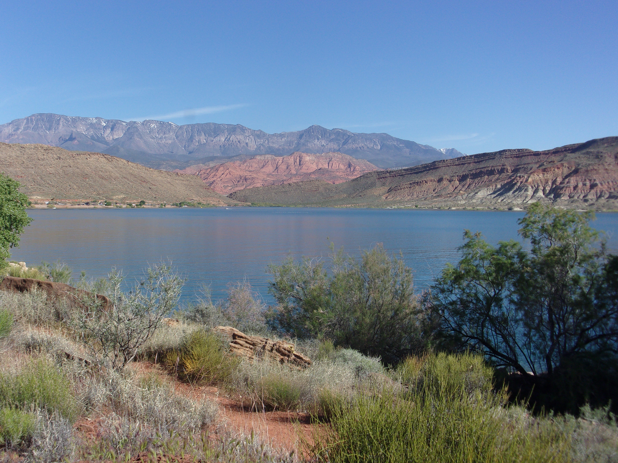
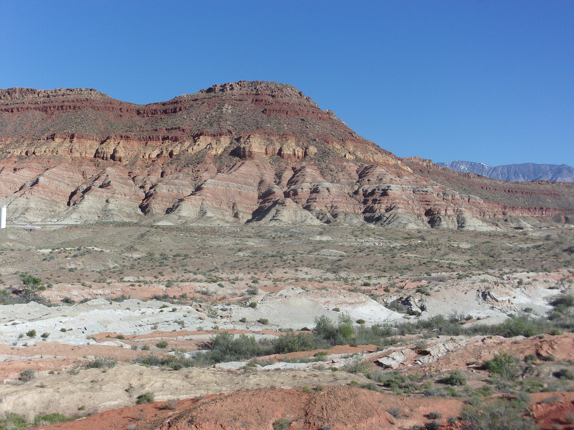
Soon, we were walking along the reservoir’s southern shore, admiring the red-hued mountains surrounding it and the Pine Valley Mountains in the distance to the north. It is a bit odd to walk along the shore of a massive, deep blue man-made lake in the middle of the desert.
At about .9 mile from the trailhead, we stopped to admire the views at the Quail Creek Overlook. Pretty nice.
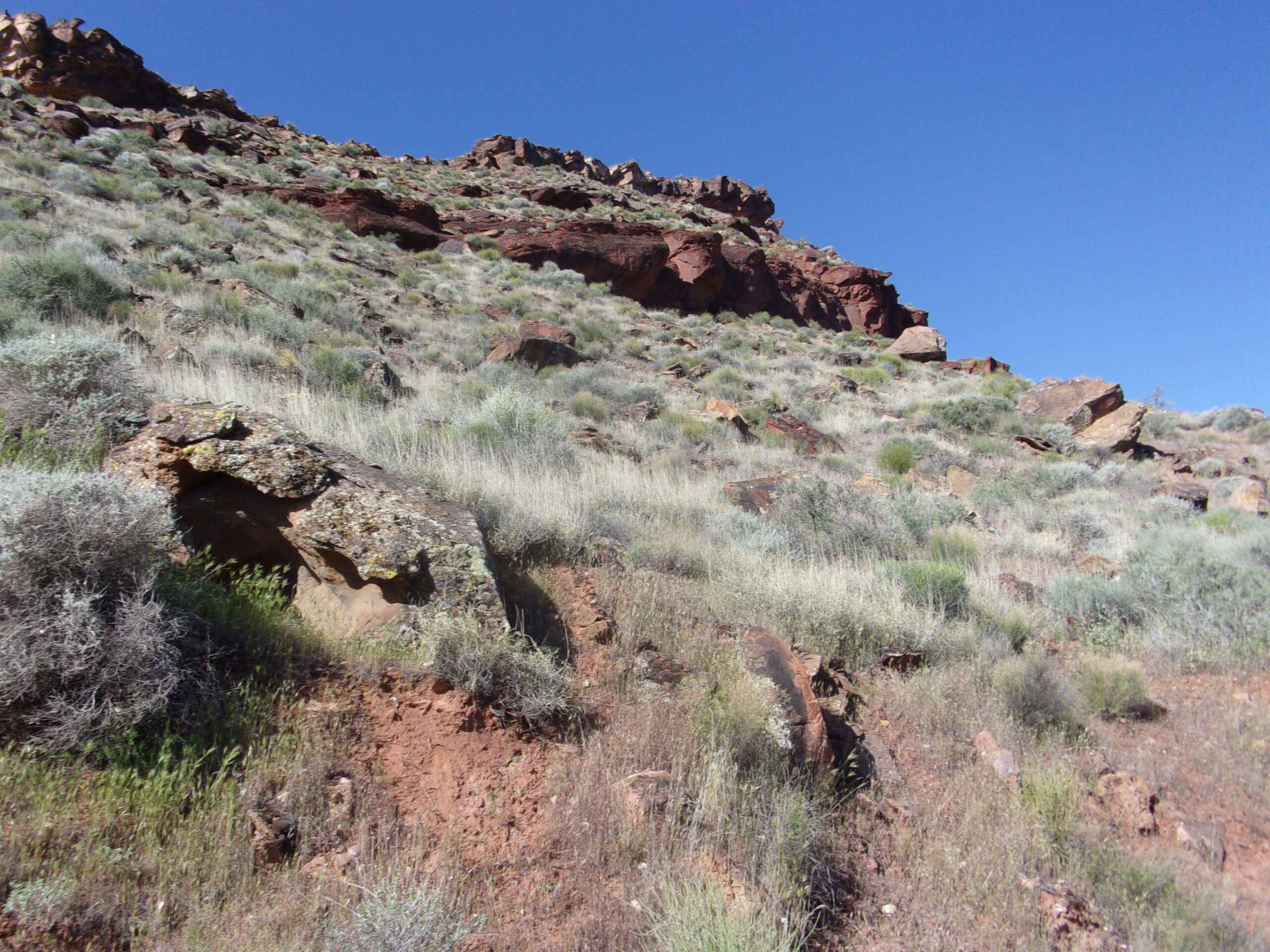
We soon reached the second dam, an earth-filled monstrosity, after .3 mile from the overlook (about 1.2 miles from the trailhead). We walked across the dam and at its eastern end made a sharp right (south) turn and headed down a steep slope southwest down the backside of the dam. Then made another sharp turn to the left and headed downhill toward the east on another steep slope. This took us to the base of a long ridge covered in rocks—the petroglyph site.
Deb and I have explored dozens of petroglyph sites in our 35+ years of desert hiking. This is the first time we have found zero petroglyphs. We spent 20 minutes examining the side of the ridge facing us and the backside and came up empty-handed. Oh well.
We trudged up the slopes and began the trip back to the trailhead. Along with great views, this hike also brought us several lizards and various species of birds, including a flock of ducks in the reservoir.
This is an easy hike of about 3.8 miles with several up-and-down sections that took us a little more than two hours. We saw a few other hikers, but the trail was not crowded.


