
Clear Creek Trail: A Hike with Many Mini Slots
By Tom Garrison
Trail: Clear Creek Trail
Location: Zion National Park
Difficulty: While the great majority of the three-mile hike is easy, I rate it moderately strenuous because it is not a maintained trail, the descent into and ascent out of the drainage is steep with loose sand and rocks, and the preponderance of the hike is on cobblestones—watch your step.
Average Hiking Time: About two hours at a leisurely pace.
Family Friendly: This hike is not a good idea for small children, good balance, and watching your step is important.
Getting There: From St. George drive to Hurricane via Interstate 15 and State Route 9. In Hurricane stay on State Route 9 and follow the signs to Zion National Park. It is about 45 minutes driving time from St. George to Zion.
Beyond the park entrance station, at Canyon Junction, continue on State Route 9 (aka Zion-Mt. Carmel Highway) as it heads east past the switchbacks, and through the 1.1 mile long Zion-Mt. Camel Tunnel. The Clear Creek Trail’s small parking lot is on the right (south) immediately after the tunnel exit. If the lot is full, there are several small overflow parking areas further east on both sides of the road. If you are coming from the east, travel 5.2 miles past the east entrance station and park on the north side of the road which leaves a short walk to the trailhead.
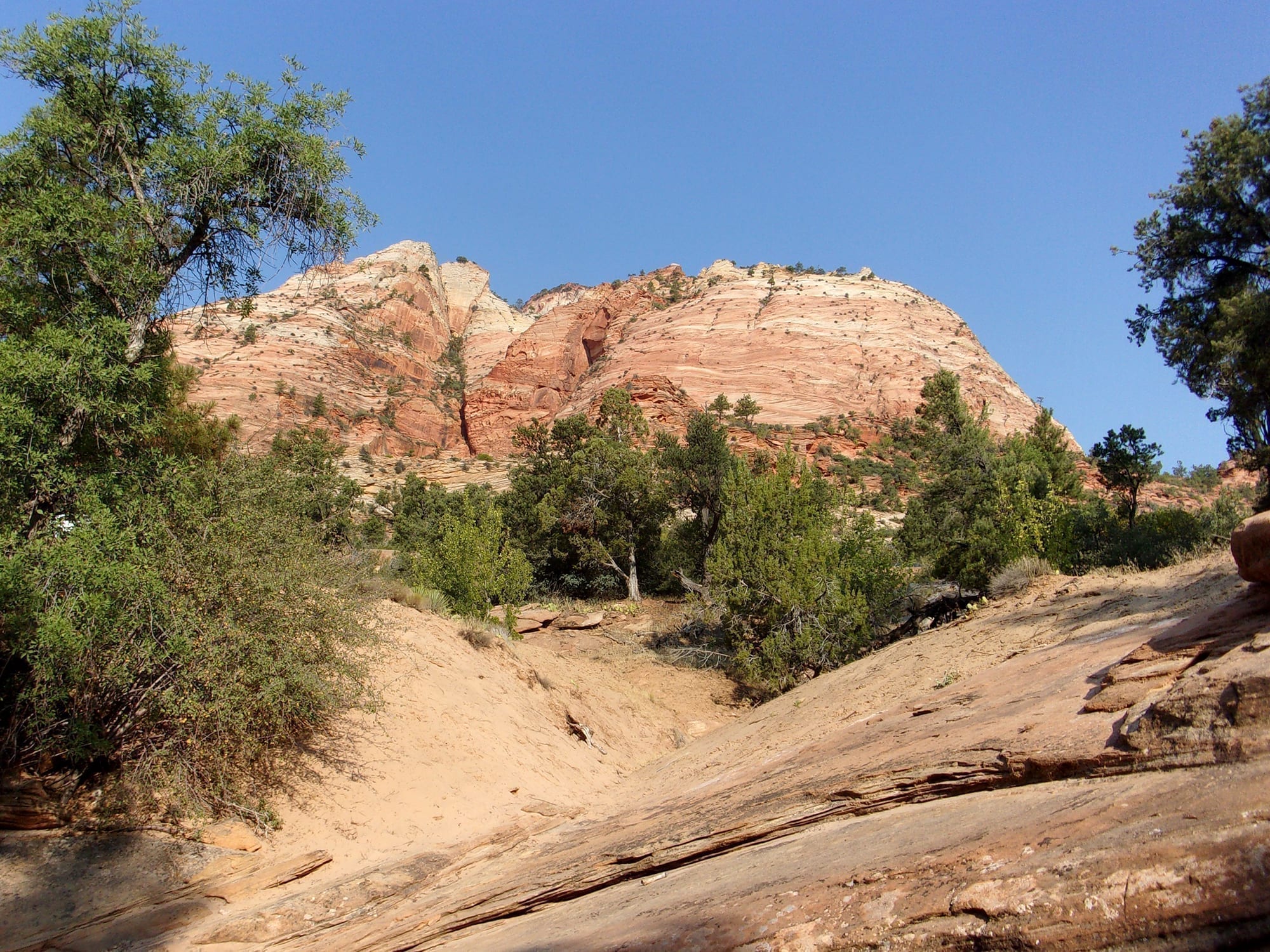
Sometimes following the herd is a good thing. But often getting off the beaten path, especially when hiking, leads to wonderful surprises. Clear Creek Trail is one of those surprises. This hike is not along a formal track and the park does not list it as a maintained trail. But not to worry, except for getting in and out of Clear Creek and all the rocks along the way, it is an easy hike following a long-drainage along State Highway 9 (aka Zion-Mt. Carmel Highway) featuring Navajo sandstone formations, plenty of vegetation, and several short deep narrows.
In 1919 Congress established Zion as Utah’s first national park. Diversity dominates the 229 square mile park. Diversity in habitats with elevations ranging from 3,600 to 8,700 feet and including arid desert, woodland, coniferous forest, and riparian environments. Diversity in life forms with 69 species of mammals, 208 birds, 29 reptiles, six amphibians, and nine fish. And diversity in geology with mountains, buttes, mesas, arches, and, of course, canyons.
Deb, my wife, and I began our adventure in mid-September. Stopping at the south Zion National Park entrance station we breezed through with our senior pass (for ages 62 and above)—pay $80 once and you can enter any national park forever with no additional fee. (The normal entrance fee is $35 per private vehicle.)
The trailhead elevation is 5,070 feet and the three miles round trip hike has an elevation gain of less than 150 feet. The sky was blue as we began our hike about 8:30 am with the temperature in the low 70s.
There is a short brown trail marker sign about 10 feet or so from the restrooms (at the back of the parking area) on the edge of the slope to Clear Creek. The sign has an arrow pointing downslope and read “River Access.” Okay. We started down the not well-maintained short, steep, and rocky user trail.
Once in Clear Creek drainage do not go right (northwest), that is Pine Creek which leads under the Highway 9 to a technical slot canyon requiring a permit and rappelling equipment. Instead, we headed left (east) up Clear Creek wash.
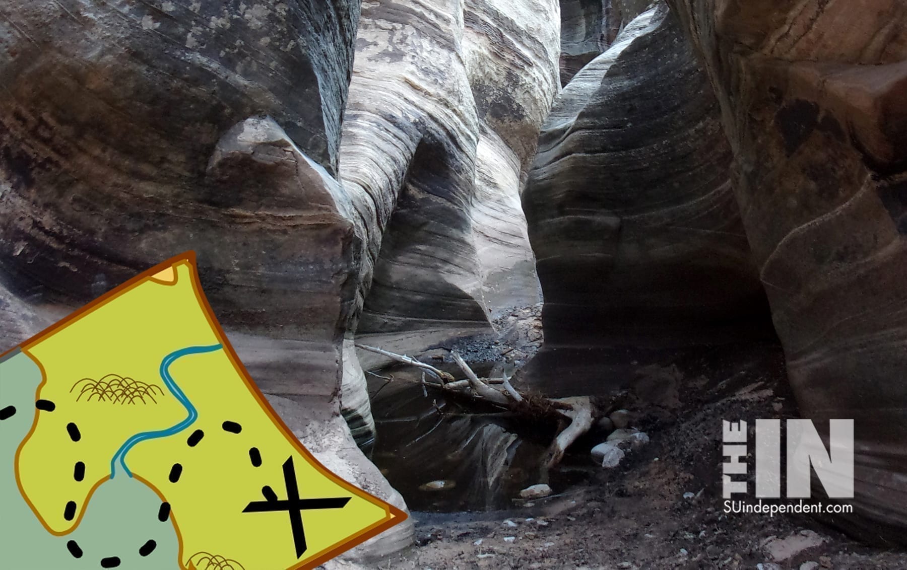
Within 100 yards we came to the first slot section about four feet wide with massive gray walls eroded into wavy patterns. Alas, it was flooded as far as we could see with stinky black water and no dry areas to circumvent the obstacle. Unless we used sticky finger pads to cling to the vertical walls (which we did not have), the path was blocked.
We walked back, scrambled up the slope, and headed east on the road. Within a couple of hundred yards, we found another entry point beyond the water-filled narrows. Once again it was down a rocky steep slope.
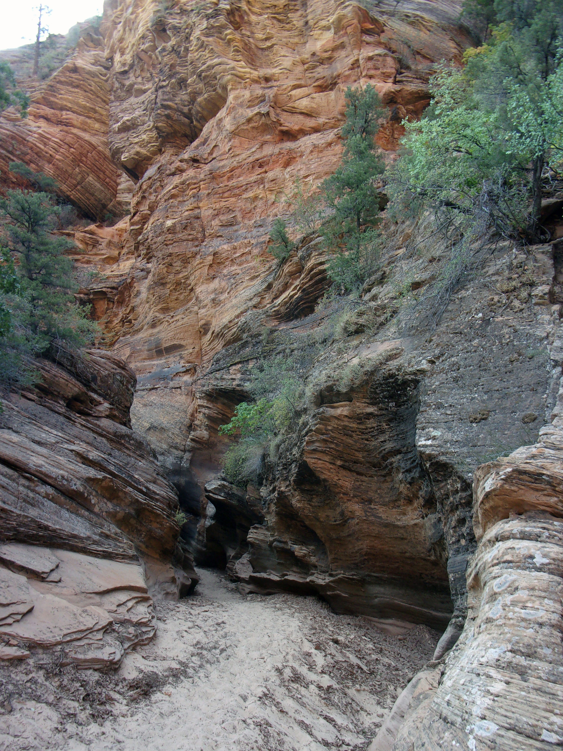
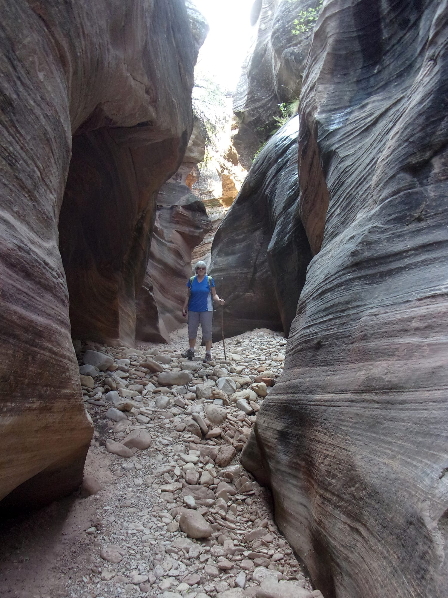
We went east, upstream, in the drainage. The trail varies from about 20 to 50 feet below the highway. Some portions loop away from the road and traffic noise is muted or absent. We hiked along the serpentine drainage admiring the views of huge red rock formations to the north across the road. Like many, the drainage varied from red rock open areas to narrows only a few feet wide. Clear Creek drainage also shares another characteristic typical of many others, most of the hike is walking on a bazillion cobblestones interspaced with short stretches of loose sand.
Including the first impassable narrows, we explored four slots. All the narrows featured swoopy almost undulating walls—creating an otherworldly feeling in the cool confines of massive grey walls.
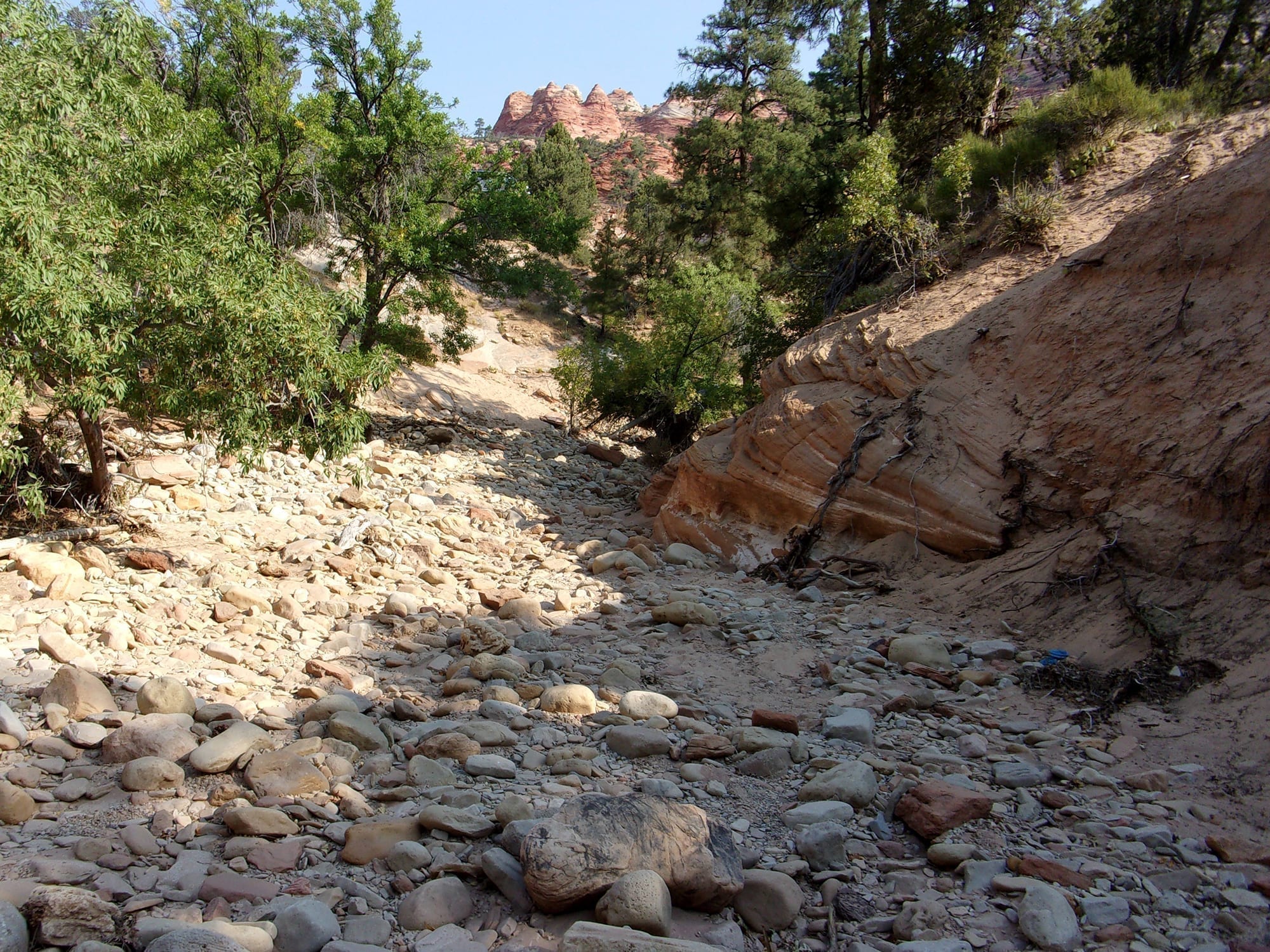
Our turn around point was about 1.5 miles from the trailhead after exploring the fourth narrows. Just prior to the fourth narrows, we passed a red rock drainage tunnel beneath Highway 9. The trail then goes south for a bit and the narrows heads back north toward the road. This narrows is also south of the second tunnel on Highway 9.
Considering the closeness of civilization, the highway above is never more than a few hundred yards away, this is a journey for those seeking solitude. We did not see another person during our two-hour hike.
While the great majority of the three-mile hike is easy, I rate it moderately strenuous because it is not a maintained trail, the descent into and ascent out of the drainage is steep with loose sand and rocks, and the preponderance of the hike is on cobblestones—watch your step.
It is the perfect opportunity for even non-experienced hikers to undergo the joy of exploring canyon narrows. You can hike further or less than did we, the choice is yours. Clear Creek drainage is hikeable from the trailhead all the way to the east entrance of the park.
Viewpoints and perspectives expressed throughout The Independent are those of the individual contributors. They do not necessarily reflect those held by the staff of The Independent or our advertising sponsors. Your comments, rebuttals, and contributions are welcome in accordance with our Terms of Service. Please be respectful and abide by our Community Rules. If you have privacy concerns you can view our Privacy Policy here. Thank you!
Click here to submit an article, guest opinion piece, or a Letter to the Editor


