
 Hiking Southern Utah: Virgin River Rim Trail

By Bo Beck and Tanya Milligan
Day hike: Yes
Distance: 8.25 miles one-way with shuttle setup. If you would like a shorter hike, some of the more interesting landmarks can be seen at about the 3.5-mile mark.
Average hiking time: Six hours
Equipment: The best map to purchase for this hike is “Cedar Mountain/Pine Valley Mountain” from National Geographic Trails Illustrated.
Difficulty: Moderate hiking, but the last section back to your vehicle is steep after hiking all day.
Trail-Head: Cascade Falls Trailhead near Navajo Lake
Trail-End: Strawberry Ridge
Trail access: Dirt roads can be impassable if wet
Elevation at Trail-Head: 9,000 feet
Elevation at Trail-End: 9,000 feet
Off the beaten path: Yes
Best season: Spring, fall, and summer.
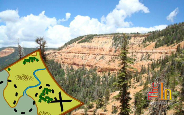
Virgin River Rim Trail is broken down into three shorter hiking trails: Dry Valley to Strawberry Ridge, Cascade Falls Trailhead to Te-ah Trailhead, and Te-ah Trailhead to Webster Flat Road. The section of the Virgin River Rim Trail we cover in this write-up begins at Dry Valley (Cow Lake) and ends at Strawberry Ridge (Strawberry Point), taking hikers to 9,000 feet and a cooler section of southern Utah to enjoy a summer hike among an abundance of evergreen trees, including what is probably the world’s oldest living tree — the bristlecone pine. Surprising acreage along the way contains collections of magnificent hoodoos that pop up quickly and unexpectedly — similar to the occasional mountain biker who can show up suddenly.
This moderately difficult route is one way with a shuttle set up, or it can be done as a lengthy out-and-back without a shuttle. The beaten path follows the rim, showcasing an impressive corner of Dixie National Forest that is found along State Route 14’s Cedar Mountain. Views span beyond the forest to include giant monoliths of Zion National Park. The headwaters of the Virgin River are formed by Cascade Falls (Navajo Lake), a watershed of the southern slopes on this ridge. The trail generally travels in a west-to-east direction ranging as high as 9,300 feet.
Shuttle setup—first car trail end
To station, a car shuttle at the Strawberry Ridge trailhead, travel 7.75 miles west on SR-14 from the US-89 junction, or 14.75 miles east from the junction of SR-14 and SR-148, which is the short road to Cedar Breaks National Monument. Look for Strawberry Point Road on the south side of SR-14, identified by the valley with homes to the south. Turn south on this dusty dirt thoroughfare and drive 8.5 miles until you come to the Virgin River Rim Trail, which is found on Strawberry Ridge. Park one vehicle at the trailend. To avoid hiking the strenuous uphill section at the end, park at the first Virgin Rim Trail sign.
Second shuttle setup
Return to SR-14 and turn left (west), then drive five miles, passing Duck Creek Village, before turning left on a dirt road where you will see the Cedar Mountain ranger station and visitor center. Follow the dirt road 1.75 miles to the west edge of Dry Valley. Then, when reaching a gravel road, turn left and continue another 1.5 miles to the parking area and shared trailhead for Cascade Falls and the Virgin River Rim Trail.
Cascade Falls Trailhead to Strawberry Ridge
The trailhead for the Virgin River Rim Trail, traveling east back to Strawberry Point, is on the south side of the parking lot. Initially, several switchbacks wind up the hillside through a forest of fir and aspen for a half-mile before you will come to the rim. The view from here overlooks multitudes of drainages that make up the watershed for the North Fork of the Virgin River. Both young and ancient bristlecone pines intermittently peak from the forest floor alongside the trail. At 1.6 miles, the path veers from the rim for a short time and once again winds into the forest. The hiking so far has been fairly level except for the gain of the rim in the beginning of the trek. At mile 1.8, the dirt path crosses a service road and signs keep hikers on the main trail.
The Cat’s Den
At 2.75 miles, there are more road crossings, and at 3 miles is Lars Fork. Just another half-mile further brings the trail back to the rim and to an amphitheater of interesting hoodoos. Locals call this amphitheater the “Cat’s Den.” One prominent hoodoo at the bottom looks like a cat sitting on its haunches, and a window is obvious farther down into the alcove. The cat’s den is definitely one of, if not the, highlight of the hike. This is a good place to stop and have a snack and soak in the beauty of the limestone formations and the grand views to the south of Zion National Park.
Strawberry Ridge
The next 3.75 miles on the well-groomed trail meander back and forth through the delightful forest, sporadically touching the rim until it finally dives into and follows a drainage to the development below in Strawberry Creek. Crossing the road and tiptoeing across a marshy area of Strawberry Creek soon finds the trail underfoot again and the uphill mile through the woods. If you stationed a vehicle here, you are done. If you parked at the upper sign, hoof up the hill to get in that last bit of exercise. Crossing the road at the top of the ridge means that the shuttle vehicle and cold drinks await just around the next corner.
Information by Zion search and rescue veteran team member and Desert Rat Outdoor Store manager Bo Beck as well as zionnational-park.com author and owner of the Best Western East Zion Thunderbird Lodge in Mt. Carmel Junction, Tanya Milligan.


 and ends at Strawberry Ridge (Strawberry Point).)