
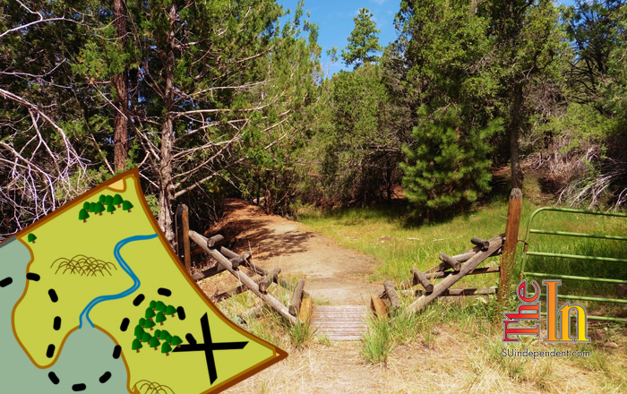

Hiking Southern Utah: Canal Trail in Pine Valley Recreation Area
Trail: Canal Trail
 Location: Pine Valley Recreation Area
Difficulty: Easy to moderate
Length: Varying lengths (4, 7, 8, or 16 miles) depending on desired hike and whether a shuttle vehicle is included in the planning
Average Time: Two hours
Family-friendly: Yes, it is mostly slightly downhill
Access: From St. George, drive north on Utah State Route 18 for approximately 23 miles until you reach Central. Turn right on Forest Route 35 toward Pine Valley. The entire Canal Trail ends at the Pine Valley Cemetery, so this is your first option for dropping off a shuttle vehicle. This would allow for an eight-mile hike from the Canal Trail trailhead to the cemetery. For this option, just before FR-35 curves to the right to take you into Pine Valley, continue straight on Hwy 920 less than a quarter-mile to the cemetery (if you cross Forsyth Creek on FR-35, you just missed Forest Route 920). Then get back on FR-35 into Pine Valley. Take a left on Main Street in Pine Valley, and it’s another three miles to the Pine Valley Recreation Area.
The fee to enter the recreation area is $4 per car, but if you tell them you are just day hiking, they will usually let you in for no charge. If you have more than one vehicle and are looking for a 4-mile hike, you can park your shuttle vehicle at the Gardner Peak trailhead, which is on the left just past the entrance station. Then follow the main road all the way to where it ends at the campground. The Canal Trail trailhead is on the north side of the campground parking lot.
The trail: The Canal Trail has some interesting historical significance. In 1914, a group of Utahns organized The New Castle Reclamation Company to develop a farming area in the New Castle area. They planned to take water from the Pine Valley Canyon streams and build a canal around the mountains to a reservoir they created in Grass Valley, which is over the mountain to the north from Pine Valley. Immigrant workers from fourteen different nations — including China, Japan, Italy and Germany — were employed to work on the project. Sadly, the investors went bankrupt before it could be completed.
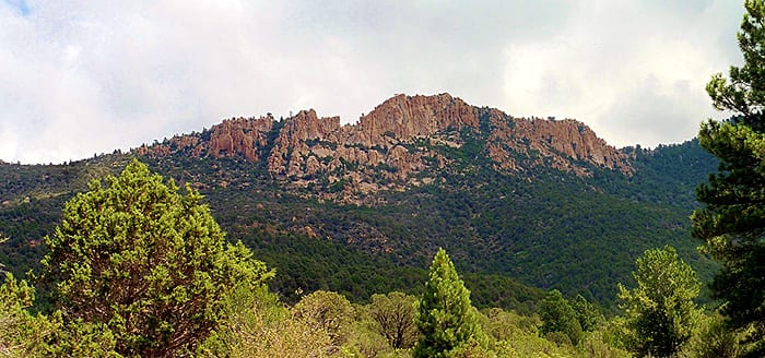
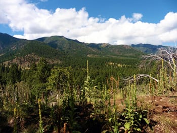
 The Canal Trail runs along and sometimes down in the remnants of this canal. If you start at the end of the road at the campground, the trail is mostly slightly downhill. Due to the elevation of Pine Valley, which is 6,519 feet, the Canal Trail is a great summer hike as it is significantly cooler than the St. George area. From some spots along the trail, you can enjoy the scenic view down onto the town and across the entire valley. Off to your right, you can catch glimpses of Gardner Peak towering above you.
 At approximately 3.7 miles, there is a fork in the trail. If you take the trail to the left, which is part of the Gardner Peak Trail, it will lead you down a little over a quarter-mile to the Gardner Peak trailhead where you can either pick up your shuttle vehicle or cross the road and follow the paved Santa Clara River Walkway back up to your car at the Canal Trail trailhead. This latter route will add approximately three miles to your hike. If you continue on the Canal Trail for approximately four more miles, you would come out at the cemetery, at which point you can either pick up your shuttle vehicle or turn around for the eight-mile return.

Articles related to “Hiking Southern Utah: Canal Trail in Pine Valley Recreation Area”
Hiking Southern Utah: Spectra Point Trail in Cedar Breaks National Monument


