

Hiking Southern Utah: Pioneer Rim Trail
Trail: Pioneer Rim Trail
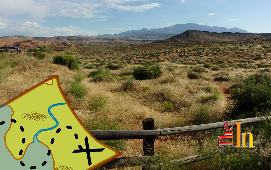
Location: Red Cliffs Desert Reserve
Difficulty: Easy
Distance: Four miles round trip
Average Hiking Time: 2 ¼ hours at an easy pace
Elevation Gain: The elevation change from the lowest point to the highest along the trail is 190 feet. Much of the trail is up and down, with only one extended steep section as you get close to the northern edge of Pioneer Park.
Family-Friendly: Yes, kid and dog friendly. Beware that most of the trail is rocky and/or over uneven layers of slickrock.
Getting there: Pioneer Rim Trail in St. George is easy to find. From Bluff Street/State Highway 18 (heading north), turn east (right) onto Red Hills Parkway, drive southeast for 1.5 miles, and turn left (east) into the signed parking area for Pioneer Hills Trailhead. Pioneer Hills Trail is the connector trail to Pioneer Rim Trail. Or turn left (west) where 1000 E intersects Red Hills Parkway, travel west for 1.8 miles, and turn right (east) into the signed parking area. Or take Exit 10 from Interstate 15 and drive west on Red Hills Parkway 4.1 miles to the signed parking area for Pioneer Hills Trailhead on the right (east).
While the large parking area is signed, the sign is set back from the road and somewhat hard to see from the road. The parking area/trailhead does not have any water or toilets.
Some hikes promise grandeur and live up to that promise. Some appear rather mundane and are mildly surprising. Pioneer Rim Trail falls in the latter category. While researching the hike, Pioneer Rim Trail looked decent and worth the effort — close to home and only four miles round trip. While it is not a spectacular hike, it does feature some interesting red rock formations and great views of St. George.
Pioneer Rim Trail lies within the Red Cliffs Desert Reserve, established in 1996 to protect a large and diverse habitat capable of sustaining wildlife populations threatened by development and habitat loss. It comprises 62,000 acres and has more than 130 miles of shared-use trails for hiking, horseback riding, and mountain biking. Three ecosystems — the Mojave Desert, the Great Basin Desert, and the Colorado Plateau — merge in southwestern Utah, and the reserve reflects the biological diversity of this unique region. The Red Cliffs Desert Reserve Habitat Conservation Plan is administered by Washington County in coordination with the Bureau of Land Management, the U.S. Fish and Wildlife Service, the Utah Department of Natural Resources, and the Utah School and Institutional Trust Lands Administration.
The first section of the hike is along Pioneer Hills Trail. About 100 yards in is a fork, we went south, the right fork, toward a row of telephone poles. After approximately 0.2 miles, we came to an intersection and the beginning of Pioneer Rim Trail. We went right — west (Pioneer Hills Trail goes left, east) — for slightly more than 0.1 mile, then the trail led southeast. At nearly one mile in, the trail goes east.
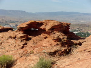
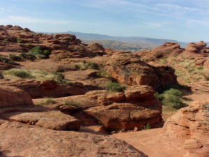
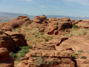
This section of Pioneer Rim Trail follows the bluff tops above St. George. It winds through some slickrock with many wonderful red sandstone formations. These formations, including two small arches, are the northern structures of Pioneer Park. Most of those who visit Pioneer Park never see the “backside” of the red rocks. Along this stretch, we were treated to differing views of St. George, including the large “D” on a hillside to the southwest.

At a bit less than 1.5 miles along, the trail intersects T-Bone Trail. We crossed the intersection and followed the east portion of Pioneer Rim Trail to its end, about 0.7 miles from the intersection, at a private land boundary fence. We then retraced our steps back to the trailhead. The eastern portion is less picturesque than the western part. However, at the beginning of the eastern segment, we came across a juvenile tortoise, maybe four inches long. We watched the little guy cross the trail. We did not touch him or get too close — remember that if you happen to encounter one of these critters.
The western section of Pioneer Rim Trail is easy to follow and marked by numerous trail signs. On the other hand, the eastern segment is faint and only marked by rock cairns. You might wander around a bit, as we did, looking for the trail. There is no shade along the entire trail; this is not a hot-weather hike. Finally, virtually the entire trail is uneven — small rocks and layers of slick rock are everywhere. This is a hike to pay attention to where you place your next step.
While I recommend this adventure, it is not the stunning hike many of us in southwest Utah have come to expect. It is a close-by, worthwhile, easy hike with portions of impressive red rocks and views of St. George.


