
Location: Dixie National Forest about 18 miles west of Cedar City, Utah.
Difficulty: Easy with some short steep sections. Much of the trail circling the Lion’s Mouth rock mound is rocky and steep.
Average Hiking Time: Less than one hour at a leisurely pace with much exploring and photo stops. The hike is about one mile round trip.
Family Friendly: Yes. We met seven people, including three children and two dogs on the hike. Do watch young children around the rock hill, there are some steep drop-offs.
Finding the Trailhead: From St. George travel north on Interstate 15. Upon reaching Cedar City leave the interstate at Exit 59 and go right which places you on Highway 56 (aka 200 North in Cedar City) going west. After 16.9 miles on Highway 56 turn left (south) onto the signed Pinto Road (aka Forest Road 009). Follow Pinto Road, a well maintained dirt road, southwest for 1.1 miles to the unsigned Lion’s Mouth Trailhead pull-out on the right (northwest) side of the road. The trailhead has a parking area for several vehicles.
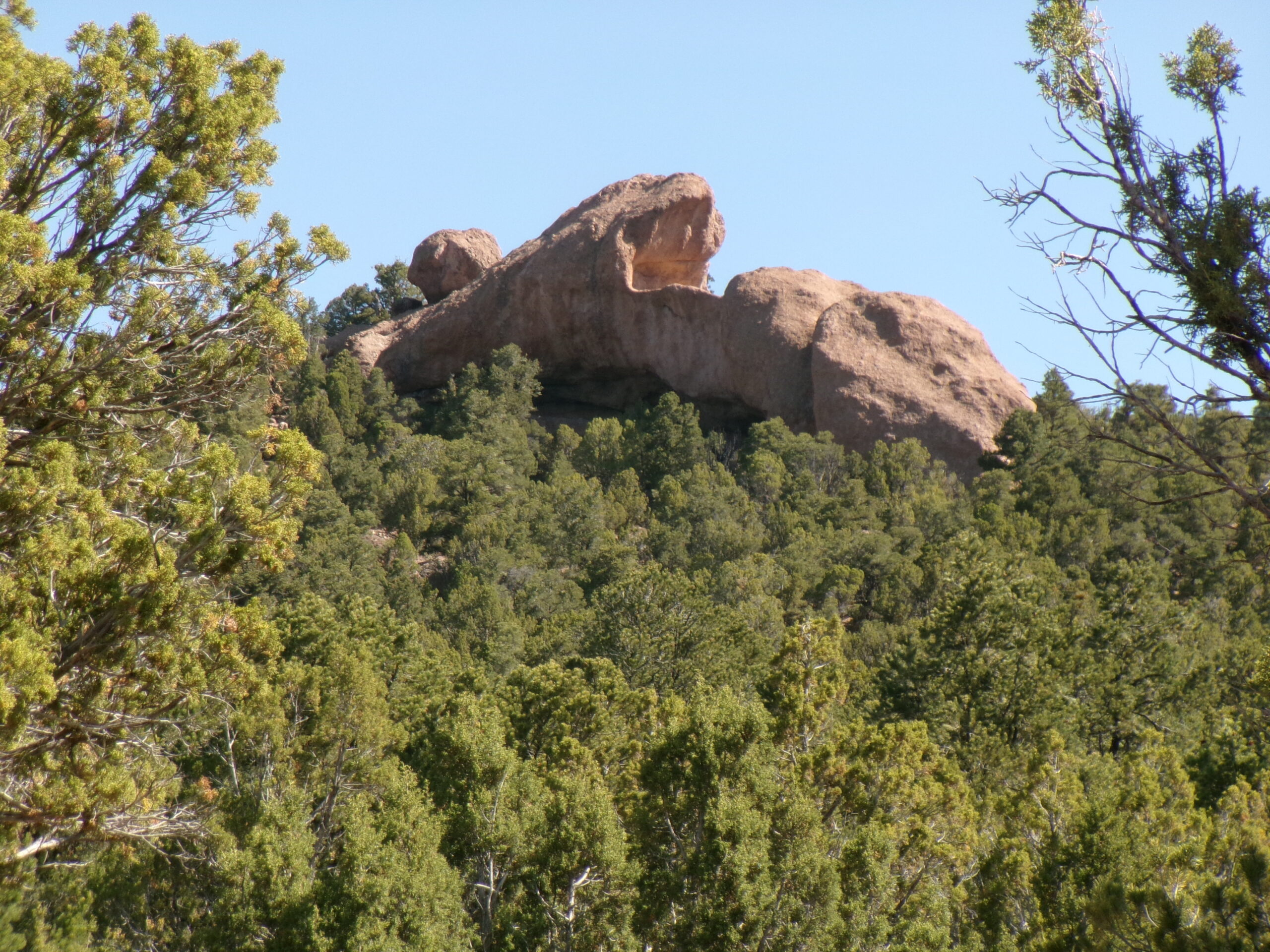
Ever heard of Lion’s Mouth Cave near Cedar City? Nope, very few have. Why such an odd name? Because from a distance the rock hill has a distinctive appearance that looks like the mouth of a lion. Okay, so what is so special about this particular cave? Three things. First, a large alcove below the lion’s mouth contains numerous Native American pictographs painted along the walls.
Second, it is about 15 degrees cooler than the St. George area. A good choice for a short hike when it is hot in St. George.

Third, it is located in a forested part of Dixie National Forest, a different environment if you are used to desert hiking as my wife, Deb, and I are. Lion’s Mouth Cave Trail is the destination for our latest exploration.
The Native American pictographs at Lion’s Mouth Cave are generally in decent condition. Visitors observing and studying rock art—this applies to pictographs (rock art painted on a rock surface) and the much more common petroglyphs (rock art chipped or scratched in a rock surface)—in the Southwests must remember and follow a few simple rules.

Rock art is a non-renewable cultural resource, once damaged it can never be replaced. Do not touch the rock art, even the small amount of oil from your fingers can cause damage. Be careful when climbing among the rocks, dislodged stones can cause damage to the paintings and carvings. Leave rocks surrounding rock art alone—the painting and carvings should be viewed in relation to its original environment. Do not remove, or in any way alter, rock art—it is against the law to remove or alter them at prehistoric or geological sites. And do not add your own images (aka graffiti).
Finally, regarding value, rock art is non-replaceable and priceless. Enjoy it, but through your actions do not deny the experience to future visitors. Anytime you encounter archeological sites and objects, do remember to follow the simple etiquette rules above.
We left St. George on a mid-week morning in late May and arrived at the unsigned trailhead and parking area about 10:15 am. The trailhead elevation is 6,525 feet and the temperature was in the mid-60s. The unmarked trail begins at an opening between two fence posts on the northwest side of the parking area. Be aware that there are no trail markers along the hike. It is easy to follow, if you use the Lion’s Mouth Cave jumble of large rocks as a landmark and head toward it.

We began exploring, under a mostly blue sky with a few puffy white clouds, by heading northwest for a short distance.
The trail quickly leaves the shade of juniper trees, veers southwest and enters an area where all vegetation has been removed—maybe a fire break. We then entered a forested area heading west to the Lion’s Mouth. The final section goes northwest to the large rock formation and becomes rocky and steep in some areas. The pictographs are on the west side of the rock formation in a large alcove about .3 mile from the trailhead.
It took a little bit of rock scrambling to climb into the alcove. The pictographs consist of several long horizontal panels along the back side of the alcove and include several anthropomorphic figures, a snake, and numerous other drawings. The figures are painted with red and yellow hues.
(By the way, in nature, an alcove is a steep-sided, arched hollow carved into the side of a cliff or rock face by water or wind erosion. Unlike a cave, an alcove is open and shallow, providing a natural rock canopy or shelter rather than a deep, enclosed tunnel.)
After examining the drawings for awhile, we continued to the north side of the hill to climb to the top for the views. At first, we only saw very steep climbs up the rock face, but by continuing around we found an approach on the northeast side that was easier with only minor rock scrambling necessary. Not surprising, the 360 degree views from the top were great—lots of trees and mountains.

We retraced our steps off Lion’s Mouth, finished the circuit around the hill, found the main trail, and returned to the trailhead.
We thought we would be alone on this easy, but out of the way trail. However, we met seven people, including three children and two dogs on the hike. All were friendly, including the dogs, and we chatted a bit.
This family friendly short hike is worth the effort. We spent less than an hour hiking about one mile for this exploration. If you enjoy musing about the meanings of ancient rock paintings in a national forest, give Lion’s Mouth Cave Trail a try.