
Mustang Pass Loop Trail
– By Tom Garrison –
Location: Red Cliffs Desert Reserve in Washington, Utah
Difficulty: Moderately strenuous due to Mustang Pass being mostly a rocky trail with a serious elevation gain as you reach the pass and a couple of long up-and-down sections on Middleton Powerline Trail/Road.
Average Hiking Time: About 2 1/2 to 3 hours at a leisurely pace with many photo stops.
Elevation: 3,070 feet trailhead elevation with a 300 feet elevation change to the highest point. There is a fair amount of up and down elevation change, especially on Middleton Powerline Trail/Road.
Family Friendly: Watch your step on the rocky sections of the trail. It may be a bit strenuous for younger children.
Getting There: Drive north on Main Street in Washington City and cross under Interstate 15. Immediately after crossing under the Interstate is a four-way stop, with Buena Vista Boulevard being the cross street. Continue north on Main Street, and at 1/2 mile from the intersection is another intersection with Washington Parkway. Turn left (west) onto the Parkway, and after 1.1 miles, turn right (north) onto Fairway Drive. Continue north on Fairway Drive to the end, .1 mile, then turn left (west) on Scenario Street. Go west on Scenario Street for about .2 mile. The street then turns left (south) and becomes Vacanza Street. Just at the turn, and on your left is a small paved parking lot—big enough for five cars. There is another, somewhat larger, parking lot about 50 yards down Vacanza Street, where it intersects Tramonto Street.
Along the back side of the parking area is a paved walkway. Go north on the walkway across the street and between two houses. At the back of the houses is a fence and a stepover onto the trail. There is also a large Red Cliffs Desert Reserve trailhead sign. This is the trailhead for Ice House Trail and Mustang Pass Trail.
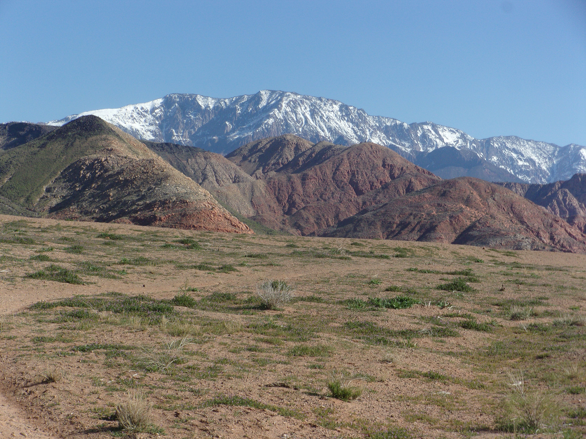
Need some alone time and a decent workout? If yes, this loop hike is for you. Mustang Pass Trail connecting to Mill Creek Trail/Road and Middleton Powerline Trail/Road, is a moderately strenuous 5.3-mile loop trail. Along the first section, getting to Mustang Pass, we saw several other hikers. Once beyond Mustang Pass, we saw no one until the end of Middleton Powerline Trail/Road. We did see some great views of snow-covered Signal Peak in the Pine Valley Mountains, many red sandstone mountains and hills, hundreds of volcanic rocks, and a bunch of lizards.
I’m recovering from a total hip replacement about ten weeks ago, and my wife Deb and I decided a mid-April hike would be a good test of my new equipment. It worked fine. And the trailhead is only a couple of miles from our home.
The Red Cliffs Desert Reserve was established in 1996 to protect a large and diverse habitat capable of sustaining wildlife populations threatened by development and habitat loss. It comprises 62,000 acres and has more than 130 miles of shared-use trails for hiking, horseback riding, and mountain biking. Three ecosystems—the Mojave Desert, the Great Basin Desert, and the Colorado Plateau—merge in southwestern Utah, and the Reserve reflects the biological diversity of this unique region. The Red Cliffs Desert Reserve Habitat Conservation Plan is administered by Washington County in coordination with the Bureau of Land Management, the US Fish and Wildlife Service, the Utah Department of Natural Resources, and the Utah School and Institutional Trust Lands Administration.
The trailhead has an elevation of 3,070 feet. The temperature was in the high-50s, with a hazy blue sky for our mid-April hike.
We headed north on Ice House/Mustang Pass Trail, and at .4 mile, the trail; forked. The left fork continues as Ice House Trail; the right was our choice—Mustang Pass Trail. Soon, within .1 mile, we came to and crossed the signed Middleton Powerline Trail/Road and continued north.
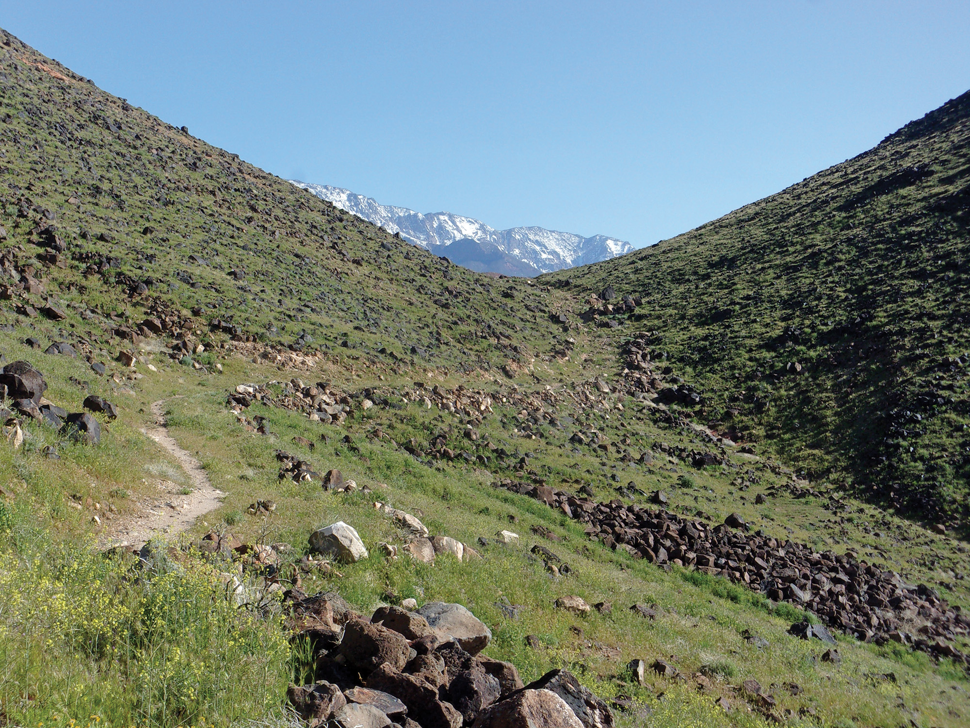
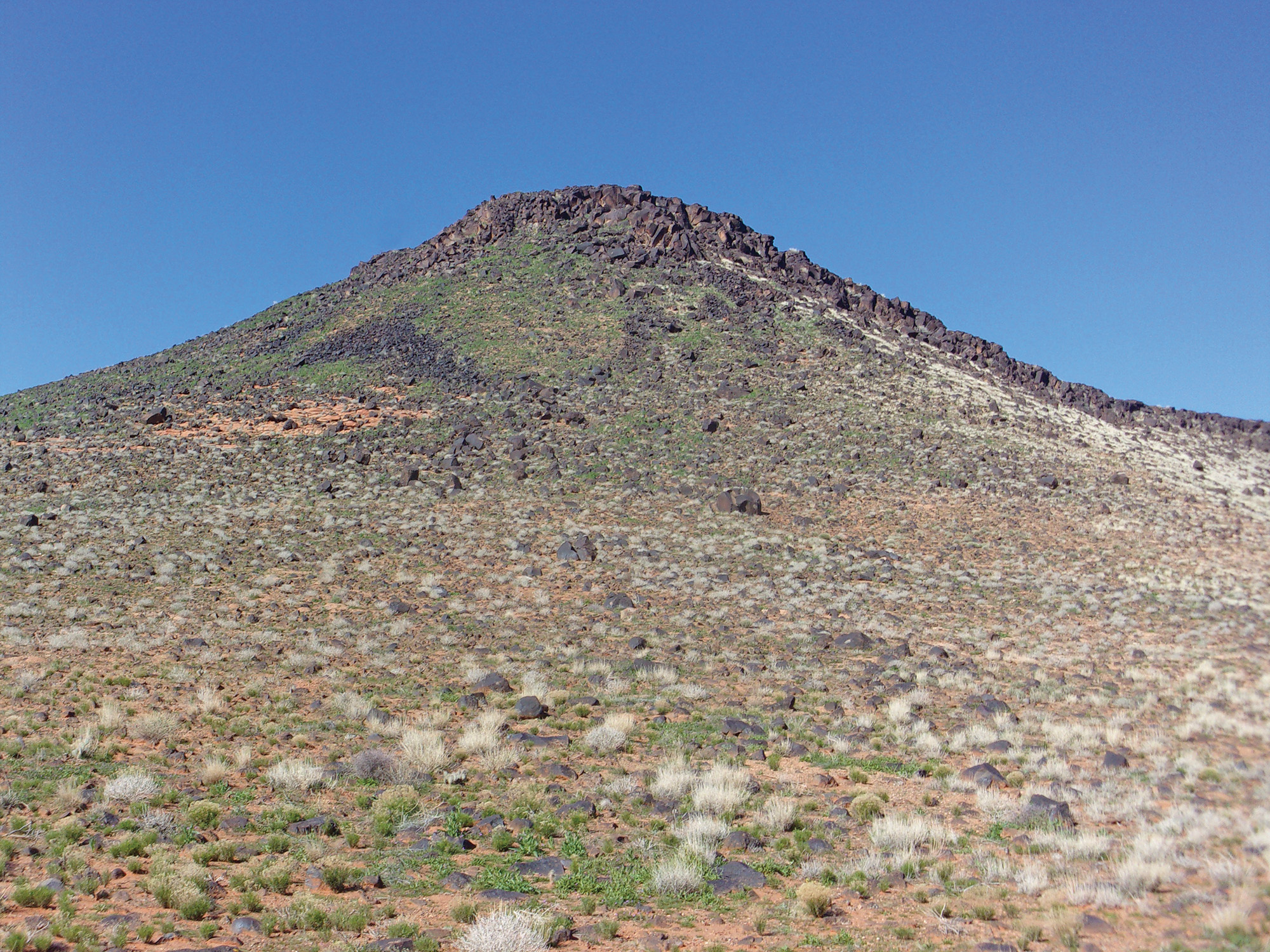
The first section of Mustang Pass Trail, up to the pass, is almost all rocky and slightly uphill. About a mile from the trailhead, we stopped to admire the views and examined the shallow valley to the north leading to the pass we would soon enter.
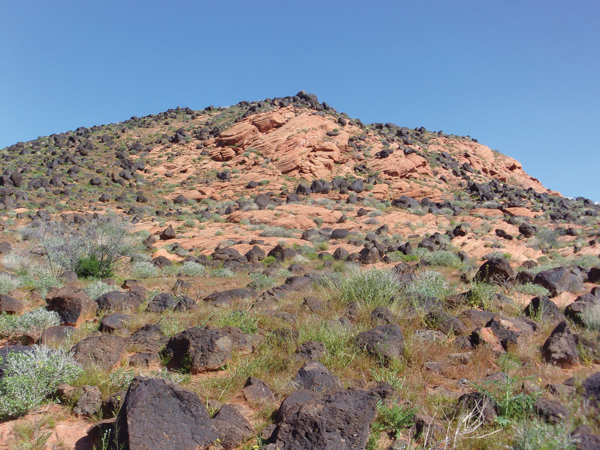
The valley was peppered with volcanic rocks and became quite steep the last 100 yards or so to the top of the pass, about 1.5 miles from the trailhead. A lot of hikers stop at the top of the pass and head back to the trailhead for a three-mile out-and-back hike. Not us; we are doing the entire loop hike.
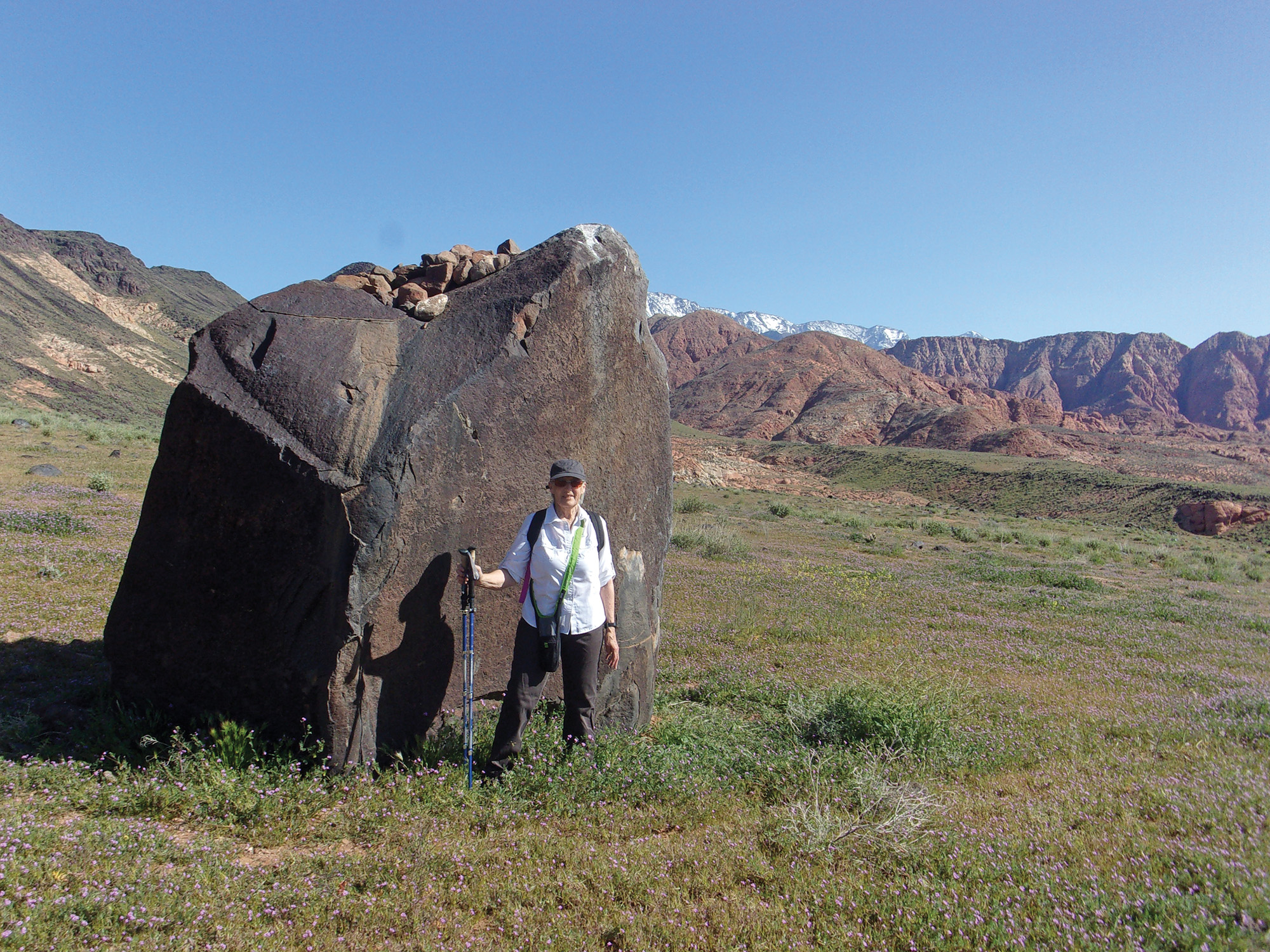
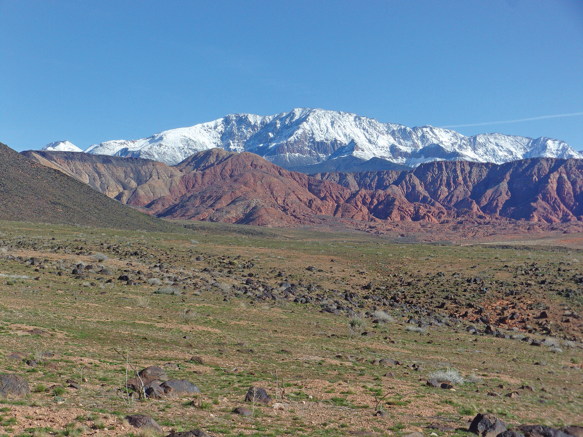
Just beyond the pass is a large desert meadow, with lots of small plants in bloom with tiny blue flowers. Here the trail is a little less rocky and serpentines across the large, relatively flat area. This portion of the hike had the best views of snow-covered Signal Peak in the Pine Valley Mountains and many other closer and smaller red sandstone mountains. Soon we came to long switchbacks heading downhill toward Mill Creek. Around here, where the trail starts downhill, are three monolithic lava rocks—two close together on the left side of the trail and one on the right. I got a great photo of Deb in front of the right side monolith with red mountains in the background.
We crossed dry Mill Creek and came to the signed junction with Mill Creek Trail/Road, 3.4 miles from the trailhead. We went right at the junction and headed southwest along sandy Mill Creek Trail/Road.
Finally, 3.7 miles from the trailhead, we reached the signed junction with Middleton Powerline Trail/Road. We turned right and headed southwest. Now it is an easy walk back to the trailhead. Nope. This portion of the hike is sandy and traverses two major ridges with some pretty steep up-and-down hiking.
After another mile from the Mill Creek Trail intersection, we turned left (south) onto Ice House/Mustang Pass Trail back to the trailhead.
The round trip distance along this well-marked loop trail is 5.3 miles. While there are relatively flat sections, much of the trail involves ascents or descents. We completed the trip in a little less than three hours at a leisurely pace, including many photo stops. I recommend this close-by adventure combining natural desert beauty with solitude.
Viewpoints and perspectives expressed throughout The Independent are those of the individual contributors. They do not necessarily reflect those held by the staff of The Independent or our advertising sponsors. Your comments, rebuttals, and contributions are welcome in accordance with our Terms of Service. Please be respectful and abide by our Community Rules. If you have privacy concerns you can view our Privacy Policy here. Thank you!
Click here to submit an article, guest opinion piece, or a Letter to the Editor


