
Location: Red Cliffs Desert Reserve near St. George, Utah
Difficulty: Moderately strenuous because most of the trail demanded a lot of up and down hiking. Although none of the inclines were truly steep, there were many of them. Most of the trail is packed dirt with many rocks. There are a couple of lengthy stretches of loose deep sand, no fun. It is an exposed trail, with almost no shade.
Average Hiking Time: About 2 ¼ hours at a leisurely pace with many photo stops.
Family Friendly: We met ten other hikers and five of the dogs accompanying them on this hike, no young children. This trek may be a bit much for young kids.
Finding the Trailhead: From St. George go north on 3050 East Street/Green Springs Drive, cross under Interstate 15 (at exit 10), and turn left (west) onto Red Hills Parkway. Continue on Red Hills Parkway for 1.6 miles and turn right (north) onto Cottonwood Springs Road (aka 1550 East). Staying on the main road, drive 1.6 miles to the signed trailhead and large parking area on the left.
Or from downtown St. George go north on 1000 East and turn right (east) on Red Hills Parkway. Take the Parkway .7 miles and turn left (north) onto Cottonwood Springs Road. Follow the above directions from there.
One of the best things about living in the St. George area is that you can take a short drive and be in the wilderness. We, my wife Deb and I, needed an adventure close to home. Although we have been steady hikers in the St. George area for 17 years, we never hiked T-Bone Trail in the Red Cliffs Desert Reserve. It’s a moderately strenuous hike beginning in a barren landscape and ending in with the sandstone formations in Pioneer Park—let’s go.
The Red Cliffs Desert Reserve was established in 1996 to protect a large and diverse habitat capable of sustaining wildlife populations threatened by development and habitat loss. It comprises 62,000 acres and has more than 130 miles of shared use trails for hiking, horseback riding, and mountain biking. Three ecosystems—the Mojave Desert, the Great Basin Desert, and the Colorado Plateau—merge in southwestern Utah and the Reserve reflects the biological diversity of this unique region.
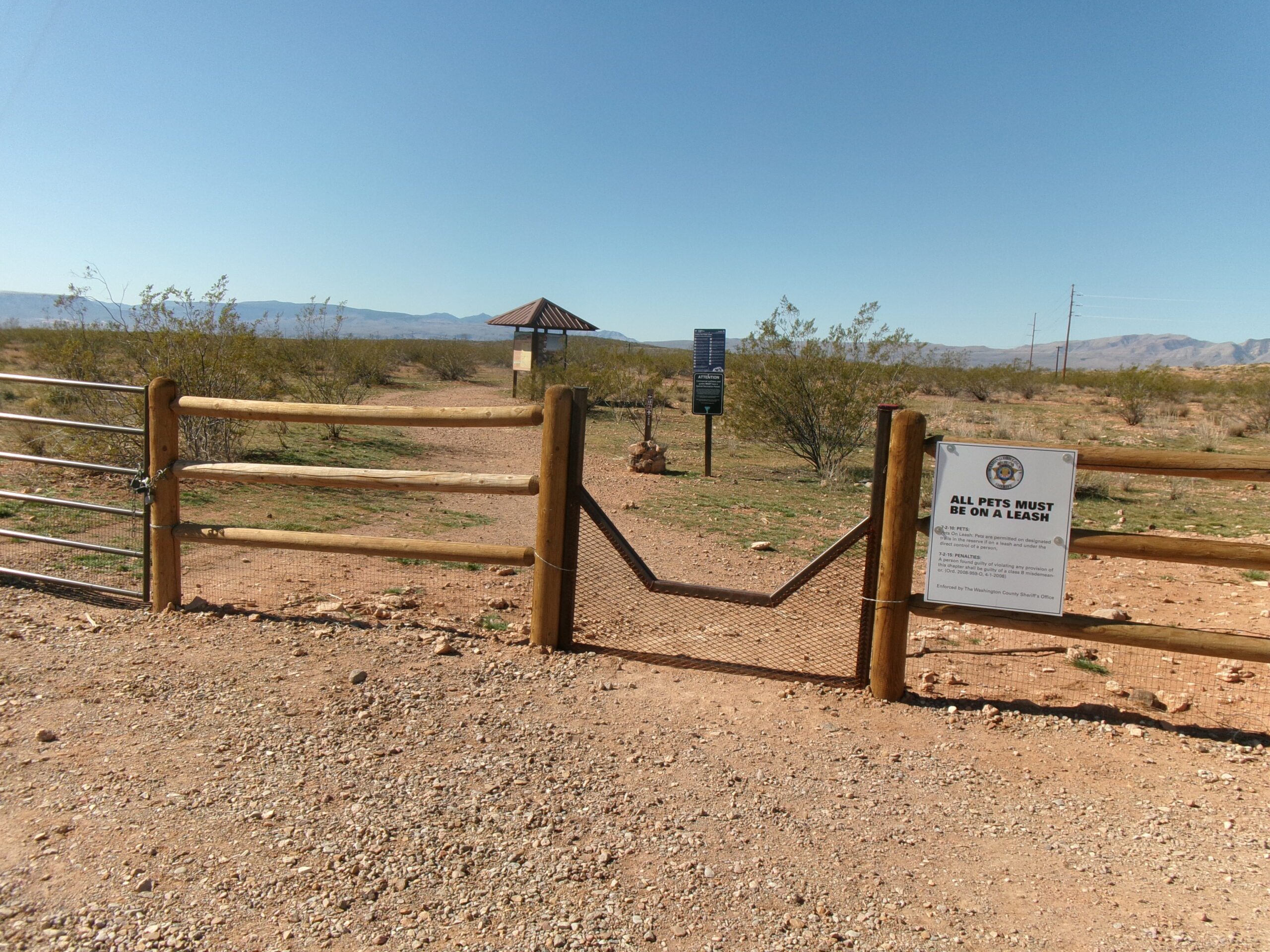
We began this exploration on a clear late March weekday morning. The trailhead has a large parking area with a step-over opening to the trail. We arrived about 9:00 am under a clear blue Utah sky. The trailhead elevation is 3,190 feet with a 150 feet elevation gain from the trailhead to the highest point on the trail. The temperature was in the mid-60s (reaching the mid-70s by the end of our trek), and the cloudless sky a deep Utah blue. T-Bone Trail is in the Red Cliffs Desert Reserve and there are no fees or permits necessary for this hike.
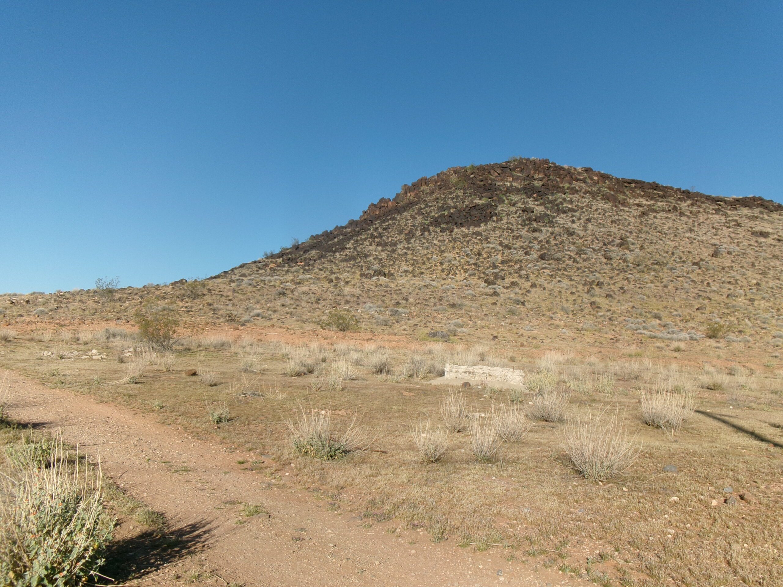
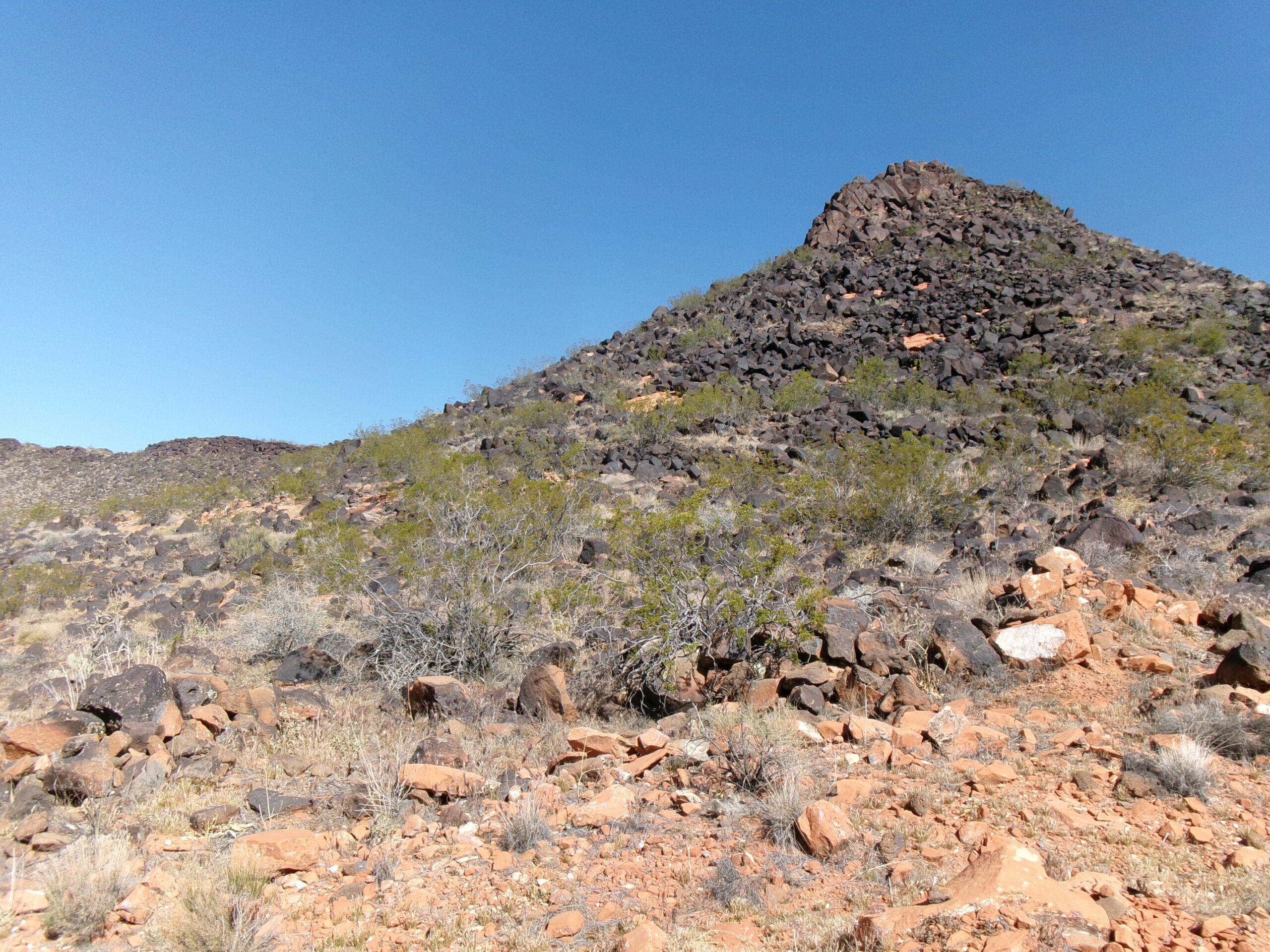
A large hill, T-Bone Hill, is not too far away and directly west from the trailhead. We began our hike by heading west toward T-Bone Hill on the well-marked packed wide dirt trail that quickly circled around the southern slope of T-Bone Hill, covered with lava rock, and headed south.
After a couple of turns and about .6 mile, we came to the straight portion of the trail, marked by a row of power lines running alongside the trail. This part of the trail is approximately 1.3 miles long, goes up and down a couple of large hills, and includes some sections of loose, deep sand. It ends at Pioneer Park. It is mostly barren land dotted with creosote and desert flowers. We spotted several lizards basking in the sun.
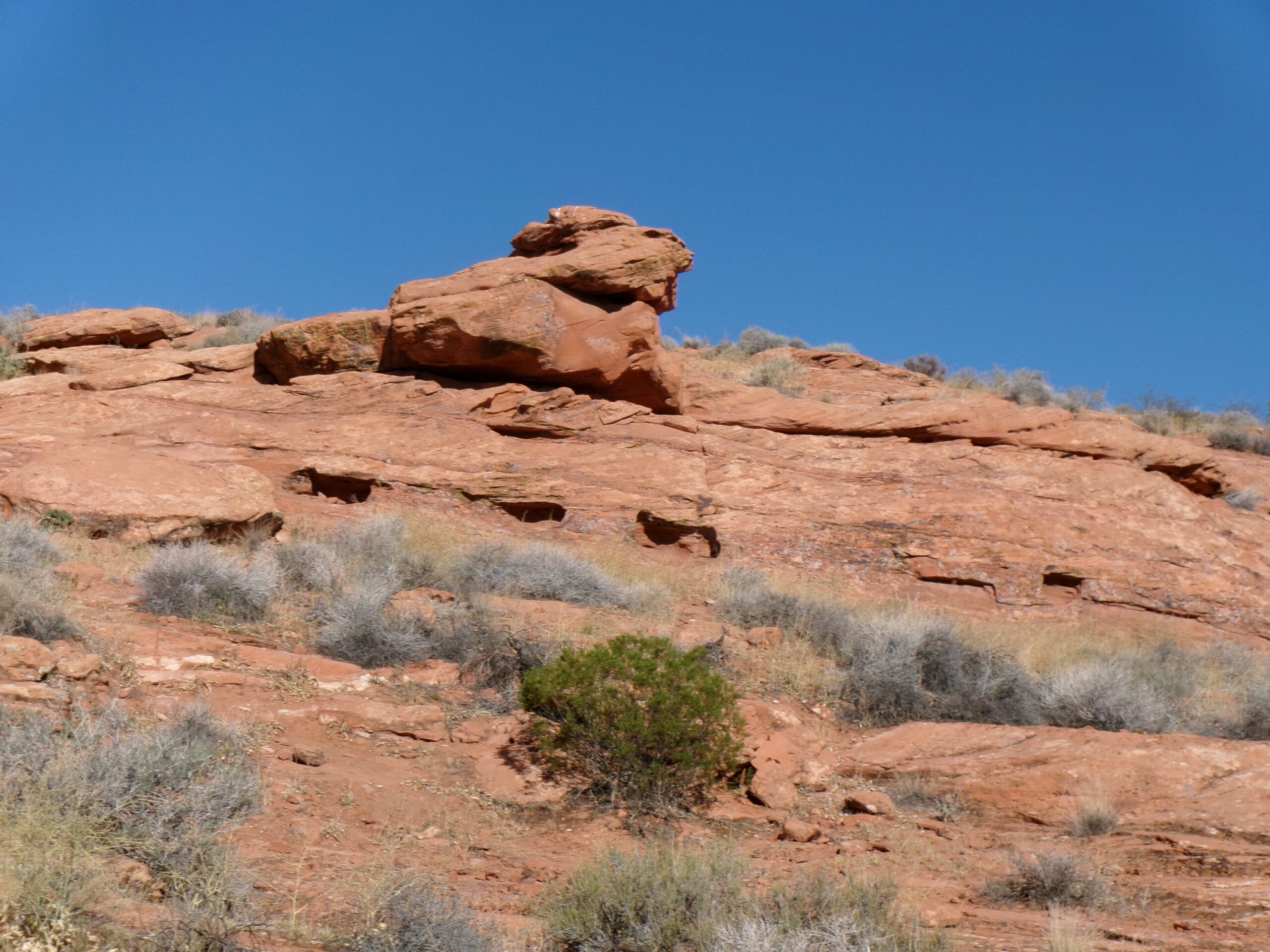
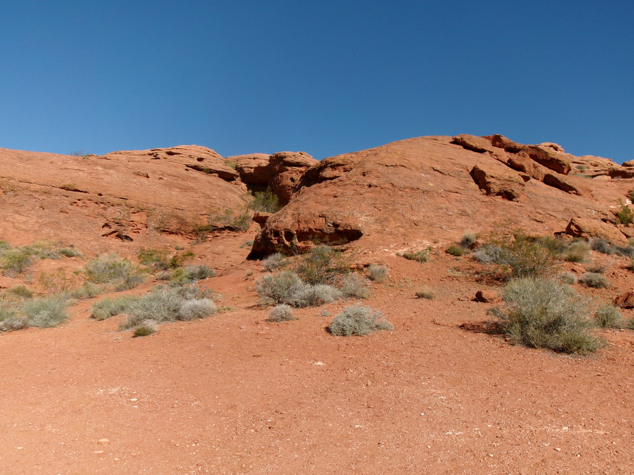
About 1.4 miles from the trailhead, T-Bone Trail intersects Pioneer Hills Trail. At this point, the line of power poles goes in a different direction and is no longer alongside T-Bone Trail. The area became more rocky with sandstone jumbles all around. We continued south and about .3 mile from the Pioneer Hills Trail intersection (1.7 miles from the trailhead) is a junction with Pioneer Rim Trail. We stayed on T-Bone Trail heading south and within .2 mile came to the end of the trail at the Pioneer Park Trailhead and parking area. This southern end is also the southern trailhead for T-Bone if you want to hike going north instead of south. We admired the red sandstone formations and the view of St. George just below Pioneer Park.
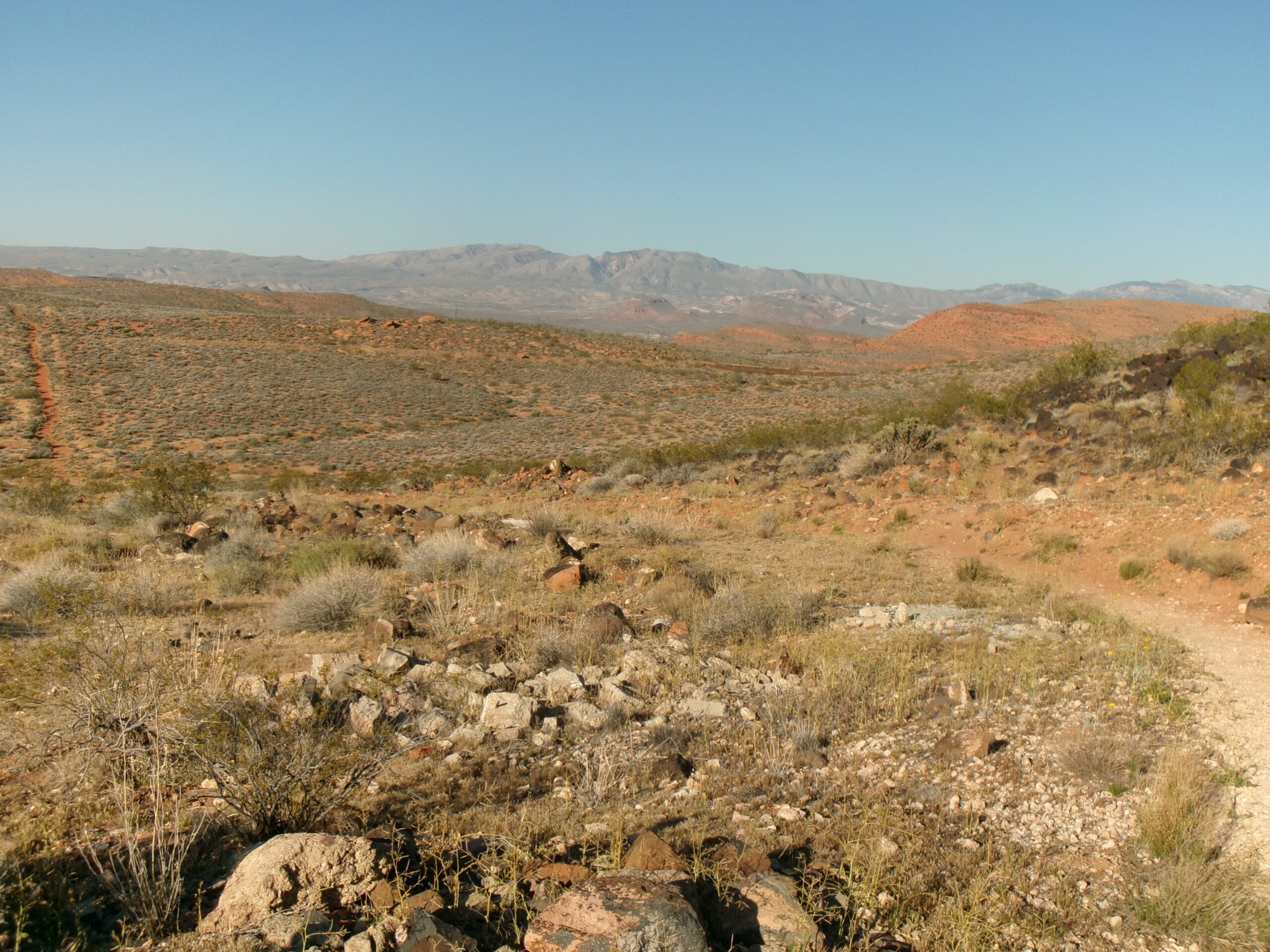
We turned around and headed back to the northern trailhead. There are good views of Pine Valley Mountains to the north on our return trip. While on the trail we met ten other hikers and five dogs accompanying them—not bad for a Wednesday morning.
The hike is 3.8 miles round trip and took around 2 ¼ hours at a leisurely pace with many photo stops. Much of the trail demanded a lot of up and down hiking. And except for the section in Pioneer Park, it is all exposed, with no shade. This is a decent hike close to St. George—perfect for a quick getaway into relative wilderness.


