

Hiking Southern Utah: Whiterocks Amphitheater Trail
 Trail Name: Whiterocks Trail
Location: Snow Canyon State Park
Difficulty: Moderate
Length: Option one, approximately 5.5 miles roundtrip; option two, one-mile roundtrip
Elevation Gain: option one, approximately 500’; option two, 100’, with bonus peak, add 250’
Average Time: 1–3 hours, depending upon options
Family-friendly: Yes, with varying levels for all family members
Dog-friendly: No, dogs are not allowed on this trail
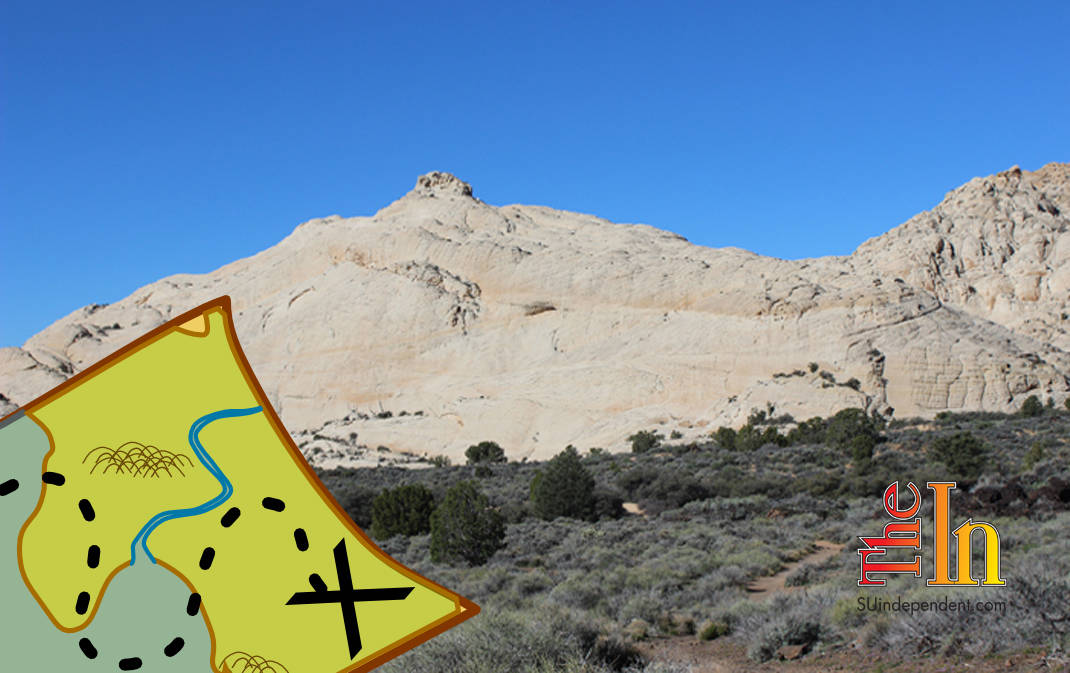
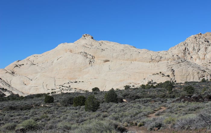
The Whiterocks trail is a scenic trail with multiple options for hikers of all abilities. In this hike description, there are two different routes with several challenges presented to allow for a variety of routes. Both options lead to the Whiterocks Amphitheater, a spectacular hollow surrounded by towering sandstone peaks. Option one begins in Snow Canyon State Park proper and is the longest route to the amphitheater. Option two begins just north of the northern entrance to the park and is ideal for hikers with small children. The bonus peak option is the most challenging route of all, but the ascent can be made even by confident, sure-footed younger scramblers.
Access for option one: From the junction of St. George Boulevard and Bluff Street, head north on Bluff for 9.1 miles (going past the turnoff at Snow Canyon Parkway and continuing as Bluff becomes State Route 18) to the North Entrance of Snow Canyon State Park. Turn right (making sure to pay the fees at the entrance station) and drive down the park road for another 0.8 miles until the Lava Flow trailhead parking area is reached on the right.
Access for option two: Instead of turning into Snow Canyon State Park, continue north on state Route 18 for another 0.5 miles. Look for a parking area on the left.
Hiking option one: The trail (which is also the Lava Flow trail for the first 0.4 miles of the trek) begins with a gentle descent towards the mixed plain of lava, scrub, and sandy desert environments. The trail initially arcs in a southwesterly direction as it curves towards its junction with the Whiterocks trail. Several interpretive signs explain the area’s volcanic past.
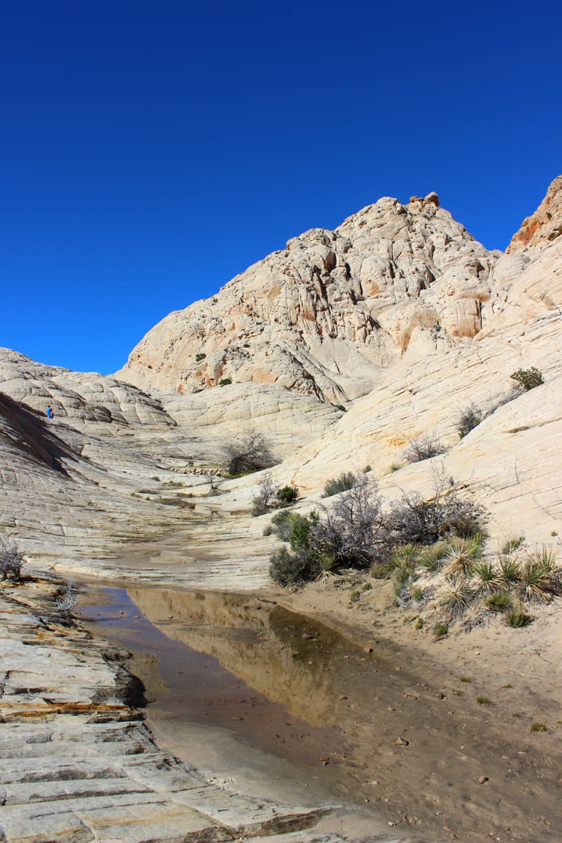
 Continue until the junction with the Whiterocks trail is reached. Turn right and head north. The trail passes by several collapsed lava tubes and then begins trending in a northwesterly direction. After another half mile or so, an outcropping of white sandstone is reached. Take the time to walk out to the west, and enjoy the startling vista of the canyon spread out below and before you.
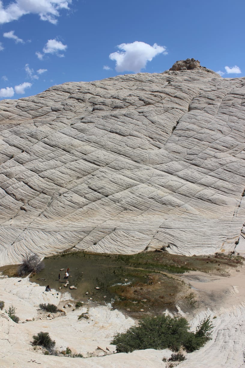
Return to the trail and continue on. The path will remain headed in a northern direction, but as the trail gets closer to the mountains that mark the north end of Snow Canyon, it will turn towards the east and then northeast. Eventually, the path reaches a steep slope where the trail carves short switchbacks to reach a saddle between two sandstone outcroppings. From here, the trail heads north to meet with the shorter trail of option two. Turn left and head west, contouring around a rock wall to reach the entrance to the amphitheater. At this point, there is no trail, but the way is obvious. Follow the canyon south to its head where a seasonal pool is surrounded by towering walls and a small section of sandstone. Take time to explore the nooks and crannies of the amphitheater. When ready, return to the parking lot for the Lava Flow Trail.
 Hiking option two: Head west and descend into a jumbled plain of lava rocks, shallow draws, and sand. After a quarter mile, the junction with option one is reached. Continue on towards and into the amphitheater as described before. This hike is perfect for little legs and short attention spans. Again, return to the parking area when done.
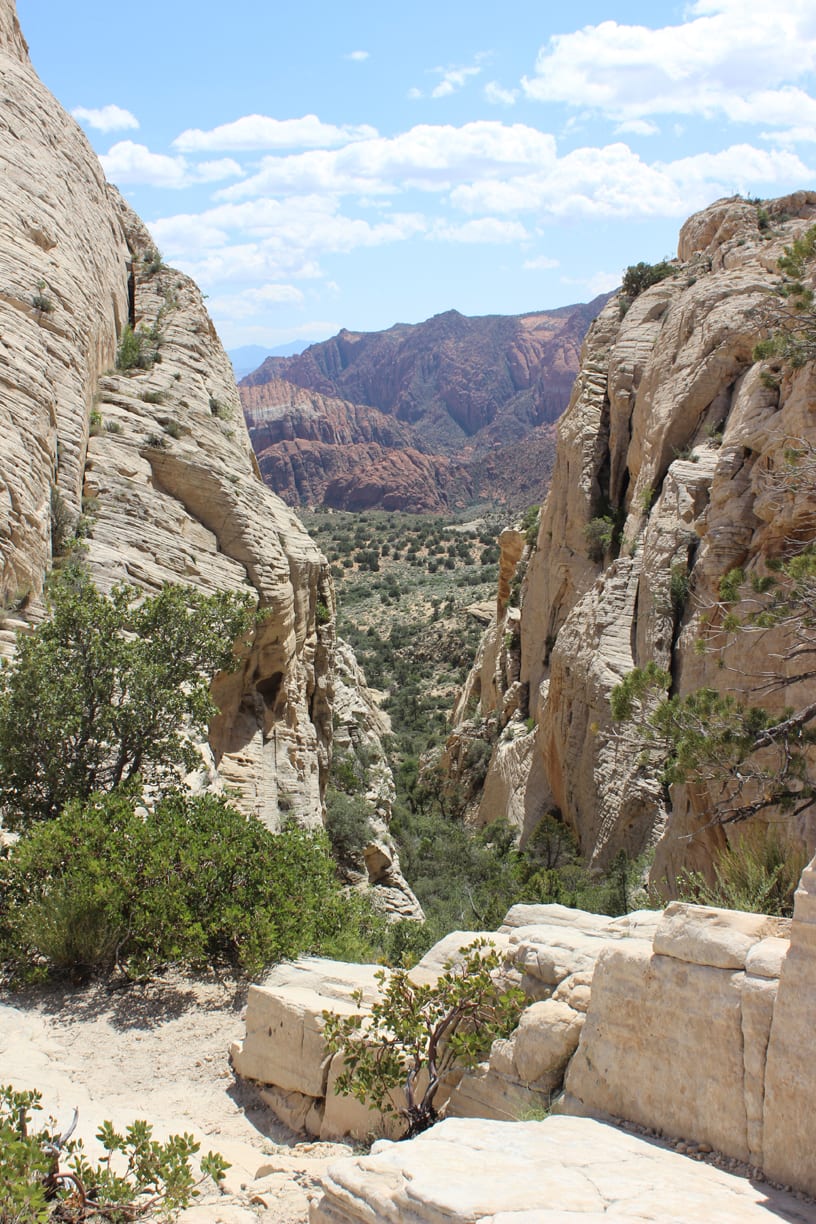
Extra credit: For an exciting, not-as-hard-as-it-looks option, climb the small peak that makes up the eastern wall of the amphitheater. While not appropriate for really young kids, confident hikers and scramblers can easily and safely make the ascent. There are numerous means of gaining the summit, but by far the easiest route is the north ridge. As the trail turns south into the canyon of the amphitheater, divert to the west and begin hiking and scrambling up the broad, gentle ridge. Take time to find the easiest route. Eventually, the summit knob is reached where the only challenging section is found. Picking the right route can be a little difficult, but there are multiple options on all sides of the block. The views from the summit are spectacular. When ready to descend, head north back down the ridge.

Articles related to “Hiking Southern Utah: Whiterocks Amphitheater Trail”
Hiking Southern Utah: Canal Trail in Pine Valley Recreation Area


Don: Thank you for what you freely give. Awesome stuff.